
- Brief description
-
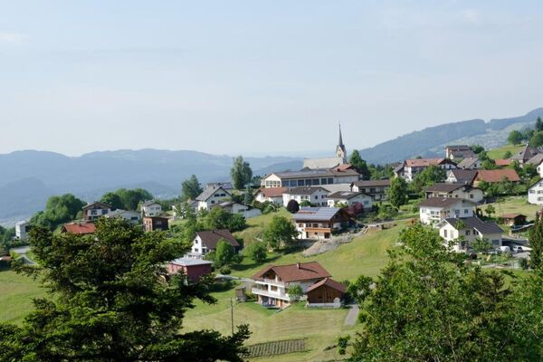
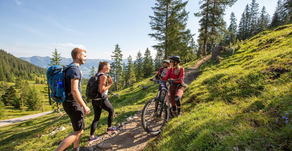
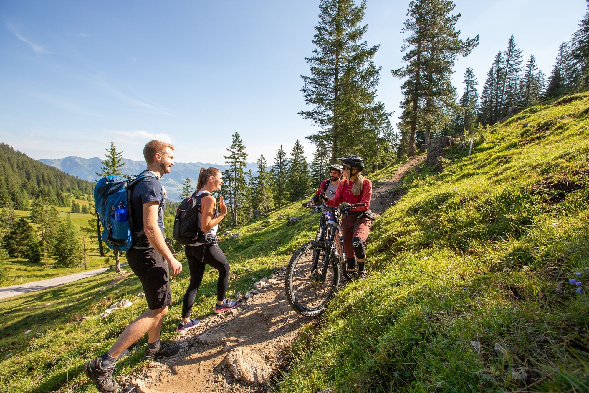
This scenic mountainbike tour offers a fantastic panoramic view over the Walgau, the Alpine town of Bludenz and far into the Klostertal.
- Difficulty
-
medium
- Rating
-
- Starting point
-
Church, Bürserberg
- Route
-
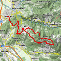
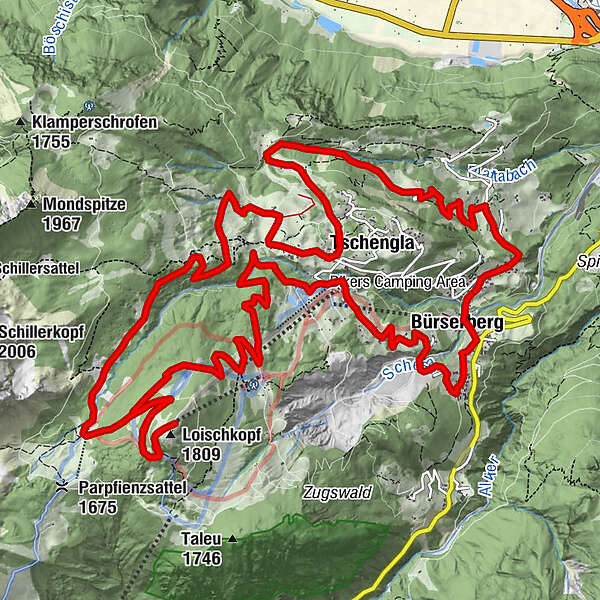
Pfarrkirche heiliger JosefBürserberg0.3 kmKapelle zu Unserer Lieben Frau2.2 kmTschengla3.3 kmUnicorn Restaurant3.4 kmBergstation Tschengla6.7 kmLoischkopf (1,809 m)10.1 kmRonaalpe15.9 kmSchwabenhaus16.9 kmTschengla16.9 kmBürserberg22.3 kmPfarrkirche heiliger Josef22.4 km
- Best season
-
JanFebMarAprMayJunJulAugSepOctNovDec
- Description
-
The drive to Loischkopf is relatively easy and leads mostly on roads and forest roads through the Brandnertal. The mountainbike tour leads from the church in Bürserberg in the direction of Brandnertalstraße. Before you reach Brandnertalstraße, keep right and drive uphill on a narrow road in the direction of Tschengla. At the parking lot of Einhornbahn II, turn left before the bridge to Kohlgrubweg. After approx. 800m continue on the left path. At the "Burtscha" (valley station of the Loischbahn) turn right uphill towards Loischkopf. Passing under the Loischkopf you will now reach the Faregg. At Faregg turn right onto "Alte Stattweg" downhill to the Ronaalpe. From the alp flat to the south and then down to the left. Turn left at Dunza - slightly uphill to the stone circles of the high plateau Tschengla. From Monteschil on asphalt over the Außerberg - back to the right.
Variants
The tour can also only be started from Bürserberg/Tschengla at Einhornbahn II and/or shortened with the ascent with Einhornbahn II. - Directions
-
Bürserberg church - Bürserberg municipal office - road past the hamlets of Baumgarten and Zwischenbäch - Einhornbahn II valley station/parking area Bikepark Brandnertal - Kohlgrubweg - turn left towards Burtscha - Loischkopfbahn valley station - Loischkopf - Faregg - Alte Stattweg - Alpe Rona - hamlet of Dunza - Monteschil - Ausserberg - Bürserberg church
- Highest point
- 1,785 m
- Endpoint
-
Church, Bürserberg
- Height profile
-

- Equipment
-
Mountain bike, helmet, rain or sun protection as well as small snacks and enough water to drink. Mobile phone in case of emergency.
Possibly valid mountain railway ticket for the optional ascent with the mountain railway.
- Safety instructions
- Directions
- Public transportation
- Parking
-
Parking space opposite church
- Author
-
The tour Loischkopf Tour | Brand-Bürserberg-Bürs is used by outdooractive.com provided.


General info
-
St. Gallen - Bodensee
152
-
Brandnertal
208
-
Bürserberg
65
")