


- Brief description
-
Difference in altitude: 700 m
Andelsbuch - Heimgarten - Bregenzerach - Schwarzenberg - Maien - Lorenapass - Bercholdshöhe - Kaltenbrunnen - Egg - Radweg - Andelsbuch - Difficulty
-
easy
- Rating
-
- Starting point
-
Andelsbuch centre of town
- Route
-
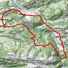
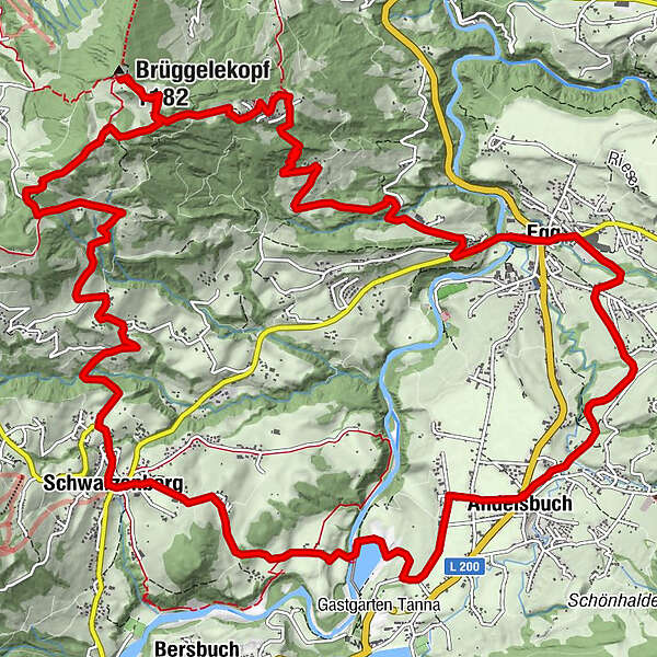
Pfarrkirche AndelsbuchAndelsbuch0.0 kmAntoniuskapelle0.4 kmPfarrkirche Schwarzenberg - Heiligste Dreifaltigkeit4.8 kmSchwarzenberg (696 m)4.9 kmAdler4.9 kmHotel Gasthof Hirschen Schwarzenberg4.9 kmKapelle Hl. Theresia6.9 kmJakob Bader Maurer Kapelle (1657)7.3 kmGasthof Berchtoldshöhe10.5 kmAlpengasthof Brüggele11.7 kmBrüggelekopf (1,182 m)11.8 kmPfarrkirche Egg18.2 kmEgg18.4 kmWasserfälle Brühlbach20.5 kmWasserfälle Brühlbach20.7 kmPfarrkirche Andelsbuch21.5 kmAndelsbuch21.6 km
- Best season
-
JanFebMarAprMayJunJulAugSepOctNovDec
- Description
-
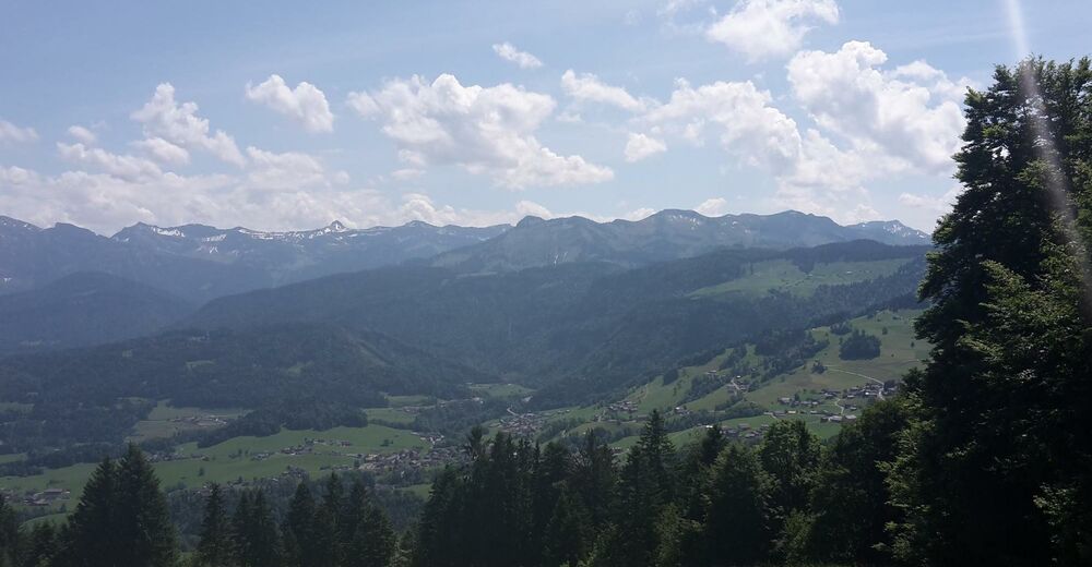
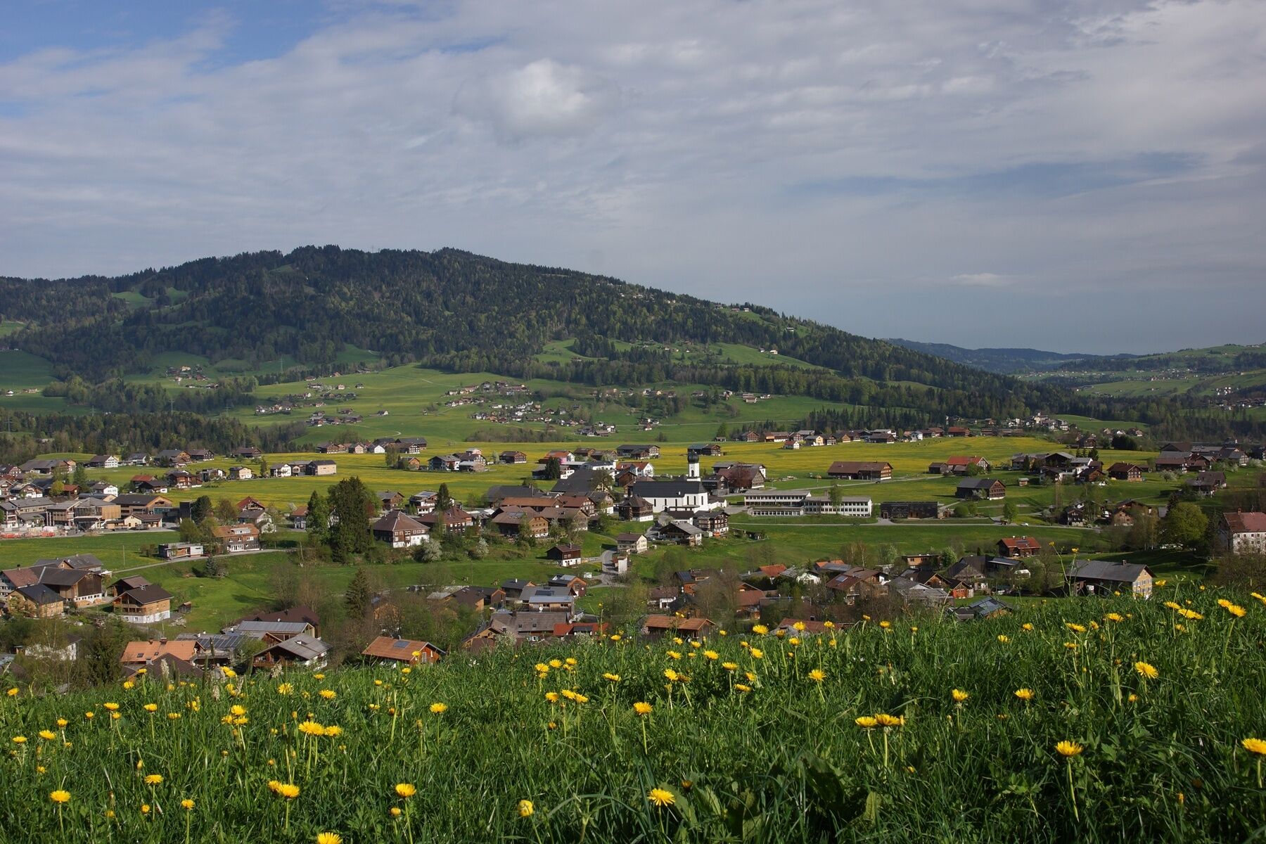
This tour is on almost exclusively asphalted roads, and is also perfect for beginners. From the centre of the village of Andelsbuch, you cycle down narrow roads to the Bregenzerache, from where you can see Andelsbuch power station. The Art Nouveau building dating from 1908 was one of the biggest hydroelectric power stations in the Austro-Hungarian empire. You then cycle through peacefully situated villages up to Schwarzenberg, one of the loveliest villages in the whole of the Bregenzerwald. After a short stretch on the Bödelestraße, you take quiet roads through the forest and across fields to reach the Lorenapass. A few gentle ascents and descents later, you arrive at the Berchtoldshöhe and then descend into Kaltenbrunnen. Following the descent into the valley on the mountain road, from the centre of the village of Egg you take the cycle path back to base.
- Highest point
- 1,155 m
- Endpoint
-
Andelsbuch centre of town
- Height profile
-

- Safety instructions
- Tips
-
Chances to stop of for a drink/food:
Gasthof Frohe Aussicht, Gasthof Berchtoldshöhe, Gasthof Alpenrose, inns in Andelsbuch, Schwarzenberg and Egg - Additional information
-
Tip: mountain bike map
Detailed descriptions of 15 recommended tours for beginners, the advanced and professionals are enclosed in the mountain bike map of Bregenzerwald (available from Bregenzerwald Tourismus, in the tourist information offices and in some sports shops.) - Directions
-
From Germany: Ulm - Memmingen - Kempten - Oberstaufen bzw. Bodensee - Lindau - Pfändertunnel - Dornbirn/Nord - Bödele oder L200 Achraintunnel - Alberschwende - Andelsbuch
From Switzerland: Zürich - St. Gallen - St. Margarethen - Dornbirn - Bödele oder L200 Achraintunnel - Alberschwende - Andelsbuch - Parking
-
centre of town


- Author
-
The tour Andelsbuch | Berchtoldshöhe is used by outdooractive.com provided.


General info
-
St. Gallen - Bodensee
154
-
Bregenzerwald
233
-
Andelsbuch
85