© Bregenzerwald Tourismus - Elisabeth Schneider

© Bregenzerwald Tourismus - Elisabeth Schneider

© Bregenzerwald Tourismus - Elisabeth Schneider

- Brief description
-
Difference in altitude: 700 m
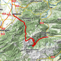
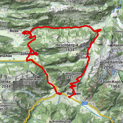
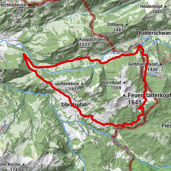
Sibratsgfäll - Rindberg - Sättele - Bodensee Hut - Lacppachalpe - Sippersegg - Sibratsgfäll - Difficulty
-
medium
- Rating
-
- Starting point
-
Sibratsgfäll centre of town
- Route
-
Pfarrkirche zum Hl. Erzengel MichaelSibratsgfällScheibladegg (974 m)0.8 kmTieftobel (987 m)1.5 kmAlpenrose1.9 kmRindberg (1,021 m)2.0 kmMariahilf2.2 kmHochschelpenbahn8.9 kmFuchsalm9.0 kmBibersteinalpe (970 m)13.9 kmGerisgschwend15.2 kmKapelle Sippersegg15.6 kmMähmoos (920 m)23.2 kmPfarrkirche zum Hl. Erzengel Michael24.2 kmDer Hirschen24.2 kmSibratsgfäll24.3 km
- Best season
-
JanFebMarAprMayJunJulAugSepOctNovDec
- Description
-
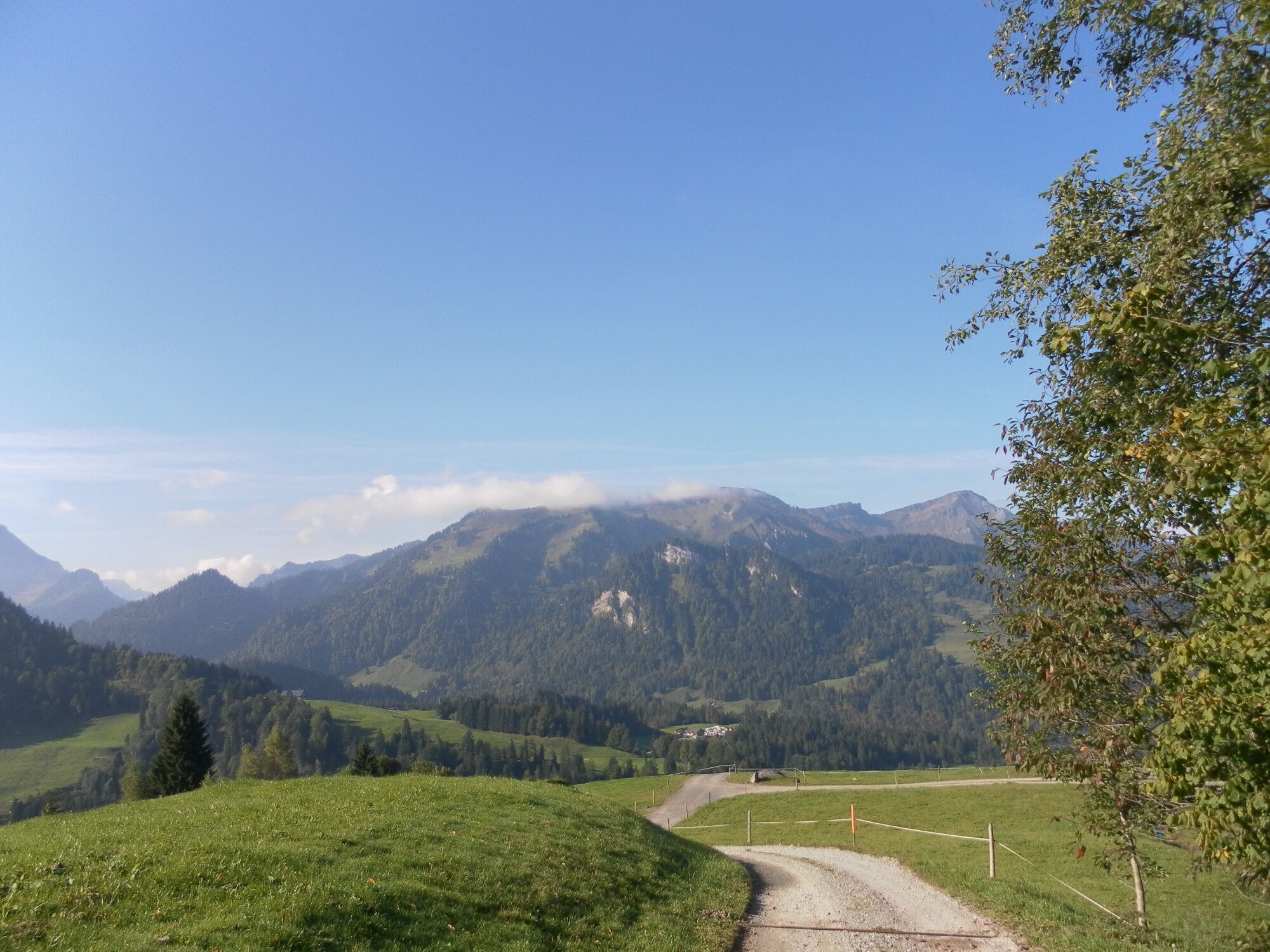
The first section takes you through the alpine terrain of Rindberg. Then it steadily ascends as far as the Sättele, where you are rewarded with a stunning view of the mighty Gottesackerwände. Going slightly downhill, you then take an agricultural path to Lake Constance hut. From there, follow the path through alpine terrain and meadows as far as Gerisgschwend. You then take the main street and branch off towards Sibratsgfäll. Following an ascent, you are rewarded with a downhill ride into the village centre.
- Highest point
- 1,429 m
- Endpoint
-
Sibratsgfäll centre of town
- Height profile
-

- Safety instructions
- Tips
-
Chances to stop off for a drink/food:
Gasthof Alpenrose, Burgl Hut, Fuchs Hut, Bodensee Hut, inns in Sibratsgfäll and Hittisau - Additional information
-
Tip: mountain bike map
Detailed descriptions of 15 recommended tours for beginners, the advanced and professionals are enclosed in the mountain bike map of Bregenzerwald (available from Bregenzerwald Tourismus, in the tourist information offices and in some sports shops.) - Directions
-
from Germany: motorway Lindau - Pfänder Tunnel - motorway exit Dornbirn Nord (toll sticker required) - Bregenzerwald - Hittisau; OR Autobahn Kempten - Immenstadt - Oberstaufen - Ach - Riefensberg - Krumbach - Hittisau - Sibratsgfäll
from Switzerland: motorway St. Gallen - St. Margrethen/Au - Lustenau - Dornbirn - Bregenzerwald - Hittisau - Sibratsgfäll - Parking
-
Sibratsgfäll centre of town


- Author
-
The tour Sibratsgfäll | Balderschwang Tour is used by outdooractive.com provided.
GPS Downloads


General info
Refreshment stop
A lot of view
Other tours in the regions
-
Allgäu
188
-
Bregenzerwald
224
-
Sibratsgfäll
73