© Andelsbuch Tourismus - Renja Metzler

- Brief description
-
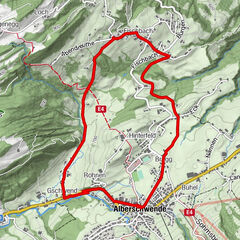
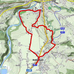
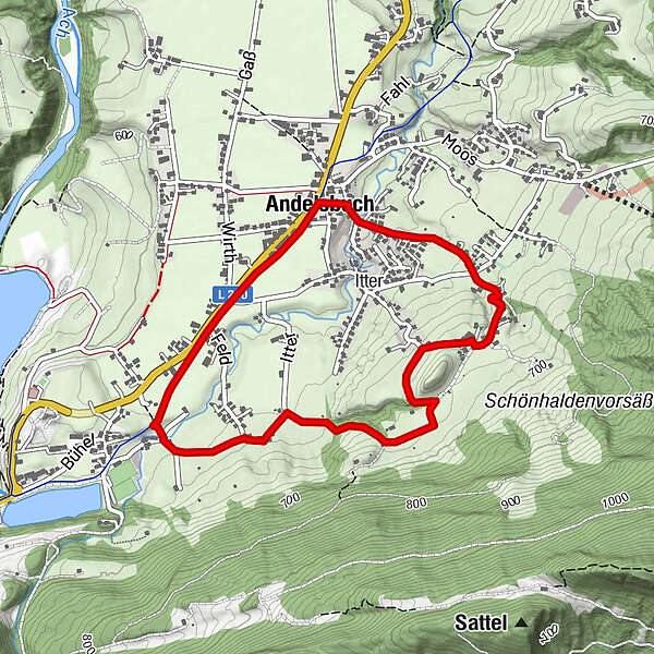
A scenic circular run through Andelsbuch.
- Starting point
-
Village square Andelsbuch
- Route
-
Unterbezegg1.0 kmAndelsbuch4.1 km
- Best season
-
JanFebMarAprMayJunJulAugSepOctNovDec
- Description
-
The circular run to the Mühle parcel of land starts in the centre of the village. Continue across a field path to the Unterbezegg parcel of land and, along the edge of the forest, to the Brand/Krähenberg parcel of land. Enjoy a lovely view across Andelsbuch from the vantage point. Continue to the Grunholz parcel of land and then back to the centre of the village.
- Highest point
- 678 m
- Endpoint
-
Village square Andelsbuch
- Height profile
-


- Author
-
The tour Andelsbuch | Panorama run is used by outdooractive.com provided.
GPS Downloads


Other tours in the regions
-
St. Gallen - Bodensee
64
-
Bregenzerwald
43
-
Andelsbuch
28