
- Brief description
-
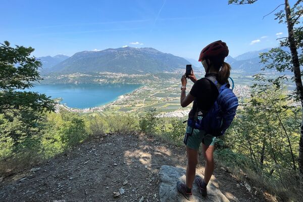
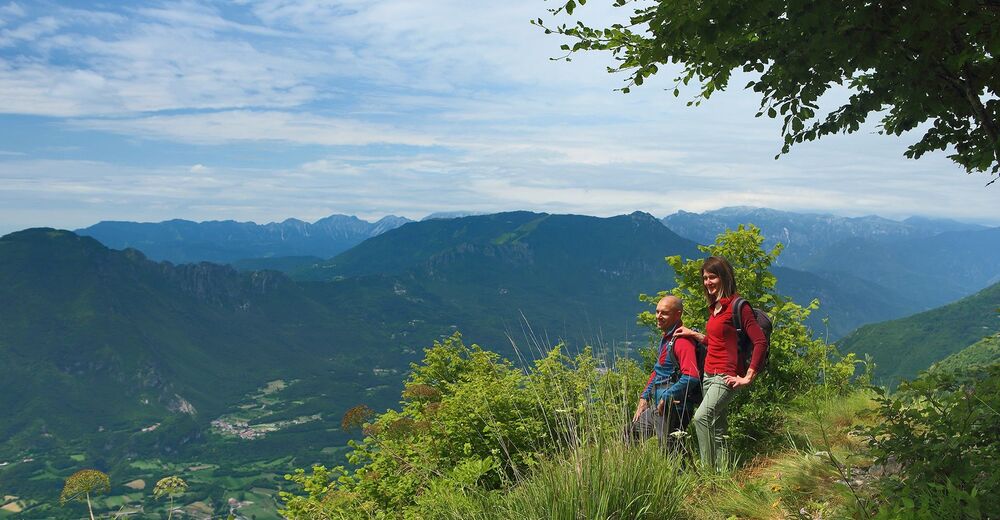
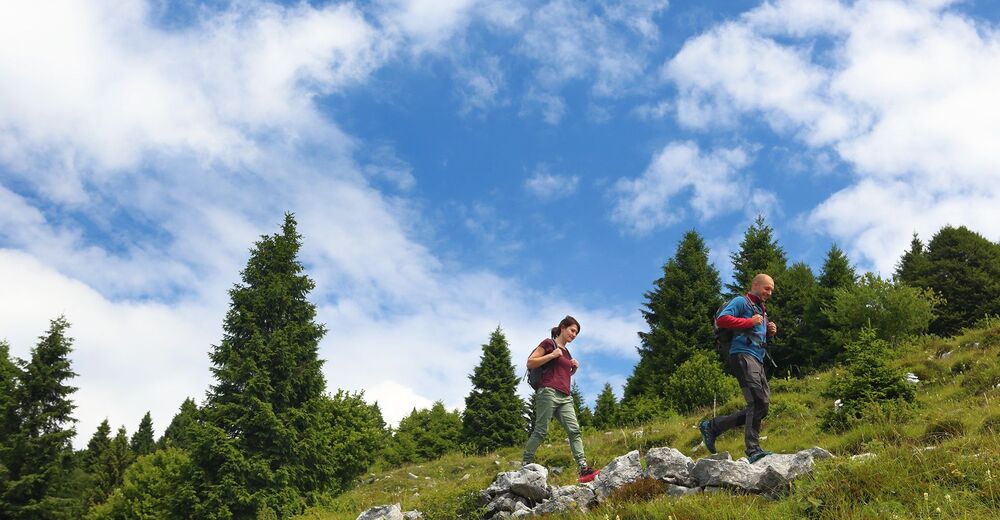
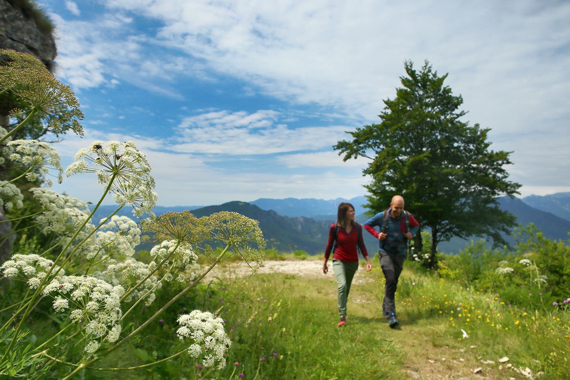
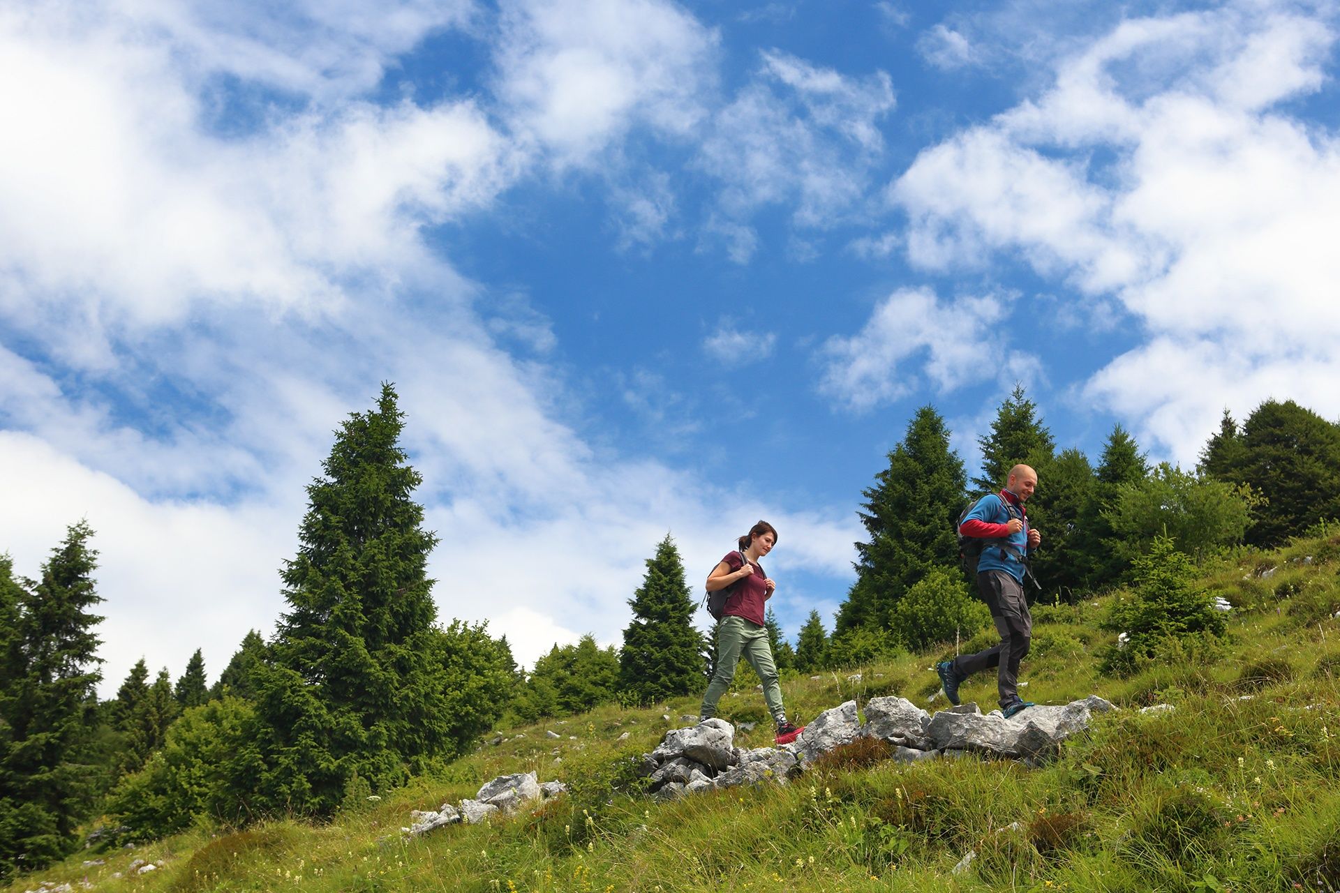
This ring-route on dirt roads and wide tracks will make you enjoy the breathtaking panorama of the Veneto plain, taste the alpine products of the many mountain huts and contemplate the silence of the woods of the Asiago Plateau.
- Difficulty
-
medium
- Rating
-
- Starting point
-
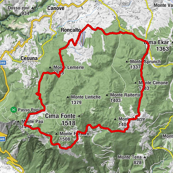
Rifugio Monte Corno, Lusiana, (VI)
- Route
-
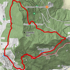
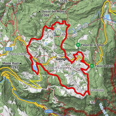
Bocchetta Granezza0.0 kmRifugio Monte Corno0.0 kmCasello del guardia0.7 kmQuattro Strade1.9 kmVasche di Sùnio (1,360 m)8.2 kmMonte Cucco (1,352 m)8.8 kmVal Magnaboschi13.3 kmRoncalto18.5 kmLa Terrazza Casa Rossa19.6 kmLa Tana Gourmet19.7 kmMadonna della Neve20.4 kmPoslen21.0 kmSan Sisto22.2 kmBivio Lucca23.1 kmTurcio24.7 kmTurcio s.n.c.24.8 kmValle Granezza di Gallio28.5 kmMalga Monte Corno (1,327 m)30.2 kmRifugio Monte Corno30.6 kmBocchetta Granezza30.7 km
- Best season
-
JanFebMarAprMayJunJulAugSepOctNovDec
- Description
-
R. Monte Corno - Bocchetta Pau - Kaberlaba - Turcio - R. Monte Corno
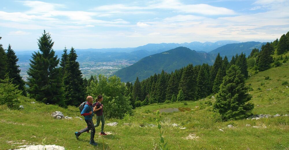
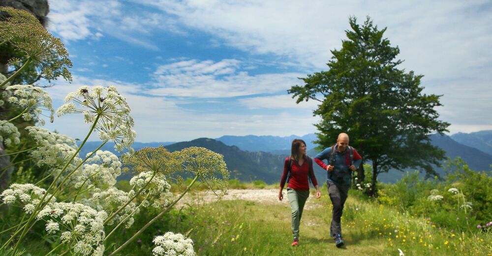
The proposed route is part of the classic tour of the mountain huts of Asiago, that dot the southern slope of the plateau overlooking the Veneto plain. Don't miss the chance to enjoy the panorama from Bocchetta Pau that sweeps from the Lagoon of Venice to the Alte Valli Vicentine. The Asiago Plateau will make you live a unique experience crossing thick forests, green pastures and landscapes enhanced by pretty mountain villages.
- Directions
-
The route is marked with red/white boards according to the C6 decoding but it is always recommended to download the gps track on the website www.laviadelleprealpi.it to avoid unpleasant situations and live a great experience.
- Highest point
- 1,364 m
- Endpoint
-
Rifugio Monte Corno, Lusiana, (VI)
- Height profile
-
 © outdooractive.com
 - Equipment
-
Every excursion requires specific clothing and equipment. Adequate equipment is always recommended in order to avoid unpleasant surprises related to the variability of the weather, the season and the condition of the soil that can cause unpleasant accidents. Make sure you always evaluate the type of route you are facing, the stopping points and any useful references in case of need.
The routes in the mountains can hide many pitfalls even for the most experienced ones, so make sure you never leave the marked trails, always warn someone where you are heading and when you expect your return.
The telephone number in case of emergency is 112. - Safety instructions
-
Follow some simple rules and enjoy a great experience in the heart of nature:
- Plan your trip in advance
- Show respect for private property and the natural environment
- Always use safety equipment and check it in advance
- Follow the marked route and respect the bans
- Adapt the speed to your preparation and don't exceed your limits
- Do not scare animals
- Do not litter
- Always give way to pedestrians and let them know when you are approaching
- Do not ride at a dangerous speed
- Do not stop too suddenly or you might damage the soil
The practicability of routes in the Alpine foothills and mountain areas depends on the weather, the climatic phenomena and the environmental changes. For this reason, the information provided may be subject to change. Before you set off, find out about the state of the route by asking the local organisations, local experts and the tourist information offices on the website www.laviadelleprealpi.it. The local authorities and associations of the involved areas do not assume any legal liability for injuries or damages to people and things that may occur along the marked routes. - Tips
-
The suggested itinerary goes along the Via delle Prealpi, which connects Lake Garda to the Cansiglio Forest. Plan your own adventure and check out the points of interest, where to sleep, where to eat and the various services that will make your experience even more complete and safe on www.laviadelleprealpi.it.
- Additional information
- Directions
-
If you are travelling from Vicenza you can take the A31 Valdastico motorway, exit at Piovene Rocchette, follow the signs for Chiuppano and continue along the SP349 road until Bocchetta di Granezza.
If you are travelling from Trento you can take the SS47 Valsugana road, exit at Levico Terme, follow the signs for Asiago along the SP133 and SP349 roads and continue until Bocchetta di Granezza.
- Parking
-
Large car park in Bocchetta di Granezza, Asiago (VI)
GPS Coordinates: 45.805549, 11.533785


- Author
-
The tour Hiking through the alpine huts of Asiago is used by outdooractive.com provided.


General info
-
Vicenza
307
-
Altopiano di Asiago 7 Comuni
345