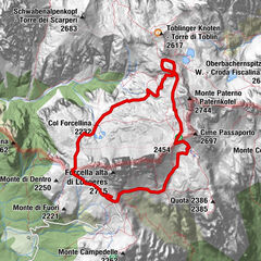
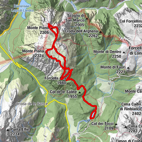
Tour data
12.92km
1,868
- 2,323m
600hm
606hm
04:01h
- Brief description
-
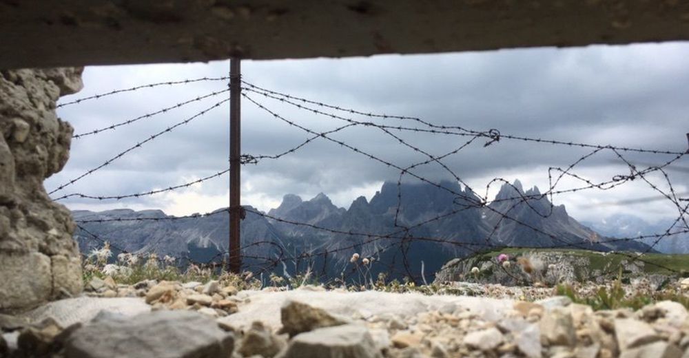
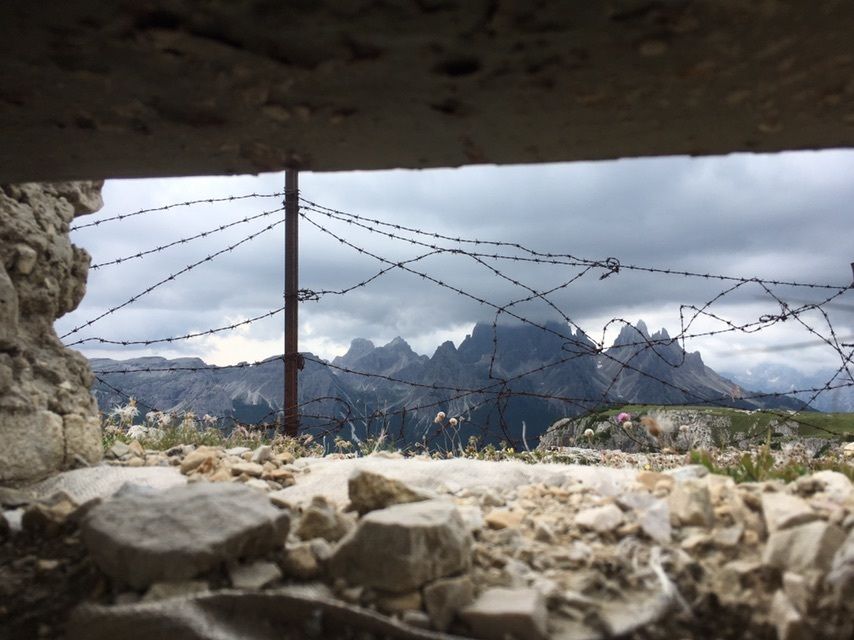
Montée par chemin et route, puis parcours sur le sommet du côté du front Italien puis Austro-Hongrois. Superbe vue sur les montagnes et vallées alentours, beaucoup de tranchées, galeries et de vestiges de la 1ère guerre mondiale.
- Difficulty
-
medium
- Rating
-
- Route
-
Rifugio Antorno0.1 kmForcella Bassa (1,880 m)1.2 kmForcella Alta (1,980 m)2.5 kmChapel Monte Piana4.3 kmToblacher Kreuz (2,301 m)6.4 kmMonte Piano (2,306 m)6.7 kmMonte Piana (2,324 m)8.1 kmForcella Alta (1,980 m)10.3 kmForcella Bassa (1,880 m)11.6 km
- Highest point
- 2,323 m
GPS Downloads


Other tours in the regions
-
Belluno-Dolomiti
1079
-
Dolomitenregion Drei Zinnen
685
-
Misurina
167