- Brief description
-
A short walk to Viote, the botanical gardens of Trento.
- Difficulty
-
medium
- Rating
-
- Starting point
-
Sopramonte - Campo Sportivo Sports Fields (620m)
- Route
-
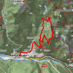
Capanna Viote7.4 kmLe Viote7.6 km
- Best season
-
JanFebMarAprMayJunJulAugSepOctNovDec
- Description
-
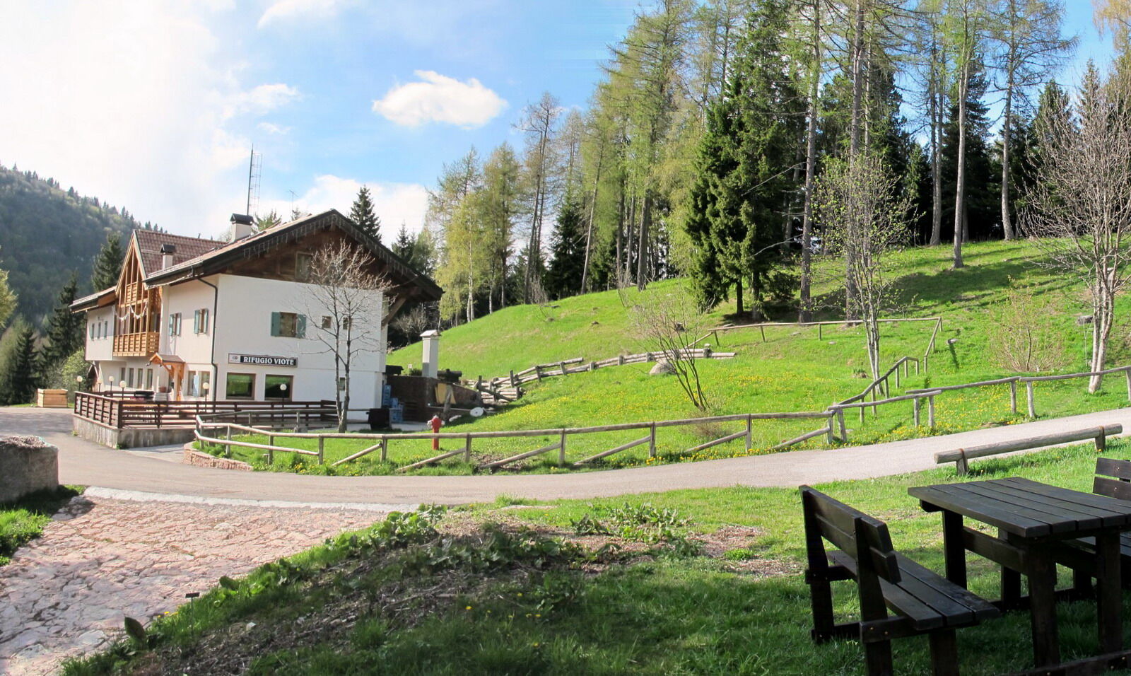
The Viote Hut, at Trento’s Viote, is the destination of this beautiful walk that starts in Sopramonte and follows trail 621. Easy to reach even by car. Near the Viote hut is a large playground with picnic area.
- Directions
-
From near the sports fields, take the road with signs marking trail 621, which are easy to spot.
You climb up by carefully following trail 621. Since you cross many forest roads and forks, it is best not to wander off and risk missing the right trail.
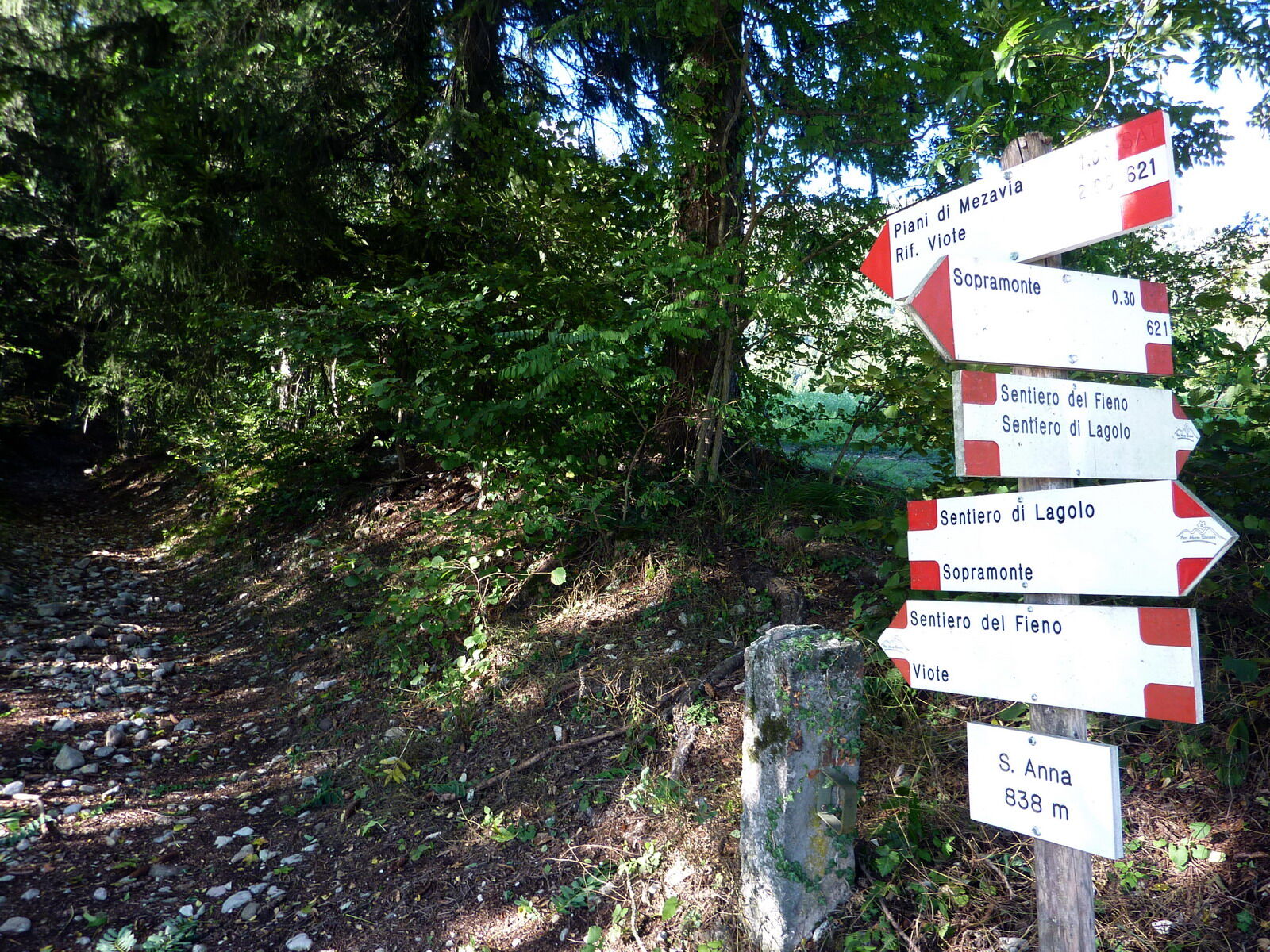
You go through Maso Bernardi locality (680 m) and past the picturesque area of Sant’Anna (873 m). Continuing along trail 621, always well-marked, sections on mule tracks alternate with forest roads and paths. You come to the “Piani di Mezavia” at an altitude of 1210 m.
Ignoring trail 607, which climbs to the left, you continue straight along trail 621, on a road that climbs a rather steep slope. At 1450 m asl, the trail leaves the valley of the small river and climbs to the left (right hand side of the river), until it reaches the Rifugio Viote Fratelli Tambosi at 1530 m. We then continue for another 300 meters until we reach the Capanna Viote restaurant.
To return, you follow the same route backwards.
VARIATION:You can comfortably reach the Viote Hut by car on road SP85.
- Highest point
- 1,566 m
- Endpoint
-
Viote Hut (1530m)
- Height profile
-
 © outdooractive.com
 - Equipment
-
Hiking boots/shoes, windbreaker, a change of clothes.
- Safety instructions
-
1) Prepare your itinerary
2) Choose a route that is suitable for your skill level
3) Choose suitable equipment and gear
4) Consult the snow/weather bulletins
5) Heading out on your own is more risky
6) Leave information on your itinerary and on the approximate time you expect to return
7) Do not hesitate to seek the support of a professional
8) Pay attention to the information and signs that you find along the trail
9) Do not hesitate to follow your steps backwards
10) In case of an accident, sound the alarm by calling the emergency number 112.
Please note that the practicability of the itineraries in a mountain environment is strictly linked to the contingent conditions and is therefore influenced by natural phenomena, environmental changes and weather conditions. For this reason, the information contained in this page may have changed. Before leaving for a tour, make sure the path you will approach is still accessible by contacting the owner of the mountain hut, the alpine guides or the visitor centres of the nature parks, the info offices of the local tourist board.
This is a rather long trail - about 14 Km there and back. Only set out if you are physically fit enough. Carefully follow the markings for trail 621. Since you cross many forest roads and forks, it is best not to wander off and miss the right trail.
- Tips
-
It is definitely worth visiting the Giardino Botanico Alpino delle Viote [Alpine Botanical Gardens] immediately next to the mountain hut Rifugio Viote.
- Additional information
-
Trento Tourist Office - Tel. +39 0461 216000 - info@trento.info - www.trento.info
- Directions
-
From Trento, you climb towards the Bondone, following road SS45bis, and then SP85 to Sopramonte.
- Public transportation
-
Reach Sopramonte by Trentino Trasporti bus No. 1.
- Parking
-
Parking area near the sports fields.


- Author
-
The tour Trekking from Sopramonte to the Viote Hut is used by outdooractive.com provided.