- Brief description
-
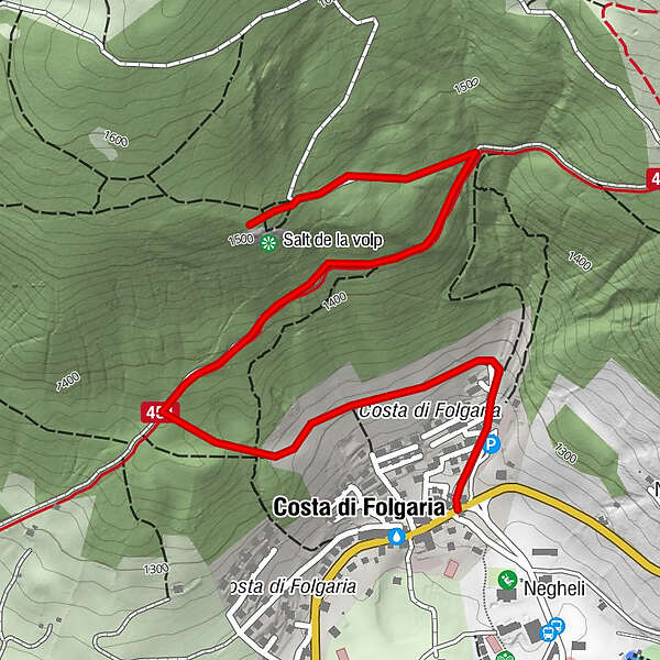
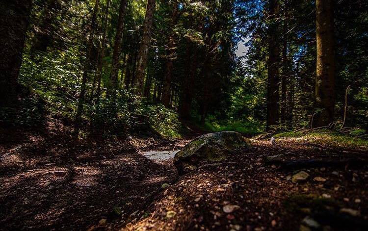
This is a variant of the Salita al Salt dela Volp that starts in Folgaria. The first section of the route cuts diagonally across the wide meadow area above the village of Costa, then dives into the dense spruce forest that covers the slope, until it joins the main route. The destination is the Salt dela Volp viewpoint. Also recommended for families with children +6 years.
- Difficulty
-
easy
- Rating
-
- Route
-
Costa di Folgaria0.8 kmSorgente Fontanelle1.8 km
- Best season
-
JanFebMarAprMayJunJulAugSepOctNovDec
- Description
-
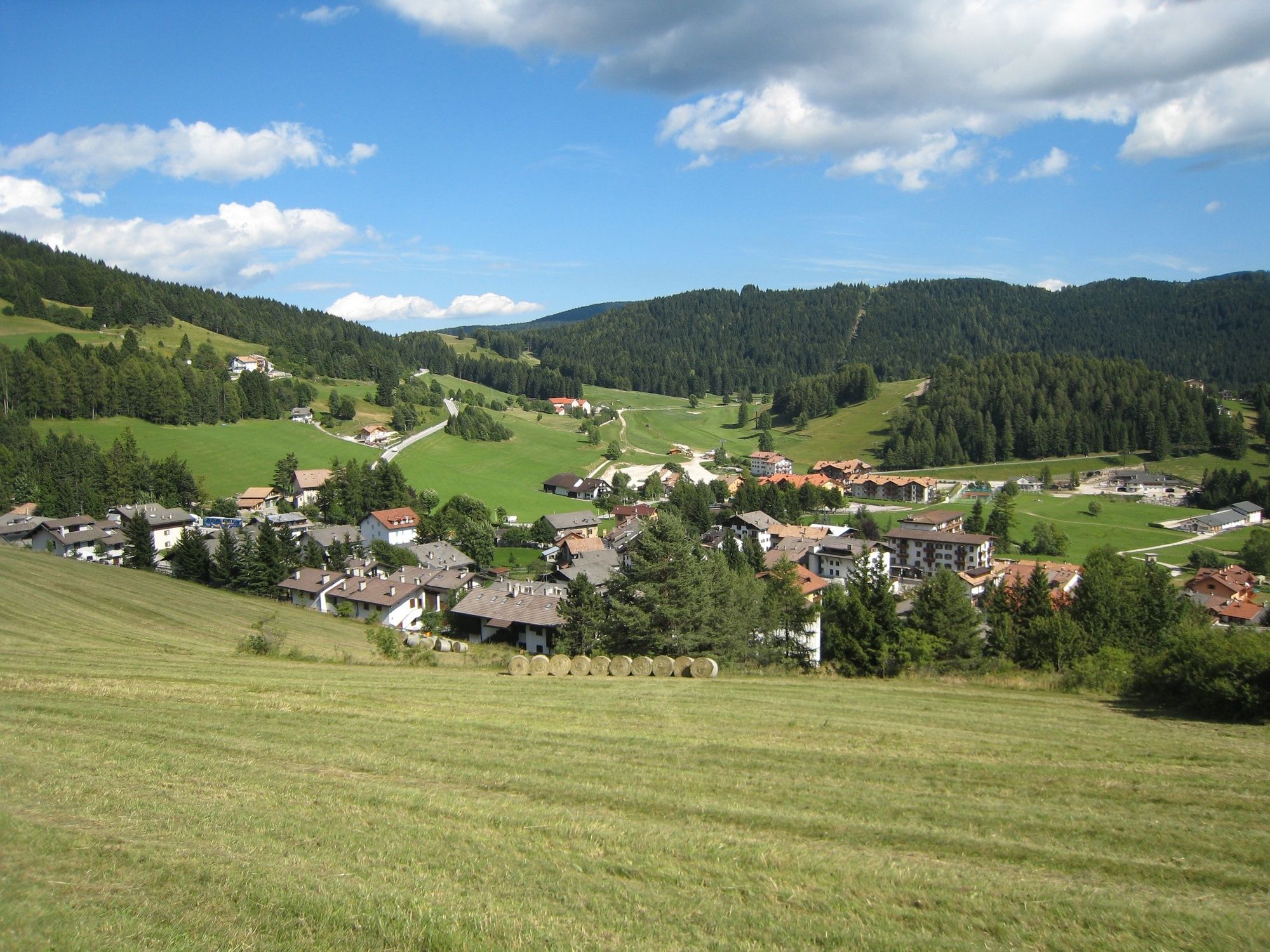
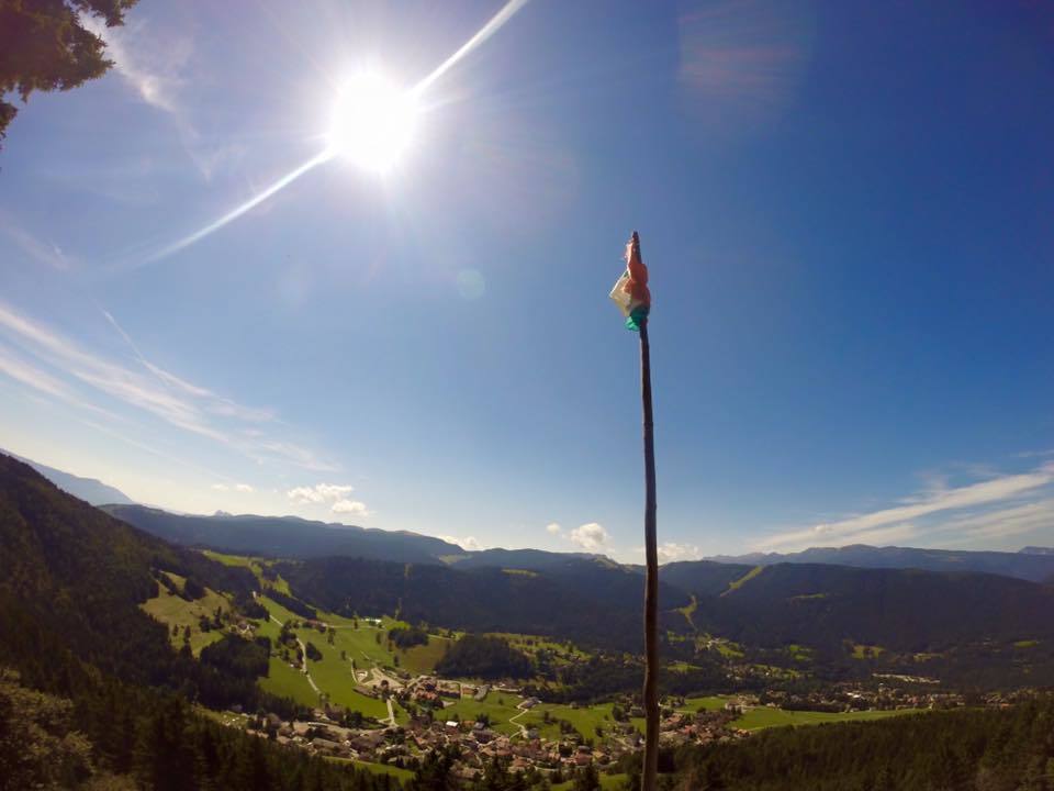
Already in the first section, the panorama opens up below us, until the village of Costa and the meadow basin that frames it are captured in all their extension. But the real panorama, capable of thrilling us, comes once we have reached our destination, from the Salt dela Volp ridge. From there one can grasp the breadth of the plateau, as far as the peaks of Passo Coe, Mount Finonchio and Mount Stivo.
- Directions
-
The starting point is located on the eastern edge of the village of Costa, beside the main road (signposted). Past the Hotel Villaggio Nevada, we take the little path that cuts through the wide meadow area above the village. When we reach the edge of the wood, we enter the forest cover and continue along the path until we cross the small forest road coming up from Folgaria. We follow it, turning right until we reach the locality of Fontanelle (fountain, rest area). The Salt della Volp is nearby. We return by the same route.
- Highest point
- 1,510 m
- Endpoint
-
Costa est
- Height profile
-
 © outdooractive.com
 - Safety instructions
-
Please note that the practicability of the itineraries in a mountain environment is strictly linked to the contingent conditions and is therefore influenced by natural phenomena, environmental changes and weather conditions. For this reason, the information contained in this page may have changed. Before leaving for a tour, make sure the path you will approach is still accessible by contacting the owner of the mountain hut, the alpine guides or the visitor centres of the nature parks, the info offices of the local tourist board.
- Author
-
The tour 11 - Fontanelle ascent is used by outdooractive.com provided.