- Brief description
-
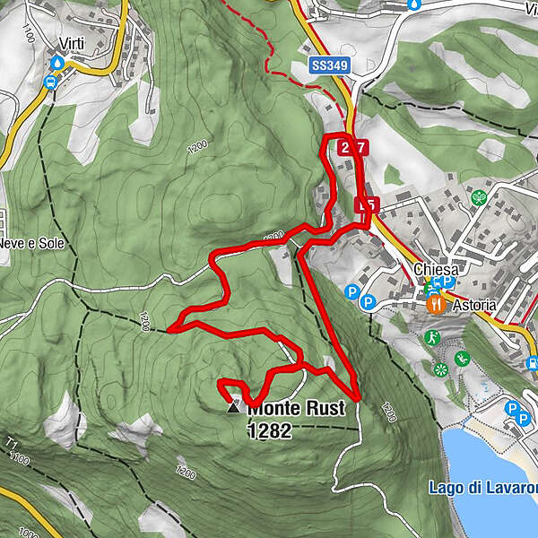
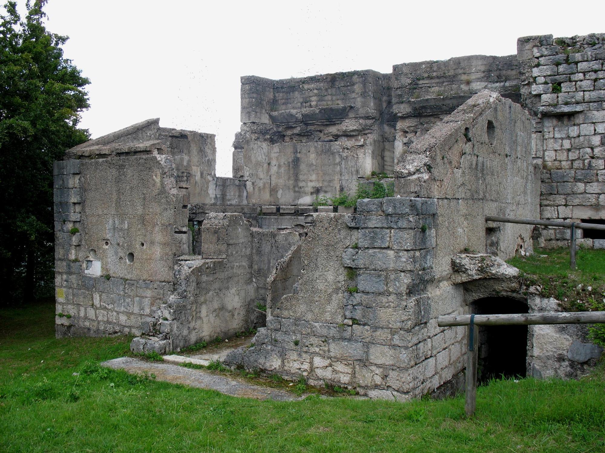
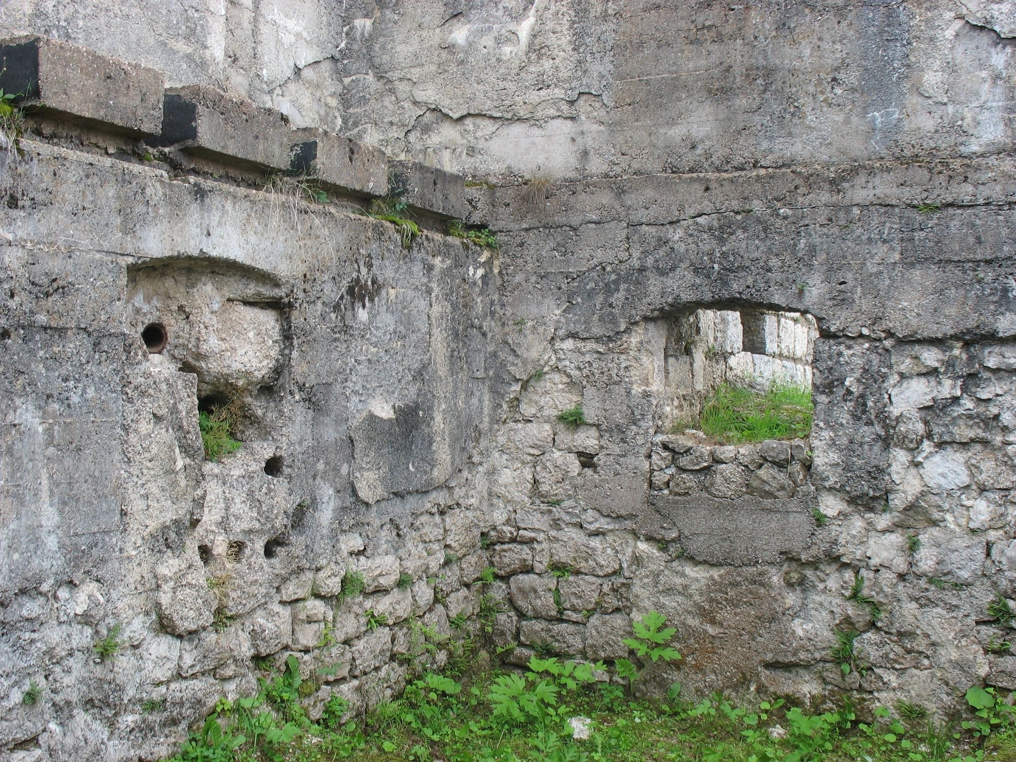
Mount Rust is a hill that rises between Lake Lavarone and the Carbonare saddle. During the Great War (1914-1918) it was chosen by the Austro-Hungarians to place an optical connection station on the summit, a structure that allowed the exchange of light messages, encrypted, between the Forts and the rear command posts. In the walls of the building, the holes that housed the electric projectors from which the signals were sent are visible.
Translated with www.DeepL.com/Translator (free version)
- Difficulty
-
easy
- Rating
-
- Starting point
-
West Chiesa
- Route
-
Monte Rust (1,282 m)1.7 km
- Best season
-
JanFebMarAprMayJunJulAugSepOctNovDec
- Description
-
The walk takes us to the summit of the mountain along the easy dirt road that climbs the northern slope of the high ground, surrounded by a mixed forest cover of broad-leaved and resinous trees. On reaching the summit, it is possible to visit the optical station and admire the panorama of the upper Astico valley and the high ground dominated by Fort Cherle. This walk is also suitable for families with children over the age of 6.
- Directions
-
From the square in Chiesa, walking on the pavement, we follow the SS349 for about 300 m in the direction of Carbonare. Having passed the Hotel Monte Rus, we take, on the left, the beautiful dirt road that, enveloped in a pleasant forest mantle, gradually climbs the northern slope of the hill. Having visited the optical connection station, we retrace our steps for a while, then turn right (signposted) and descend the slope along an easy path that cuts through the forest and quickly takes us back to our starting point.
- Highest point
- 1,269 m
- Endpoint
-
West Chiesa
- Height profile
-
 © outdooractive.com
 - Safety instructions
-
As you can imagine, the practicability of itineraries in a mountain environment is closely linked to conditions and therefore depends on natural phenomena, environmental changes and weather conditions. For this reason, the information contained in this sheet may have changed. Before setting off, find out about the status of the route by contacting the manager of the huts on your route, mountain guides, nature park visitor centres and tourist offices.
- Tips
-
The optical connecting centre: During the 1914-1918 War it had the function of receiving and transmitting otical signals among the fortresses.
-

-
AuthorThe tour Giro del Rust is used by outdooractive.com provided.