
- Brief description
-
Beautiful itinerary that leads to the panoramic summit in the heart of the Lagorai Group. Little known but very interesting and relatively safe peak.
- Difficulty
-
medium
- Rating
-
- Starting point
-
Ponte Stue
- Route
-
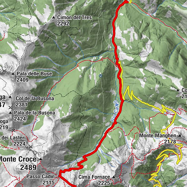
Piazza dei Siori (1,339 m)0.9 kmCima Bolénga (2,272 m)7.4 kmPasso Cadin (2,115 m)8.0 kmPiazza dei Siori (1,339 m)14.0 km
- Best season
-
AugSepOctNovDecJanFebMarAprMayJunJul
- Description
-
One of the several ski touring itineraries in Val Cadino, Cima Bolenga is a destination that does not present particular difficulties. It is therefore also ideal for not very experienced skiers. It can also be done after heavy snowfalls, however in this case, paying attention to the Cadin Pass, where snowdrifts often form, which could be dangerous. The stretch that connects the pass to the peak can sometimes be without snow due to the wind. In this case it is recommended to finish the ascent at Passo Cadin.
- Directions
-
From Ponte Stue parking take the main road that leads to Passo Manghen. After about 2 kilometers, at an altitude of 1440 m., take the road on the right following the signs for Malga Agnelezza. Continue on the forest road until you reach and pass the hut, continuing through the sparse wood. You always remain on the left of the stream and along it you enter the valley where the wood thins out, allowing you to see the Cadin pass. The slope increases and it is necessary to pay attention to snowdrifts often present. Once you reach the pass, if the snow conditions allow it, continue southwards, bypassing the last rocks of Cima Bolenga on the right, and reach the summit.
- Highest point
- 2,224 m
- Endpoint
-
Bolenga Peak
- Height profile
-
 © outdooractive.com
 - Equipment
-
For all ski-mountaineering activities, the proper apparel is strongly recommended. Skiers must bear in mind that temperatures can dip quickly and garments should also be suitable for snowy conditions (such as waterproof Gore-Tex jackets). Furthermore, gloves, cap, sun glasses and sun cream should also form part of every off-piste skier’s basic gear.
It’s COMPULSORY to carry with you an avalanche rescue kit consisting of avalanche transceiver, probe and shovel (this is also available for rent). In the case of hard snow cover or ice, ski crampons are recommended.
- Safety instructions
-
Remember, snowpack stability is subject to sudden and unforeseeable changes and shifts. Always check the local avalanche bulletin (www.meteotrentino.it or any other service that suits your needs) before departure and make sure you gather all possible information concerning current conditions by calling the Mountain Guides.
GPS routes are merely indicative of the more reasonable track but must not be followed blindly without first checking current slope and terrain conditions.
THE 10 RULES FOR HIKERS
Prepare your itinerary beforehand Choose an itinerary that suits your physical abilities Choose suitable clothes and equipment Check the weather forecast Hiking by yourself is more risky; if this is the case, take a mobile phone with you Leave information about your itinerary and your expected return time If you are not sure about your itinerary, contact an Alpine Guide Pay attention to signposts and directions that you find along your way Do not hesitate in going back if you feel too tired In case of emergency call 112 - Additional information
- Directions
-
From Molina di Fiemme, follow the sign to Passo Manghen and drive until you reach Ponte Stue (1.252 m), where the snow clearing ends.
- Parking
-
Leave your car before or after the bridge.

-

-
AuthorThe tour Passo Cadin and Cima Bolenga is used by outdooractive.com provided.