
- Brief description
-
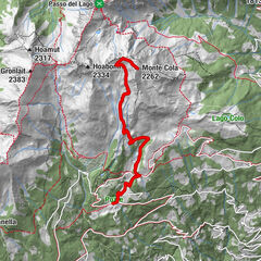
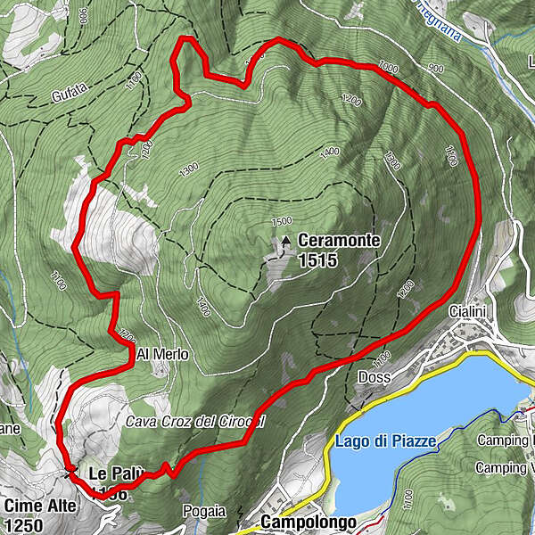
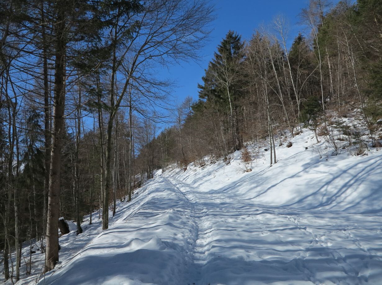
Ring of 8 Km around the watershed mountain between Altopiano di Pinè and Valle di Cembra
- Difficulty
-
medium
- Rating
-
- Starting point
-
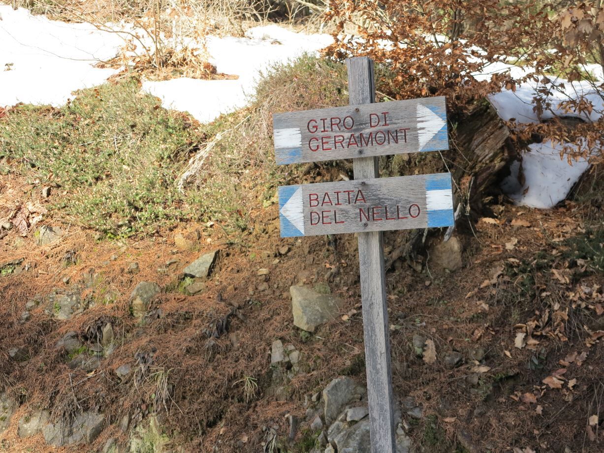
Ceramont shelter ex hut of “Nello” (see "direction to follow")
- Route
-
Baita del NelloCialini5.6 kmDoss6.0 kmRizzolaga7.4 kmLe Palù (1,196 m)7.9 km
- Best season
-
AugSepOctNovDecJanFebMarAprMayJunJul
- Description
-
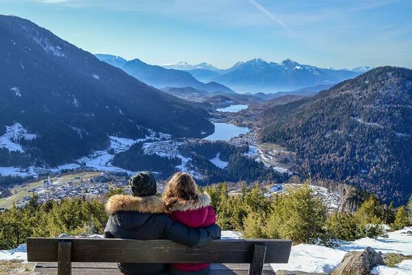
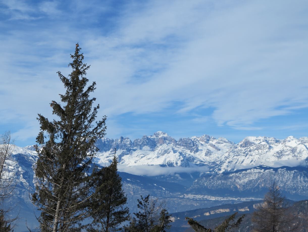
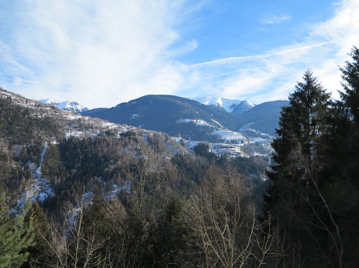
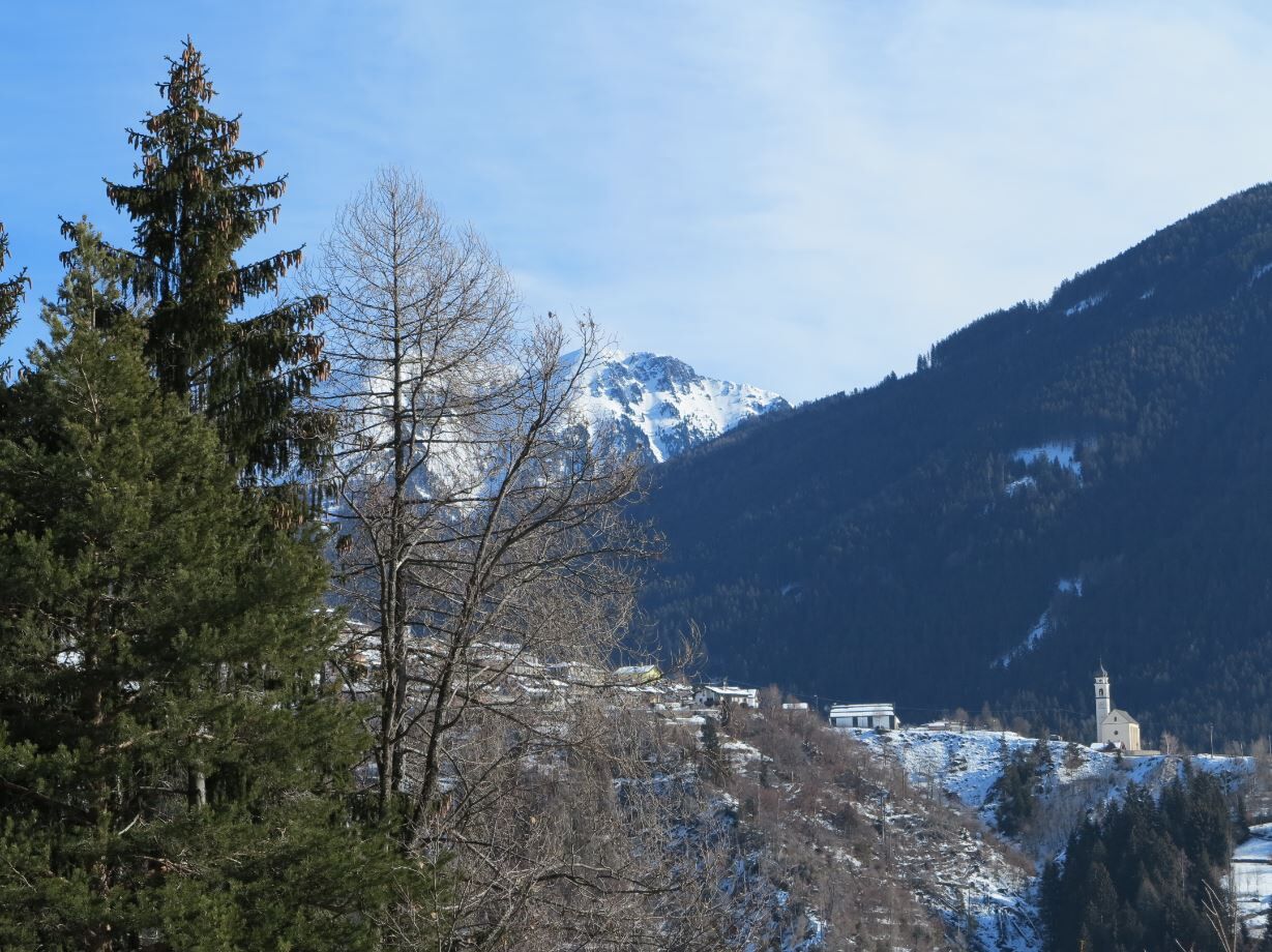
Interesting itinerary through the woods of Mount Ceramont; the superb view sweeps from the Brenta group to the Lagorai and from the Pinè Plateau to the Cembra Valley.
- Directions
-
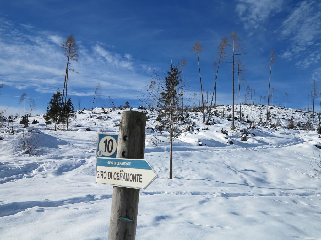
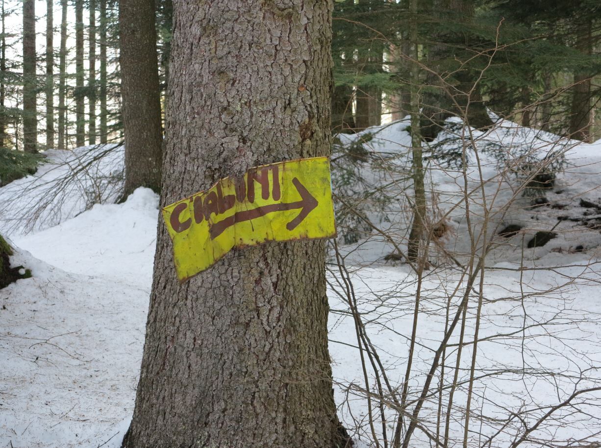
From the "Nello" hut (coordinates N46.15202 E11.25725) with indications for "Giro di Ceramont" take a forest road heading north in a slightly downhill direction (there are two roads, take the one on the left) and continue following the "Cialini" sign.
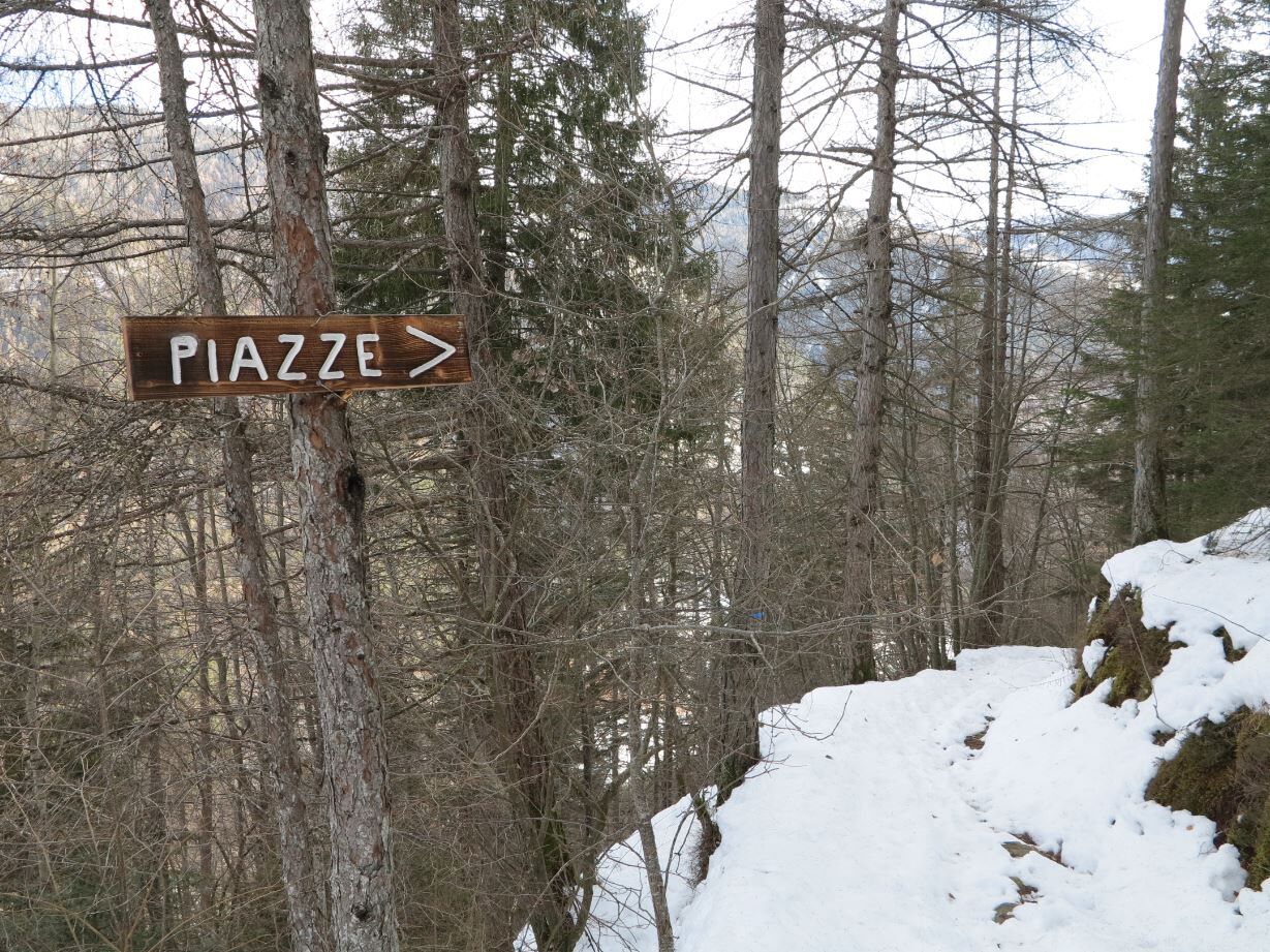
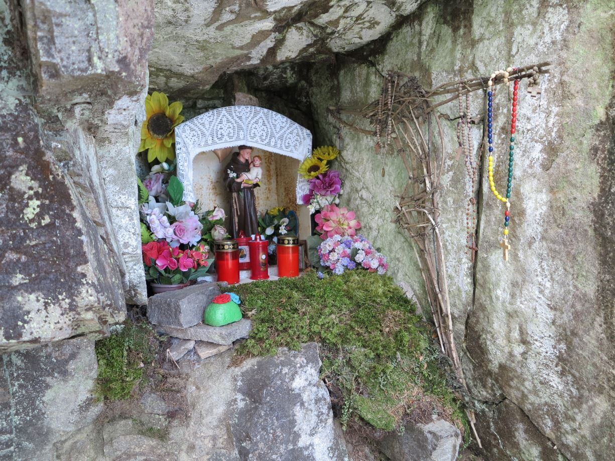
After about 3.5 km, at the crossroads, take the path for "Piazze"; a stop is recommended to observe the capital set into the rock and dedicated to St. Anthony.At the end of the path, a pleasant forest road begins. When you come to a green bar, take the slightly uphill road (right-hand road) signposted "baita del Nello" and continue along the forest road until you reach the starting point.
- Highest point
- 1,221 m
- Endpoint
-
Ceramont shelter ex hut of “Nello”
- Height profile
-
 © outdooractive.com
 - Equipment
-
When embarking on snowshoeing or snow walking take with you:
Waterproof boots that are the right size (if they are too tight they can give rise to principles of frostbite in the feet);
Snowshoes and trekking poles;
Comfortable, warm, waterproof Gore-Tex-type winter clothing;
Beanie, gloves, sunglasses and protective sunscreen;
Backpack with snacks and hot drinks;
MANDATORY avalanche self-rescue kit (consisting of Artva, shovel and probe) 'where avalanche risks exist' (Art.26 Legislative Decree February 28, 2021 No.40). Before embarking on any hike, make sure you know how to use it. The kit can be rented. - Safety instructions
-
Degree of difficulty according to the common symbology: path E (on mule tracks and paths)
External risks present along the route: small stretch of narrow path near the capital dedicated to Sant Antonio
Snowpack stability is subject to sudden and unpredictable changes. Before setting out:
Always consult the avalanche bulletin (www.meteotrentino.it) and inquire about the route and its conditions by calling your local mountain guides or at the Tourist Office; Check the opening of huts and refuges; Study and prepare your itinerary well, choosing a route suitable for your physical condition (if you are not sure, do not hesitate to rely on a professional); Leave information about your route and approximate time of return.Do not leave trash at high altitudes and, if possible, avoid leaving it at the shelters or huts you will visit; If you spot wild animals along the route, do not approach them, do not shout, and keep your dog on a leash.
In case of fatigue or problems, do not hesitate to retrace your steps.
In case of an accident, call 112. - Tips
-
Points of interest include the capital dedicated to St. Anthony and the panoramic view of the Pinè Plateau.
ATTENTION: Before starting the route, check the snow conditions with our offices. Tel. +39 0461 557028 / info@visitpinecembra.it
- Additional information
-
Trento Tourist Office - Tel. +39 0461 216000 - info@trento.info - www.trento.info
- Arrival
-
From the A22 Brennero motorway (from the south exit Trento south – from the north exit Trento north) and from the Statale 12 del Brennero, continue along the S.S. 47 to Pergine Valsugana – Padova, and then pass on the S.P. 83 to the Piné Plateau. Reach the town of Rizzolaga, go up to the village, pass the two churches and continue on the "via di Ceramont" up to the Ceramont refuge-former hut of Nello.
- Public transportation
-
From Trento bus station, take line B403 towards Montesover (Trento - Pergine - Baselga di Pinè - Montesover) or line B402 (Trento - Nogarè - Baselga di Pinè - Montesover) and get off at the "Rizzolaga" stop. There is no public transport that connects the town of Rizzolaga with the Baita del Nello therefore the place of departure must be reached by own means or on foot (about 30 minutes walk).
- Parking
-
Parking is available at the "Nello" hut resort.


- Author
-
The tour Snowshoeing around the Ceramont is used by outdooractive.com provided.