
- Brief description
-
A tour on the slopes of Mount Baldo, for those who adore long climbs: 16 kilometres, with some tough sections, which lead to the San Valentino skiing resort.
- Difficulty
-
difficult
- Rating
-
- Starting point
-
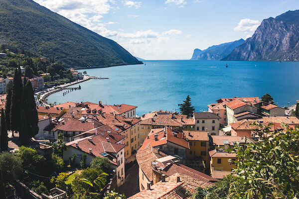
Torbole - Info office
- Route
-
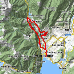
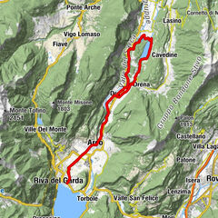
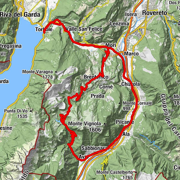
Torbole0.2 kmChiesa di Sant'Andrea0.3 kmQuartiere Europa0.8 kmNago1.5 kmVal del Molin1.7 kmAquais2.3 kmSantissimo Nome di Maria6.7 kmMaso dello speck6.8 kmLoppio6.9 kmSant'Antonio (224 m)7.5 kmMori10.8 kmChizzola16.3 kmSerravalle all'Adige16.4 kmVilletta17.1 kmSanta Lucia18.3 kmPilcante22.1 kmSabbionara (152 m)27.5 kmChiesa della Beata Vergine Maria Assunta28.6 kmAvio29.3 kmCalchera32.2 kmPozzo Beccaria39.6 kmPra da Stua41.8 kmSan Valentino45.2 kmMaso Palù53.5 kmTordoi54.0 kmFontechel54.4 kmBrentonico55.0 kmCazzano56.9 kmSàuga58.9 kmBesagno59.9 kmTierno62.3 kmMori63.0 kmSant'Antonio (224 m)65.8 kmLoppio66.4 kmMaso dello speck66.6 kmSantissimo Nome di Maria66.7 kmNago71.8 kmVal del Molin71.9 kmQuartiere Europa72.4 kmTorbole73.0 kmChiesa di Sant'Andrea73.3 km
- Best season
-
JanFebMarAprMayJunJulAugSepOctNovDec
- Description
-
This route takes us to the San Valentino skiing resort, located in the garden of Mount Baldo. There is a choice of different itineraries for getting there: in this tour we suggest taking on the road that leaves from Avio and heads into the Valle dei Molini.
Technically speaking, this climb is quite long and features an average gradient of 7.5%, with a few brief slopes that exceed 10%. Just as long a descent takes us back to where we started.
Almost completely traffic-free, this tour offers cyclists an opportunity to enjoy the nature of Mount Baldo to the full. Its quiet slopes, stunning in the winter but just as characteristic without snow, provide the perfect setting for a challenging tour, suitable for expert cyclists.
- Directions
-
Start from Torbole sul Garda and then go uphill until Nago along the “Nago Vecchia (Old Nago)” road. From here on, following the cycle path reach Mori by passing the San Giovanni Pass and flanking the nature reserve of Loppio.
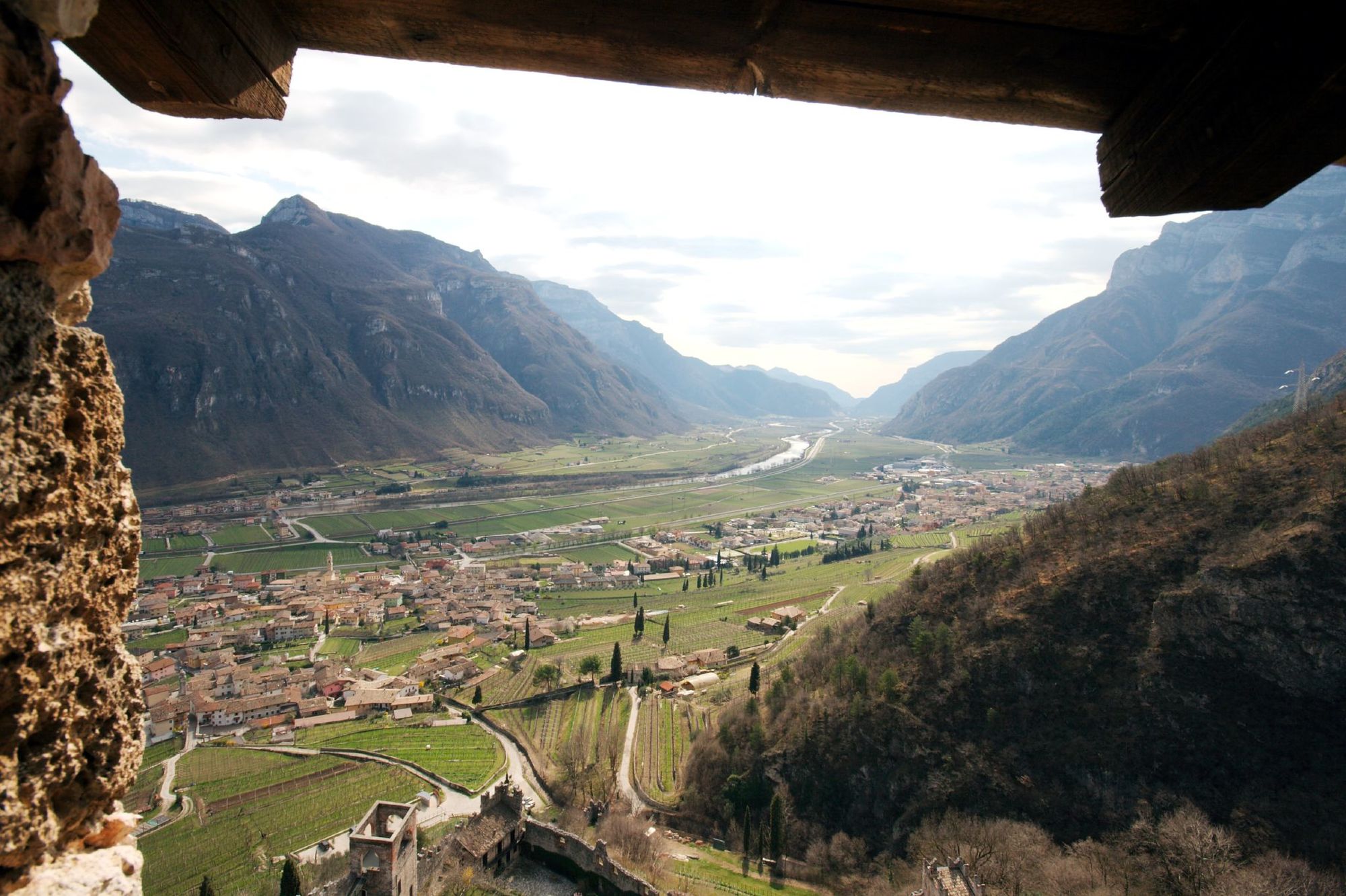
Arrived at the centre of Mori, turn right at the traffic light following the directions to Avio. Take the path running along the river Adige passing through Chizzola and Sabbionara. Once reached Avio turn right taking a 16km uphill road, called “little Stelvio”. Go through some gorges until the dam, before the last uphill road that leads to the S. Valentino's meadows.
Turn right, go downhill towards Brentonico and head back to Mori. From here on, take again the cycle path to Nago and go downhill to Torbole.
- Highest point
- 1,316 m
- Endpoint
-
Torbole - Info office
- Height profile
-
 © outdooractive.com
 - Equipment
-
Riding your bike requires specific clothing and equipment, even for relatively short and easy trips. It is always better to be prepared… e.g. for bad weather or a drop your energy levels. The unexpected things also make up a part of the fun!
Do not compare a road bike with a mountain bike. They are very different, especially in technical terms, and facing a hill with a road bike could be much more difficult than facing the same hill with a MTB. Therefore, remember to throughly evaluate the type of route you plan to do and the locations you plan to cross. Do not forget to consider the current season. Has it been raining? Attention: the paint of the crosswalk could be very slick.
What do I need to bring on my bike tour?
Bike helmet Bike gloves Bike glasses Waterproof/Windproof jacket Headlights and rearlights Reflecting suspenders Plenty of snacks (for example, dried fruit or energy bars) Water Bottle Bike repair kit (tire levers, mini bike pump, bike tube)It is always advised to let someone know where you plan to go and how long you expect to be.
Emergency telephone number 112.
- Safety instructions
-
Give your bike a regular checkup, especially if you've had it for years.
Be seen: you must wear a high vis jacket (or sash) in tunnels and on country roads after sunset.
Always wear your helmet.
Make sure your front and rear lights are working.
Put out your arm to give advance warning of your intention to change position and before you do anything, check there are no vehicles coming up behind you.
Don't use headphones or your mobile phone handsfree kit: you need all your concentration on the road!
Obey the road signs: stop at traffic lights and don't ride on the wrong side of the road.
If you are cycling in a group, always go in single file.
You've got a bell: use it to let pedestrians know you're there. Don't ride on footpaths. If you have to then get off and push your bike.
If there are cycle paths use them. It's your safety that's at stake and the rules of the road say you must. - Tips
-
This itinerary can also be ridden in the opposite direction since the distance and gradients of the climbs do not change. The descent does though: it runs down a narrow road full of curves and is therefore much more technical.
- Additional information
- Directions
- Public transportation
-
The towns in Garda Trentino - Riva del Garda, Torbole sul Garda and Arco – are connected by several urban and intercity bus lines which will take you to the starting point or in the immediate surroundings.
For up-to-the-minute information on timetables and routes
You can also get to Riva del Garda and Torbole sul Garda by the public ferry service.
- Parking
-
Free parking in Torbole in the Busatte Park.
More Pay parking at the Panorama parking area, in Via Strada Granda or and along the lakefront Lungolago Conca d'Oro
-

-
AuthorThe tour Mori - Avio - San Valentino is used by outdooractive.com provided.