
- Brief description
-
This short itinerary, all uphill, brings you to the hamlet of Campi, little known because it is hidden in a mountain valley, and then on to the San Martino archeological site.
- Difficulty
-
medium
- Rating
-
- Starting point
-
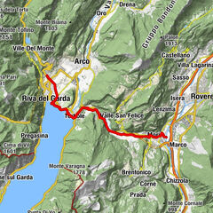
Parking place at Lake Tenno
- Route
-
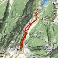
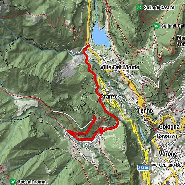
Pranzo1.6 kmZumiani3.3 kmCazzoli3.9 kmChiesa di San Rocco Pellegrino4.0 kmCampi4.2 kmRighi4.3 kmParisi4.8 km
- Best season
-
JanFebMarAprMayJunJulAugSepOctNovDec
- Description
-
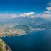
This route starts at Lake Tenno and winds up the slopes on the western side of Garda Trentino where the mountains plunge sheer into the lake.
The itinerary follows provincial road 37 which leads from the junction at the car park by the lake as far as Campi and the San Martino archeological site above. This is a little known area in Garda Trentino but well worth the visit.
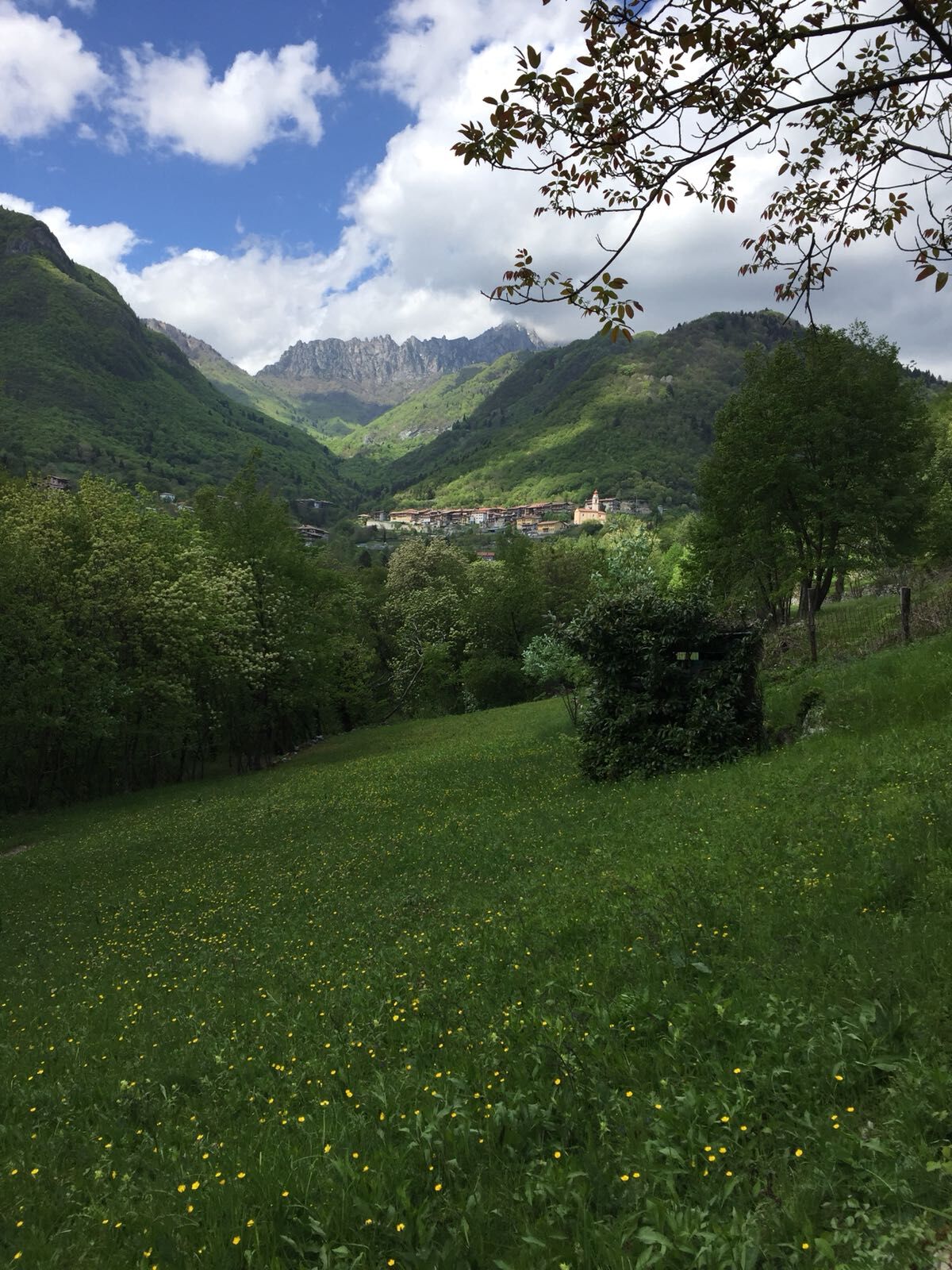
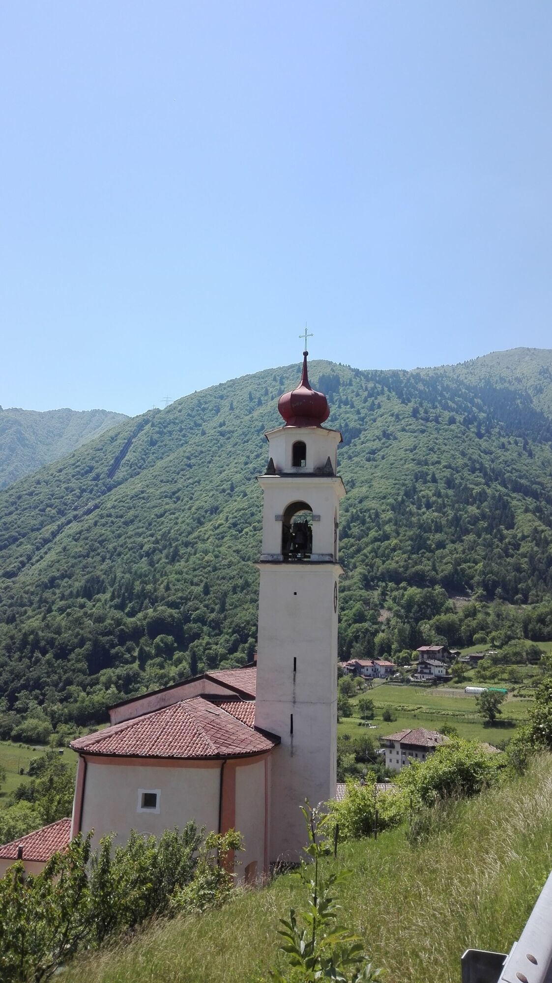
The road winds among chestnut woods and climbs towards Campi, a little hamlet of Riva del Garda nestled in a green dale among the mountains. This small village has retained its rural character thanks to the traditional stone houses with their wooden floors. The arrival point is the San Martino archeological site, one of the most important in the area, at about 800 metres above sea level. From here you have a marvellous view of the Tenno area.
- Directions
-
From the car park of Lake Tenno follow the road signs for Campi. At the side of the road there is a protected cycle path which you can use for the first downhill stretch. After the picnic area (Acqua dei Malai), the cycle path finishes and you continue downhill on the main road as far as the turnoff for Campi where you take the road on the right. When you come to the tunnel, you will notice some steps on your left: get off your bike here and push it for a short stretch until you reach the old road. After the tunnel, go back onto the main road and you soon come to Campi. Pass through the little village and follow directions for your destination, the San Martino archeological site. Watch out! After the village, the road gets steeper.
To get back to where you started from (Riva del Garda), retrace the route as far as the junction after the tunnel. Turn right here, following directions for Pranzo/Riva del Garda and stay on the main road until you get down to the valley. Alternatively, you can go back to Lake Tenno and wait for the BiciBusTrek shuttle to take you back to Riva del Garda.
- Highest point
- 853 m
- Endpoint
-
Archeological site San Martino (Campi)
- Height profile
-
 © outdooractive.com
 - Equipment
-
Riding your bike requires specific clothing and equipment, even for relatively short and easy trips. It is always better to be prepared… e.g. for bad weather or a drop your energy levels. The unexpected things also make up a part of the fun!
Remember to thoroughly evaluate the type of route you plan to do, the locations you plan to cross and the current season. Has it been raining? Attention: The paths may be slippery and require more caution.
- Safety instructions
-
Give your bike a regular checkup, especially if you've had it for years. Be seen: you must wear a high vis jacket (or sash) in tunnels and on country roads after sunset. Always wear your helmet. Make sure your front and rear lights are working. Put out your arm to give advance warning of your intention to change position and before you do anything, check there are no vehicles coming up behind you. Don't use headphones or your mobile phone handsfree kit: you need all your concentration on the road! Obey the road signs: stop at traffic lights and don't ride on the wrong side of the road. If you are cycling in a group, always go in single file. You've got a bell: use it to let pedestrians know you're there. Don't ride on footpaths. If you have to then get off and push your bike. If there are cycle paths use them. It's your safety that's at stake and the rules of the road say you must.
Note:
The cycle pathe in Trentino are usually closed by the local authorities from November, 15th to April, 15th. Exceptions are the cycle paths along the River Adige and in the Basso Sarca/Garda Trentino, where cycling is prohibited only in case of ice or during a snowfall.
- Tips
-
Don't forget your camera. You will have plenty of photo opportunities of picturesque views along the way.
- Additional information
-
Shortly after the start of the route, on the right, you will come across a car park and picnic area. Nearby there is a spring called "Acqua dei Malai", meaning “Water of the Sick”: this spring was once considered to have miraculous properties (it could heal the sick) and it was a local custom to come and fill bottles to keep in the house. We have no idea if it really has these powers, but we do advise you to fill your water bottle before you start the uphill climb to Campi. The tour ends at the archeological site San Martino, one of the most important of Garda Trentino. A path through the woods, where you will come across strange figures sculpted in wood, takes you to the higher area of the site. Here excavations uncovered a place of worship dating back to Pre-Roman times (3rd- 1st century B.C.) which in the middle of the first century B.C. was converted into a Roman sanctuary (1st century B.C. - 4th century A.D.), with the addition of a monumental staircase which can still be used today. This building, perched at the edge of the cliff, offers a breathtaking view over the towns beneath. Another few minutes and you come to the ruins of a village abandoned due to fire in the 8th century A.D. Here you can just make out the ruins of a little church dedicated to San Martino (8th -18th century A.D.)
For more information on routes and bike services: rentals, workshops, shops and cycling friendly accommodation - APT Garda Trentino Tel. +39 0464 554444
- Directions
- Public transportation
- Parking
-
Pay parking at Lake Tenno


-
-
AuthorThe tour From Lake Tenno to San Martino archeological site in Campi is used by outdooractive.com provided.


General info
-
Garda Trentino
26
-
Tenno
14