- Brief description
-
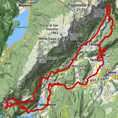
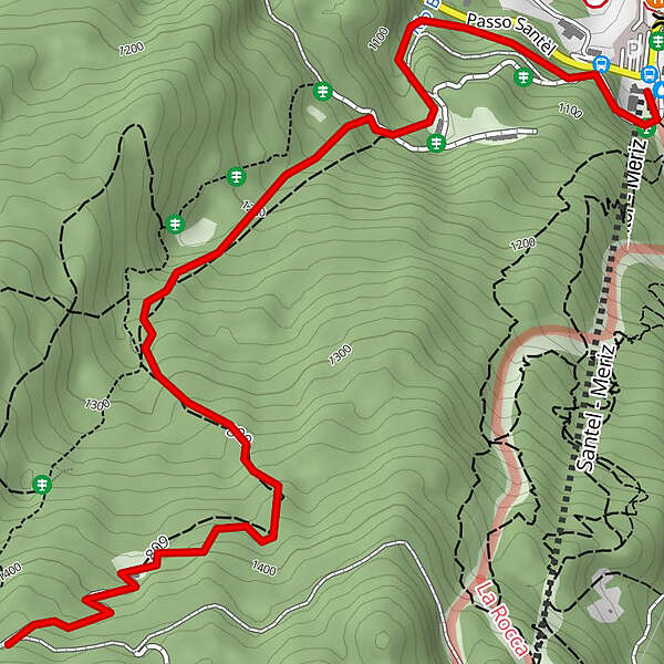
Meriz - Malghette - Santel
- Difficulty
-
difficult
- Rating
-
- Starting point
-
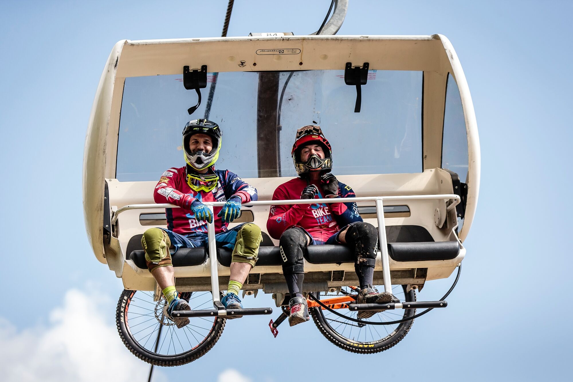
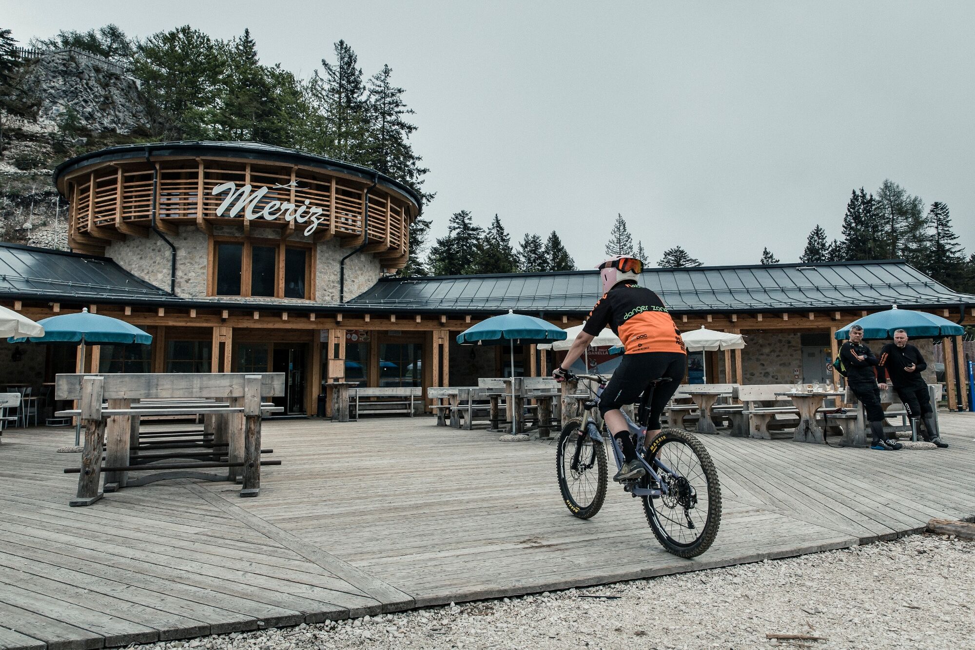
Meriz
- Route
-
Santel3.0 kmTre33.0 km
- Best season
-
JanFebMarAprMayJunJulAugSepOctNovDec
- Description
-
Enduro trail that retraces in part the PS2 of the European Enduro Series (EES) of 2015. It presents various counterslopes, alternating with stretches flow and guided pieces in the woods. It's located very close to the Bike Park of Fai della Paganella, the starting point is easy to reach thanks to "Santel-Meriz chairlift" and 5 minutes riding on a dirt road towards "Pian del Dosson". It's a trail for expert riders but can also be faced by beginners accompanied by a DPB guide.
- Directions
-
From loc. "Meriz", continue along the dirt road in the direction of "Pian del Dosson" for about 1.5 km until you see on your right a dirt road bordered by a green bar which goes downhill. Turn on this new road and follow it until you get to "Malghette". Then continue holding right along a trail that, starting in slight ups and downs, will become progressively steeper and faster developing completely in the woods. Continue to lose altitude in an alternation of fast sections and guided pieces until you cross another dirt road, follow it for a few meters and then turn left in the last part of the trail that will take you to the starting area of the Bike Park of Santel.
- Highest point
- 1,434 m
- Endpoint
-
Santel
- Height profile
-
 © outdooractive.com
 - Equipment
-
Trail - All Mountain - Enduro Bike, recommended full suspension (at least 140mm)
Helmet - Knee Pads - Back Protector or Backpack with back protector - Gloves
Maps - GPS - Mobile Phone - K/Way - Tools kit & repair kit for tires
Water - Snack
Bring everything needed for a journey in self-sufficiency
- Safety instructions
-
Trail suitable for expert riders
Rules DPB: http://www.dolomitipaganellabike.com/trentino/en/about-us/rules
1 Ride Open Trails
Respect trail and road closures — ask a land manager for clarification if you are uncertain about the status of a trail. Do not trespass on private land. Obtain permits or other authorization as required. Be aware that bicycles are not permitted in areas protected as state or federal Wilderness.
2 Leave No Trace
Be sensitive to the dirt beneath you. Wet and muddy trails are more vulnerable to damage than dry ones. When the trail is soft, consider other riding options. This also means staying on existing trails and not creating new ones. Don't cut switchbacks. Be sure to pack out at least as much as you pack in.
3 Control Your Bicycle
Inattention for even a moment could put yourself and others at risk. Obey all bicycle speed regulations and recommendations, and ride within your limits.
4 Yield Appropriately
Do your utmost to let your fellow trail users know you're coming — a friendly greeting or bell ring are good methods. Try to anticipate other trail users as you ride around corners. Bicyclists should yield to other non-motorized trail users, unless the trail is clearly signed for bike-only travel. Bicyclists traveling downhill should yield to ones headed uphill, unless the trail is clearly signed for one-way or downhill-only traffic. In general, strive to make each pass a safe and courteous one.
5 Never Scare Animals
Animals are easily startled by an unannounced approach, a sudden movement or a loud noise. Give animals enough room and time to adjust to you. When passing horses, use special care and follow directions from the horseback riders (ask if uncertain). Running cattle and disturbing wildlife are serious offenses.
6 Plan Ahead
Know your equipment, your ability and the area in which you are riding and prepare accordingly. Strive to be self-sufficient: keep your equipment in good repair and carry necessary supplies for changes in weather or other conditions. Always wear a helmet and appropriate safety gear.
Please note that the practicability of the itineraries in a mountain environment is strictly linked to the contingent conditions and is therefore influenced by natural phenomena, environmental changes and weather conditions. For this reason, the information contained in this page may have changed. Before leaving for a tour, make sure the path you will approach is still accessible by contacting the owner of the mountain hut, the alpine guides or the visitor centres of the nature parks, the info offices of the local tourist board.
- Tips
-
Trail suitable for expert riders, however, under the supervision of a DPB guide, can also be faced by beginners riders with a good preparation.
Take note of the lifts' timetable.
Restaurants "Meriz" and "TRE3" are great places for a typical lunch or for a short break to regain energy.
Along the way there are no fountains to stock up on water. Start properly prepared.
- Additional information
- Directions
-
from North:
On the highway A22 take the exit "San Michele" we follow the state road SS43 until the exit from the village of Mezzolomardo, then we follow the provincial road SP64 towards "Paganella" Altopiano. (Fai-Andalo-Molveno).
From South:
On the highway A22 take the "Trento Nord", and follow the road towards Val di Non to the village of Mezzolombardo, exceeded the gallery turn to the right towards "Paganella" (Fai-Andalo Molveno).
- Public transportation
-
from Trento:- Autobus extraurbano number 611 (Trento -Mezzolombardo - Fai della Paganella - Andalo - Molveno)
- Train "Trento - Malè" (Trento - Mezzolombardo) + autobus extraurbano number 611 (Mezzolombardo - Fai della Paganella - Andalo - Molveno).
- Parking
-
-Fai della Paganella:
In "Santel", opposite to the ski lifts, ample free parking.
-Andalo:
Near the ski lifts, ample free parking.
-Molveno:
Near the lifts, pay parking.
Near the Lido of Molveno, ample parking.


-

-
AuthorThe tour 809 "Malghette Trail" is used by outdooractive.com provided.