- Brief description
-
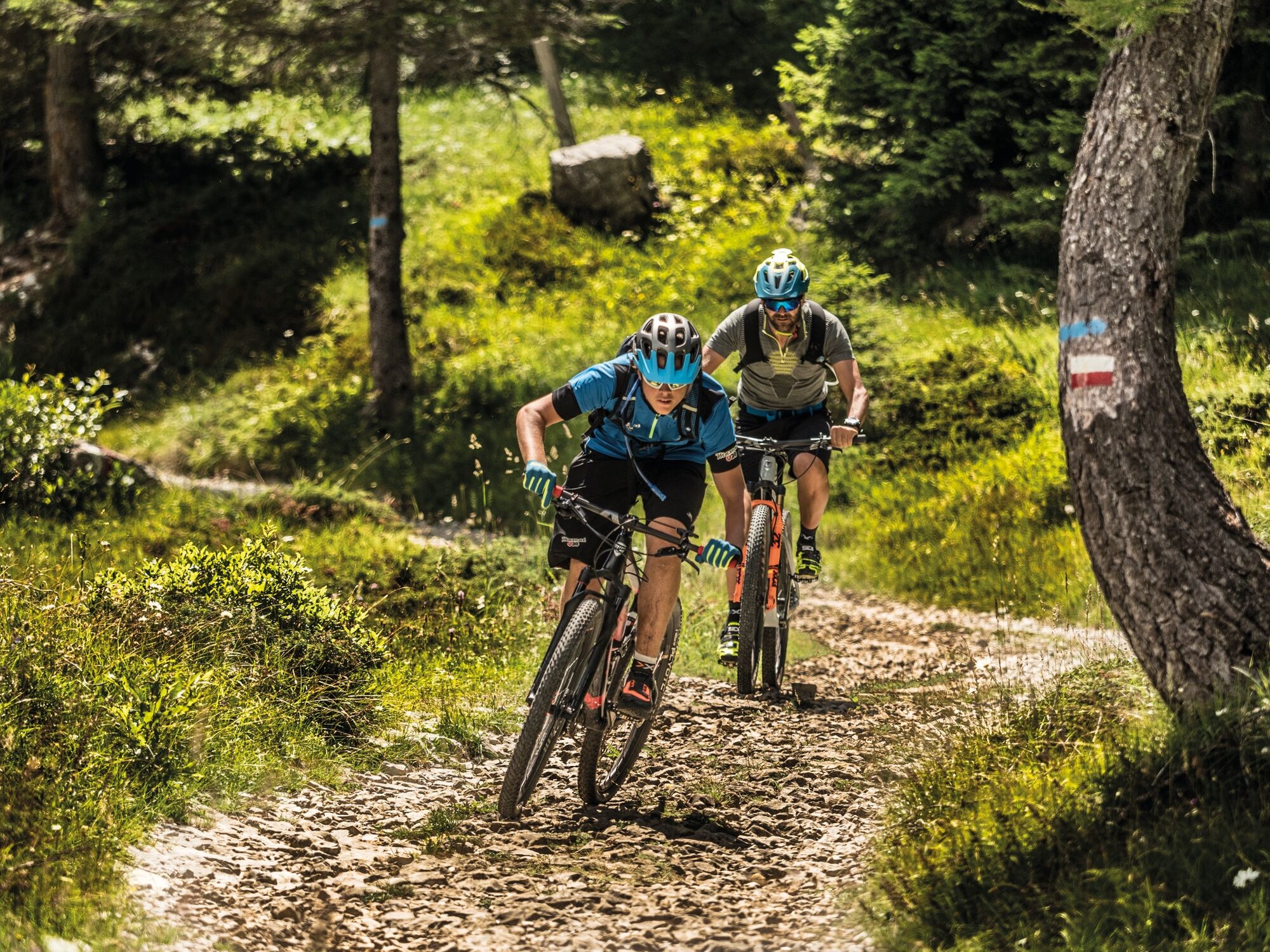
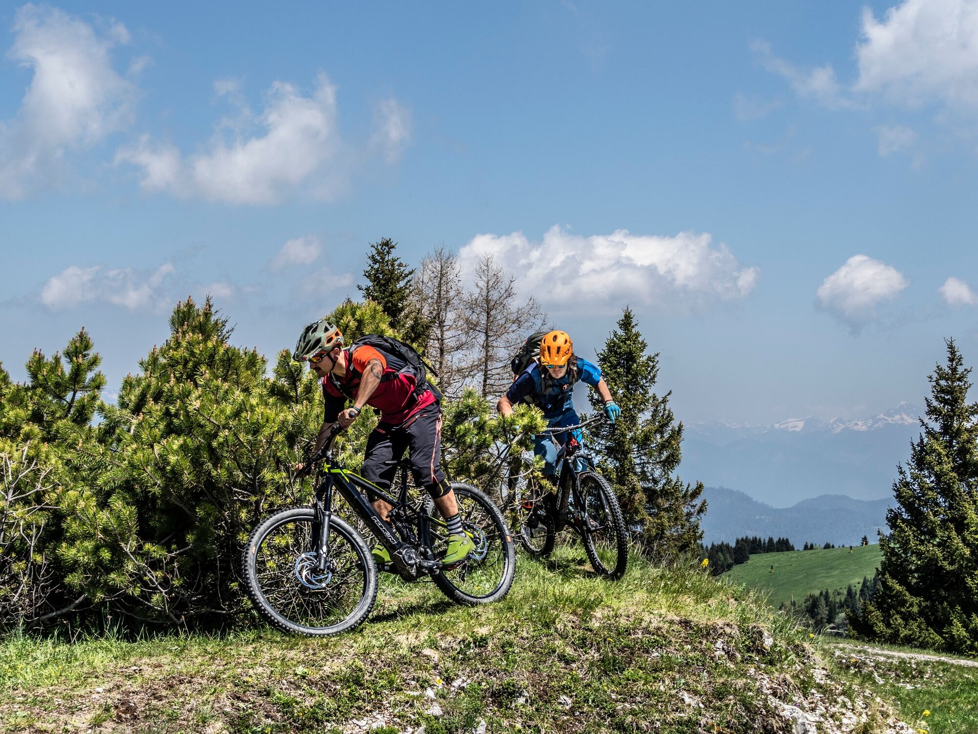
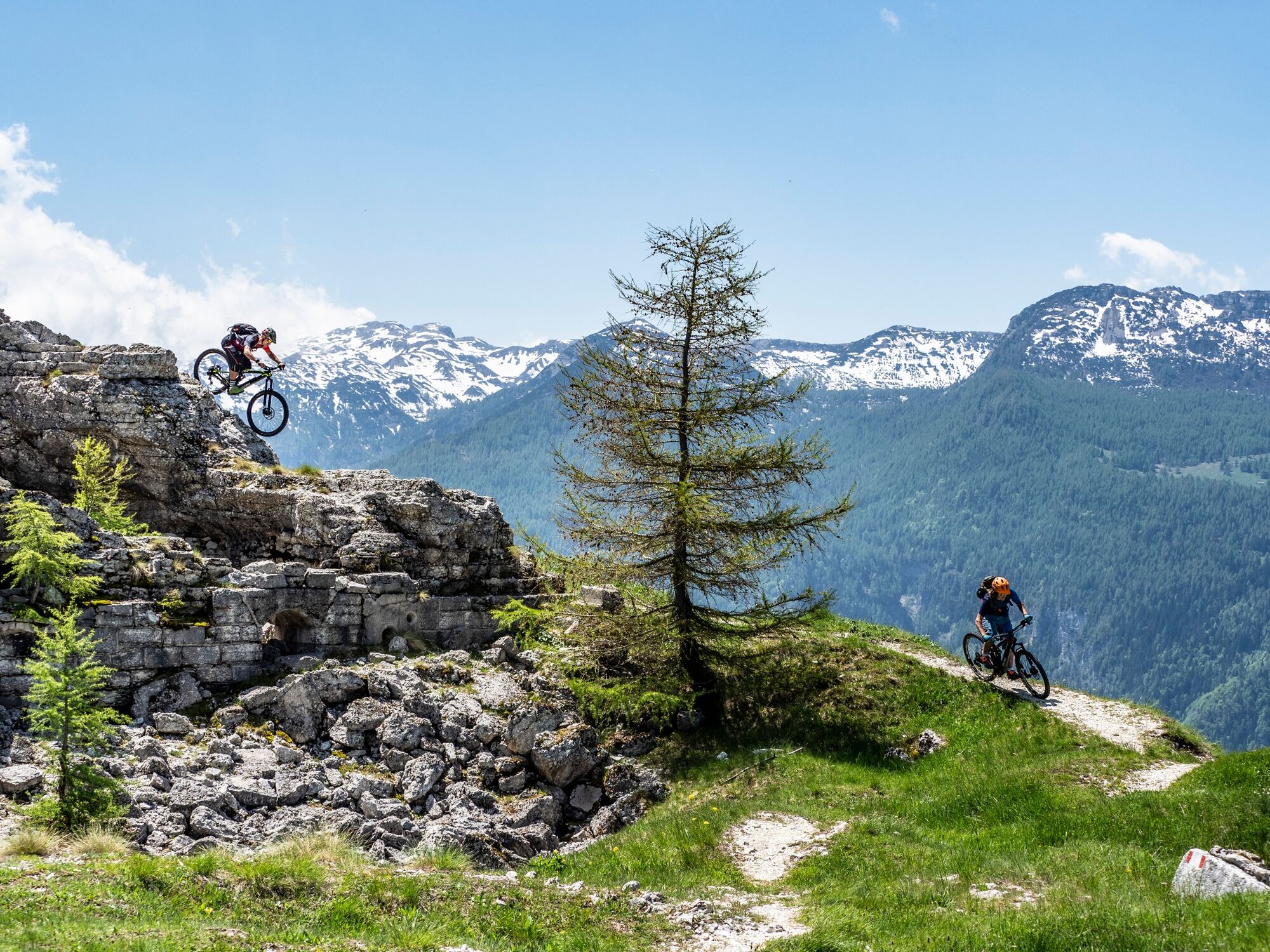
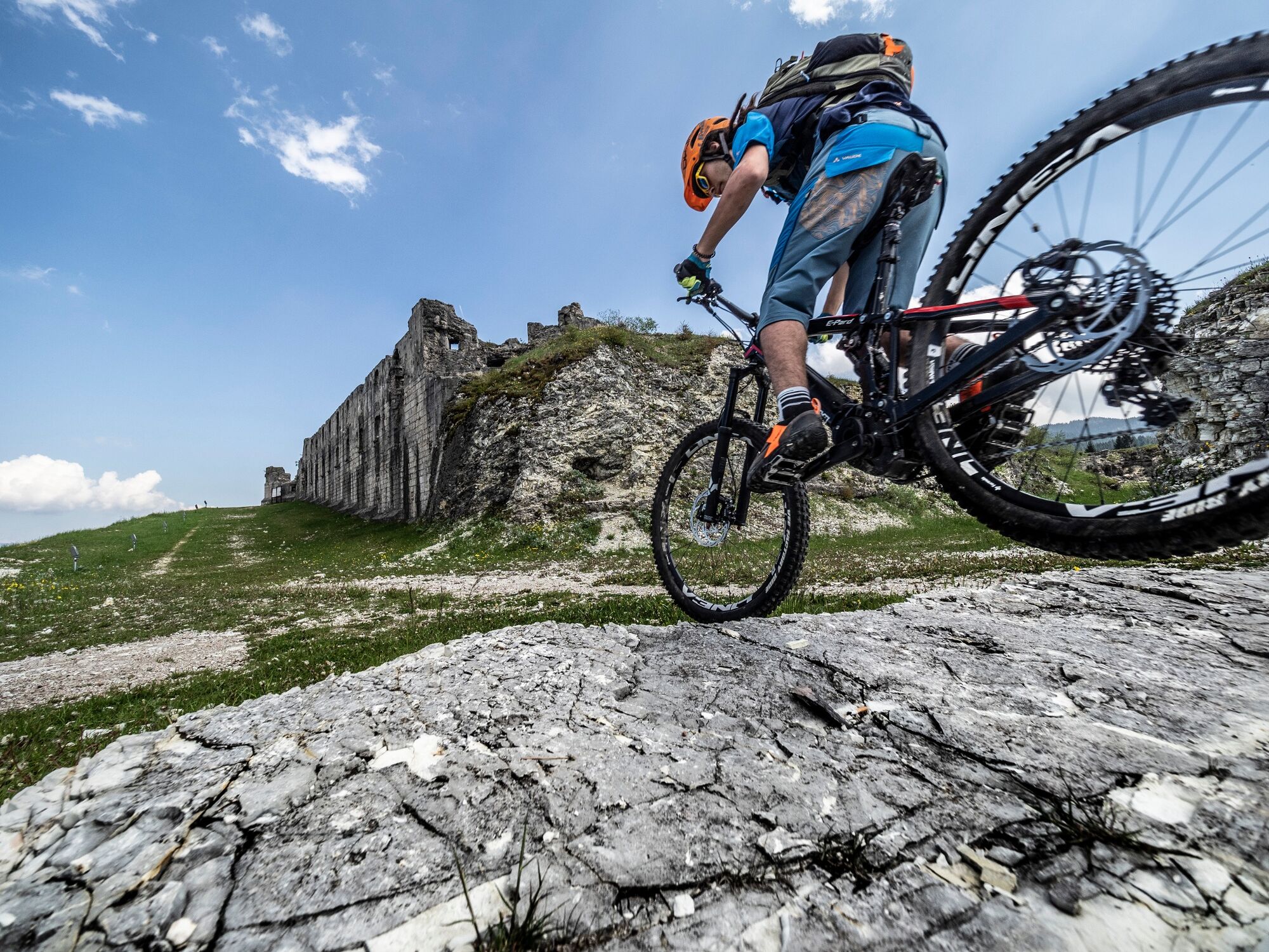
Spectacular route among the Austro-Hungarian fortresses of the Alpe di Folgaria. Challenging, it requires good training in the first section, from Folgaria to Fort Dosso delle Somme. After that it runs along the ridges and back to Folgaria with mostly downhill stretches. It is a succession of panoramas, suggestions of history, climbs and descents.
- Difficulty
-
difficult
- Rating
-
- Route
-
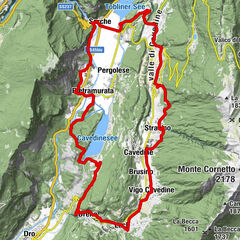
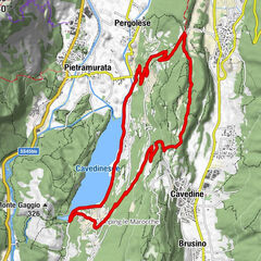
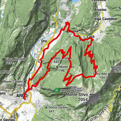
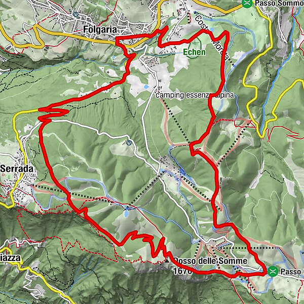
FolgariaSantuario Madonna delle Grazie1.5 kmColpi (1,266 m)1.7 kmSommo Alto5.7 kmStella d'Italia5.7 kmAi Camini8.0 kmCargadore (1,591 m)9.2 kmTruagalait9.4 kmDosso delle Somme (1,670 m)10.7 kmValletta14.4 kmRoccolo (1,307 m)16.3 kmMezzaselva (1,140 m)18.6 kmFolgaria20.4 km
- Best season
-
JanFebMarAprMayJunJulAugSepOctNovDec
- Description
-
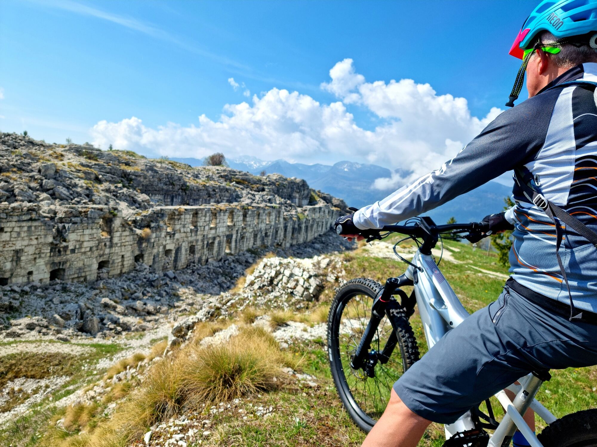
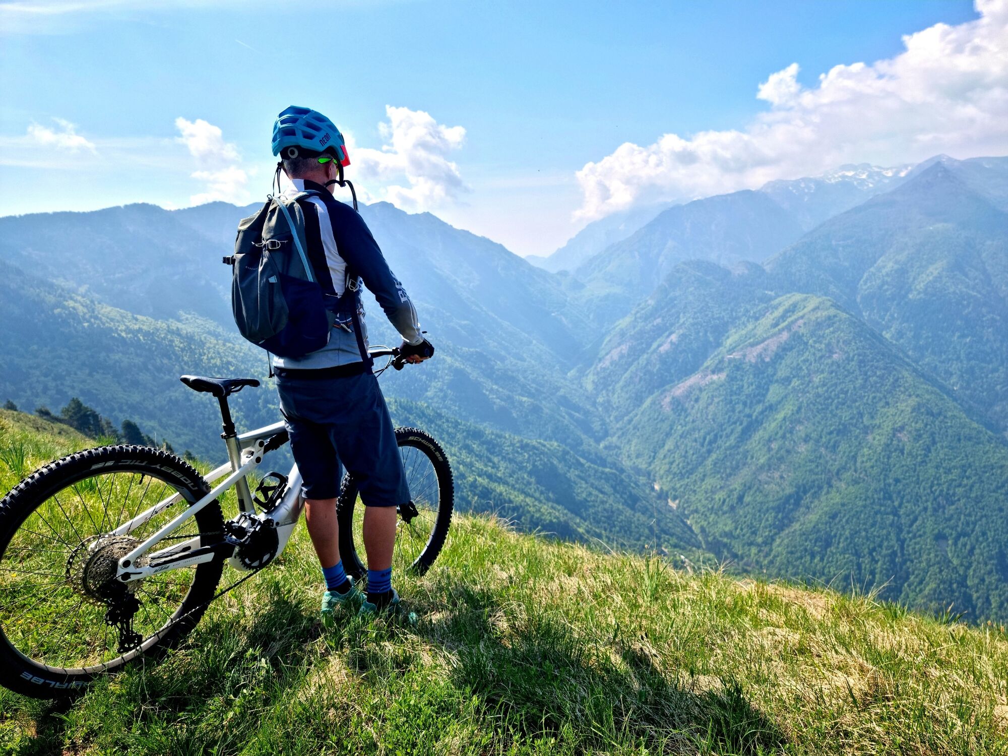
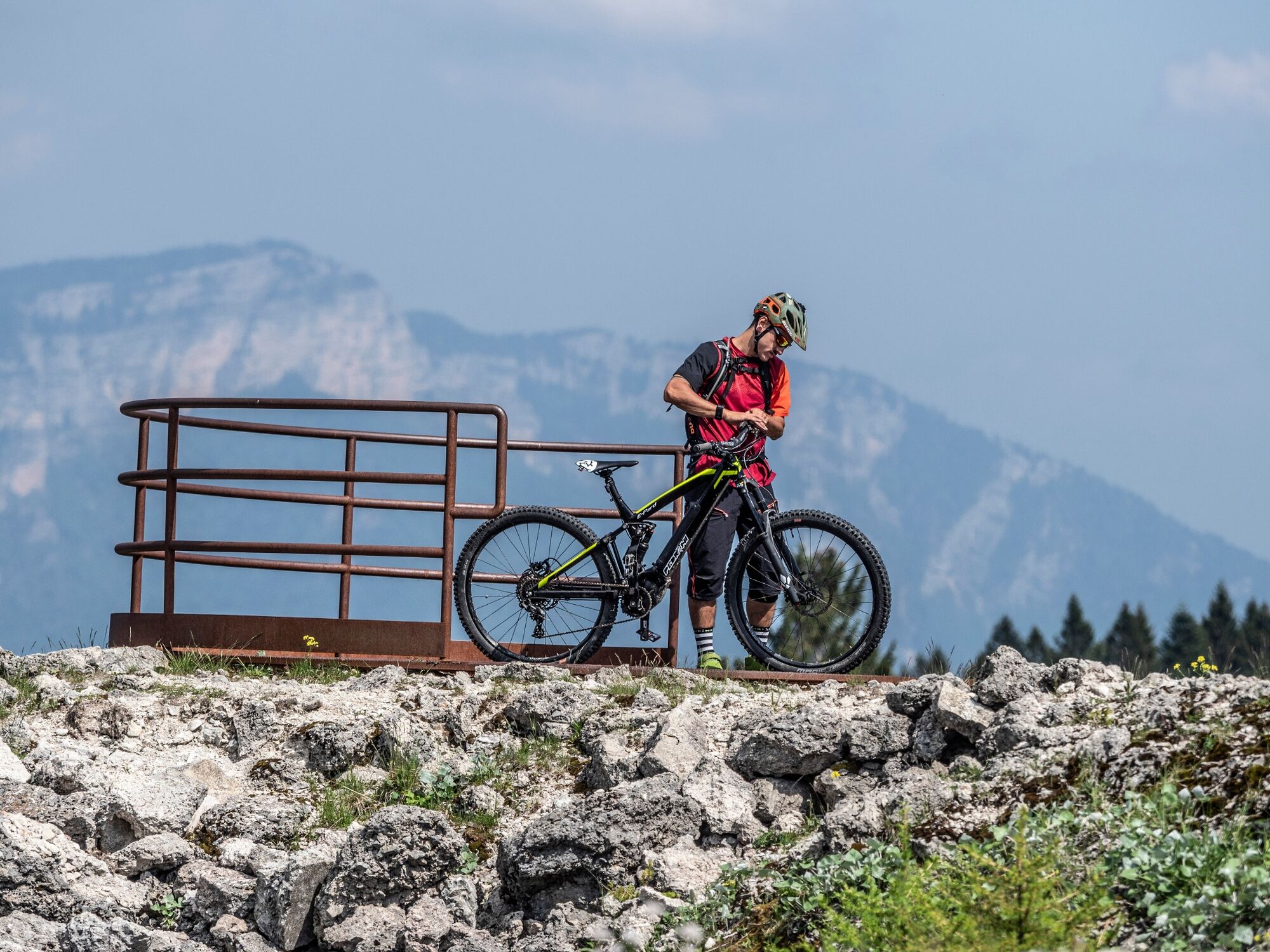
This is not the tour for those who feel 'strong', but a wide mtb tour among the forts of the Great War. And it's no joke, there's pedalling, there's sweating, there's climbing, but it's worth it. If you are not so well trained, we recommend the E-bike. The view from Forte Dosso delle Somme over the Pasubio massif, the deep Val di Terragnolo and the Brenta Dolomites is priceless. So is the panorama from Forte Sommo alto, over Folgaria and the Val Orsara. A long, scenic tour that deserves well-deserved gastronomic stops: at the Rifugio Baita Tonda, the Osteria Coe, the La Stua restaurant or the Rifugio Stella d'Italia, you'll be spoilt for choice!
- Directions
-
From the Folgaria East roundabout, we follow the signs for Serrada, turning right. We follow the easy provincial road for a couple of kilometres until we reach the Belvedere viewpoint; before reaching the viewpoint, we turn left (signs) and climb up the dirt road that reaches loc. Ròccolo, briefly travelling along the SS350 Serrada - Fondo Grande road and then turn right (signs) and take the long dirt road that cuts diagonally across the wide southern slope of the Martinella and leads to Forte Dosso delle Somme (1670 m). From the Fort, we continue in an easterly direction (signposts), with great caution we walk along the ridge of the bumps and descend to the Crocicchio delle Coe; we cross the SP dei Francolini and on a dirt road we reach the Dosso dei Camini in a short climb and continue up and down to Forte Sommo alto (1613 m). From the fort we descend to the nearby Rifugio Stella d'Italia and follow the dirt road that leads to the Sommo Pass; in loc. Caserma (pay attention to the signposts) we turn left following the path that descends through a steep spruce forest and quickly takes us near the Golf Course and the Ecken biotope; we turn left, pass between two greens, reach the biotope (protected area), turn left again, follow the road around the perimeter of the area and then head (signposted) towards the Sanctuary of Madonna delle Grazie from which, by means of an asphalted road, we quickly descend to Folgaria, to our starting point.
- Highest point
- 1,659 m
- Endpoint
-
Folgaria
- Height profile
-
 © outdooractive.com
 - Safety instructions
-
As you can imagine, the practicability of routes in a mountain environment is closely linked to conditions and therefore depends on natural phenomena, environmental changes and weather conditions. For this reason, the information contained in this sheet may have changed. Before setting off, find out about the status of the route by contacting the manager of the huts on your route, mountain guides, nature park visitor centres and tourist offices.
- Tips
-
along the route you can find bike chalets for bike charging, route information and technical assistance
- Additional information
-
Challenging route in the first section, then becomes relaxing and fun. It takes place entirely on footpaths and dirt roads.
- Directions
-
Folgaria is 18 km from Rovereto (highway exit Rovereto nord A22) and 28 km from Trento (highway exit Trento sud A22)
- Public transportation
-
In Folgaria passes the public transport of Trentino Trasporti. Info APT Tel. 0039 0464 724100.
- Parking
-
Near the starting point, there is a pay parking lot and a free parking lot near the Palasport.


-

-
AuthorThe tour 838 - Tour dei Forti is used by outdooractive.com provided.