
- Brief description
- Difficulty
-
medium
- Rating
-
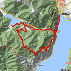
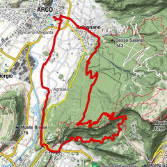
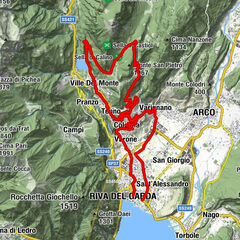
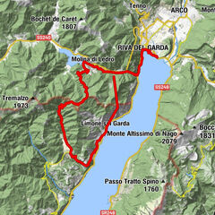
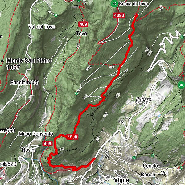
- Starting point
-
Nanzone
- Route
-
Varignano3.7 km
- Best season
-
JanFebMarAprMayJunJulAugSepOctNovDec
- Description
-
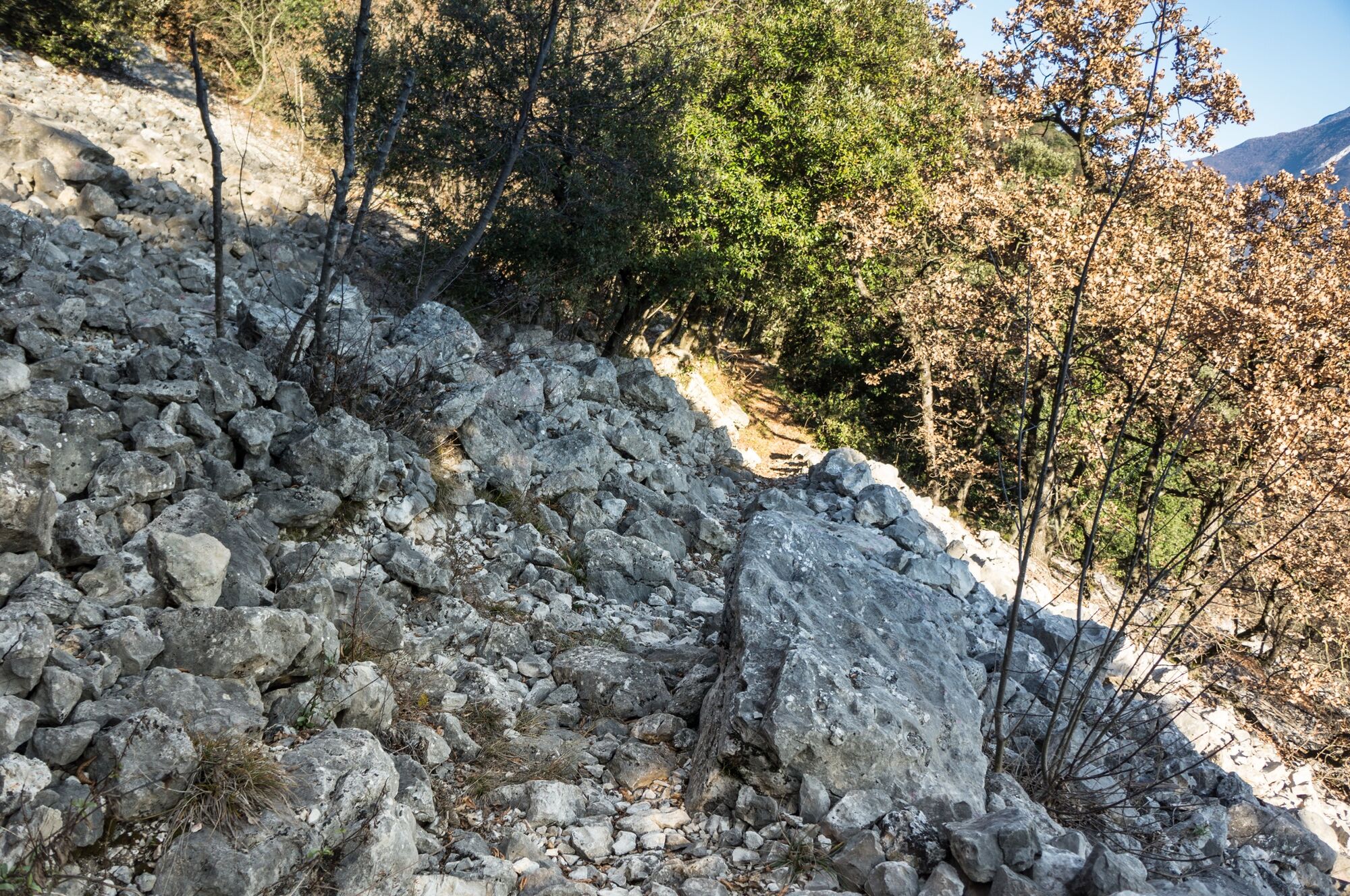
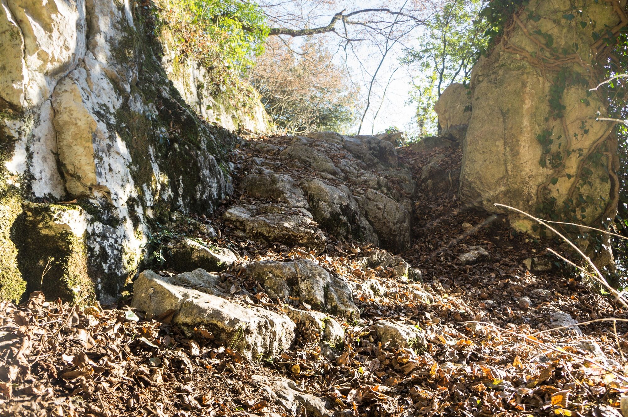
Signage: 743d. Variante Piazzole - Trail
This variant begins between Doss del Clef and Bocca di Tovo with a short stretch of forest track, then turns into a long, varied and demanding trail that meets the road again just above Varignano.
- Directions
-
Coming from Dos del Clef towards Bocca di Tovo, you come to the entrance of path 409B. To your left you’ll find the beginning of the descent which, to start with, offers no particular challenge. Quite quickly however, you’ll find yourself facing the first of a long series of steep, loose stretches. The route - indicated by the signs, leads you to cross the forest road several times. And, eventually, you will once again meet the paved road to Padaro and the main tour.
- Highest point
- 912 m
- Endpoint
-
Romarzollo
- Height profile
-
 © outdooractive.com
 - Equipment
-
Riding your bike requires specific clothing and equipment, even for relatively short and easy trips. It is always better to be prepared… e.g. for bad weather or a sudden drop in your energy levels. The unexpected things are part of the fun!
Remember to thoroughly evaluate the type of route you plan on doing, the locations you intend to cross and the current season. Has it been raining? Attention: The paths may be slippery and require more caution.
What do I need to bring on my bike tour?
An adequate water supply according to your needs (considering temperature, possibility of refuelling and duration of the route) Plenty of snacks (for example, dried fruit or energy bars) Waterproof / Windproof jacket A spare top / spare socks (Descending in a sweaty garment, will make you cold). Suncream Sunglasses Bike gloves/mitts Map or GPS device Bike lights: best placed on your helmet or handlebars. (It is always best to be prepared) Bike repair kit for punctures and mechanical breakdowns First aid kit Emergency whistleIt is always advised to let someone know where you plan to go and how long you expect to be.
Emergency telephone number 112.
- Safety instructions
-
ITRS - International Trail Rating System
The ITRS is an objective way to assess trails and routes from a biker’s perspective, evaluating four aspects:
Technical Difficulty: riding skill level needed Endurance: combined effect of length, uphill and downhill Wilderness: amount of planning required based on mobile phone reception, rescue options, water supply and wildlife Exposure: consequences of a fallDiscover more about the ITRS system and check the classification of this tour in the photo gallery.
Safety Tips
Always wear your helmet. Plan your ride. You share the trail with other users. Yield right of way to hikers. Let your speed be determined by your experience. Ride slowly on crowded trails, overtake with politeness and respect. Cycle only on authorized and open trails. Avoid muddy trails in order not to damage them further. Respect public and private property. Always be self-sufficient. Do not cycle solo in remote areas.This information is subject to inevitable variations, so none of these indications are absolute. It is not entirely possible to avoid giving inexact or imprecise information, given how quickly environmental and weather conditions can change. For this reason, we decline any responsibility for changes which the user may encounter. In any case, it is advisable to check environment and weather conditions before setting out.
- Tips
-
The variants of the 743. Bocca di Tovo Trail-Tour unfold on the slopes of Monte Calino, which commands the Tenno area and Lake Garda.
- Additional information
- Directions
- Public transportation
-
The main towns in Garda Trentino - Riva del Garda, Arco, Torbole sul Garda, Nago – are connected by several urban and intercity bus lines which will take you to the starting point of tours or in the immediate surroundings.
You can also get to Riva del Garda and Torbole sul Garda by the public ferry service.
- Parking

-
-
AuthorThe tour Variante Piazzole - Trail is used by outdooractive.com provided.


Surfaces
General info
-
Garda Trentino
143
-
Tenno
76