- Difficulty level
- B/C

- Brief description
-
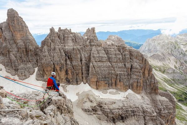
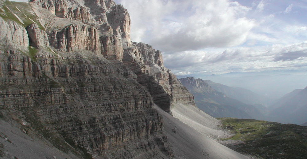
A panoramic via ferrata along the upper ledges of Pietra Grande that are exposed but not particularly challenging and run through an area of great natural and geological interest.
- Difficulty
-
mediumDifficulty level B/C
- Rating
-
- Starting point
-
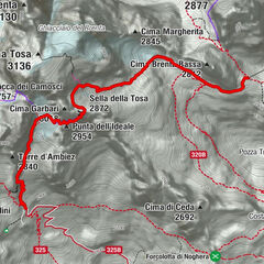
Grostè Pass (upper station of the Grostè gondola lift)
- Route
- Best season
-
JanFebMarAprMayJunJulAugSepOctNovDec
- Description
-
An easy via ferrata that may be suitable for families. It is often recommended as an introduction to the world of via ferratas, and it runs along the amazing ledges at the base of the west face of Pietra Grande (2,937m / 9,636 ft) for an enjoyable itinerary along ledges that are not heavily trafficked.
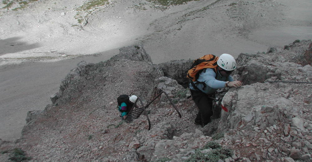
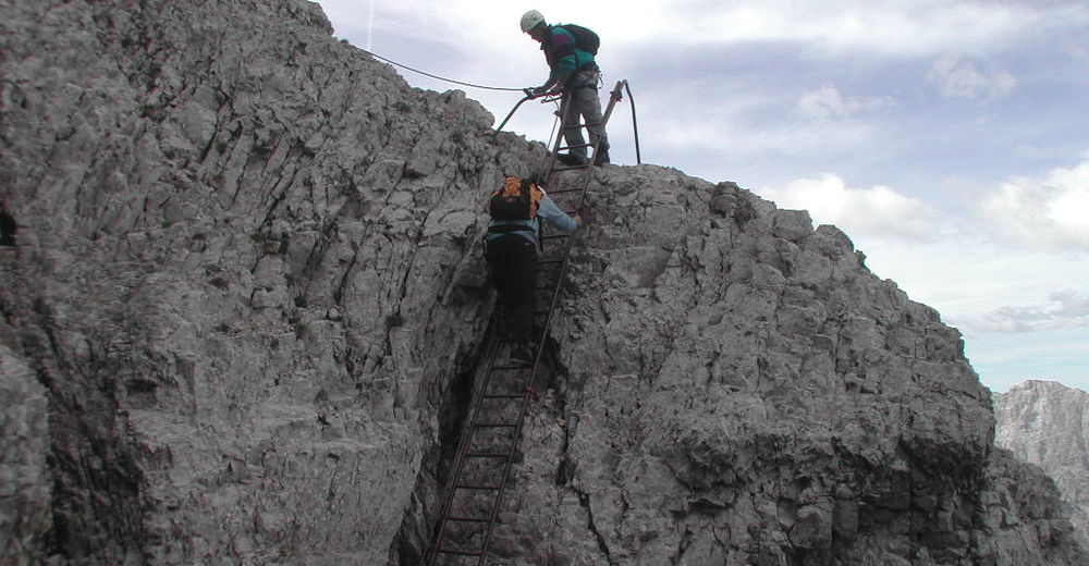
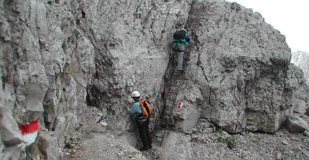
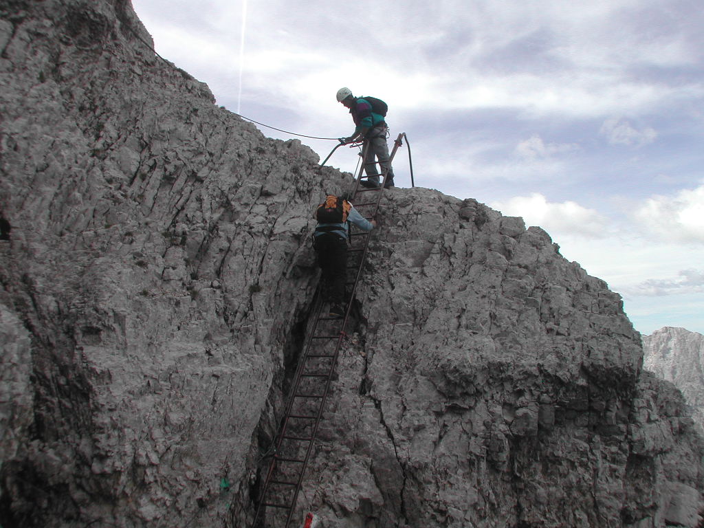
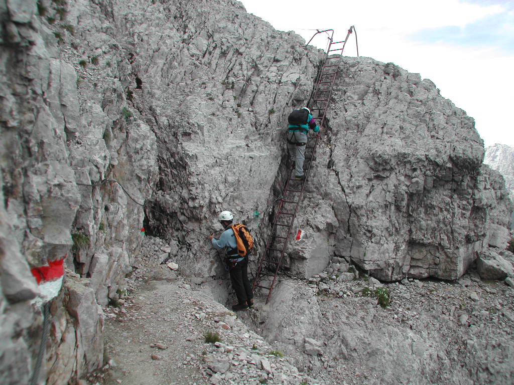
There are some exposed sections, but the trail is generally easy. The via ferrata may be done in either direction, but we recommend doing it from the Grostè Pass towards Rifugio Graffer due to the lower elevation gain. Created in 1969 by two mountain-guide brothers, Natale and Raffaele, and dedicated to their father, the alpine guide Gustavo Vidi. The trail was also dedicated to Natale following his death.
- Directions
-
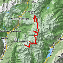
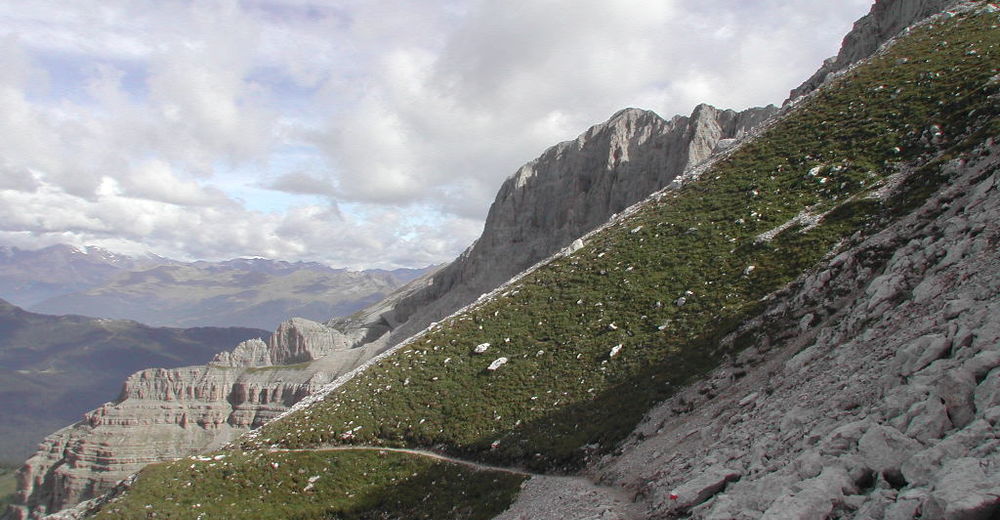
From the arrival of the Grostè gondola lift (2,438m / 7,998 ft), head around the uphill side of the station and follow the directions to the base of the corner of Pietra Grande and the junction with trails O301 – O306. From here, head up the eastern slope of Pietra Grande and cross a great ledge up to the ridge.
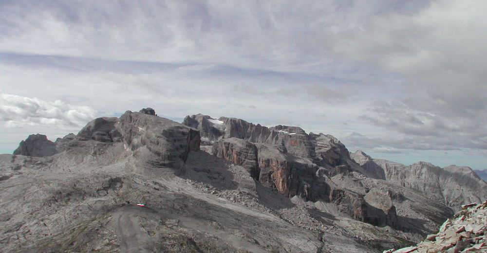
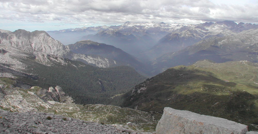
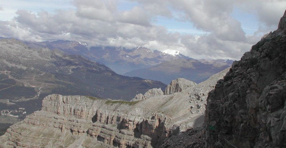
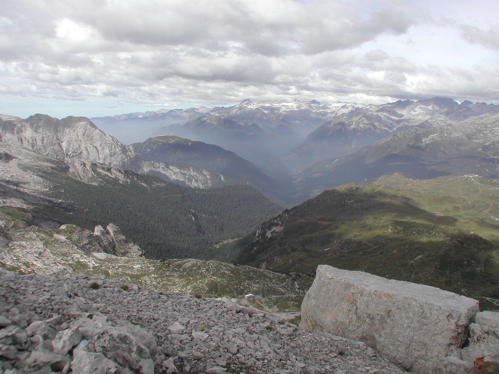
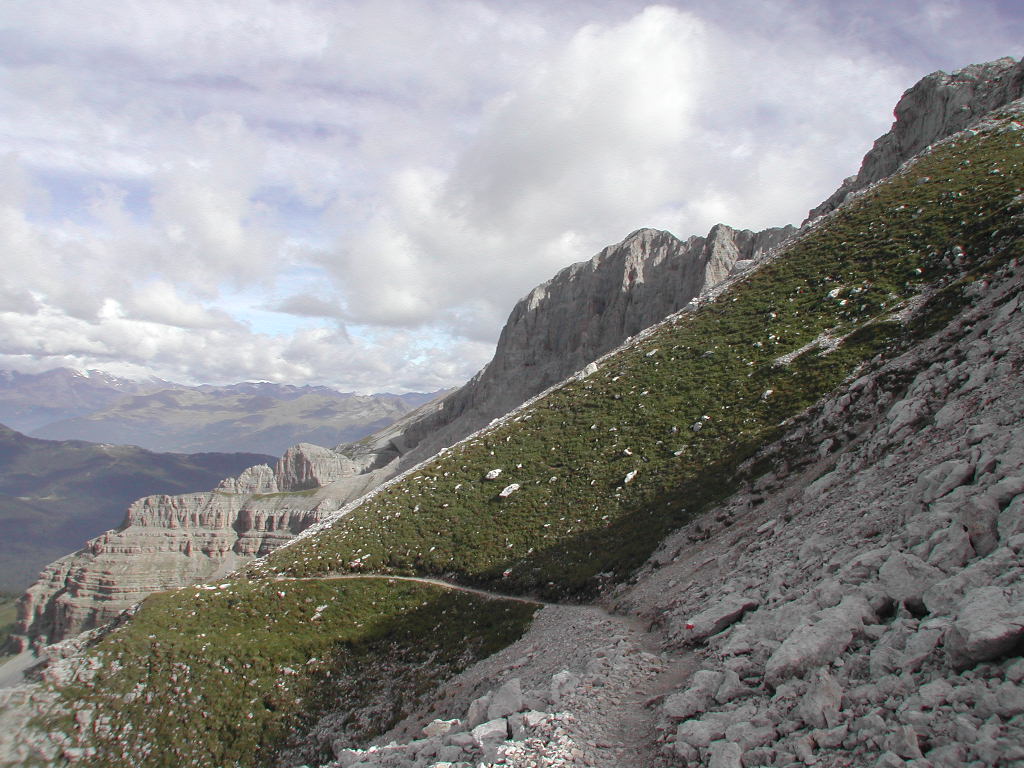
Continue along the ridge and cross the bridge, which is the most exposed section of the trail but offers up a stunning view of Lake Tovel to the east and of the Adamello-Presanella, Ortles and Cevedale groups to the west. Continue up until the ridge is interrupted by a rock wall (2,663m / 8,736 ft). At this point, you will shift over to the west face of Pietra Grande, where you will continue along ridges and past a number of fissures (where there could be snow late into the season). From here, follow the iron cables and rungs to a grassy plateau above Orti della Regina (2,346m / 7,697 ft), where trail O390 ends.
Then follow trail O336 in the direction of Rifugio Graffer to Orti della Regina (Garden of the Queen), one of the most stunning natural terraces of the entire Brenta Group, so named because legend has it that a queen and her entourage came here and planted flowers and shallots. It is famous not only for this legend, but also for the fact that there are a number of boulders with some amazing fossils. From Orti della Regina, continue down to Rifugio Graffer (2,261m / 7,418 ft).
- Highest point
- 2,700 m
- Endpoint
-
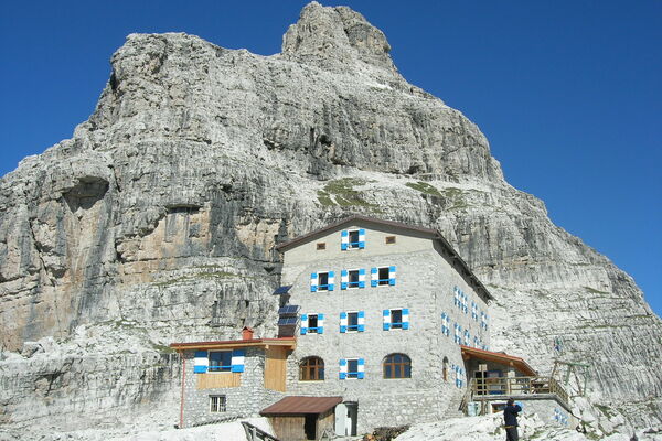
Rifugio Graffer
- Exposition
- Height profile
-
 © outdooractive.com
 - Equipment
-
Equipment needed:
technical mountain clothing hiking boots with Vibram or similar sole via ferrata gear harness helmet gloves pickaxe and crampons (when necessary) a length of rope (recommended) - Safety instructions
-
It is best to do this route from mid-July to mid-October to avoid snow along the western ledges.
Please note that the practicability of the itineraries in a mountain environment is strictly linked to the contingent conditions and is therefore influenced by natural phenomena, environmental changes and weather conditions. For this reason, the information contained in this page may have changed. Before leaving for a tour, make sure the path you will approach is still accessible by contacting the owner of the mountain hut, the alpine guides or the visitor centres of the nature parks, the info offices of the local tourist board.
- Tips
-
The itinerary can be done in the clockwise direction if you would like a greater challenge from the increased elevation gain, but the lighting conditions will not be as good (as the west face is in shadows in the morning).
- Additional information
- Directions
-
To get to Rifugio Stoppani:
- from Campo Carlo Magno Pass by way of the Grostè gondola lift or the trail along the ski slope (approx. 3 hrs).
- from Malga Spora along trail 301 (2.5 hrs).
- from Rifugio Tuckett taking the Dallagiacoma and Benini via ferratas.
- Public transportation
-
- Shuttle bus service (in summer, from late June to early September) from Madonna di Campiglio (Piazza Brenta Alta) to the Grostè gondola lift. Check schedule and prices online or ask for the booklet from the tourist office at Via Pradalago 4.
- You may also check the bus schedule of Trentino Trasporti www.ttesercizio.it.
- Parking
-
Ample paid parking is also available at the base of the Grostè gondola lift.


-
-
AuthorThe tour Via ferrata Gustavo & Natale Vidi, Brenta Dolomites is used by outdooractive.com provided.