
- Brief description
-
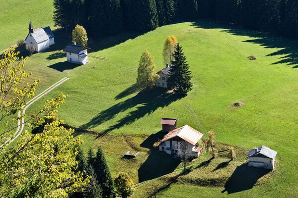
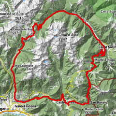
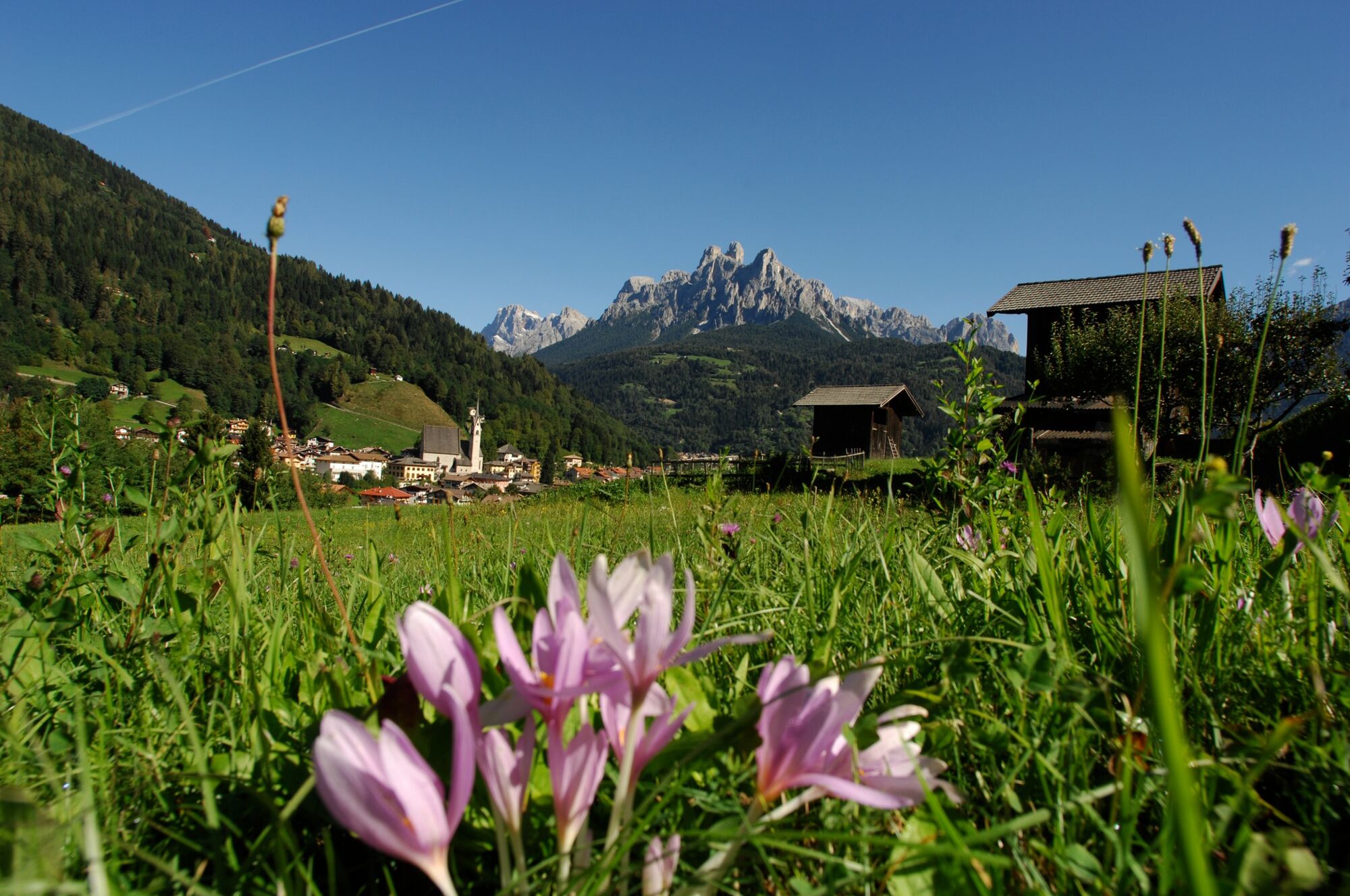
A route that crosses the entire Primiero Valley, on a path of discovery of hamlets and traditions.
- Difficulty
-
easy
- Rating
-
- Starting point
-
Toruist office - Fiera di Primiero
- Route
-
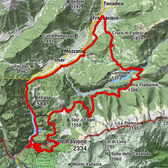
Fiera di PrimieroNavoi1.4 kmTransacqua1.9 kmOrmanico3.1 kmForno3.2 kmFol3.5 kmIl Caminetto3.6 kmLanterna Verde3.7 kmTonadico4.9 kmSiror6.0 kmNolesca (770 m)8.2 kmArea Giochi Vallombrosa9.4 kmParco Belzer9.4 kmTressane (726 m)9.5 kmFiera di Primiero9.6 kmSangrillà10.1 kmChiesa della Madonna dell'Aiuto10.2 kmTransacqua10.2 kmPieve10.5 kmChiesetta di San Martino10.5 kmLa terrazza10.5 kmChiesa di Santa Maria Assunta10.5 kmPieve10.7 kmMolarén (727 m)11.2 kmCollegio Santa Croce (720 m)12.0 kmMezzano13.4 kmAl Borgo13.9 kmImer14.6 kmPezze (677 m)15.4 kmTransacqua19.7 kmFiera di Primiero19.7 km
- Best season
-
JanFebMarAprMayJunJulAugSepOctNovDec
- Description
-
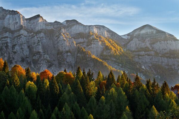
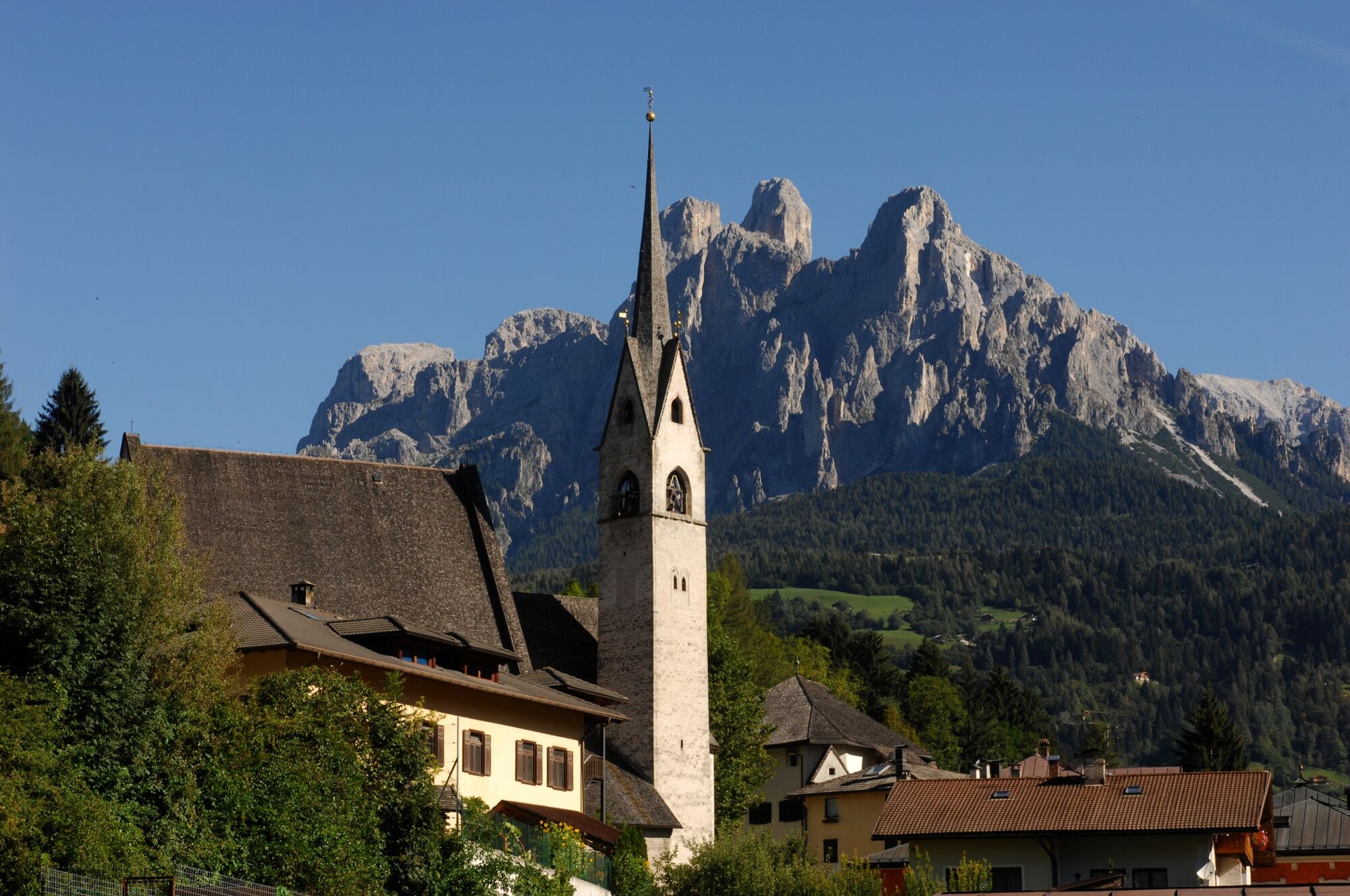
The circular route, about 20km in length, allows hikers to enjoy the breath-taking mountainous scenery of the Pale di San Martino and the Vette Feltrine peaks (both UNESCO heritage sites since 2009), combined with history, art and culture. There are some ancient buildings in the historic centres (Palazzo Scopoli, Palazzo del Dazio, the Chiesa Arcipretale, etc.) which silently preserve age-old memories, showcased by works of art and exhibitions (Cataste & Canzéi, Sentarte, wooden sculptures, frescoes and fountains), aimed at enhancing the heart of each one of them.
- Directions
-
From the car park next to the ApT tourist office of Fiera di Primiero, take the road that runs alongside the river Cismon, crossing over on the bridge (Auditorium), and continuing on the short, but challenging uphill section (about 150 m) which leads to a wide grassy area in the town of Navoi. Then, continue on the road with the same name, which goes gently downhill and then flattens out for about 1 km, crossing fields and small villages, until you meet up with Via S. Antonio. From here, after about 40 m, in line with the lovely public fountain, turn right along Via Miniere, another short, but fairly steep uphill section (350m) that you can ride on the road or on the pedestrian, unpaved track next to it. At the end of this section, you turn sharp left onto Via Bellavista. Halfway along Via Bellavista, the trail veers left downhill into a narrow pedestrian street (watch out for the bollards at the entrance and for any pedestrians): after about 150m, turn right towards the church of Transacqua and continue until you get to Via dei Bersaglieri. At the crossroads, turn left and continue along the side of the church for about 130m until you get to the next right turn into a narrow pedestrian street. This street leads through a grassy area and across a small covered wooden bridge to the historic centre of Ormanico. Here, after about 50m of winding bends along the narrow streets of the historic centre (”canisèle”), you come to Via Sanguarna at the ancient public wash-house, continuing straight on downhill for about 170m as far as the junction with Via Venezia. Turn right and go along Via Venezia as far as the bridge over the river Canali (in the town of Fol) but turn right again along Via Zochet before you get to the bridge. Continue upstream alongside the river Canali for about 550m, passing by several hotels and tourist sites until you reach the cycling/pedestrian board walk which takes you over the river. At the end of the board walk, take extra care at the junction with Via Castelpietra (this is a major, heavily trafficked road - provincial road 347): At the end of the board walk, turn right and continue to climb gently up Via Castelpietra for about 300m as far as the junction with Via Scopoli, where you must take care as you turn right into the historic centre of Tonadico. Once on Via Scopoli, continue straight on towards the centre of Tonadico, going past an obvious narrow section before turning right along a narrow lane, for pedestrians only, which leads to Via San Vittore in front of Palazzo Scopoli. From here, continue to the right along Via Siror towards the town of Siror through the “Campagna Alta” of Tonadico. Once across the little wooden bridge over rio Lazer, you enter the town of Siror which you cross at the top along Via Civerza until you get to a small crossroads where there is a public fountain. Turn right here into Via Caspeda at the end of which you leave the main road where there is a sharp left bend. Take the small pedestrian street on the right (watch out for the bollards at the entrance) which leads to the sports area of Siror. Take extra care at the final part of the lane which is very steep (20%) with concrete bollards at the exit onto Via Cismon. From the sports area, continue straight up a gentle slope alongside the sports field and the river Cismon, reaching the highest point of the trail (810m a.s.l.) after a little over 1 km, near a bridge. After the bridge, turn left and take the embankment road on the right of the Cismon which, after going 1.1 m gently downhill, converges with the cycling/footpath again, reserved for cyclists and pedestrians only. This path runs alongside the river Cismon for about 1.2 km, ending at the “Vallombrosa” public park, at the entrance of Fiera di Primiero. From here, first turn right into Via Montegrappa, continuing along the side of the secondary school, and then left, in straight line along Via San Francesco which, after a few hundred metres, leads to the historic centre of Fiera di Primiero (pedestrian area). You can cross the centre of Fiera di Primiero (about 150m) either on your bike or pushing it, depending on how many pedestrians there are. After crossing the elegant historic centre of Fiera di Primiero, at the end of the pedestrian area beyond the main street, turn right onto Via Rivetta Enrico Koch, heading towards the church, the Chiesa Arcipretale of Primiero, which can be clearly seen. Once past the church, turn right towards the town of Mezzano, following the panoramic road which crosses the extensive grassy area of Molaren for about 1.6 km (of which 1 km is a cycling/footpath). Then, turn left downhill along Via Santa Fosca (be careful on the first section as it is quite steep) and go through the fields of Molaren to get to the historic town of Mezzano which is well worth visiting. There are allotments, fountains, frescoes and perfectly preserved traditional architectural features, wood piles (called “canzei”), many of which have been turned into authentic works of art by visiting artists. Rejoin the trail at the town hall of Mezzano (Via Don Bartolomeo Cosner) and after crossing the newly-resurfaced pedestrian square (Piazza Fontana), continue on towards Imèr, leaving the town along the provincial road (Via Roma) which is mostly free from traffic now that the ring road has been recently completed. The stretch on the main road is about 450m and ends just past the town boundary between Mezzano and Imèr, with a right turn towards the cemetery (Via San Francesco). There is a short uphill stretch of about 200m (TAKE CARE: AGAINST THE FLOW OF TRAFFIC!!!!) which can be hard on the legs towards the end, taking you into the historic centre of Imèr, first crossing the bridge on the Rio San Pietro. From here you can see the church above you with a beautiful view of the Val Noana and the Vette Feltrine peaks below you. Then, continue straight on along Via Marconi (slightly downhill). This street ends after two downhill bends at Via Roma and the Information Bureau. Continue on towards the Bike Sharing station, turning left near the Hotel Al Bivio. Carry on along Via Meatoli, past the fire station as far as Ghiale, where a few metres before the roundabout, you turn right onto a secondary tarmacked road, following the directions for the cycling/footpath. About 50 m further on, you then turn left towards the cycling underpass which takes you under the ring road, following a short stretch (60m) of reserved cycling/footpath as far as the bridge to the town of Calavise-Villaggio Sass Maor. Leave the ring road roundabout on your left and take the PEDESTRIAN crossing to the secondary road in the direction of Casabianca. Keep on the RIGHT of the lane because this stretch is still open to motor vehicles (ignore the red markings on the road surface which will make you go against the flow of traffic!). Carry on for about 200m until you reach the start of the cycling/footpath on the left at the end of the bridge on the river Cismon. Once on the cycling/footpath, the route continues N-NE until you reach the town of Oltra after about 1.3km (there is a STOP sign at the crossroads with Via del Pian). This is the first entry point for the town and historic centre of Mezzano which you can reach by abandoning the cycling circuit and continuing towards the left along Via del Pian (about 500m from the historic centre). To continue on the Family Green Way, from the Stop sign, turn right and then immediately left, rejoining the cycling/footpath which runs alongside the river Cismon in countryside that alternates between riparian vegetation, conifer woods and meadows. This ends after about 2.5km at Via Navoi (keep an eye out for the STOP sign). Take advantage of the pedestrian crossing and go over the bridge again, rejoining the road along the river which takes you back to your departure point.
- Highest point
- 833 m
- Endpoint
-
Toruist office - Fiera di Primiero
- Height profile
-
 © outdooractive.com
 - Equipment
-
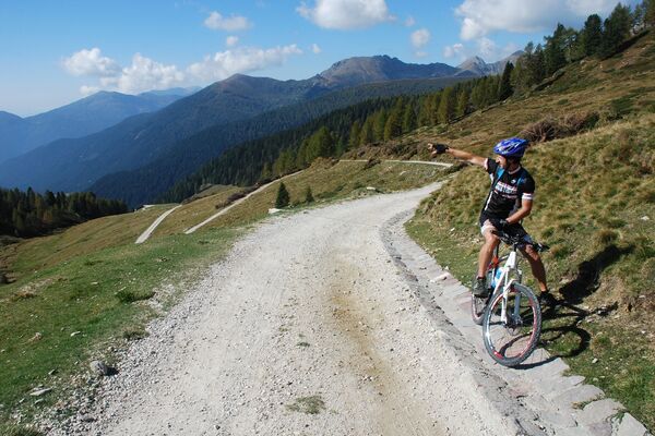
Helmet, windproof jacket
- Safety instructions
-
Remember that part of the route is on secondary roads which are open to albeit limited, slow-moving traffic, on which the highway code must also be respected by cyclists. In particular, the section along Via Castelpietra and the left-hand turn onto Via Scopoli are probably the only potentially dangerous points for cyclists on the route, especially if there are children in the group. To reduce the risk as far as possible, it is advisable, once you have left the cycling/footpath on the river Canali, to cross Via Castelpietra on the pedestrian crossing and use the pavement on the left-hand side of the street (going uphill), pushing your bikes if necessary, which is the safest way to reach the turning into Via Scopoli. To ride the route in total safety, you can also contact a qualified instructor by visiting the Primiero bike website
Please note that the practicability of the itineraries in a mountain environment is strictly linked to the contingent conditions and is therefore influenced by natural phenomena, environmental changes and weather conditions. For this reason, the information contained in this page may have changed. Before leaving for a tour, make sure the path you will approach is still accessible by contacting the owner of the mountain hut, the alpine guides or the visitor centres of the nature parks, the info offices of the local tourist board.
- Tips
-
The route, which is marked all the way, can be followed in both directions, starting from Imer, Fiera di Primiero and Siror.
- Additional information
- Public transportation
- Parking
-
Parking near the Toursit office
-

-
AuthorThe tour Family Green Way Primiero Tour is used by outdooractive.com provided.