
- Brief description
-
Alternate route of the Via Claudia Agusta, which runs via Verona to Ostiglia
- Difficulty
-
medium
- Rating
-
- Starting point
-
Trento
- Route
-
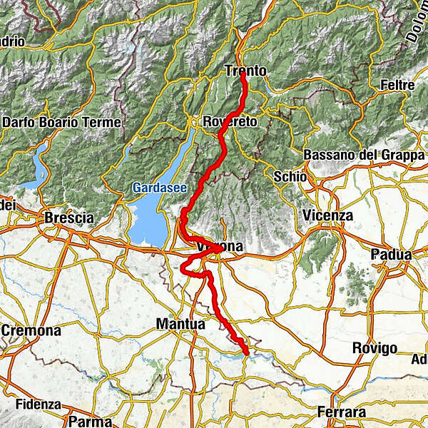
PiedicastelloTrient (194 m)0.0 kmex SIT0.0 kmLe Albere0.5 kmMattarello7.2 kmMaset7.7 kmCalliano16.1 kmBiciGrill Asgard17.5 kmNomi18.4 kmChiusole19.6 kmVilla Lagarina21.5 kmSant'Ilario22.0 kmSan Giorgio23.7 kmRovereto (204 m)24.2 kmBorgo Sacco24.6 kmChiesa di San Nicolò25.8 kmChiesa della Santissima Trinità26.2 km3 Pini29.7 kmSerravalle all'Adige35.5 kmSS. Fabiano e Sebastiano35.6 kmChizzola36.3 kmVilletta36.9 kmSanta Lucia37.5 kmPilcante41.2 kmVò Destro (136 m)46.8 kmVò Sinistro46.9 kmBorghetto52.1 kmMama di Sotto52.8 kmRoeno54.0 kmBelluno Veronese55.0 kmAlbergo Belvedere58.5 kmRivalta58.9 kmBrentino (187 m)61.0 kmPreabocco63.3 kmSantuario Cristo della Strada65.3 kmCanale68.8 kmRivoli Veronese72.7 kmChiesa di San Giovanni Battista72.9 kmGiarette73.7 kmMontalto di Sopra75.9 kmMontalto di Gaium - Pimpine76.2 kmMontalto di Sotto77.6 kmRivolti78.8 kmRagano81.2 kmLa sosta81.5 kmBar Ristorante DA RIGO81.8 kmSega (99 m)82.2 kmPol (104 m)84.5 kmBussolengo88.3 kmArcè88.6 kmChiesa di San Rocco90.2 kmPescantina90.4 kmSettimo93.5 kmCorno Alto (97 m)95.3 kmSant'Antonio Abate97.9 kmSaval100.2 kmSanta Maria Regina101.0 kmBorgo Trento102.2 kmChiesa di Santa Maria Antica103.4 kmChiesa di Santa Maria della Scala104.0 kmVerona104.4 kmChiesa di San Lorenzo104.5 kmSanta Maria Immacolata107.3 kmSan Massimo109.2 kmCasone (85 m)111.5 kmPalazzo115.6 kmAlbergo Merica115.7 kmPirlar116.4 kmSommacampagna118.1 kmCoronini124.2 kmGrattarole124.6 kmCa' Orsi125.2 kmCa' Orsi125.3 kmVillanova125.8 kmAcquaroli126.0 kmVillafranca di Verona128.5 kmSant'Eurosia129.8 kmSorgente Branca o del Segretario131.1 kmPovegliano Veronese131.9 kmAzzano136.9 kmIl Richiamo137.1 kmCastel d'Azzano137.5 kmRistoro Martin Pescatore137.6 kmForette138.9 kmAl Senato140.4 kmPizzeria alla Fermata140.8 kmVigasio141.8 kmErbè151.4 kmPontepossero153.0 kmSorgà154.8 kmTorre di Masino156.5 kmBonferraro159.1 kmRistorante Natural Cuisine159.4 kmSan Pietro in Valle166.6 kmSan Pietro in Monastero166.7 kmChiesone168.1 kmSelici168.5 kmOstiglia179.3 km
- Best season
-
JanFebMarAprMayJunJulAugSepOctNovDec
- Description
-
The Roman road that led from the Adriatic Sea and the plains of the Po over the Alps to the Danube experiences today , after 2000 years, a new bloom. Not only is it a great piece of history, which the places along the route have together. She is not only a successful tourist route . It is a piece of identity and lived by the population as an axis of encounter, exchange and cooperation .
- Directions
-
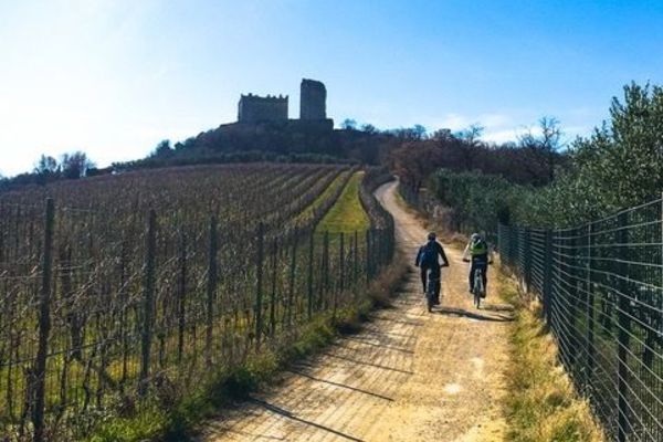
The Vallagarina (southern Trentino Valle dell'Adige. The first section of the alternative route runs through the southern part of the Adige River valley, which is still in the Alps – Vallagarina. The home of the Marzemino is full of vineyards and the impressive forts of the Austro-Hungarian monarchy. Throughout awaits the imposing fortress Beseno "Strada del Vino e dei Sapori della Vallagarina," the little Baroque jewel Villa Lagarina and the capital Region Rovereto, which impresses with its cultural opposites: the same name Castello has the largest collection of weapons and armor from the First World War. Art from the 20th century can be admired in the futuristic Mart museum. Further remains of a Roman villa and the baroque town of Ala can be admired to the south in Isera.
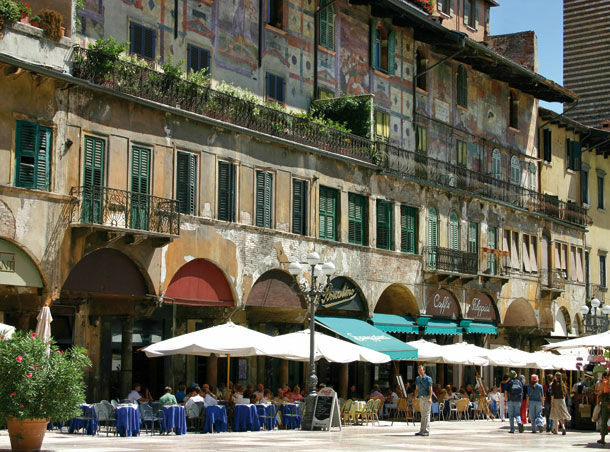
The Valpolicella and Verona level: This section accompanies the Adige river from the Alps, into the planes of the Valpolicella and Verona. With the place Dolcè begins, soon after the border between Trentino and Veneto, the level of Valpolicella, which means as much as place with many wineries. Soon after follows Verona with its world-famous Roman arena for 25,000 visitors and city center on the Piazza Erbe which has existed since Roman times. Nearby is the famous House of Juliet, the hapless lover Romeo.
From Verona to Ostiglia along the Po: The last section of the alternative route leads through the plains of Verona to the rice city of Ostiglia on the river Po, where there was once an important Roman river port. Throughout lie Sommacampagna and Isola della Scala. In the Archaeological Museum in Nogara the history of the region can be admired, starting from the pile dwellings of the Etruscans. Along the way we encounter the first rice fields that accompany the route to the town of Ostiglia on the Po. The ancient city port of Hostiglia is continued today in the numerous artefacts that are preserved in the Palazzo Foglia from the 19th century, the towers of the medieval fortress, the buildings from the 18th century and the church of Santuario della Madonna dell Comuna. - Highest point
- 209 m
- Endpoint
-
Ostiglia
- Height profile
-
 © outdooractive.com
 - Additional information


- Author
-
The tour Via Claudia Augusta (alternate route) is used by outdooractive.com provided.
GPS Downloads


General info
Refreshment stop
Cultural/Historical
A lot of view