
- Brief description
-
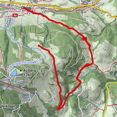
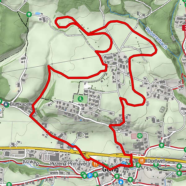
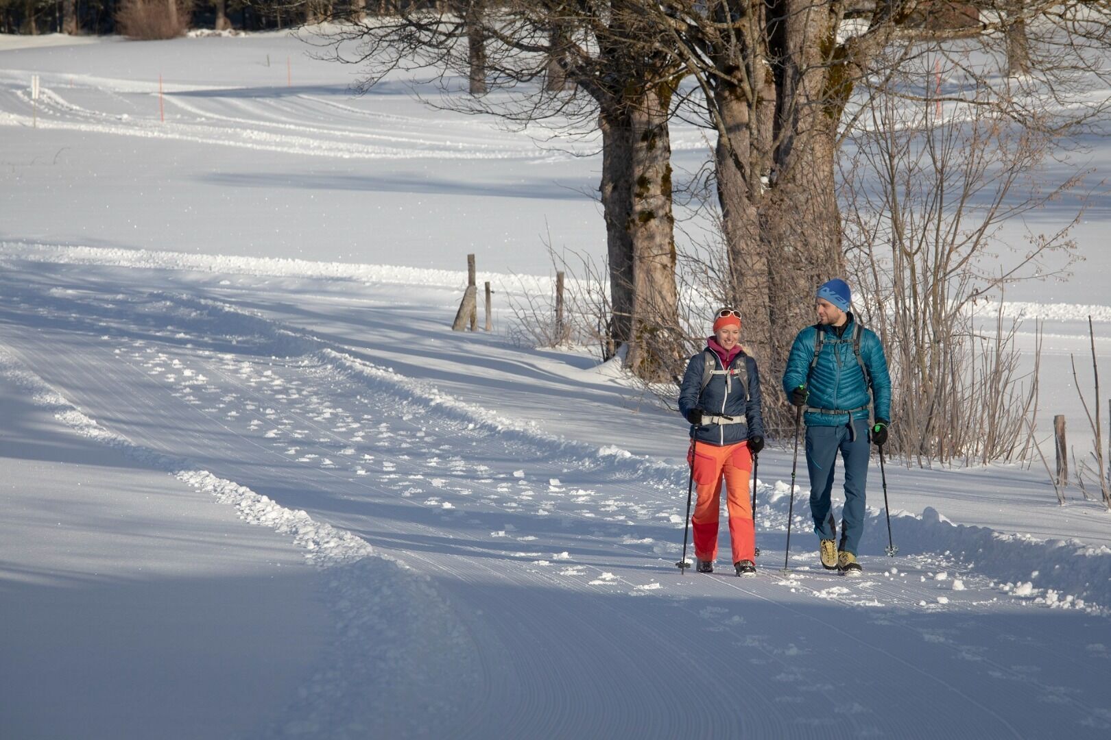
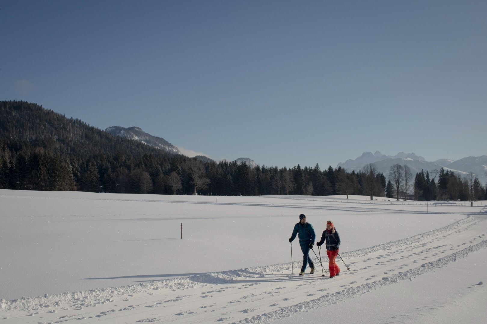
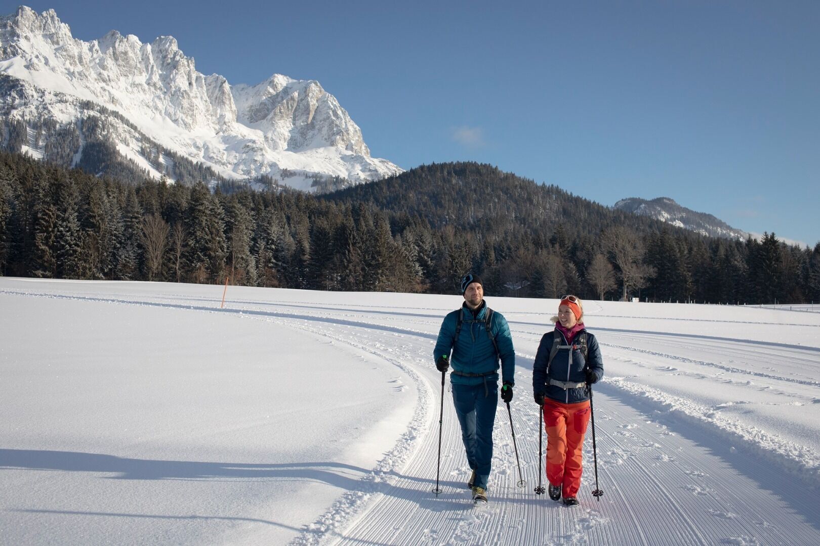
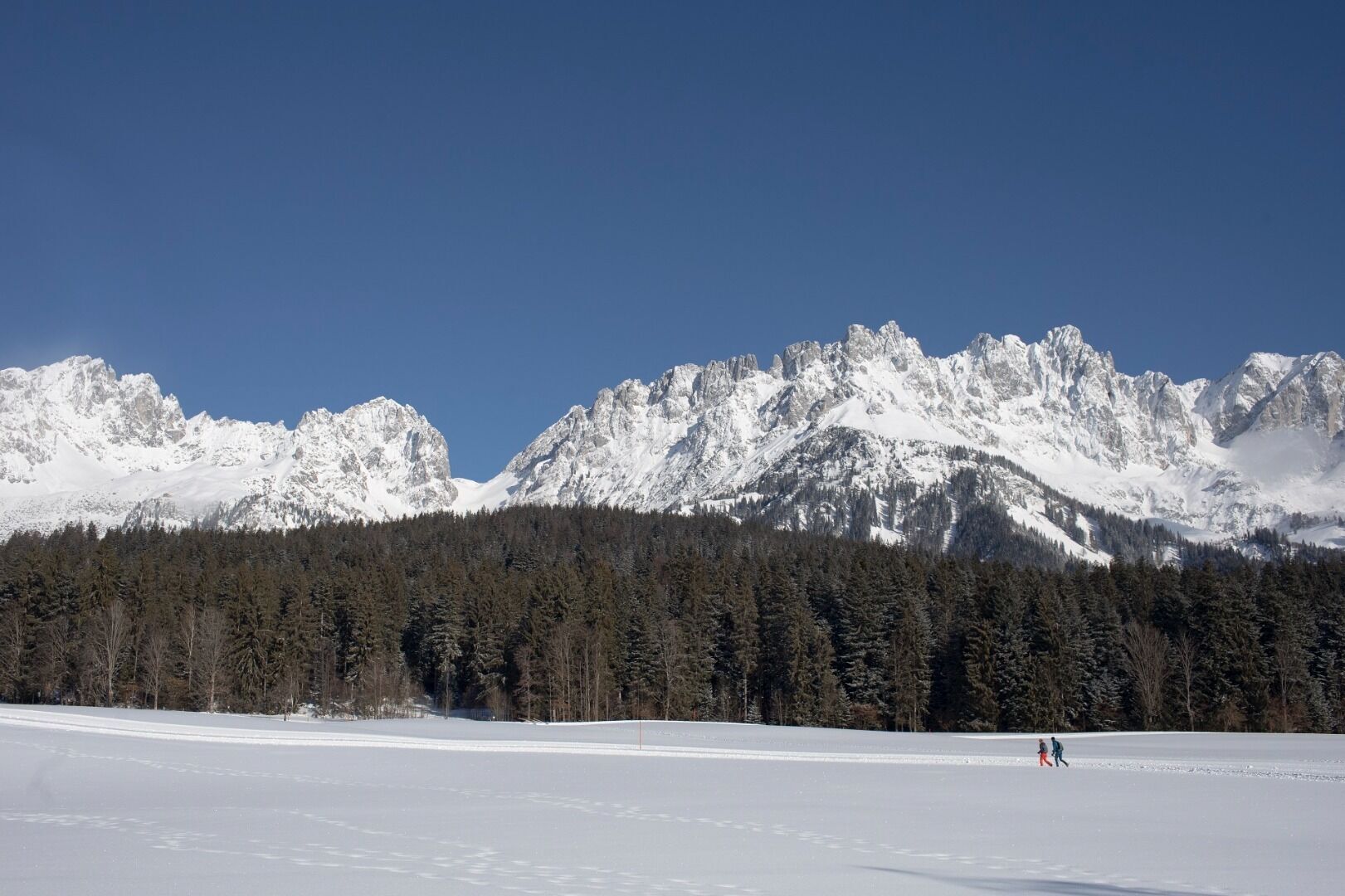
Picturesque circular route on the sunny side of Going in unspoilt natural surroundings through snow-covered fields offering wonderful views of Going and the Wilder Kaiser region.
- Difficulty
-
medium
- Rating
-
- Starting point
-
Hiking starting point Going center (former tourist information Going) (764 m)
- Route
-
Going4.7 km
- Best season
-
AugSepOctNovDecJanFebMarAprMayJunJul
- Description
-
Start this picturesque round tour at the hiking stating point ‚Going Center’ (former tourist information office). Walk north-west past the ‘Going Sport’ store and the Pizzeria Primavera, through the underpass and past the Vitalhotel Sonnenhof.
In the middle of the Rettweg settlement, there is a fork to the right which you follow until you reach a specially prepared winter trail. Snow-covered trees accompany you through the valley until you take the path uphill to the right and arrive at the Goinger sun plateau around the district ‘Schwendterdörfl’. Enjoy the peace and quiet with a fantastic view of the Wilder Kaiser.
Follow the groomed winter hiking trail around the ‘Schwendterdörfl’ at the foot of the Wilder Kaiser. When you are heading south again and the groomed trail joins the Schwendterweg, you can make a short stop at the ‘s’Kaiser Ladl’ (self-service store) to discover the variety of regional products.
From there, follow the road towards the village until you reach the Raiffeisenbank underpass, which will take you back to the village.
Tips and special features:
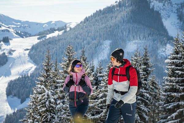
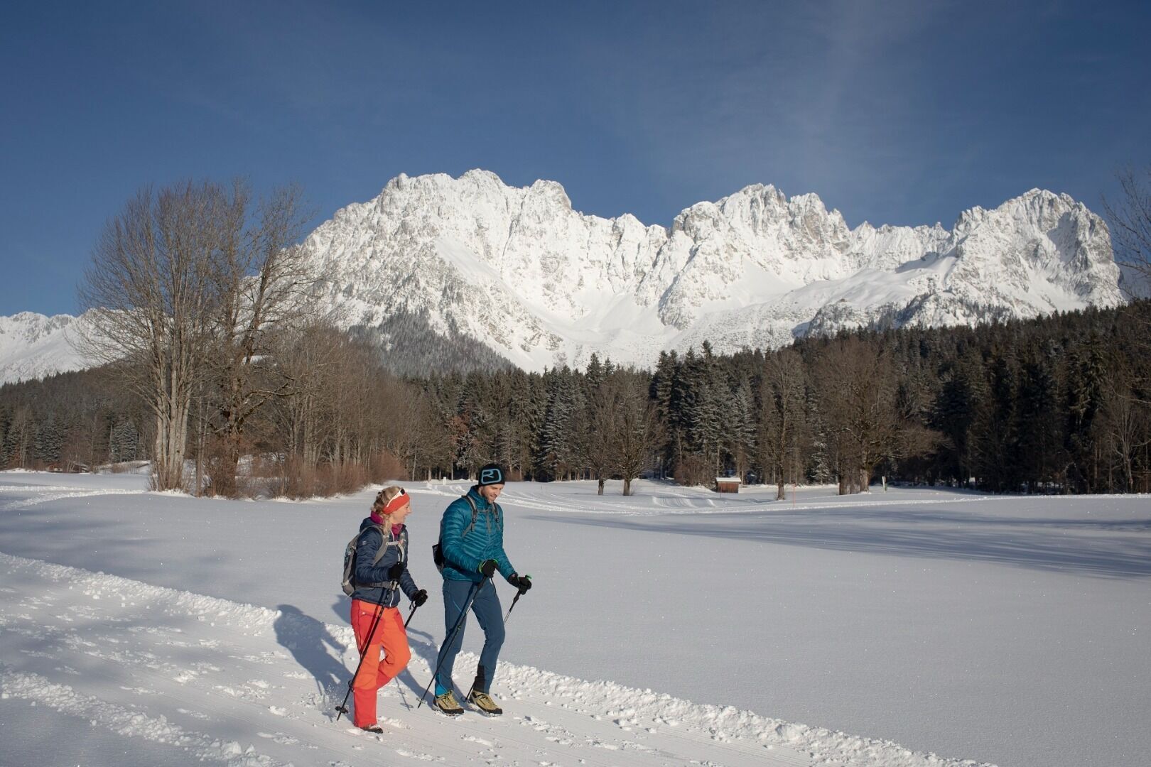
• Enjoy the magnificent views and the proximity to the Wilder Kaiser mountain range. - Highest point
- 841 m
- Endpoint
-
Hiking starting point Going center (former tourist information Going) (764 m)
- Height profile
-

- Equipment
-
Sturdy high mountaineering boots with anti-slip treaded soles (waterproof), weather-appropriate outdoor gear (breathable) incl. a change of clothes, sun protection (sunglasses, sun cream, lip protection, headgear), waterproofs (rain jacket/poncho, pocket umbrella, rucksack protector), cold protection (hat, gloves), sufficient food and hot drinks, hiking poles (height adjustable) if required, first aid kit, mobile phone with fully charged battery, plastic bag for waste, hiking map, route description and information materials (GPX track), ID card, insurance card, cash
- Directions
-
Heading from Wörgl or Kufstein on the B178 road, take the exit to Going. You will see the Tourist Information Office and the hiking starting point on the right-hand side after approx. 100 m.
Heading from St. Johann on the B178 road, take the first exit to Going and drive through the town until you see the Tourist Information Office and the hiking starting point on the left-hand side after crossing the bridge. - Public transportation
-
Skibus stop "Riederhaus/Tourismus Info" or Postbus "Going Dorf".
More information at: www.wilderkaiser.info - Parking
-
Car park opposite the hiking starting point (located to the left of the road and before the bridge; 764 m) - for free
- Author
-
The tour Schwendter Sonnenplateau circular winter hiking route is used by outdooractive.com provided.


General info
-
Wilder Kaiser
190
-
Going
88