

© www.pixabay.com
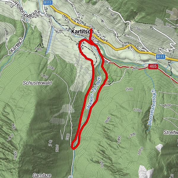

- Difficulty
-
easy
- Rating
-
- Route
-
Kartitsch0.1 kmHeilig-Kreuz-Kapelle0.3 kmKartitsch3.7 km
- Highest point
- 1,456 m
- Endpoint
-
Kartitsch Ort, Gemeindehaus
- Height profile
-

- Author
-
The tour Winterwanderweg Winklertalweg is used by outdooractive.com provided.
GPS Downloads


Other tours in the regions

