- Brief description
-
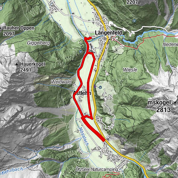
LÄNGENFELD -> Ötztaler Ache -> Astlehn -> Runhof -> Huben -> Runhof -> Astlehn -> LÄNGENFELD
- Difficulty
-
medium
- Rating
-
- Starting point
-
Campsite Ötztal in Längenfeld
- Route
-
Längenfeld (1,179 m)Maria Himmelfahrt3.0 kmAstlehn5.8 kmLängenfeld (1,179 m)7.7 km
- Best season
-
AugSepOctNovDecJanFebMarAprMayJunJul
- Description
-
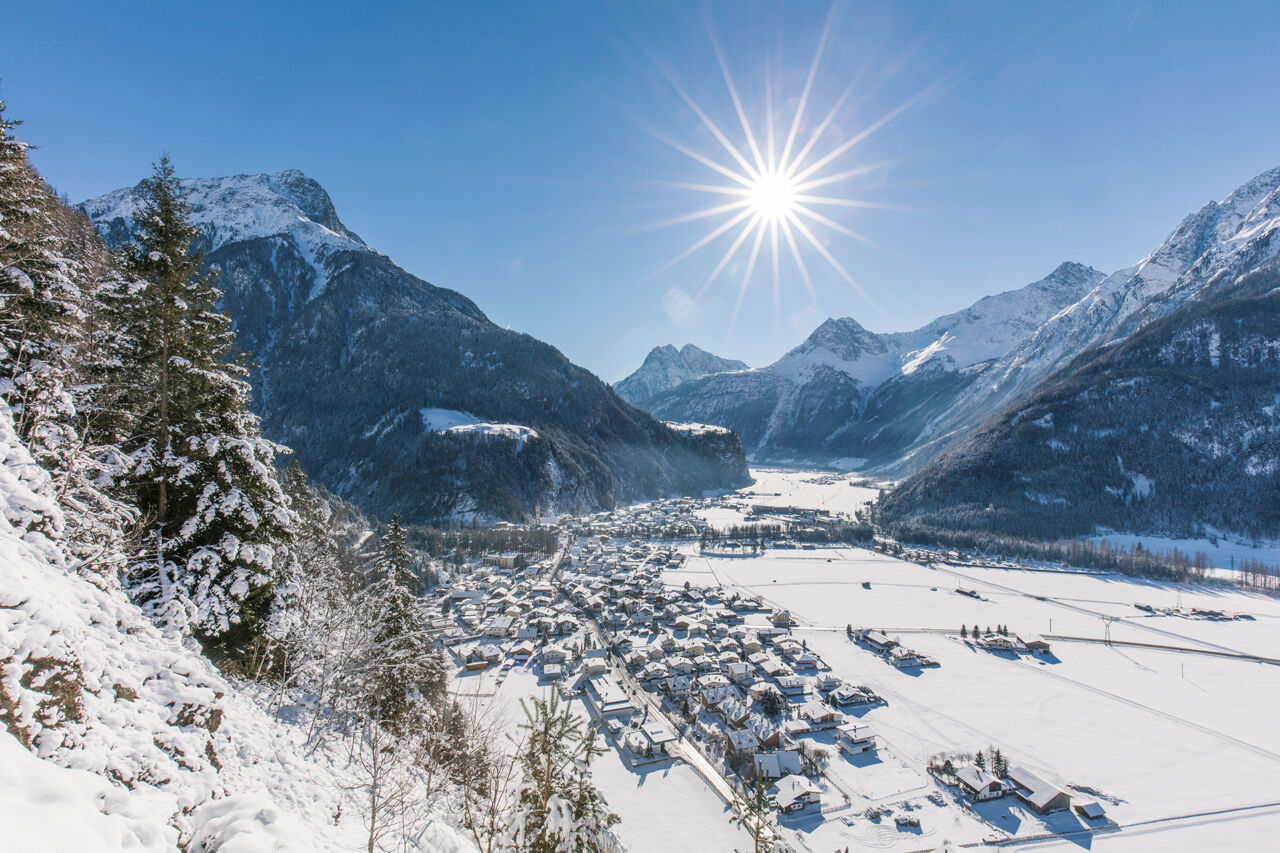
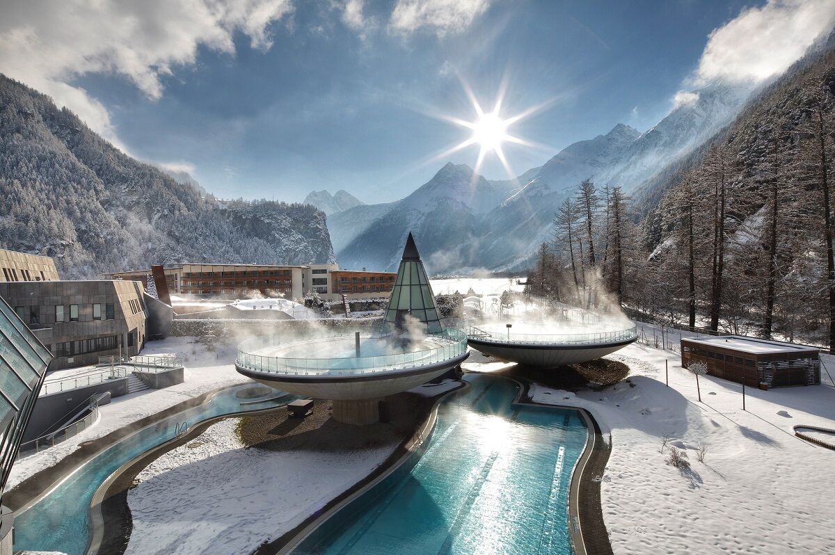
The Langenfeld sports center is a good starting point for this circular hike. At the beginning you walk a short distance along the Ötztaler Ache past the thermal bath "Aqua Dome". At the first junction, keep left until you reach the access road to the baths. A small chapel comes into view on the right. The winter hiking trail leads right past the hamlet of Astlehn to Runhof. Here the path leads to the right past the few houses to the bridge. This is not crossed but follows the Ötztaler Ache upstream to Huben. There you cross the bridge and hike back to Runhof on the other side of the river. There you change the river bank and hike along the river back to Längenfeld.
- Directions
-
At the beginning of sportcenter you pass the Aqua Dome. A beautiful winter hiking trail runs along the meadows to Runhof. From there you follow the Ötztaler Ache upstream towards Huben. The way back is on the other side of the river to Längenfeld.
- Highest point
- 1,189 m
- Endpoint
-
Campsite Ötztal in Längenfeld
- Height profile
-

- Equipment
-
Appropriate equipment such as breathable suitable outdoor clothes for the weather, is for all hikes and tours necessary.
- Safety instructions
-
Please pay attention to the current weather- & avalanche report: https://www.oetztal.com/de/ & https://lawinen.report/bulletin/latest
The Ötztal Tourismus team will be happy to inform you personally about the nature of the winter hiking trails.
Oetztal tourism T +43 5 72 00 300 - info@laengenfeld.com
- Additional information
-
More details about winter hiking in Ötztal:
https://www.oetztal.com/winter-hiking
- Directions
-
The drive to the ÖTZTAL
Arriving by car leads holidaymakers over the Inntal to the valley entrance and further along the Ötztal. In addition to the motorway can also be used on rural roads. With the route planner, your journey can be quickly and easily determined. To the route planner: https://www.google.at/maps
- Public transportation
-
Travel comfortably and safely by train. Endstation or exit point is the station ÖTZTAL. Then you drive comfortably and quickly by public transport or the
local taxi company through the entire valley to your desired destination. The current bus timetable can be found at: http://fahrplan.vvt.at
- Parking
-
The following parking facilities are available in Längenfeld:
- Sports center - (icerack) - free of charge
- Opposite the Ötztal Tourismus (small number of parking spaces) free of charge
- Author
-
The tour Round hiking trail Längenfeld / Huben - Längenfeld 200 is used by outdooractive.com provided.