- Brief description
-
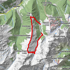
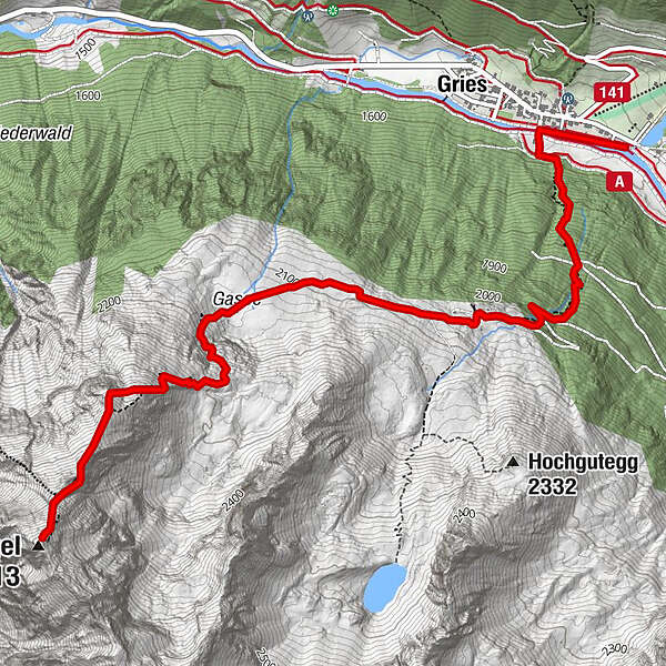
GRIES -> Nisslalm -> Gasse -> GAMSKOGEL
Increased truck and car traffic on the entire Sulztalweg.
Driving times:
Trucks: Mon - Fri from 06:00 a.m. - 10:00 p.m
Car: all day
- Difficulty
-
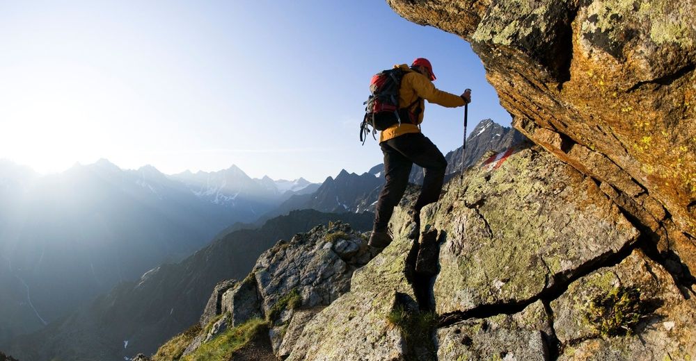
difficult
- Rating
-
- Starting point
-
Gries
- Route
-
Gries (1,569 m)0.4 kmNisslalm (2,051 m)1.8 kmGamskogel (2,813 m)4.6 km
- Best season
-
JanFebMarAprMayJunJulAugSepOctNovDec
- Description
-
In the village center of Gries you keep to the south, cross the wooden bridge towards the edge of the wall and follow the steeply climbing trail through the forest, which merges into the cart road. A more leisurely but longer ascent to the mountain hut travels along the cart road that forks off to the right at the entrance to Sulztal valley. Hiking past Nisslalm you continue on the rising trail behind the hut, leading uphill towards the tree line for about 30 minutes. You get to grass-covered Alpine meadows. Proceed towards the steeply ascending rock ledges to the eastern ridge at 2600 m above sea level. The last part requires another hour as it travels to lofty heights on a precipitous path.
- Directions
-
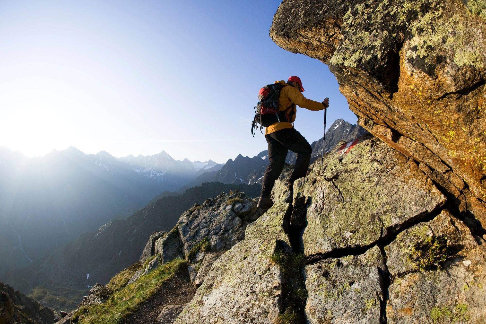
Near the car park at the end of Gries (Tiroler Hütte) the ascent begins a steep forest path to the Nisslalm, which crosses the forest path several times. After the pasture, the path leads slightly uphill to lush green meadows. The further increase runs steeply over stone slabs and partly rocky. Difficult passages such as granite slabs and steps are always insured with stepping aids and short wire ropes.
- Highest point
- 2,792 m
- Endpoint
-
Gamskogel
- Height profile
-

- Equipment
-
Appropriate equipment such as breathable suitable outdoor clothes for the weather, is for all hikes and tours necessary. Please bring a first-aid box, a mobile phone, a walking map and if there is no hut on the way a snack and enough to drink.
- Safety instructions
-
For experienced mountaineers that are free from vertigo & surefooted, Very good physical condition, mountain experience & mountain equipment (see notice equipment) necessary, such as alpine security material, good weather conditions recommended. Please pay attention to the current weather report
- Tips
-
It is possible to go to the Nisslalm by mountain bike. Instead of a long descent, a fast descent awaits you.
- Additional information
- Directions
-
The car drive to the Ötztal valley. Situated in Tirol, the Ötztal valley set off in southerly direction and is the
longest side valley in the Eastern Alps. The journey with the car leads you through the Inntal valley to the
entrance of the valley and further on through the valley. Among the toll motorways you can also use the country
roads. A route planner will show you the easiest and most convenient way: https://www.google.at/maps
- Public transportation
-
Travel safe and comfortable with the train to the Ötztal Bahnhof train station. Last stop and exit point is the
train station Ötztal Bahnhof. Afterwards you can travel smoothly and quick with the public transport or our local
taxi companies through the valley to your desired destination. Please find the current bus timetable here:
http://fahrplan.vvt.at
- Parking
-
The following parking facilities are available :
Gries at the end of the village - chargeable

- Author
-
The tour Gamskogel 2813m - Längenfeld/Gries is used by outdooractive.com provided.


General info
-
Ötztal
1107
-
Längenfeld - Huben - Gries
354