


- Brief description
-
HUBEN FUSSBALLPLATZ -> direction Alpengasthof am Feuerstein -> direction Hahlkogelhaus -> HAHLKOGEL
- Difficulty
-
difficult
- Rating
-
- Starting point
-
Huben / sports court
- Route
-
Huben (1,198 m)0.1 kmEbenalm3.9 kmÄußerer Hahlkogel (2,655 m)6.6 km
- Best season
-
JanFebMarAprMayJunJulAugSepOctNovDec
- Description
-
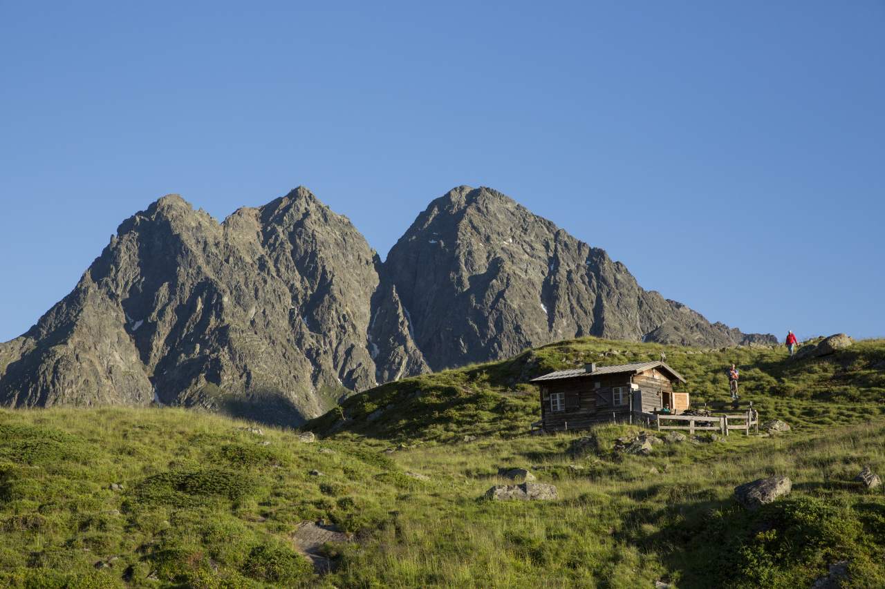
Follow the signposts to "Ötztaler Fun Park" in Huben and walk past the water park. Here you take the cart trail up to Polltalalm and Breitlehnalm. A switch-backing route winds its way up to the forest on 13 kilometers. At about 2/3 of the hike the path forks-off and you leave the route to Polltalalm and Breitlehnalm, heading southwards across wonderful Alpine rose and heather meadows, blueberry and bilberry fields to lofty Hahlkogelhaus hut. A level path travels southwards to a wide open right-hand turn, merging into a steep green slope. You reach the peak after conquering a couple of rocky and fairly precipitous sections.
- Directions
-
From the football field in Huben a forest road leads to Alpengasthof am Feuerstein. (Ascent can also be done via the legendary path) After some walking time, follow the steep mountain path with a ropeway up to the Hahlkogelhaus, which is no longer cultivated. From the hut, the trail continues on beautiful pastures until the junction "Hahlkogel - Wartkogelsee". From here, the climb takes place in steep serpentines and easy block climbing to the summit.
- Highest point
- 2,615 m
- Endpoint
-
Hahlkogel
- Height profile
-

- Equipment
-
Appropriate equipment such as breathable suitable outdoor clothes for the weather, is for all hikes and tours necessary. Please bring a first-aid box, a mobile phone, a walking map and if there is no hut on the way a snack and enough to drink.
- Safety instructions
-
For experienced mountaineers that are free from vertigo & surefooted, Very good physical condition, mountain experience & mountain equipment (see notice equipment) necessary, such as alpine security material, good weather conditions recommended. Please pay attention to the current weather report
- Tips
-
The ascent to the summit can be shortened by using the hut taxi, which in summer goes up to the Polltalalm. Reservation required at Ötztal Tourismus.
- Additional information
- Directions
-
The car drive to the Ötztal valley. Situated in Tirol, the Ötztal valley set off in southerly direction and is the
longest side valley in the Eastern Alps. The journey with the car leads you through the Inntal valley to the
entrance of the valley and further on through the valley. Among the toll motorways you can also use the country
roads. A route planner will show you the easiest and most convenient way: https://www.google.at/maps
- Public transportation
-
Travel safe and comfortable with the train to the Ötztal Bahnhof train station. Last stop and exit point is the
train station Ötztal Bahnhof. Afterwards you can travel smoothly and quick with the public transport or our local
taxi companies through the valley to your desired destination. Please find the current bus timetable here:
http://fahrplan.vvt.at
- Parking
-
The following parking facilities are available in Huben:
- Soccer field Huben


- Author
-
The tour Hahlkogel 2655m - Längenfeld/Huben is used by outdooractive.com provided.


General info
-
Ötztal
1107
-
Längenfeld - Huben - Gries
354


