

- Brief description
-
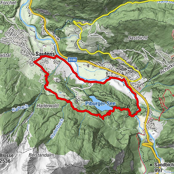
SAUTENS -> Wiesenweg Beerweg -> Wellerbrücke -> Piburger See -> Seejöchl -> Haderlehn -> SAUTENS
- Difficulty
-
easy
- Rating
-
- Starting point
-
Sautens
- Route
-
Sautens (812 m)0.0 kmOetz (812 m)2.7 kmSeerestaurant5.2 kmSeehäusl5.2 kmSautens (812 m)9.7 km
- Best season
-
JanFebMarAprMayJunJulAugSepOctNovDec
- Description
-
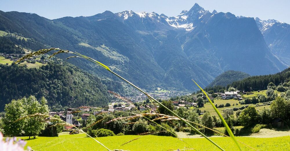
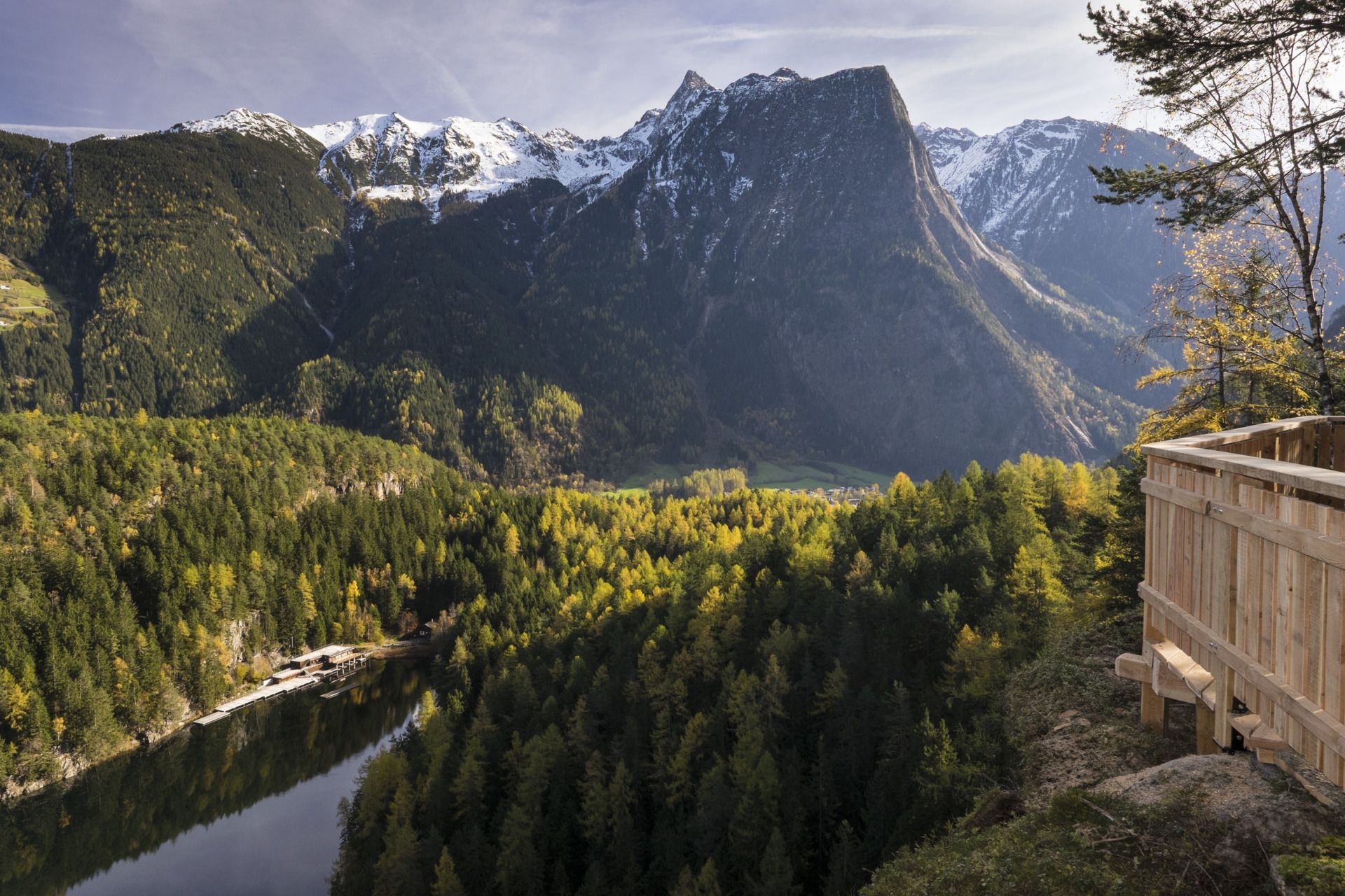
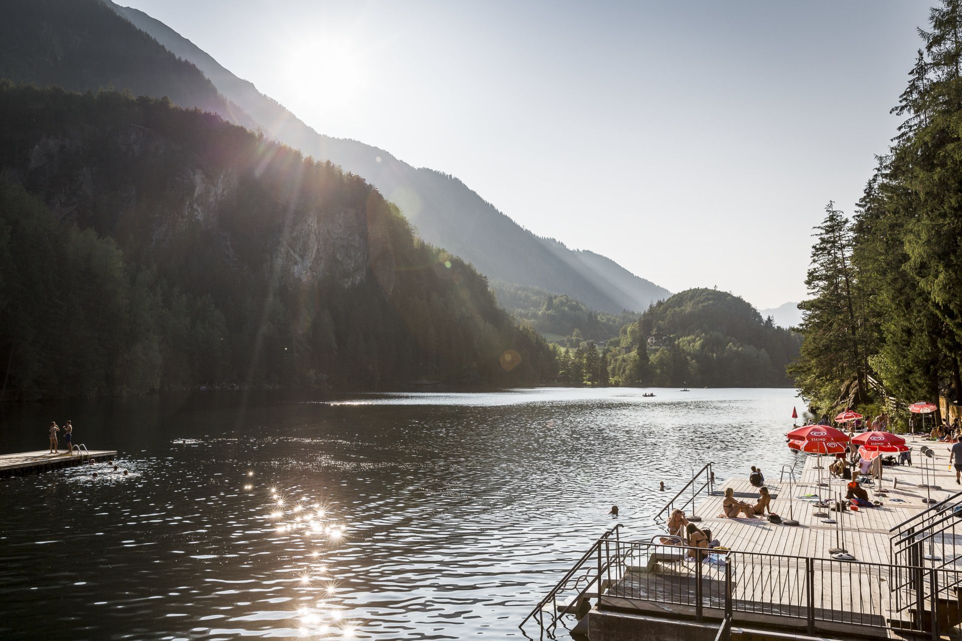
A huge rockslide after the last Ice Age was the origin of today's highly idyllic nature preserve of Achstürze-Piburger See. The hiking tour travels from Sautens along Ötztaler Ache brook to the white waters of the "Achstürze" mountain brook falls. Cross the river on the exciting Wellerbrücke bridge, then continue to the wildly rugged "Fairytale Forest" with giant boulders. The path leads up to lovely lake Piburger See - a true natural gem. Return via Seejöchl to Haderlehn and back to Sautens.
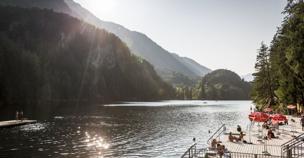
"Lake Piburgersee and the 9 treasures"
The „9 treasures“ are nine very special places in the area of the lake Piburger See. At these nine outstanding vantage spots, hikers can enjoy a beautiful nature and dream! Write down your dreams and personal wishes in the “treasure book” which you can find on every platform. So every place becomes a personal treasure site!
- Directions
-
A huge rockslide after the last Ice Age was the origin of today's highly idyllic nature preserve of Achstürze-Piburger See. The hiking tour travels from Sautens along Ötztaler Ache brook to the white waters of the "Achstürze" mountain brook falls. Cross the river on the exciting Wellerbrücke bridge, then continue to the wildly rugged "Fairytale Forest" with giant boulders. The path leads up to lovely lake Piburger See - a true natural gem. Return via Seejöchl to Haderlehn and back to Sautens.
- Highest point
- 1,046 m
- Endpoint
-
Sautens
- Height profile
-

- Equipment
-
Appropriate equipment such as breathable suitable outdoor clothes for the weather, ankle-high walking boots, wind-, rain- & sun protection, hat, possibly gloves, is for all hikes and tours necessary. Please bring a first-aid box, a mobile phone, a walking map and if there is no hut on the way a snack and enough to drink.
- Safety instructions
-
Easy hike; suitable for beginners and walkers. Please pay attention to the current weather report: www.oetztal.com/de/sommer.html
- Tips
-
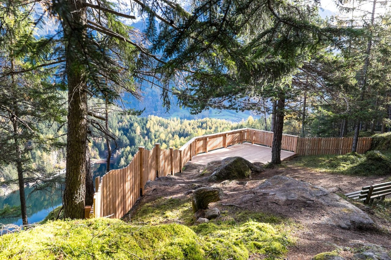
Take a rest at the platform "Seeejöchl" and enjoy the beautiful view on the lake.
- Additional information
- Arrival
-
The car drive to the Ötztal valley. Situated in Tirol, the Ötztal valley set off in southerly direction and is the longest side valley in the Eastern Alps. The journey with the car leads you through the Inntal valley to the entrance of the valley and further on through the valley. Among the toll motorways you can also use the country roads. A route planner will show you the easiest and most convenient way: www.google.at/maps
- Public transportation
- Parking
-
The following parking facilities are available in Sautens:
- directly in front of the town hall - for free of charge
- right after the big bridge right on the big gravel parking lot - for free
- at the sports field / cross chapel / experience Kalkofen as - for free
- in front of the elementary school / kindergarten, Kirchblickweg - for free

- Author
-
The tour Sautens - Oetz - Lake Piburger See - Sautens is used by outdooractive.com provided.