
- Brief description
-
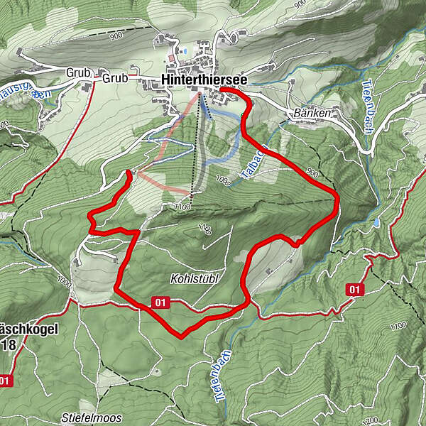
Around the Schattberg, this circuit lives up to its name.
- Difficulty
-
easy
- Rating
-
- Starting point
-
Village center Hinterthiersee
- Route
-
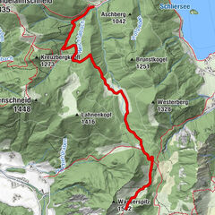
HinterthierseeVorderthiersee-Blick0.3 kmWieshof4.2 km
- Best season
-
AugSepOctNovDecJanFebMarAprMayJunJul
- Description
-
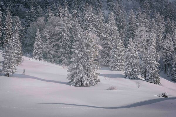
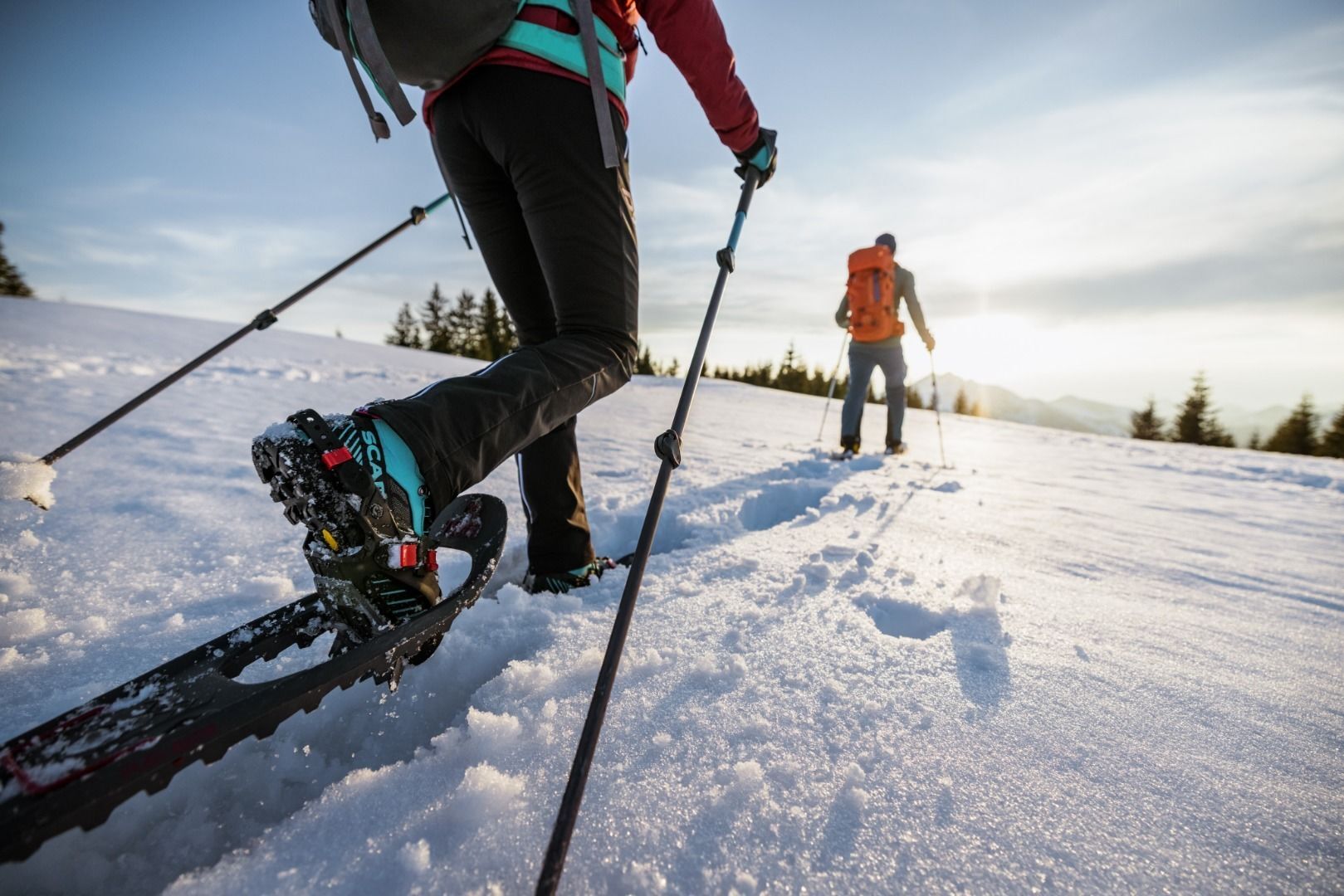
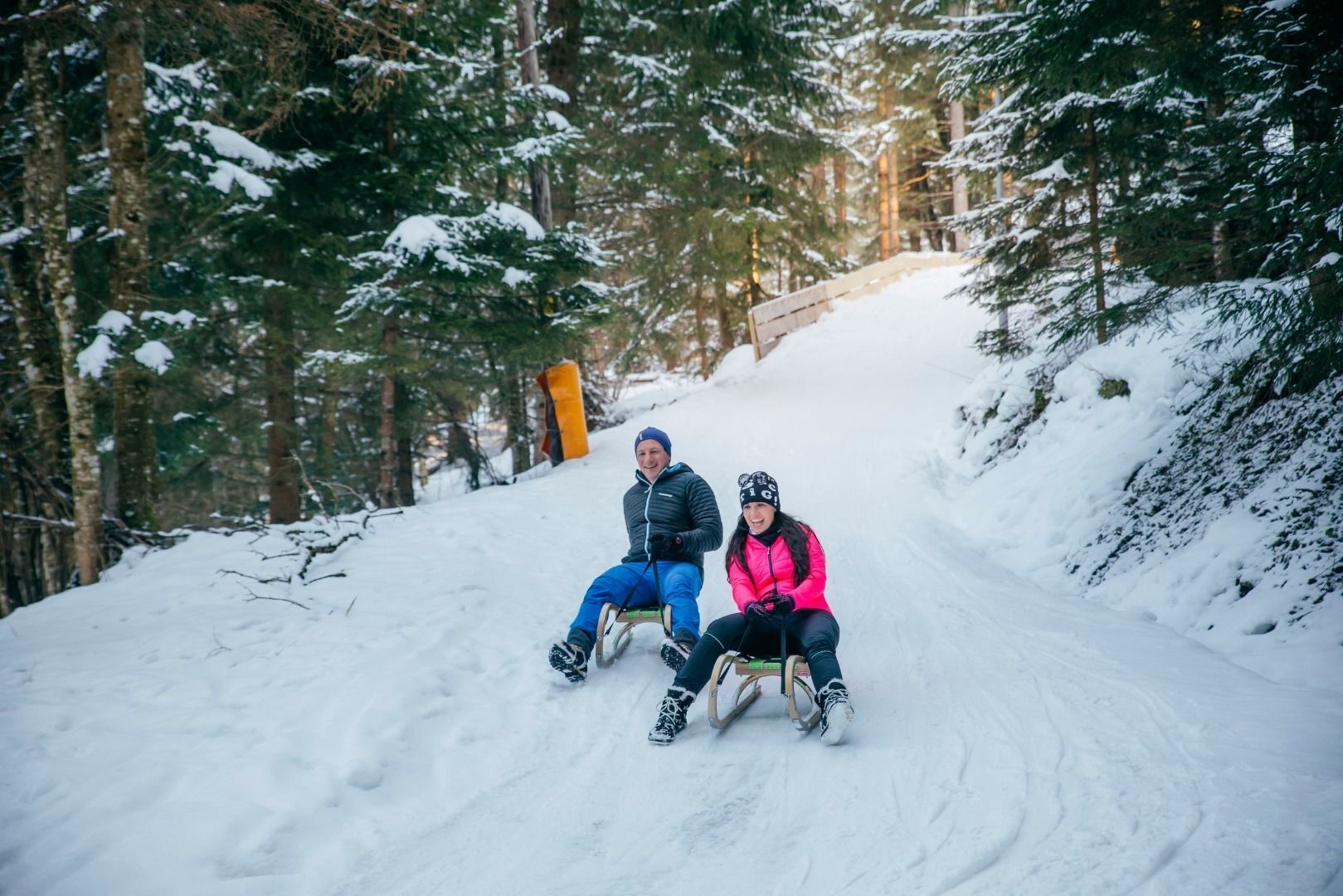
Starting in Hinterthiersee, this loop leads on the shady and thus very snow-sure side of Hinterthiersee first to Breitenau, there over snow-covered alpine meadows and on to Modal. Over this charming clearing you reach the snack station Wieshof and if desired with the toboggan from there further into the valley.
Snowshoe rental at Sporthaler Hinterthiersee. - Highest point
- 1,067 m
- Endpoint
-
Wieshof
- Height profile
-

- Equipment
-
Outdoor clothing appropriate to the weather (good footwear, rain protection, breathable clothing...), snacks (e.g. fruit, muesli bars, wholemeal breads) and drinks (make sure you drink enough), first-aid equipment, mobile phone with full battery, hiking map and guide literature, sun protection (sun cream and glasses, cap), bivouac sack, snowshoes, hiking sticks
- Directions
-
From the Inntal motorway A12 take the exit Kufstein Nord and follow the signs to Thiersee/Hinterthiersee.
- Public transportation
-
Take bus line 4046 in the direction of Grub and get off at the bus stop "Hinterthiersee Dorf". With the KufsteinerlandCard you can take the bus free of charge within the region.
- Parking
-
Primary schools Hinterthiersee, free of charge.


- Author
-
The tour Snowshoe hiking Schattberg Thiersee is used by outdooractive.com provided.


-
Kufsteinerland
190
-
Thierseetal
47