

- Brief description
-
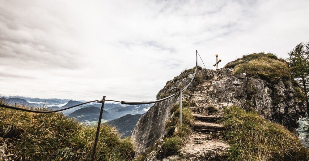
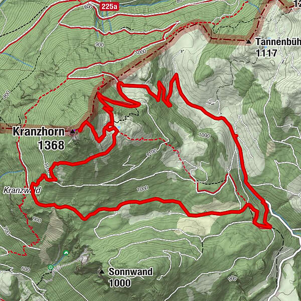
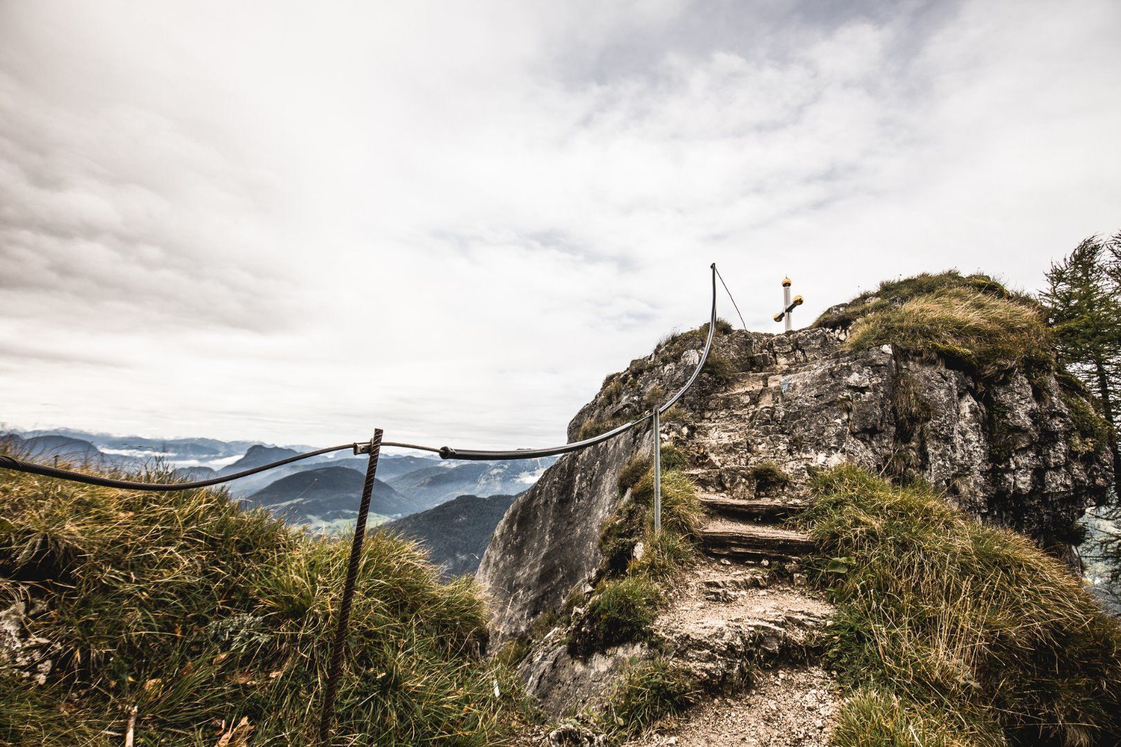
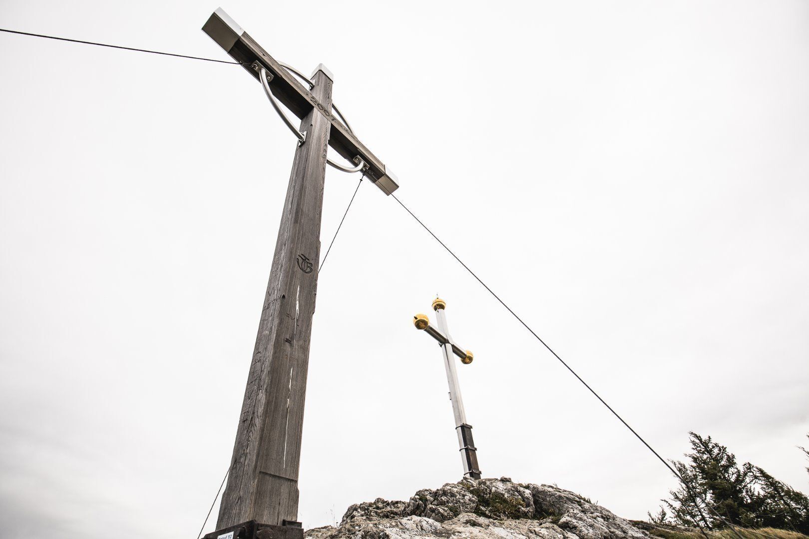
Varied mountain hike with wonderful views of the Chiemgau Alps and the Kaiser Mountains. The German/Austrian border runs over the Kranzhorn summit, which is why the climb is (unusually) rewarded with two peak crosses. The rustic Kranzhornalm is popular with climbers.
- Difficulty
-
medium
- Rating
-
- Starting point
-
parking Kranzhorn
- Route
-
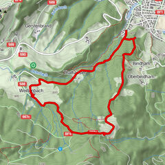
Hintermoar-Alm0.4 kmKranzhorn Alm3.5 kmKranzhorn (1,368 m)4.0 km
- Best season
-
JanFebMarAprMayJunJulAugSepOctNovDec
- Description
-
The shortest way leads begins at the parking area Kranzhorn (€ 2,-). From here around one hour on a gently inclined path up to the Kranzhornalm. (Option: steep path from district Scheiben in Erl, takes about 2 hours) From the alpine cabin you'll reach the summit of the Kranzhorn mountain in about 15 minutes.
From Bavaria you can reach the destination in 2 hours from Windshausen following a forest path up the hill. For Mountainbiker an official MTB route from Erl or Windshausen/Nussdorf leads up the mountain. At the alpine hut Kranzhorn, owned and managed by family Anker, you get served tyrolean good traditional fare, as well as cake and coffee. With a petting zoo, playground and "dogbar" the destination leaves nothing to be desired for the young and their pets. Furthermore there is the possibility to stay overnight at the hut. From the hut you can take a ten minute walk up to the summit crosses, where you can enjoy breathtaking views. - Highest point
- 1,357 m
- Endpoint
-
summit Kranzhorn
- Height profile
-

- Equipment
-
Dem Wetter entsprechende Outdoor-Bekleidung (gutes Schuhwerk, Regenschutz, atmungsaktive Kleidung…)
Jause (z.B. Obst, Müsliriegel, Vollkornbrote) und Getränke (ausreichend Flüssigkeit einplanen)
Erste-Hilfe-Ausrüstung
Handy mit vollem Akku
Wanderkarte und Führerliteratur
Sonnenschutz (Sonnencreme- und Brille, Kappe)
Biwaksack - Arrival
-
The journey is possible by car to the Kranzhorn hiking car park.
- Public transportation
-
With the KufsteinerlandCard within the region bus free of charge.
- Parking
-
Hiking car park Kranzhorn, subject to a charge.
- Author
-
The tour Kranzhorn Erl is used by outdooractive.com provided.


-
Kufsteinerland
2116
-
Erl
662