- Brief description
-
ETAPPE 21 – 22
Frischmannhütte (2.192 m) – Fundusfeiler (3.079 m) – Erlanger Hütte (2.541 m) – Forchheimer Weg – Maisalm (1.631 m) – Ötztal-Bahnhof (704 m) - Difficulty
-
medium
- Rating
-
- Starting point
-
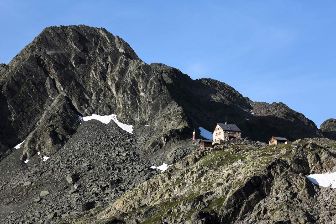
Frischmann Hut
- Route
-
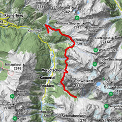
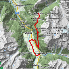
Fundusfeiler (3,079 m)2.4 kmFeilerscharte (2,928 m)2.8 kmErlanger Hütte (2,550 m)9.4 kmMutzeiger (2,277 m)16.2 kmMaisalm18.7 kmWirtsboden23.2 kmMairhof27.6 kmLourdeskapelle27.6 kmRoppen (724 m)27.8 kmLöckpuit28.0 kmSchlierenzau34.2 kmÖtztal (692 m)34.9 kmÖtztal-Bahnhof36.4 km
- Best season
-
JanFebMarAprMayJunJulAugSepOctNovDec
- Description
-
ACROSS GEIGENKAMM – FORCHHEIMER WEG
Frischmannhütte (2192 m) – Fundusfeiler (3079 m) – Erlanger Hütte (2541 m) – Forchheimer Weg – Maisalm (1631 m) – Ötztal- Bahnhof (704 m)
Changes in elevation: ascent 1750 meters / descent 3250 meters
Distance in kilometers: 29 km
The last Ötztal Trek Route covers 2 stages, on the last stage an overnight stay is recommended. Otherwise you descend some 2350 meters on a single day! From Erlanger Hütte you hike on the scenic Forchheimer Weg high elevation trail.
STAGE 21:
FRISCHMANNHÜTTE (2192 m) –> FUNDUSFEILER (3079 m) –> ERLANGER HÜTTE (2541 m)
Route: steep path
Requirements: surefootedness, good head for heights; black mountain trail
Difficulties: none
Equipment: standard hiking equipment
Walking time: approx. 6 hrs
Changes in elevation: ascent approx. 1250 m / descent 900 m
Highest point: 3079 m
Distance in kilometers: approx. 10 km
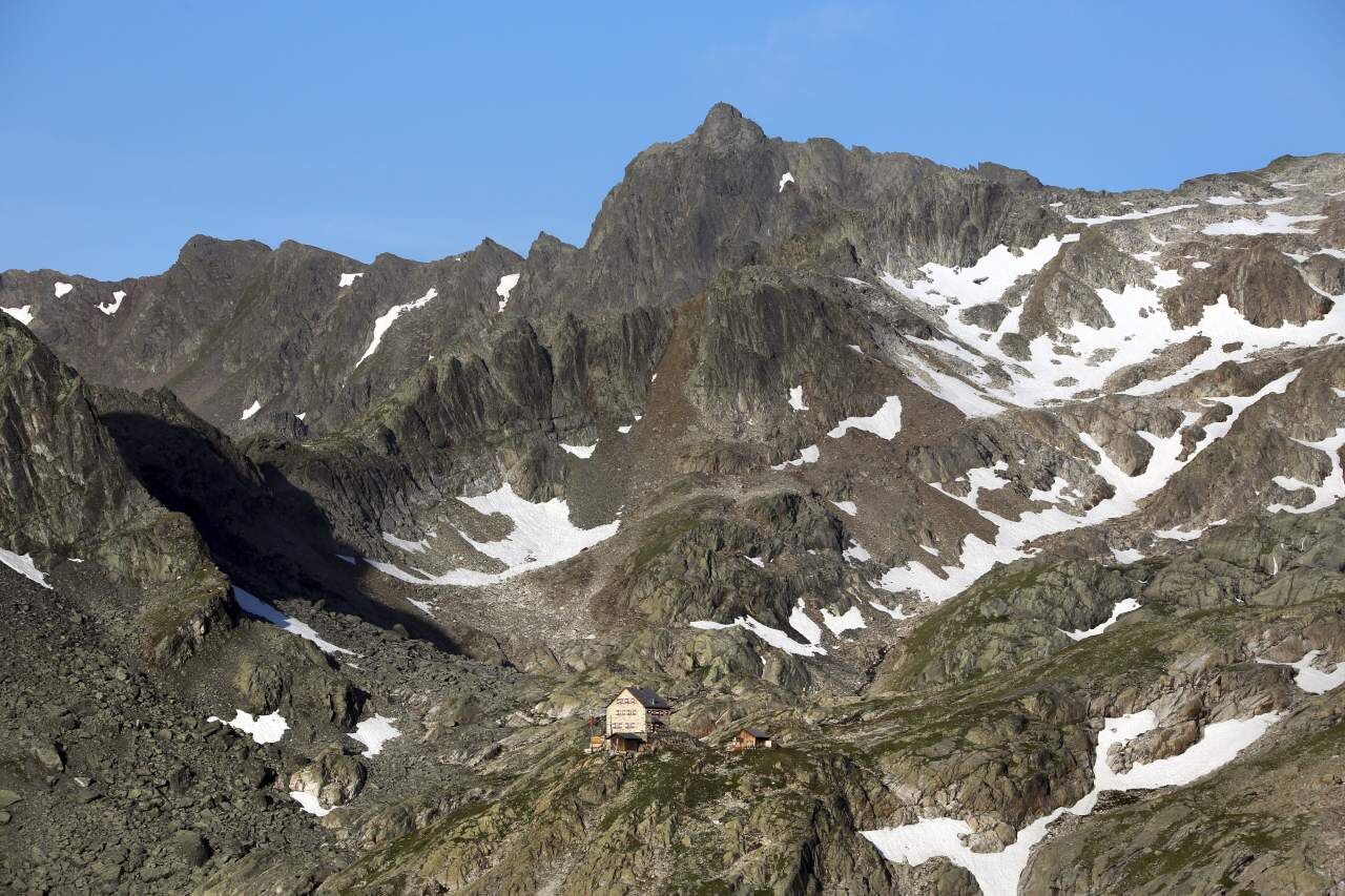
Lodging, refreshment stops: Frischmannhütte, Erlanger Hütte
Access/exit points: from Umhausen to Frischmannhütte (ascent approx. 3.5 hrs / descent 2.5 hrs; alternatively by taxi from Umhausen to Hintere Fundusalm from where it’s a 30-minutes hike to Frischmannhütte); from Köfels (Umhausen) to Frischmannhütte (ascent approx. 2.5 hrs / descent 2 hrs); from Umhausen to Erlanger Hütte (ascent approx. 4.5 hrs / descent 3.5 hrs; alternatively by taxi from Umhausen to Vordere Leierstalalm from where it’s another 2-hours hike to Erlanger Hütte /descent approx. 1.5 hrs)
3000-Meter High Peak and Scenic Mountain Lake
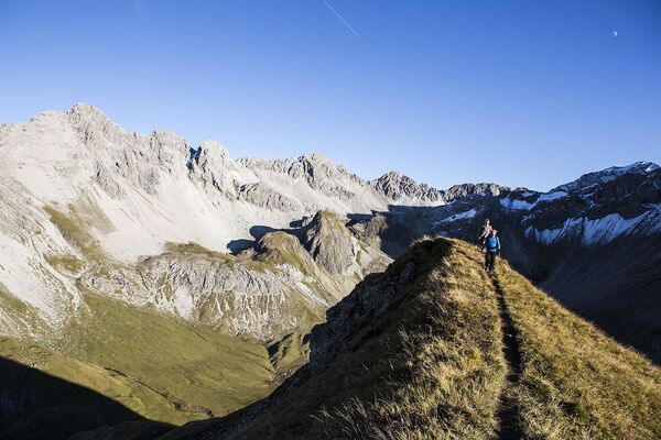
From the refuge hut the trail leads to Funduskar Cirque and then switchbacks up steeply to Fundusfeilerrinne and further on to Feilerscharte Ridge. A scenic ridge walk takes you to the panoramic peak of Fundusfeiler (3079 m) featuring 150 meters of altitude gain, an absolute must for passionate hikers! Head in northern direction through scree areas down to Schwarzes Loch. At the fork, make a right turn and continue westwards through the gently rolling pasturelands of Leierstal. Later on the trail climbs in switchbacks to a mountain dip past which you can already see crystal-clear Wettersee, one of Ötztal’s most pristine mountain lakes. From the lake it’s only a few more minutes down to Erlanger Hütte.
STAGE 22:
ERLANGER HÜTTE (2541 m) –> FORCHHEIMER WEG –> MAISALM (1631 m) –> ÖTZTAL-BAHNHOF (704 m)
Route: steep path, footpath, (sealed) road
Requirements: surefootedness, good head for heights, good physical condition and stamina; red mountain trail
Difficulties: none; stable weather conditions essential
Equipment: standard hiking equipment
Walking time: approx. 9 hrs, 2-day hike
Changes in elevation: ascent approx. 500 meters / descent 2350 meters
Highest point: 2660 m
Distance in kilometers: approx. 19 km
Lodging, refreshment stops: Erlanger Hütte, Maisalm
Access/exit points: from Umhausen to Erlanger Hütte (ascent approx. 4.5 hrs / descent 3.5 hrs; alternatively by taxi from Umhausen to Vordere Leierstalalm from where it takes 2 hrs up to Erlanger Hütte and 1.5 hrs down)
Two Days on Vordere Geigenkamm
If it wasn’t for Maisalm where you can spend the night on your way between Erlanger Hütte to Ötztal-Bahnhof you would be forced to climb down 2350 meters in one day. From Erlanger Hütte the trail descends northwards, crosses a few slopes, climbs up to a ridge and drops steeply down to Tumpental Valley. You ascend to Murmentenkarjoch where the trail descends in a northern direction and travels along a ridge down to the small Forchheimer Bivouac (a basic mountain shelter left unlocked; sleeps four persons; 3-hour walk).The trail contours along the ridge to Hahnenkamm which is circumvented through a scree field to the east. Then the route heads to Mutkopf Peak and Muthütte (not serviced). Continue down on a cart road and follow it to Maisalm Hut (approx. 6 hrs from Erlanger Hütte) where you spend the night (advance booking required!). The next day you continue along a cart road & footpath, then a cart road again down to the village of Roppen. In Roppen you follow the road parallel to the rail tracks in an eastern direction, from Ötztaler Ache Mountain Brook you continue on the Ötztal Mountain Bike Trail until you get to Ötztal-Bahnhof.
- Highest point
- 3,038 m
- Endpoint
-
Ötztal Bahnhof
- Height profile
-

- Equipment
-
It is recommended to wear hiking equipment such as breathable and weather-adapted outdoor clothing, ankle-high mountain boots, wind, rain and sun protection, cap and possibly gloves. It is also important to have enough food, as well as a first-aid package, a cell phone and a hiking map.
- Additional information
- Directions
- Public transportation
- Parking
-
The following parking facilities are available in Umhausen:
- Umhausen Parking Mure - free of charge
- Umhausen Bischoffsplatz - payable from 07:00 to 18:30 hour
- Parking Köfels (payable)


- Author
-
The tour Ötztal Trek Route 6 is used by outdooractive.com provided.