- Brief description
-
ETAPPE 18 – 20
Braunschweiger Hütte (2.758 m) – Mainzer Höhenweg – Rüsselsheimer Hütte (2.328 m) – Luibisscharte (2.914 m) – Hauerseehütte (2.383 m) – Felderjöchl (2.797 m) – Frischmannhütte (2.192 m) - Difficulty
-
difficult
- Rating
-
- Starting point
-
Braunschweiger Hut
- Route
-
Marienkapelle0.0 kmBraunschweiger Hütte0.0 kmGletscherstube (1,891 m)3.3 kmMittelberg5.5 kmMandarfen6.2 kmAlmbar Hexenkessel7.0 kmRestaurant-Cafe s'Pfandl7.0 kmTieflehn7.1 kmPfarrkirche Plangeross8.3 kmBergwerk8.4 kmPlangeross8.5 kmRüsselsheimer Hütte11.7 kmFrischmannhütte29.9 km
- Best season
-
JanFebMarAprMayJunJulAugSepOctNovDec
- Description
-
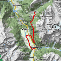
ACROSS GEIGENKAMM – MAINZER HÖHENWEG
STAGE 18 – 20
Braunschweiger Hütte (2758 m) – Mainzer Höhenweg – Rüsselsheimer Hütte (2328 m) – Luibisscharte (2914 m) – Hauerseehütte (2383 m) - Felderjöchl (2797 m) – Frischmannhütte (2192 m)
Changes in elevation: ascent 2600 meters / descent 3200 meters
Distance in kilometers: 27 km
Mainzer Höhenweg high-altitude trail ranks among the undisputed attractions when it comes to Alpine hiking. Geigenkamm Ridge promises quiet and authentic mountaineering. This route is quite demanding but offers very beautiful stages.
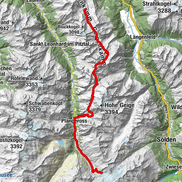
STAGE 18:
BRAUNSCHWEIGER HÜTTE (2758 m) –> MAINZER HÖHENWEG –> RÜSSELSHEIMER HÜTTE (2328 m)
Route: steep path, footpath
Requirements: surefootedness, good head for heights, good physical condition, stamina, high Alpine experience; black mountain trail, partly high Alpine route
Difficulties: extremely long tour, several glacier crossings (crevasses!), some sections are equipped with fixed ropes; stable weather conditions essential; guide recommended
Equipment: standard hiking equipment; rope, crampons and icepick depending on snow conditions
Walking time: approx. 10 hrs
Changes in elevation: ascent approx. 800 meters / descent 1200 meters
Highest point: 3252 m
Distance in kilometers: approx. 9 km
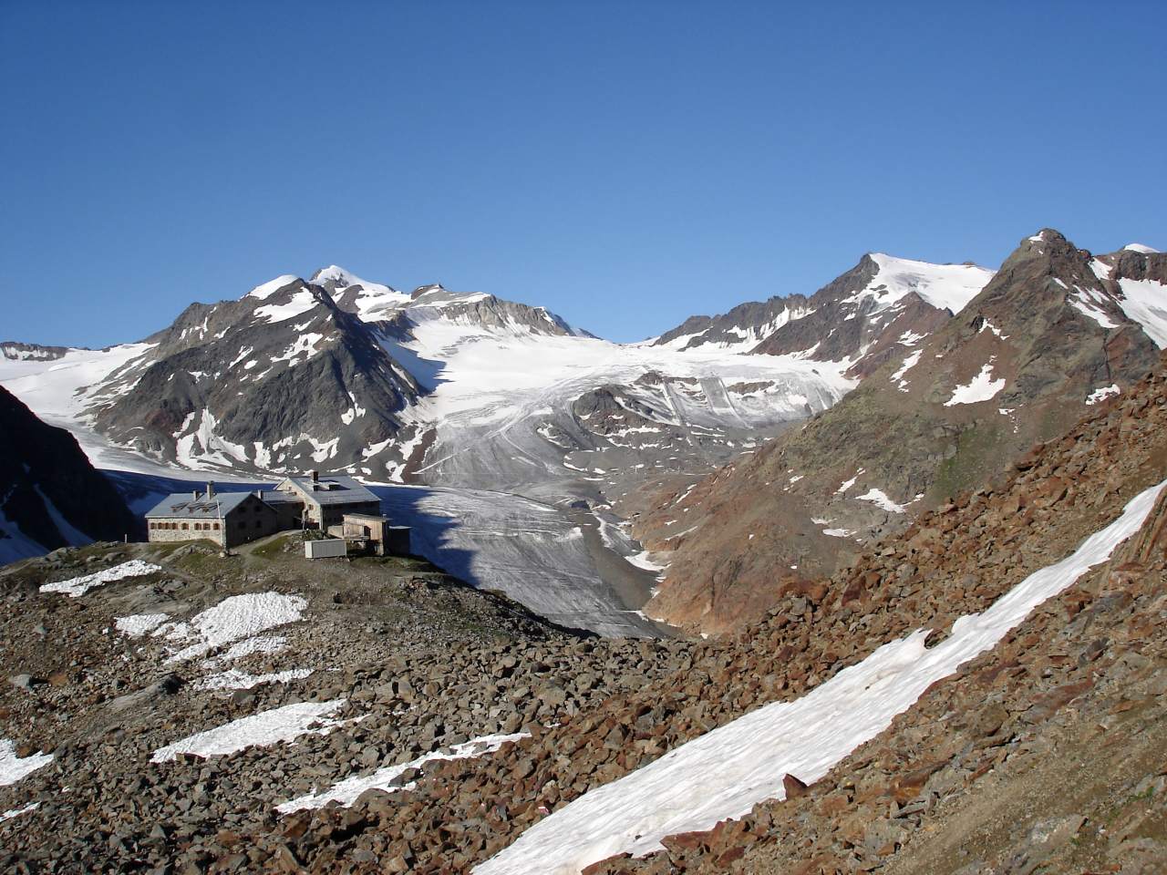
Lodging, refreshment stops: Braunschweiger Hütte, Rüsselsheimer Hütte
Access/exit points: from Rettenbach Glacier base terminal via Rettenbachjoch to Braunschweiger Hütte (ascent approx. 1.75 hrs / descent 1.5 hrs); from Plangeross (St. Leonhard im Pitztal) to Rüsselsheimer Hütte (ascent approx. 2 hrs / descent 1.5 hrs)
Ibex Goulash after a Strenuous Alpine Hike
The hike along Geigenkamm takes you across 3 three-thousand meter high peaks, all of which command magnificent views of the Alpine scenery. The hike starts with a short uphill section from Braunschweiger Hütte towards Pitztaler Jöchl. Follow the trail to your left down to Silbergrube. Now you climb up to a wide ridge along which the route travels for a while, climbing and descending frequently. The first splendid peaks along the way are Wurmsitzkogel (3079 m), Gschrappkogel (3197 m) and scenic Wassertalkogel (3252 m). On top of Wassertalkogel mountaineers find an orange bivouac which accommodates up to 12 people (accessible without key). From Wassertalkogel the trail descends through a glacier field. Soon after the first glacier field the trail crosses another one and a third one. After some easy scrambling the path continues to Weißmaurachjoch Ridge – once there you have mastered all the difficult parts of this tour. From here it’s an easy walk down to Rüsselsheimer Hütte after ten incredible hours.
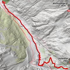
STAGE 19:
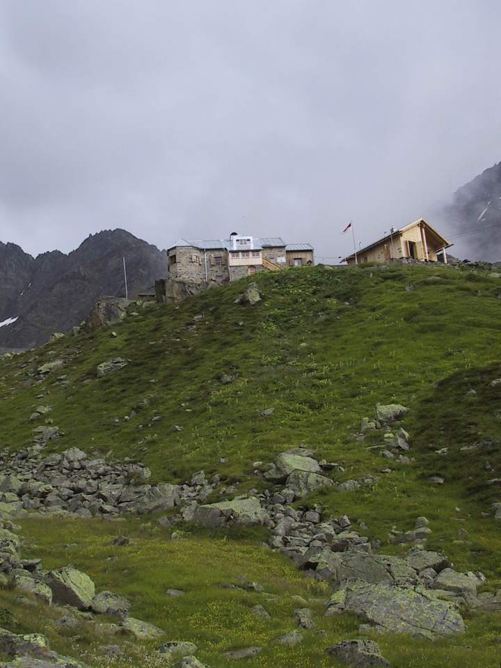
RÜSSELSHEIMER HÜTTE (2328 m) –> KAPUZINERJÖCHL (2710 m) –> BREITLEHNJÖCHL (2637 m) –> SANDJÖCHL (2826 m) –> LUIBISSCHARTE (2914 m)–> HAUERSEEHÜTTE (2383 m)
Route: steep path, footpath
Requirements: surefootedness, good head for heights, good physical condition and stamina; black mountain trail, partly high Alpine route
Difficulties: strenuous ascent to Luibisscharte, Hauerferner glacier crossing (no crevasses); stable weather conditions essential
Equipment: standard hiking equipment, icepick and crampons depending on snow conditions
Walking time: approx. 7 hrs
Changes in elevation: ascent approx. 1200 meters / descent 1200 meters
Highest point: 2914 m
Distance in kilometers: approx. 10.5 km
Lodging, refreshment stops: Rüsselsheimer Hütte, Hauerseehütte
Access/exit points: from Plangeross (St. Leonhard im Pitztal) to Rüsselsheimer Hütte (ascent approx. 2 hrs / descent 1.5 hrs); from Unterried or Oberried (Längenfeld) to Hauerseehütte (ascent approx. 3.5 hrs / descent 2.5 hrs)
Saddles and Small Glaciers
Behind the refuge walk down in an eastern direction, make a left turn towards Gahwinden vista point. From Gahwinden the trail descends through scree fields to Rötkarle and then ascends to Kapuzinerjöchl. Beyond Kapuzinerjöchl the trail drops down through steep and rocky terrain - there are fixed cables to hold on to for safety - before leveling out and climbing leisurely towards Breitlehnjöchl. Then the trail first climbs, then descends, then climbs again towards Sandjöchl Col. The path falls steeply and flattens out a bit before climbing through a very steep scree and boulder field to Luibisscharte. Here the path descends to crevasse-free Hauerferner Glacier and crosses it in an eastern direction. The trail between the glacier and Hauerseehütte has been closed off due to a rockslide – a bypass trail follows the glacier in a north-eastern direction and descends to the right of a rocky knoll to Hauerseehütte. Please note: Hauerseehütte is a self-catering hut nestling in the north eastern foothill of Luibiskogel; during peak season a temporary hut tenant takes care of the refuge.
STAGE 20:
HAUERSEEHÜTTE (2383 m) –> FELDERJÖCHL (2797 m) –> FRISCHMANNHÜTTE (2192 m)
Route: steep path
Requirements: surefootedness, good head for heights; black mountain trail
Difficulties: none
Equipment: standard hiking equipment; enough food and drink (Hauerseehütte is not serviced)
Walking time: approx. 4 hrs
Changes in elevation: ascent approx. 600 meters / descent 800 meters
Highest point: 2797 m
Distance in kilometers: approx. 7.5 km
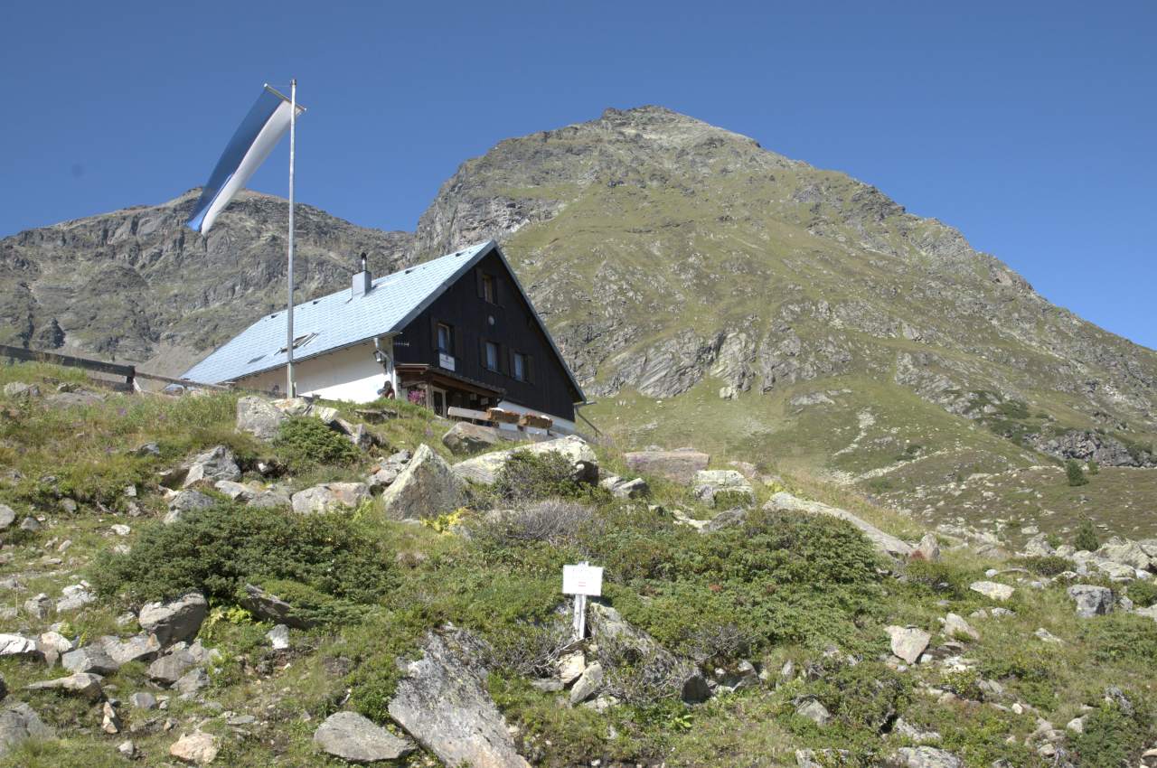
Lodging, refreshment stops: Hauerseehütte, Frischmannhütte
Access/exit points: from Unterried or Oberried (Längenfeld) to Hauerseehütte (ascent approx. 3.5 hrs / descent 2.5 hrs); from Umhausen to Frischmannhütte (ascent approx. 3.5 hrs / descent 2.5 hrs; alternatively by taxi from Umhausen to Hintere Fundusalm from where it’s a 30-minutes hike to Frischmannhütte); from Köfels (Umhausen) to Frischmannhütte (ascent approx. 2.5 hrs / descent 2 hrs)
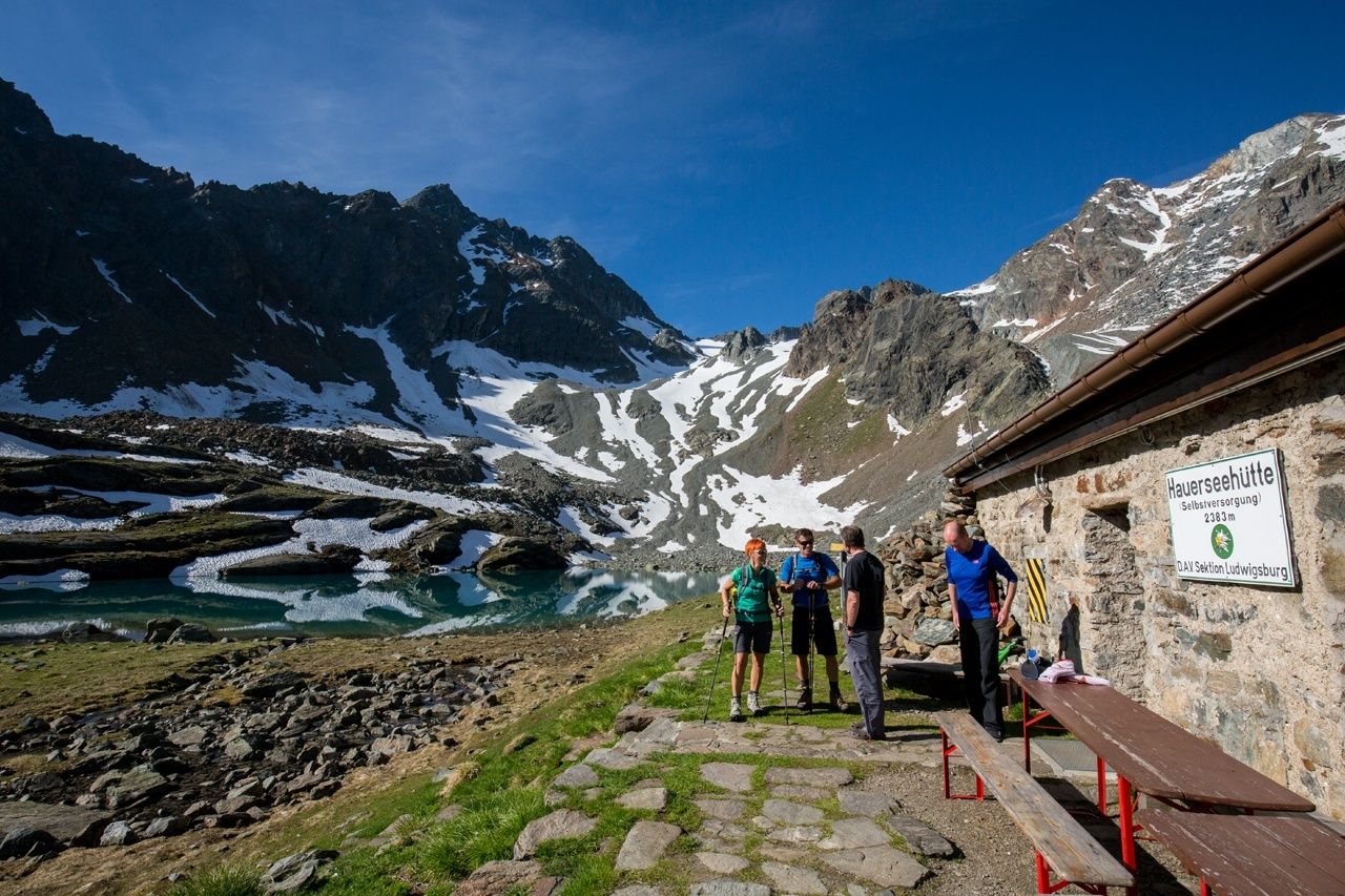
Lake Hike on Mittlerer Geigenkamm
The first awe-inspiring mountain lake can be found right next to Hauerseehütte and also gave its name to the hut. Here the trail descends moderately past Lake Unterer Spitzigsee, then climbs gently in a north-western direction through picture-book Innerbergtal Valley and crosses the slopes above Felderkar. Then follows a more strenuous section: the trail switchbacks steeply up to Lake Weißer See below Felderjöchl (2800 m), the saddle you have to cross to get to Frischmannhütte. The footpath travels to the right of the lake and climbs in switchbacks through very steep and rocky terrain to Felderjöchl (fixed cables). From the saddle the trail drops steeply at the beginning and then levels out and continues through Fernerkar below Ploderferner Glacier. Later on the route descends quickly east of Griesköpfe Peaks and through high Alpine meadows and pasturelands in full bloom to Frischmannhütte.
- Highest point
- 2,889 m
- Endpoint
-
Frischmann Hut
- Height profile
-

- Equipment
-
It is recommended to wear hiking equipment such as breathable and weather-adapted outdoor clothing, ankle-high mountain boots, wind, rain and sun protection, cap and possibly gloves. It is also important to have enough food, as well as a first-aid package, a cell phone and a hiking map.
- Additional information
- Arrival
- Public transportation
- Parking
-
The following parking facilities are available in Sölden:
- Parking lot
- parking lot Stiegele
- stair parking
- Giggijochbahn + underground garage
- Gaislachkoglbahn + underground garage
- Parking Hochsölden
- parking garage Hochsölden 1. parking lot
- parking Zwieselstein
- parking Zwieselstein / sports ground
All parking is free during the day.
Parking for several days (eg hike tour):
- Postplatz, Parkticket available at the information Sölden Parkgarage Gaislachkoglbahn
- Parkticket either online or directly at the cash desk of the Gaislachkoglbahn

- Author
-
The tour Ötztal Trek Route 5 is used by outdooractive.com provided.


-
Ötztal
1108
-
St. Leonhard im Pitztal
332