

© TVB Wilder Kaiser - TVB Wilder Kaiser/GMedia

- Brief description
-
Challenging adventure hike to the Ellmauer Tor
- Difficulty
-
medium
- Rating
-
- Starting point
-
Hiking starting point Wochenbrunner Alm, Ellmau (1,085 m)
- Route
-
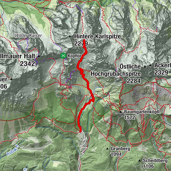
Gaudeamushütte1.2 kmIm Kübel (1,570 m)2.6 kmGaudeamushütte6.5 km
- Best season
-
JanFebMarAprMayJunJulAugSepOctNovDec
- Description
-
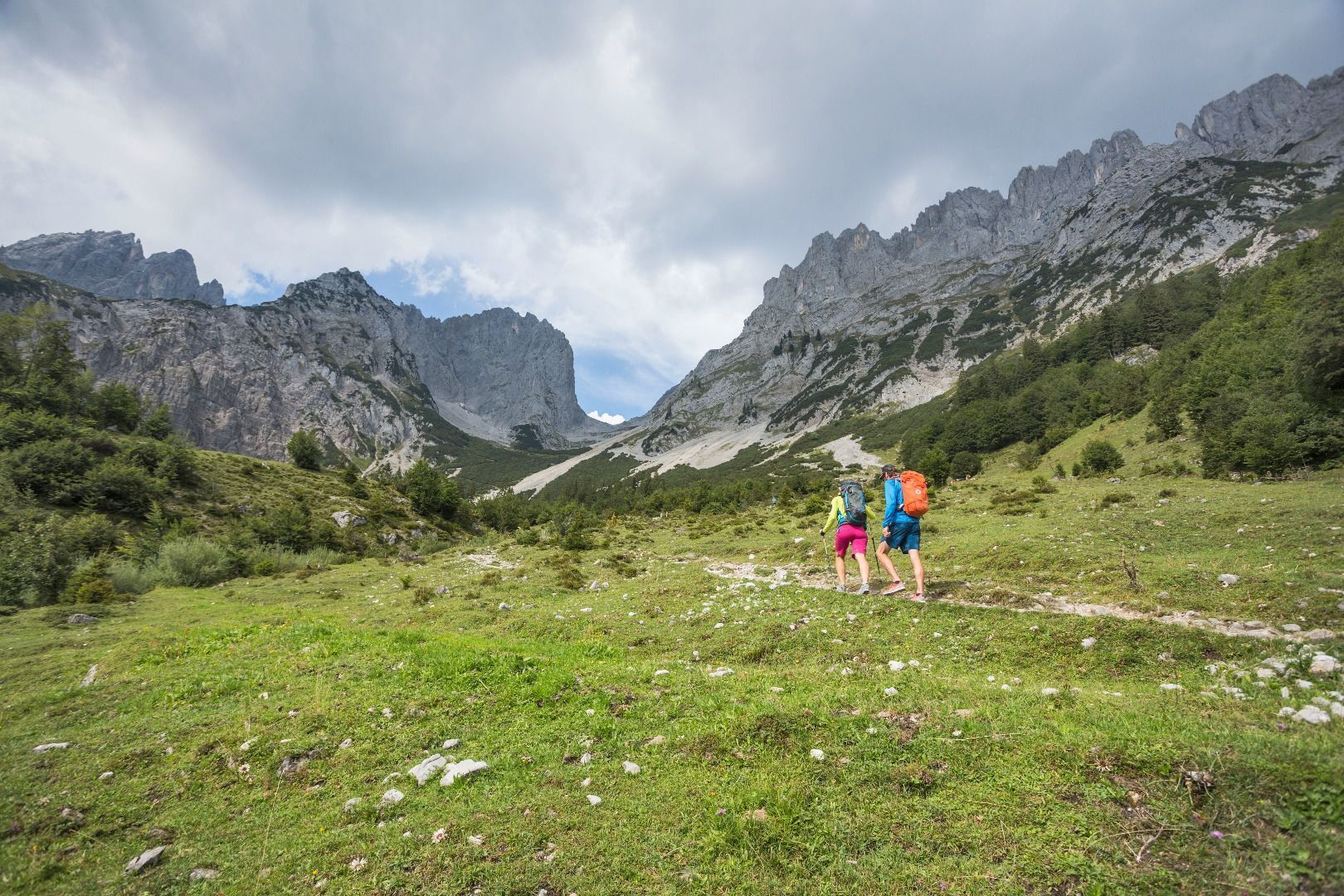
You begin at the Wochenbrunner Alm hiking starting point and head towards the Gaudeamushütte mountain hut. Continue on trail no. 812 across Alpine meadows, through mountain pines and later across scree to the Ellmauer Tor rock saddle. You are now at the heart of the Wilder Kaiser and, with some luck, can observe climbers on the impressive rock faces. The return trip follows the same trail to the Wochenbrunner Alm mountain hut, where you can round off this beautiful hike by treating yourself to a local delicacy – a Kaiserschmarrn (shredded pancake).
Tip: for experienced mountain walkers, we recommend heading back either via the Jubiläumssteig (black mountain path) to the Gruttenhütte mountain hut or via the Bergsteigergrab to the Gaudeamushütte mountain hut and back to the starting point.
TIP:
Thursdays - guided tour with a Tyrolean mountain hiking guide.
Inform yourself about details, dates and registration. - Directions
-
You begin at the Wochenbrunner Alm hiking starting point and head towards the Gaudeamushütte mountain hut. Continue on trail no. 812 across Alpine meadows, through mountain pines and later across scree to the Ellmauer Tor rock saddle. You are now at the heart of the Wilder Kaiser and, with some luck, can observe climbers on the impressive rock faces. The return trip follows the same trail to the Wochenbrunner Alm mountain hut, where you can round off this beautiful hike by treating yourself to a local delicacy – a Kaiserschmarrn (shredded pancake).
Tip: for experienced mountain walkers, we recommend heading back either via the Jubiläumssteig (black mountain path) to the Gruttenhütte mountain hut or via the Bergsteigergrab to the Gaudeamushütte mountain hut and onward to the hiking starting point. - Highest point
- 1,968 m
- Endpoint
-
Ellmauer Tor, Ellmau (2,001 m)
- Height profile
-

- Equipment
-
Rucksack, mountaineering boots, hiking gear (breathable), change of clothes, sun protection (sunglasses, sun cream, headgear), waterproofs, cold protection (gloves and hat), water bottle, food for eating on the way, hiking poles if desired, first aid kit, plastic bag for waste, hiking map/route description (gpx track)
- Directions
-
Heading from Wörgl or Kufstein on the B178 road, take the first exit to Ellmau and then take the first exit at the roundabout. Drive straight on until you reach the junction (green signs - leading towards KaiserBad/Kaisergebirge/Wochenbrunn). Turn left here, then turn right immediately after passing the bus stop. Follow the (toll) road until you reach the Wochenbrunner Alm car park.
Heading from St. Johann on the B178 road, take the first exit to Ellmau and then drive straight on until you reach the junction (green signs – leading towards KaiserBad/Kaisergebirge/Wochenbrunn). Turn right here, then turn right again immediately after passing the bus stop. Follow the (toll) road until you reach the Wochenbrunner Alm car park. - Public transportation
- Parking
-
Wochenbrunner Alm mountain hut, Ellmau (1,085 m) – free car park (toll road)
- Author
-
The tour Ellmauer Tor is used by outdooractive.com provided.
GPS Downloads


General info
Refreshment stop
Flora
A lot of view
Other tours in the regions
-
Wilder Kaiser
1951
-
Ellmau
640
 und Wasserwand")


