Winter
Summer
Weather
Webcams
Accommodations
Tours
Search history
Search suggestions
No results found
Search
Tours
Home
Summer Österreich
Tyrol
Tours
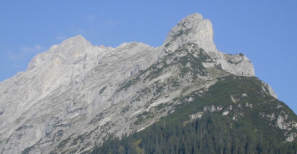
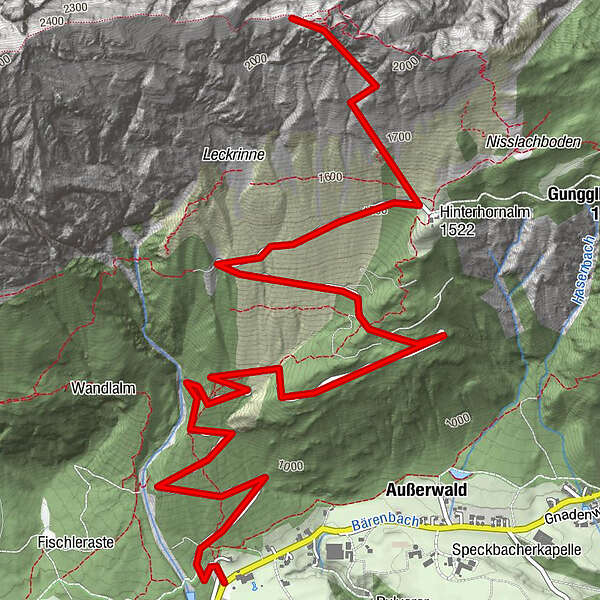
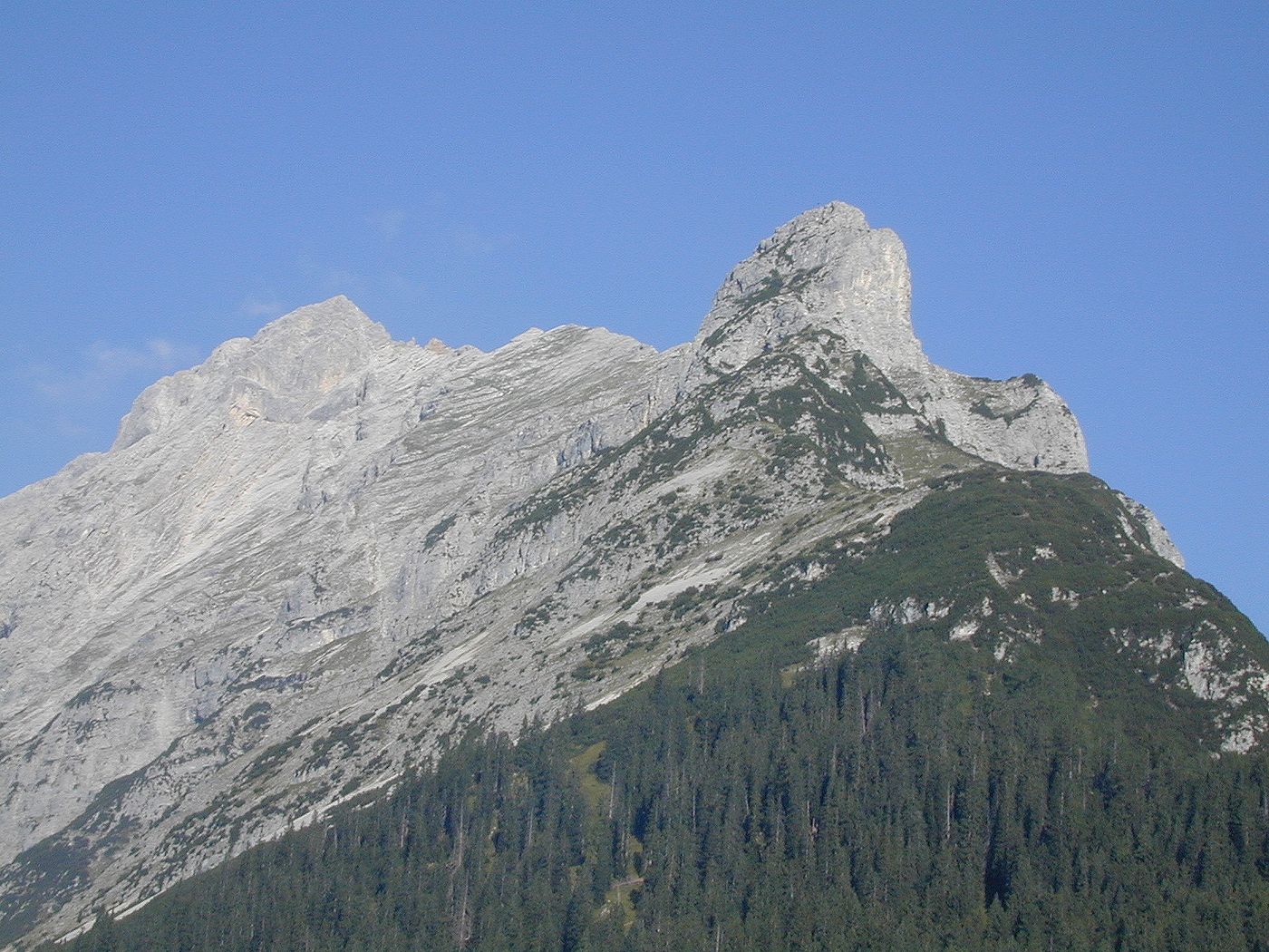
Gnadenwald - Hinterhornalm - Hundskopf
Regions
Weather
Webcams
Tours
Highlights
Bathing lakes
Accommodations
Offers
Sports provider
Events
Ski resorts
Cross-country skiing
Snow parks
Gnadenwald - Hinterhornalm - Hundskopf
Hiking
Bookmark
Map
show
hide
Print
Tour data
7.1
km
882 - 2,174
m
Distance
1,283
hm
Ascent
01:46
h
Duration
created am 16.05.2011
6,239
Views
Rating
Technique
Fitness
Landscape
Experience
Route
Martlboden
locality
4.1 km
Hundskopf
(2,229 m)
peak
6.8 km
Highest point
2,174 m
Write a review
Overall rating
5
0
%
4
0
%
3
0
%
2
0
%
1
0
%
Reviews
(0)
0 Comments
Write a review
Error
An error has occurred. Please try again.
Thank you for your review
Rating has been deleted
Report tour
GPS Downloads
GPX
GPS Exchange Format (XML)
KML
Google Earth, Google Maps
QR Download Codes for Mobile Phones
Gnadenwald - Hinterhornalm - Hundskopf
QR Codes - tour download for cell phones
GPX
KML
Other tours in the regions
Ferienregion Hall - Wattens
1491
Gnadenwald
354
Popular tours in the area
Stanser Joch
medium
Hiking
14.09
km |
1111
hm |
05:00
h
Trip Tirol ➤ Wolfsklamm Die Perle des Tiroler Unterlandes
easy
Hiking
6.76
km |
328
hm |
02:20
h
In den Enger Grund / Risstal - Eng
easy
Hiking
3.68
km |
166
hm |
02:00
h
Vordere Brandjochspitze, Tirol/Österreich
medium
Hiking
15.2
km |
1705
hm |
04:57
h
No entries found.
The search is currently not available.
Please refine your search.
Local search results
(<= 25km)
More results
(> 25km)
%count% Search results
%name%
%type%
%elevation%
%population%
%lpButton%