


- Brief description
-
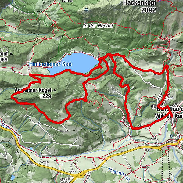
A hike on varied paths around the Achleitberg.
- Difficulty
-
medium
- Rating
-
- Starting point
-
Hiking starting point Tourist Info, Scheffau (738 m)
- Route
-
Scheffau am Wilden Kaiser0.1 kmPfarrkirche Scheffau0.1 kmSonnwies0.9 kmWurzach (661 m)1.3 kmSeebach (720 m)1.6 kmHinterstein4.2 kmBichl4.5 kmMarienkapelle Gut Alte Mühle4.7 kmGreidern5.6 kmHochegg6.1 kmSchupfen6.8 kmGamsbründl8.9 kmGreidern12.6 kmSeestüberl13.5 kmBichl13.7 kmHinterstein14.0 kmBärnstattkapelle Sankt Leonhard14.4 kmBärnstatt14.5 kmBeinstingl14.8 kmGaisberg (761 m)16.9 kmLeiten (794 m)17.1 kmBruggenmoos17.3 kmPfarrkirche Scheffau17.9 kmScheffau am Wilden Kaiser17.9 km
- Best season
-
JanFebMarAprMayJunJulAugSepOctNovDec
- Description
-
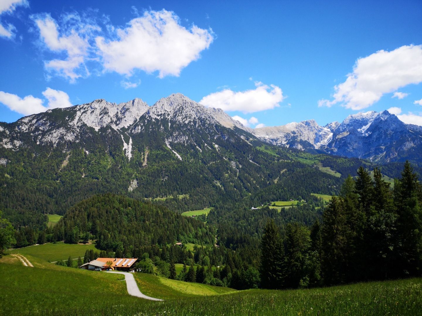
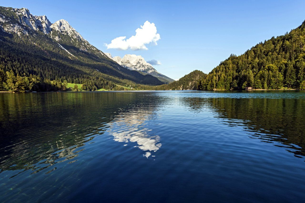
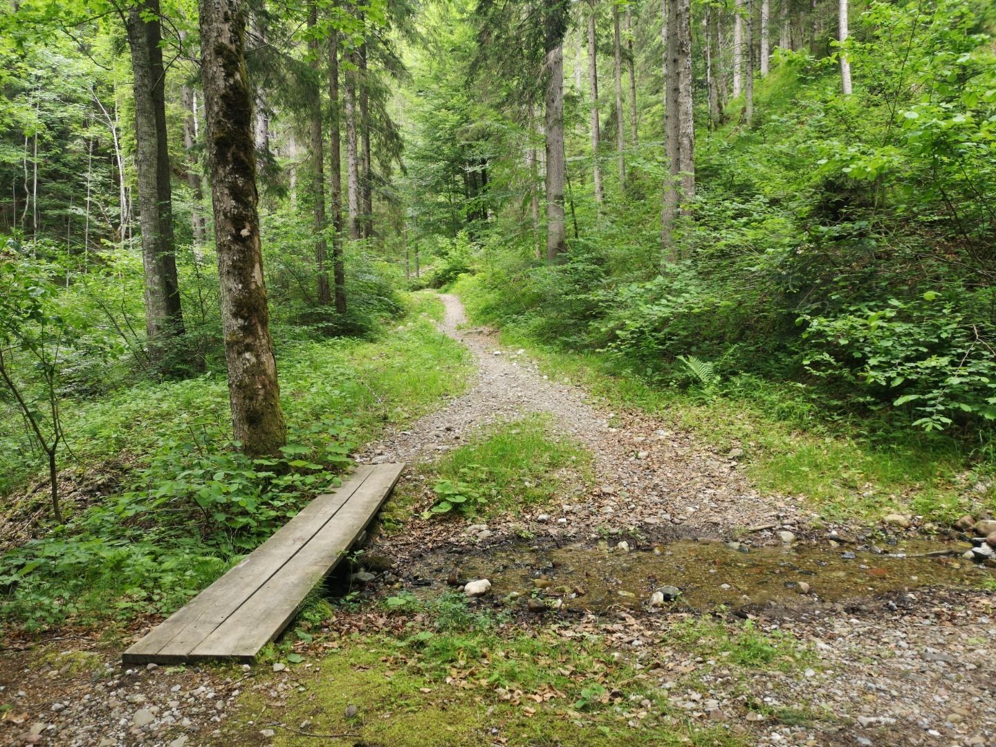
Starting point is the community hall Scheffau. Follow the road (no. 56) towards Söll and Hintersteiner See via Seebachgraben. After a short downhill section through the forest, turn right and walk along the Seebach creek (no. 43) to the Grüblernhof farm. Here you turn left and just before the parking lot at the lake turn left again towards Greidern / Achleiten. Now follow hiking path no. 57 to the former Achleiten inn, to the Tischleralm and to the Hintersteiner See. On the south bank of the lake with a view of the Wilder Kaiser you hike on the path (no. 822) to the Seestüberl, further to the Bärnstatt inn and a few hundred meters after that, turn left to the Steinerhof. Here you continue on the path (No. 822) and through the Rehbachklamm (No. 42) back to the center of Scheffau.
- Directions
-
This hike to one of the most beautiful mountain lakes in Tirol starts in the village centre of Scheffau. From the Community Hall you follow the road to the Café Rosemarie (no. 56). After the café carry straight on by the side of the Seebach stream (no. 43) to the Grüblernhof farm. From here you follow the road heading west till you come to the turnoff to Greidern/Achleiten where you head south. You now follow the hiking trail (no. 57) to the former Gasthof Achleiten inn. Follow hiking trail (no. 57) to the Tischleralm mountain hut and carry on to the Hintersteiner See. You take trail no. 822 along the southern bank of the picturesque lake, enjoying the views of the rugged rocks of the Wilder Kaiser. The trail takes you to the Seestüberl restaurant, from where you continue on the road to the Gasthof Bärnstatt inn and after a few hundred metres you turn off left to the Steinerhof farm. Continue along the trail (no. 822) and through the Rehbachklamm gorge (no. 42) back to the centre of Scheffau.
- Highest point
- 1,003 m
- Endpoint
-
Hiking starting point Tourist Info, Scheffau (738 m)
- Height profile
-

- Equipment
-
Rucksack, sturdy hiking shoes, weather-appropriate hiking gear, sun protection, waterproofs, snack and drink, hiking poles (height adjustable) if required, mobile phone, plastic bag for waste, hiking map, route description and information materials (GPX track), ID, cash
- Directions
-
Heading from Wörgl, Kufstein or St. Johann on the B178 road, take the exit to Scheffau. Shortly before you come to the church, you will see the Tourist Info and the hiking starting point on the left-hand side (short-stay parking zone).
- Public transportation
- Parking
-
Public car park, Scheffau (740 m), north of the Community Hall - free


- Author
-
The tour Round the Achleitberg mountain is used by outdooractive.com provided.


General info
-
Wilder Kaiser
1951
-
Scheffau am Wilden Kaiser
614


