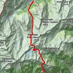
Tour data
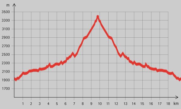
20.6km
1,894
- 3,397m
1,475hm
09:30h
- Brief description
-
Schöne, absolut hochalpine Tour in den Ötztaler Alpen
- Rating
-
- Starting point
-
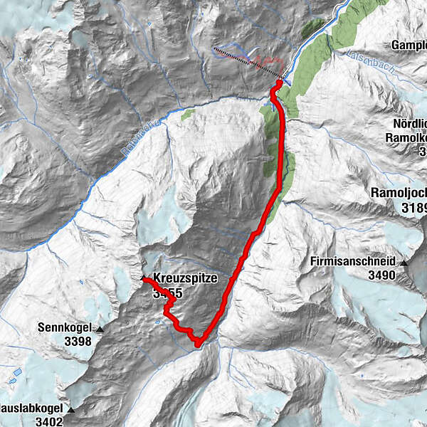
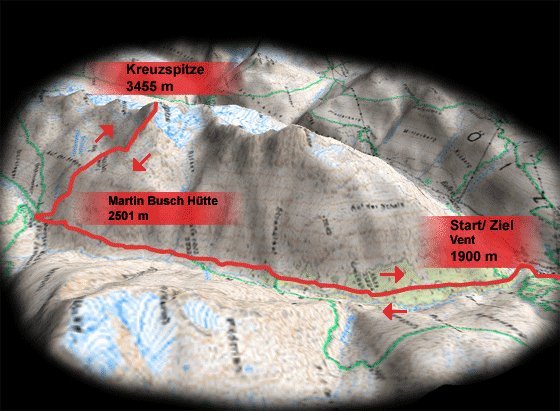
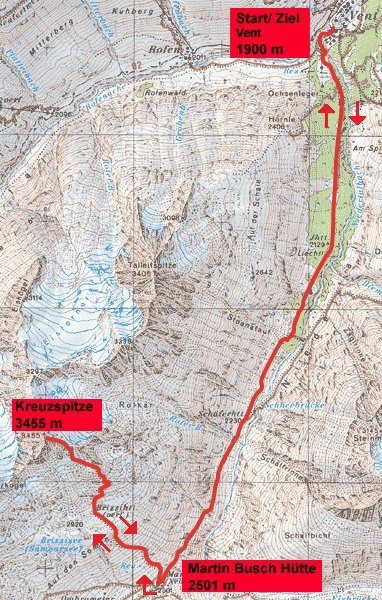
Vent
- Route
-
VentBerghotel Gasthof Gstrein0.2 kmMartin-Busch-Hütte7.3 kmKreuzspitze (3,455 m)10.3 km
- Highest point
- 3,397 m
- Rest/Retreat
-
Martin Busch Hütte
- Ticket material
GPS Downloads


Trail conditions
Asphalt
Gravel
Meadow
Forest
Rock
Exposed
Other tours in the regions
-
Vinschgau
1290
-
Schnalstal
595
-
Vent
293