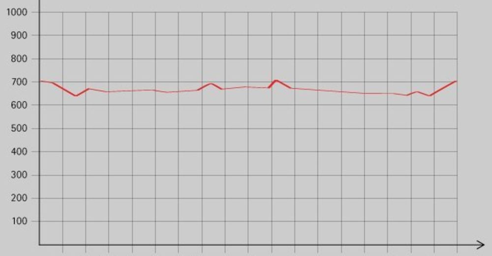
Schwendt: Kohlental

Logo Schwendt: Kohlental
Tour data
8.92km
-
Distance
200hm
Ascent
02:30h
 
Duration
Brief description

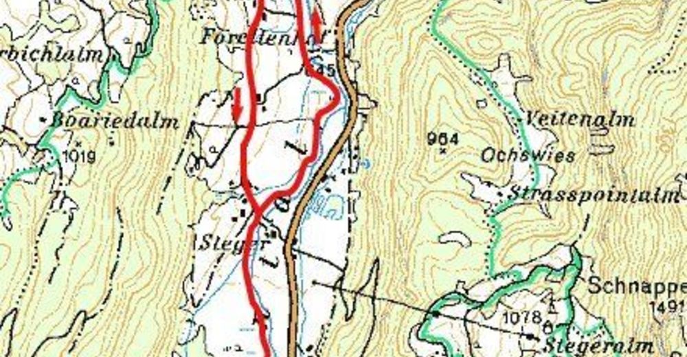
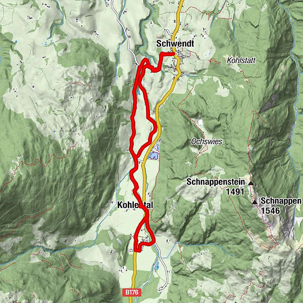
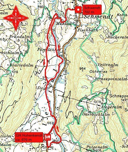
Schöne Wanderung von Schwendt durch das Kohlental mit einer Einkehrmöglichkeit entlang der Strecke.

Rating
Technique
Fitness
Landscape
Experience
Starting point

Gasthaus Mairwirt in Schwendt (702 m)


Rest/Retreat

Gasthaus Mairwirt, GH Hohenkendl;

Ticket material

Info phone

0043 501 100

Link

Overall rating

5

0

%

4

0

%

3

0

%

2

0

%

1

0

%

Error
An error has occurred. Please try again.
Thank you for your review

Rating has been deleted

GPS Downloads
  • GPX GPS Exchange Format (XML)
  • KML Google Earth, Google Maps
QR Download Codes for Mobile Phones

Trail conditions

Asphalt
Gravel
Meadow
Forest
Rock
Exposed
Other tours in the regions

Popular tours in the area

Hochfelln über Bründling Alm

medium Hiking
7.93km | 1108hm | 04:30h

Eifersbacher Waterfall

easy Hiking
8.61km | 251hm | 03:00h

Kaisertal Rund-Wanderung

medium Hiking
13.94km | 887hm | 03:29h

Musikantensteig zur Naunspitze

medium Hiking
8.96km | 979hm | 03:28h