
- Brief description
-
FISCHBACHBRÜCKE - Albin Egger Lienz Weg - PESTKAPELLE
- Difficulty
-
easy
- Rating
-
- Starting point
-
Fischbach Bridge
- Route
-
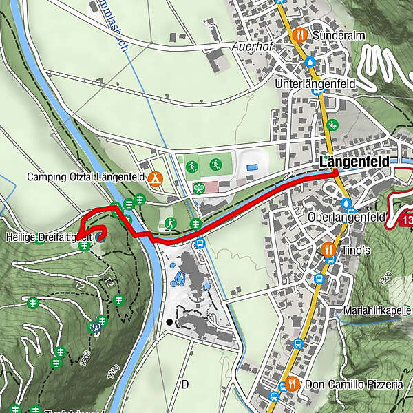
Längenfeld (1,179 m)Oberlängenfeld0.0 kmHeilige Dreifaltigkeit1.1 km
- Best season
-
JanFebMarAprMayJunJulAugSepOctNovDec
- Description
-
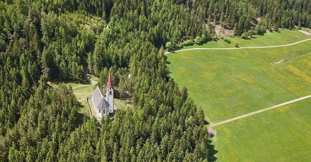
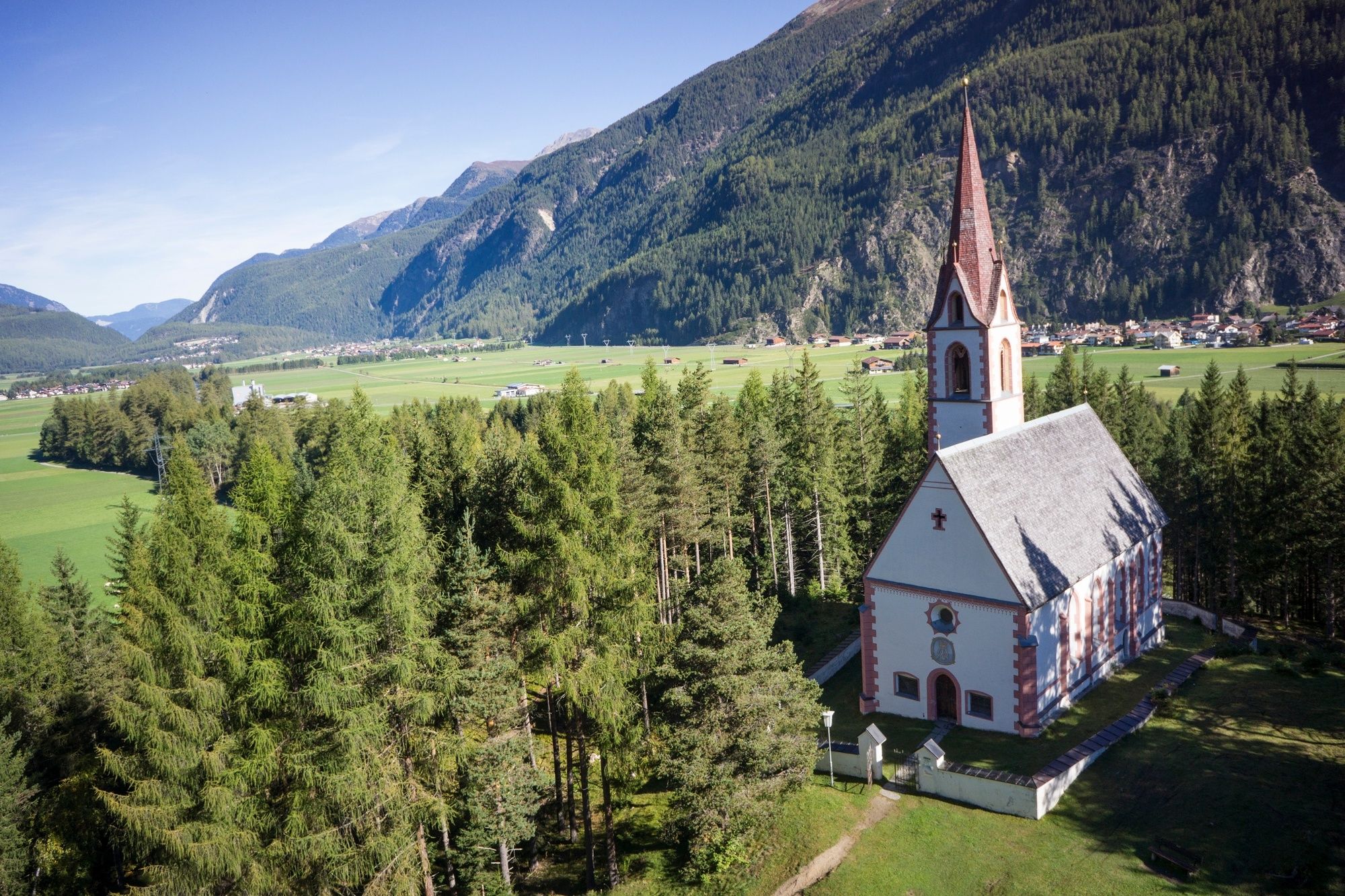
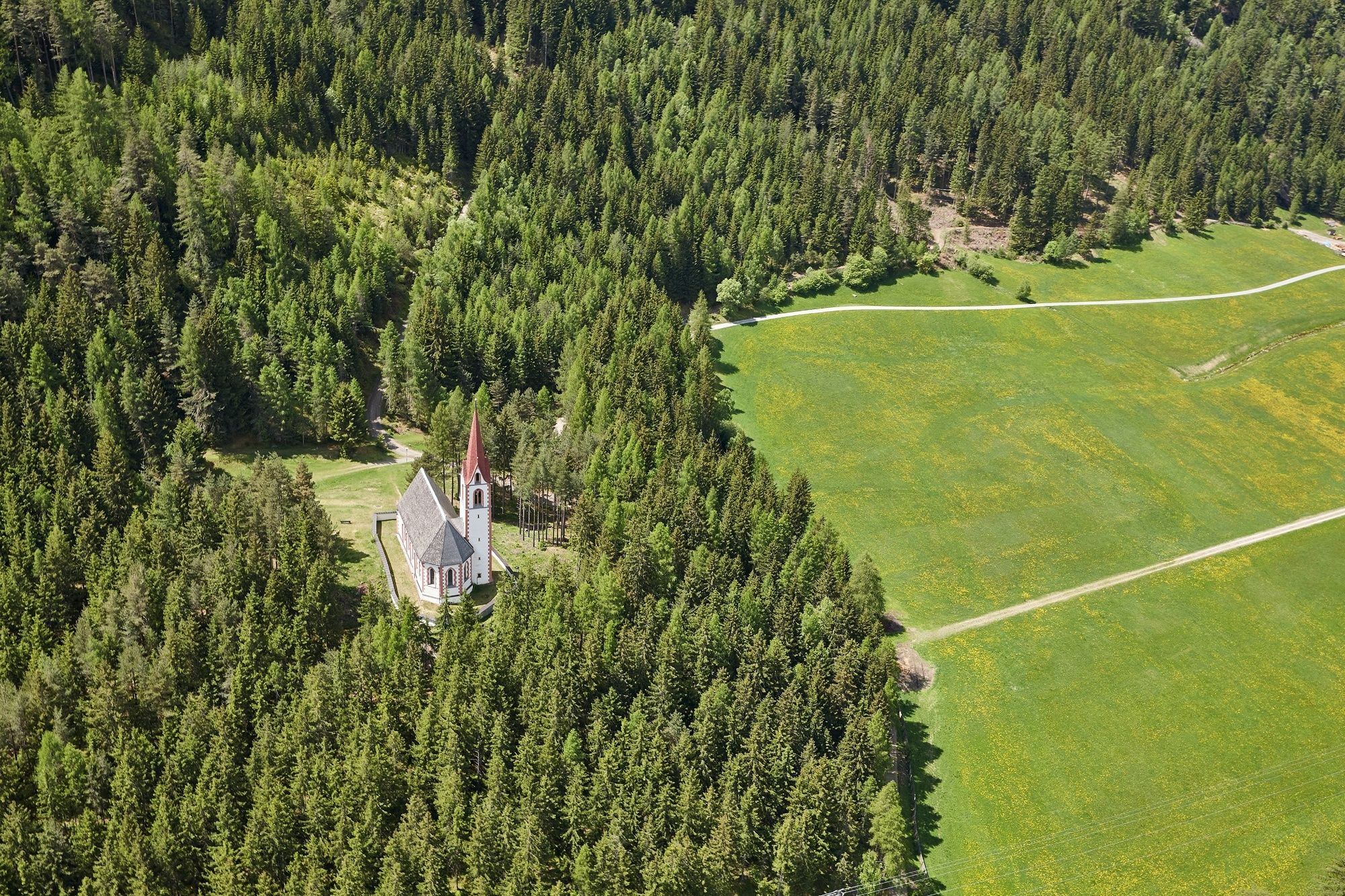
If you don‘t feel well then this is the right place, it provides a feeling of deep peace and quiet. A place that gives comfort to all those in need of encouragement. Just like the locals back in the 17th century who came here to mourn for the victims of the plague. It was a must to bury them on this shore of the river, therefore a small Trinity Chapel was erected in 1661 amid the forest at Kropfbühel area. Locals call the precious little building Bichl Church or Plague Chapel.
Closing your eyes you will feel the infinite strength coming from the red/white chapel. A place of silence where you refuel your energy.
The atmosphere inside the chapel seems to be light-hearted. A bright white barrel vault towers above the golden high altar with many figurines and the huge side altar in Rococo style. The audience fully indulges in this magic setting where also choir, baroque and pop music open-air concerts are held.
- Directions
-
From the Fischbach bridge in the center of Längenfeld, the Albin Egger Lienz path leads along the Fischbach to the mouth of the Ötztaler Ache. There the path continues for a short distance along the Ötztaler Ache to the small pedestrian bridge. After crossing it, the path leads through a sparse forest to the plague chapel.
- Highest point
- 1,199 m
- Endpoint
-
Pestkapelle
- Height profile
-

- Equipment
-
Appropriate equipment such as breathable suitable outdoor clothes for the weather, ankle-high walking boots,
wind-, rain- & sun protection, hat, possibly gloves, is for all hikes and tours necessary.
- Safety instructions
-
Easy hike; suitable for beginners and walkers. Please pay attention to the current weather report.
- Tips
-
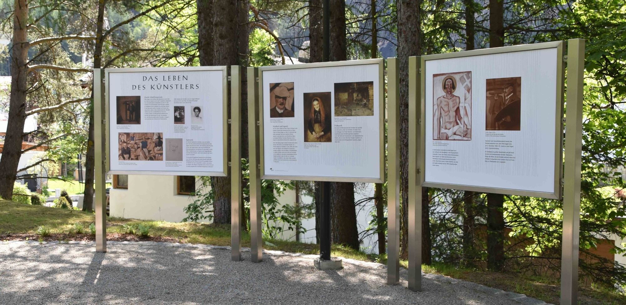
Take your time to look at the pictures of the artist Albin Egger (* 1868 - † 1926). These were created during his stays in Längenfeld.
- Additional information
- Directions
-
The car drive to the Ötztal valley. Situated in Tirol, the Ötztal valley set off in southerly direction and is the
longest side valley in the Eastern Alps. The journey with the car leads you through the Inntal valley to the
entrance of the valley and further on through the valley. Among the toll motorways you can also use the country
roads. A route planner will show you the easiest and most convenient way: https://www.google.at/maps
- Public transportation
-
Travel safe and comfortable with the train to the Ötztal Bahnhof train station. Last stop and exit point is the
train station Ötztal Bahnhof. Afterwards you can travel smoothly and quick with the public transport or our local
taxi companies through the valley to your desired destination. Please find the current bus timetable here:
http://fahrplan.vvt.at
- Parking
-
The following parking options are available:
- Sports center Längenfeld
-
Längenfeld town center (only a small number of parking spaces)
- Author
-
The tour Pestkapelle - Kraftquell Längenfeld is used by outdooractive.com provided.


General info
-
Ötztal
1107
-
Längenfeld - Huben - Gries
354