


- Brief description
-
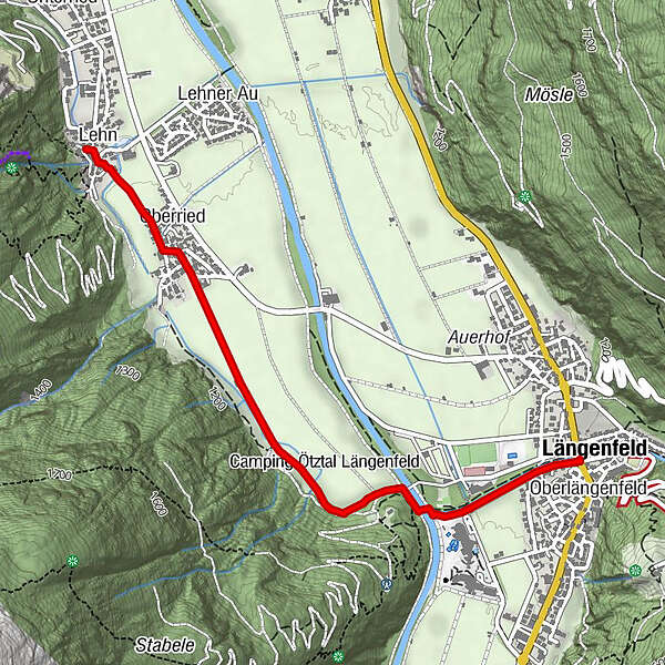
FISCHBACHBRÜCKE - Albin Egger Lienz Weg - Oberried - PESTKAPELLE
- Difficulty
-
easy
- Rating
-
- Starting point
-
Fischbach Bridge
- Route
-
Längenfeld (1,179 m)Oberlängenfeld0.0 kmOberried2.2 kmGasthaus Oberried2.3 kmLehn2.8 km
- Best season
-
JanFebMarAprMayJunJulAugSepOctNovDec
- Description
-
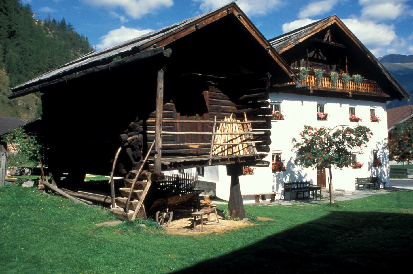
Rattling, clattering, rushing and roaring – this is the sound of the 19th century when flax industry reached its peak in the Ötztal. Flax was said to be the valley‘s gold. Discover history close-by at the outdoor museum. Saw, mill, scutch and flax breaker are driven by the rushing waters of Lehnbach brook.
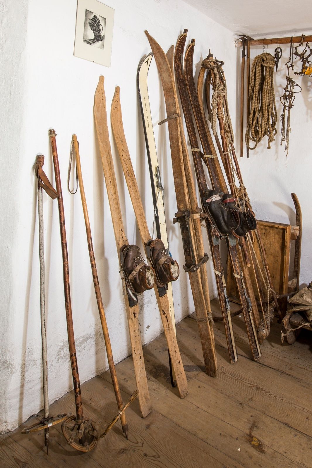
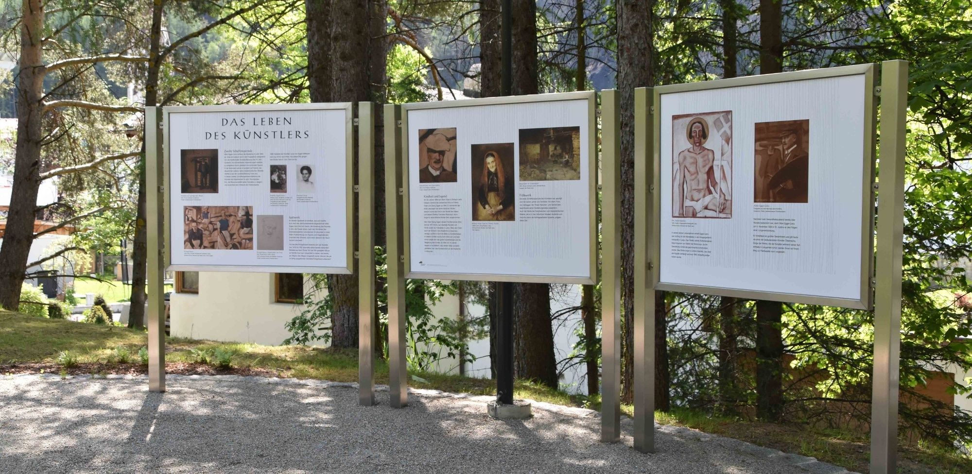
Time traveling can be so easy as soon as you enter one of the ten authentic buildings with all their original furniture. Among the attractions ranks Tirol‘s oldest wooden chest and a myriad of working tools. One of the unique farmhouses hosts the precious Memory Archives displaying even the smallest detail about the Ötztal and its inhabitants. Long past memories, modern funds of knowledge, future expectations. Various texts, images, audio and film documentations give an insight into Ötztal‘s life and work, its secrets and roots. Not without reason the Ötztal Dialect was declared a UNESCO Intangible Cultural Heritage.
- Directions
-
From the Fischbach bridge in the center of Längenfeld, the Albin Egger Lienz path leads along the Fischbach to the mouth of the Ötztaler Ache. There the path continues for a short distance along the Ötztaler Ache to the small pedestrian bridge. After crossing it, the path leads through a sparse forest and later past meadows to the Oberried district. From here you follow the road through the small village to the museum.
- Highest point
- 1,181 m
- Endpoint
-
Heimatmuseum
- Height profile
-

- Equipment
-
Appropriate equipment such as breathable suitable outdoor clothes for the weather, ankle-high walking boots,
wind-, rain- & sun protection, hat, possibly gloves, is for all hikes and tours necessary.
- Safety instructions
-
suitable for beginners and walkers. Please pay attention to the current weather report.
- Tips
-
Afterwards, visit the Lehner waterfall.
- Additional information
- Directions
-
The car drive to the Ötztal valley. Situated in Tirol, the Ötztal valley set off in southerly direction and is the
longest side valley in the Eastern Alps. The journey with the car leads you through the Inntal valley to the
entrance of the valley and further on through the valley. Among the toll motorways you can also use the country
roads. A route planner will show you the easiest and most convenient way: https://www.google.at/maps
- Public transportation
-
Travel safe and comfortable with the train to the Ötztal Bahnhof train station. Last stop and exit point is the
train station Ötztal Bahnhof. Afterwards you can travel smoothly and quick with the public transport or our local
taxi companies through the valley to your desired destination. Please find the current bus timetable here:
http://fahrplan.vvt.at
- Parking
-
The following parking options are available:
- Sports center Längenfeld
- opposite information office
- Author
-
The tour Heimatumuseum - Kraftquell Längenfeld is used by outdooractive.com provided.


General info
-
Ötztal
1111
-
Längenfeld - Huben - Gries
355


