- Brief description
-
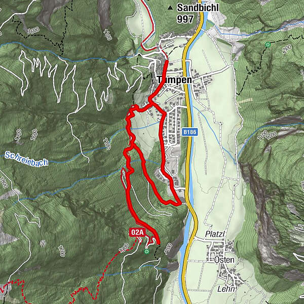
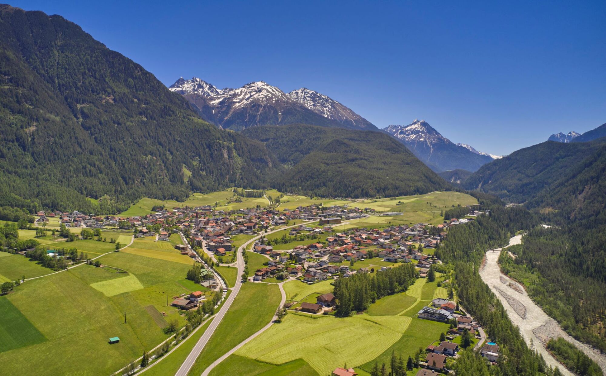
CAR PARK PRIMARY SCHOOL TUMPEN->Talblick Umhausen->CAR PARK PRIMARY SCHOOL TUMPEN
- Difficulty
-
easy
- Rating
-
- Starting point
-
car park primary school Tumpen
- Route
-
Tumpen0.2 kmSt. Martin0.3 kmSt. Martin5.0 km
- Best season
-
JanFebMarAprMayJunJulAugSepOctNovDec
- Description
-
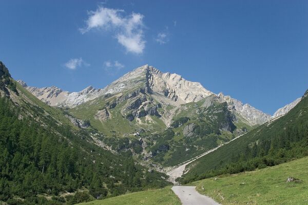
The hiking starts by the parking space primary school Tumpen. From there you walk to the church and through the village and after you follow the signage “Talkblick Umhausen”. If you want you can walk the same way back or the other way by the industrial park. And from here you walk back to the parking space by the primary school Tumpen.
- Directions
-
The hiking starts by the parking space primary school Tumpen and walk to the church and through the village. From there you follow the signage “Talkblick Umhausen”. If you want you can walk the same way back or the other way by the industrial park. And from here you walk back to the parking space by the primary school Tumpen.
- Highest point
- 1,160 m
- Endpoint
-
car park primary school Tumpen
- Height profile
-

- Equipment
-
Appropriate equipment such as breathable suitable outdoor clothes for the weather, ankle-high walking boots, wind-, rain- & sun protection, hat, possibly gloves, is for all hikes and tours necessary. Please bring a first-aid box, a mobile phone, a walking map and if there is no hut on the way a snack and enough to drink.
- Safety instructions
- Additional information
- Directions
-
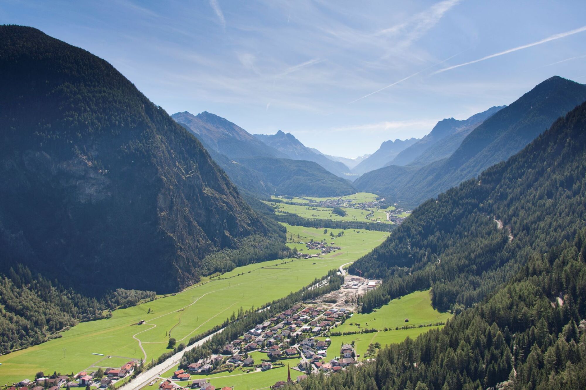
The car drive to the Ötztal valley. Situated in Tirol, the Ötztal valley set off in southerly direction and is the longest side valley in the Eastern Alps. The journey with the car leads you through the Inntal valley to the entrance of the valley and further on through the valley. Among the toll motorways you can also use the country roads. A route planner will show you the easiest and most convenient way: https://www.google.at/maps.
- Public transportation
-
Travel safe and comfortable with the train to the Ötztal Bahnhof train station. Last stop and exit point is the train station Bahnhof ÖTZTAL. Afterwards you can travel smoothly and quick with the public transport or our local taxi companies through the valley to your desired destination.
Please find the current bus timetable here: http://fahrplan.vvt.at.
- Parking
-
The following parking facilities are available in Tumpen:
- car park primary school Tumpen | free of charge
- Author
-
The tour Talblick Umhausen - Umhausen/Tumpen is used by outdooractive.com provided.