- Brief description
-
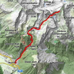
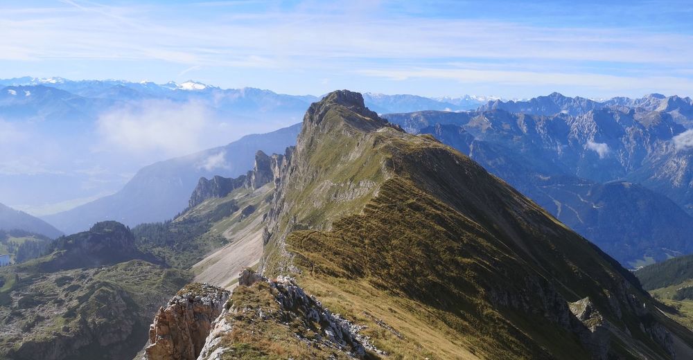
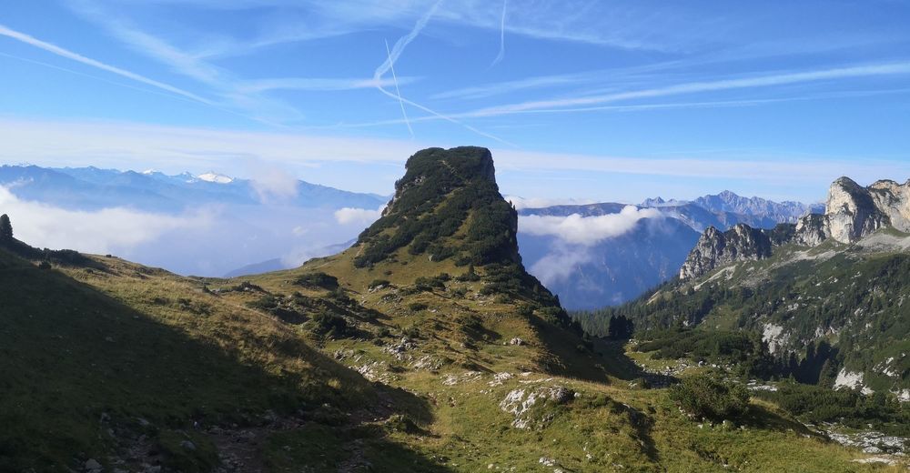
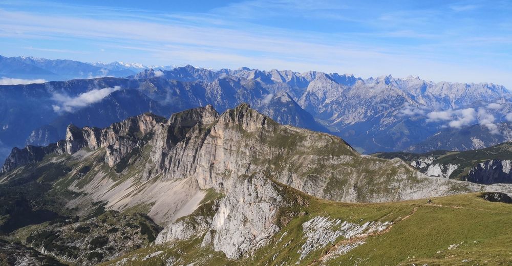
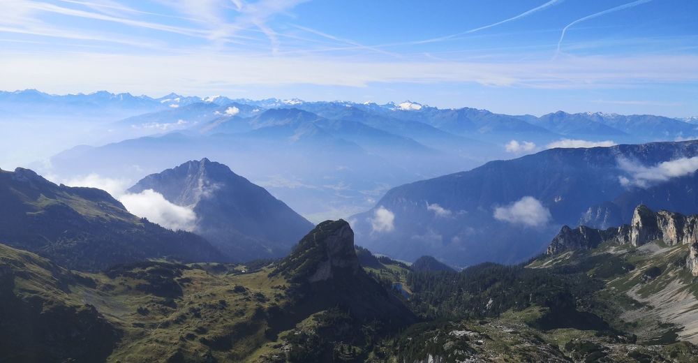
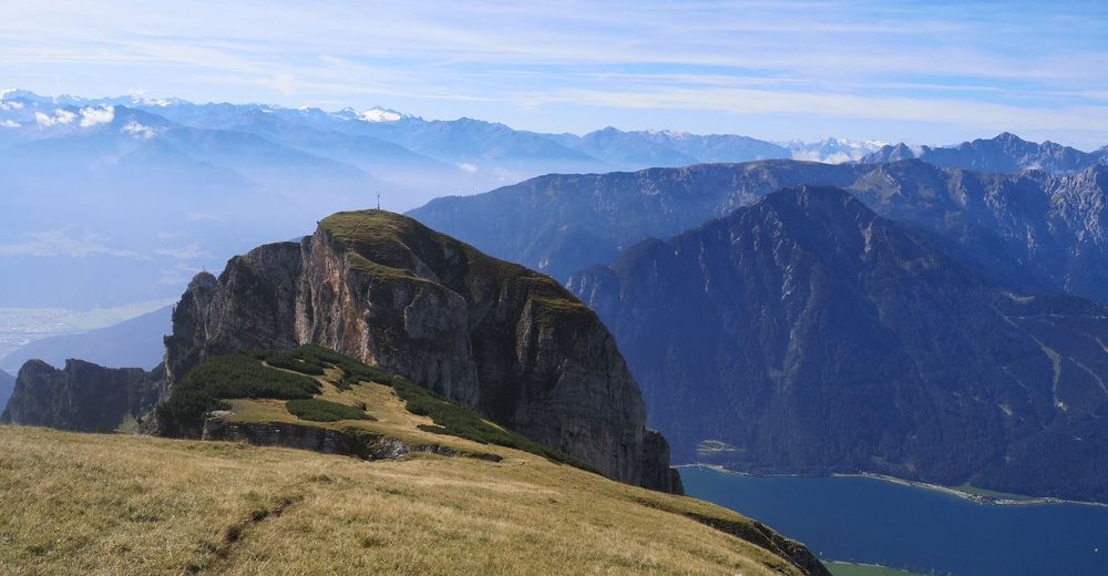
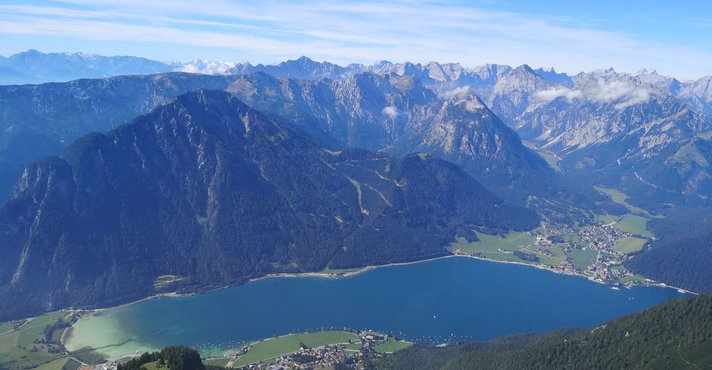
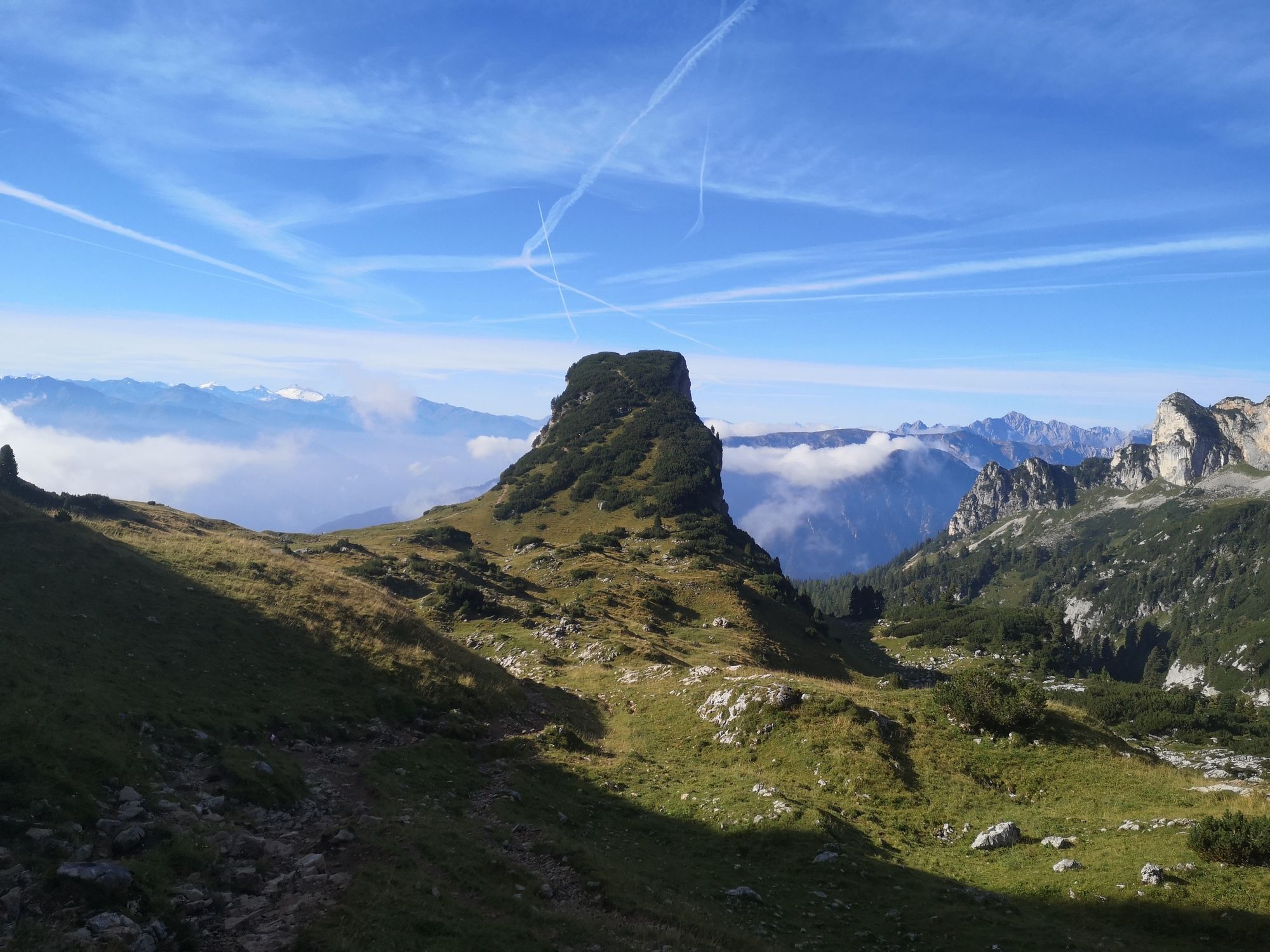
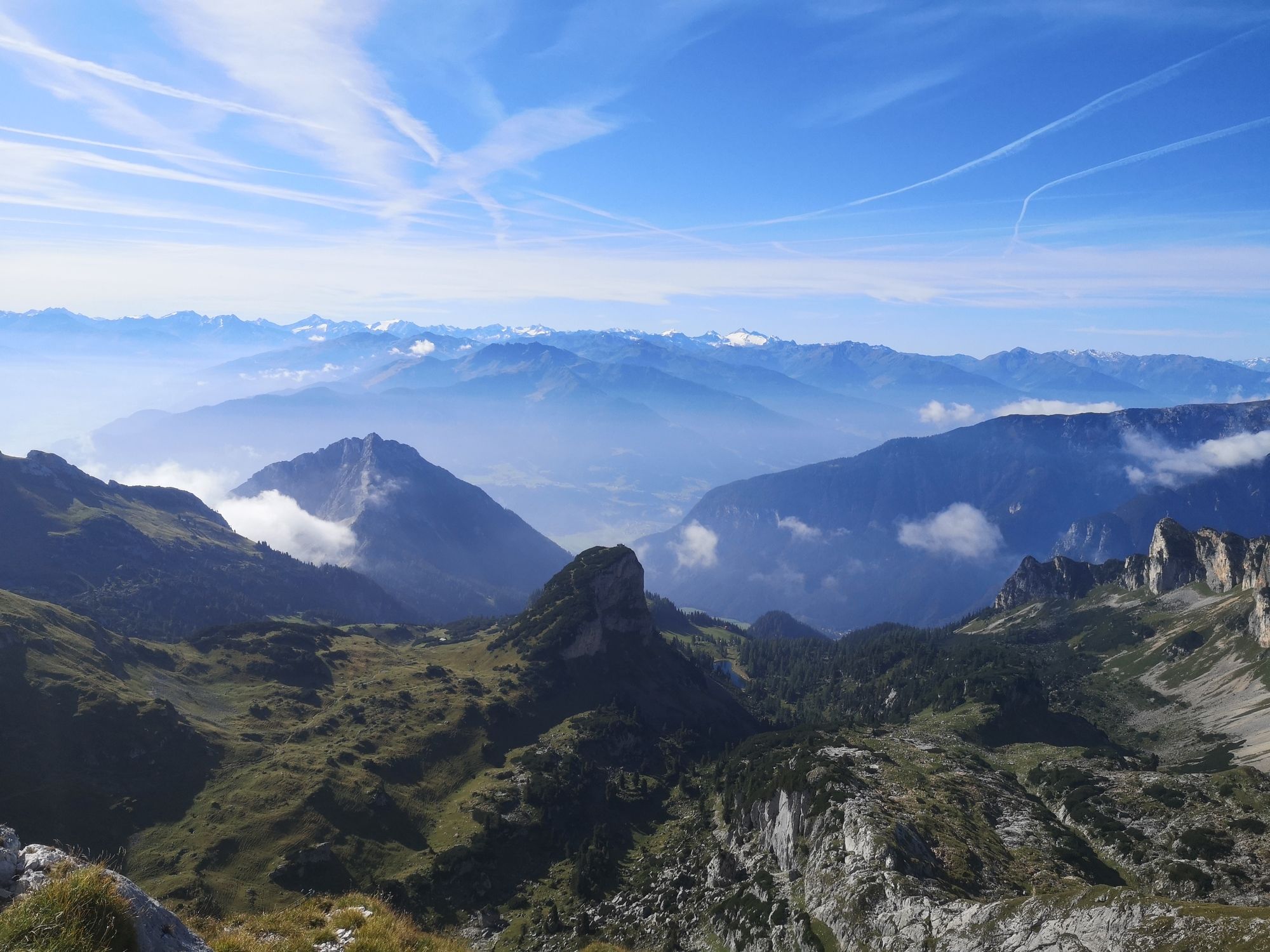
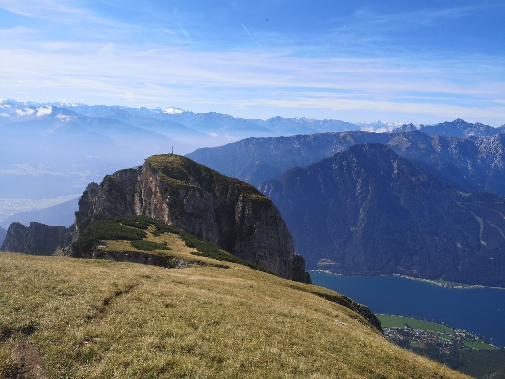
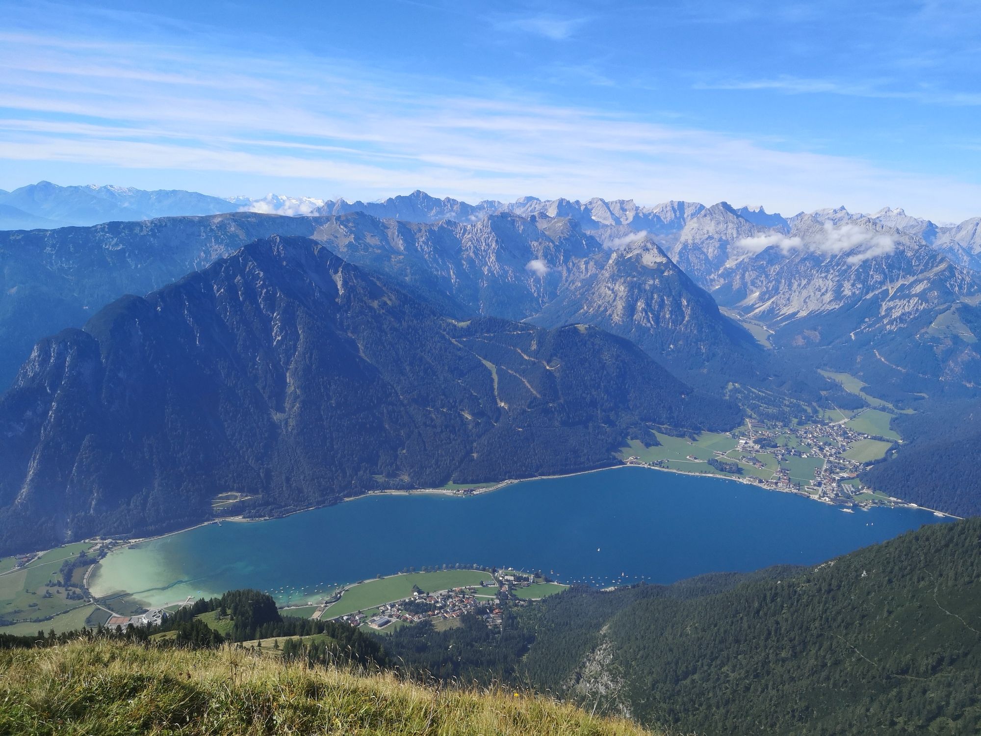
Alpine hike onto Hochiss, the highest peak in the Rofan mountains. The descent along "Dalfazer Kamm" ridge offers stunning views down to Achensee lake and the Karwendel mountains behind.
- Difficulty
-
difficult
- Rating
-
- Starting point
-
Top station "Rofanbahn" gondola
- Route
-
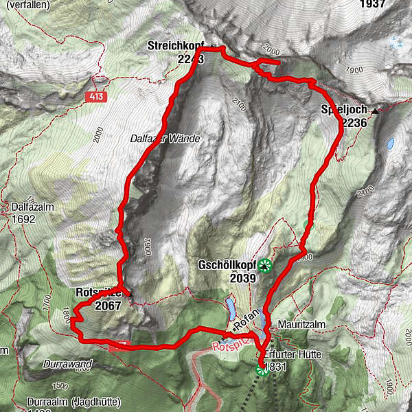
AlmstüberlBerggasthof RofanRofanseilbahn0.0 kmErfurter Hütte0.0 kmJausenstantion Mauritzalm0.3 kmHochiss (2,299 m)2.8 kmStreichkopf (2,243 m)3.3 kmDalfazer Joch (2,233 m)4.0 kmDalfazer Roßkopf (2,143 m)4.7 kmRotspitze (2,067 m)5.1 kmDurrakreuz5.9 kmErfurter Hütte7.2 kmRofanseilbahn7.2 kmAlmstüberl7.3 kmBerggasthof Rofan7.3 km
- Best season
-
JanFebMarAprMayJunJulAugSepOctNovDec
- Description
-
For German click here:
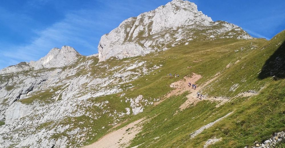
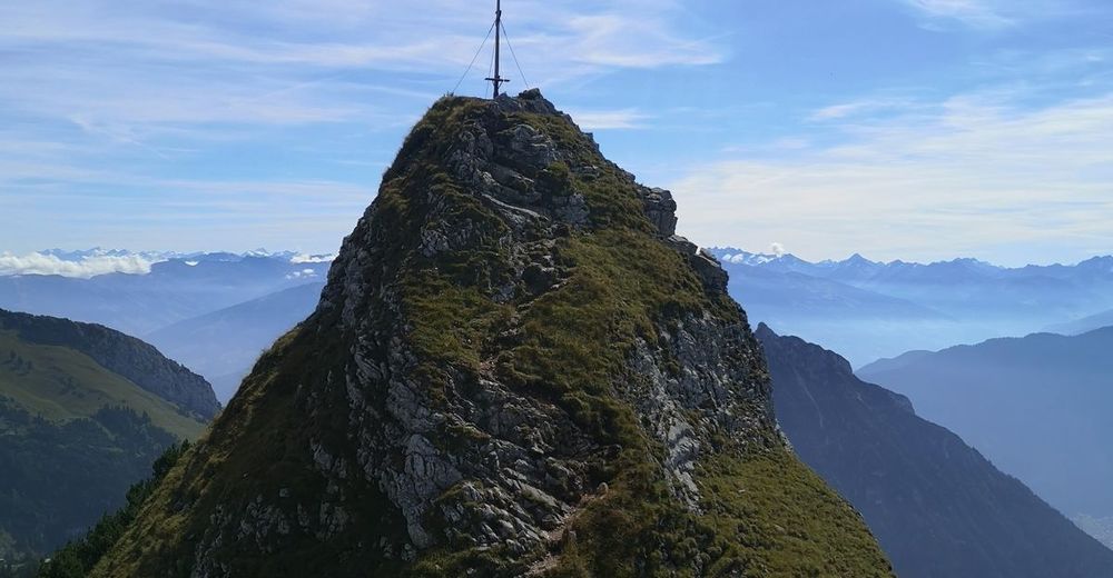
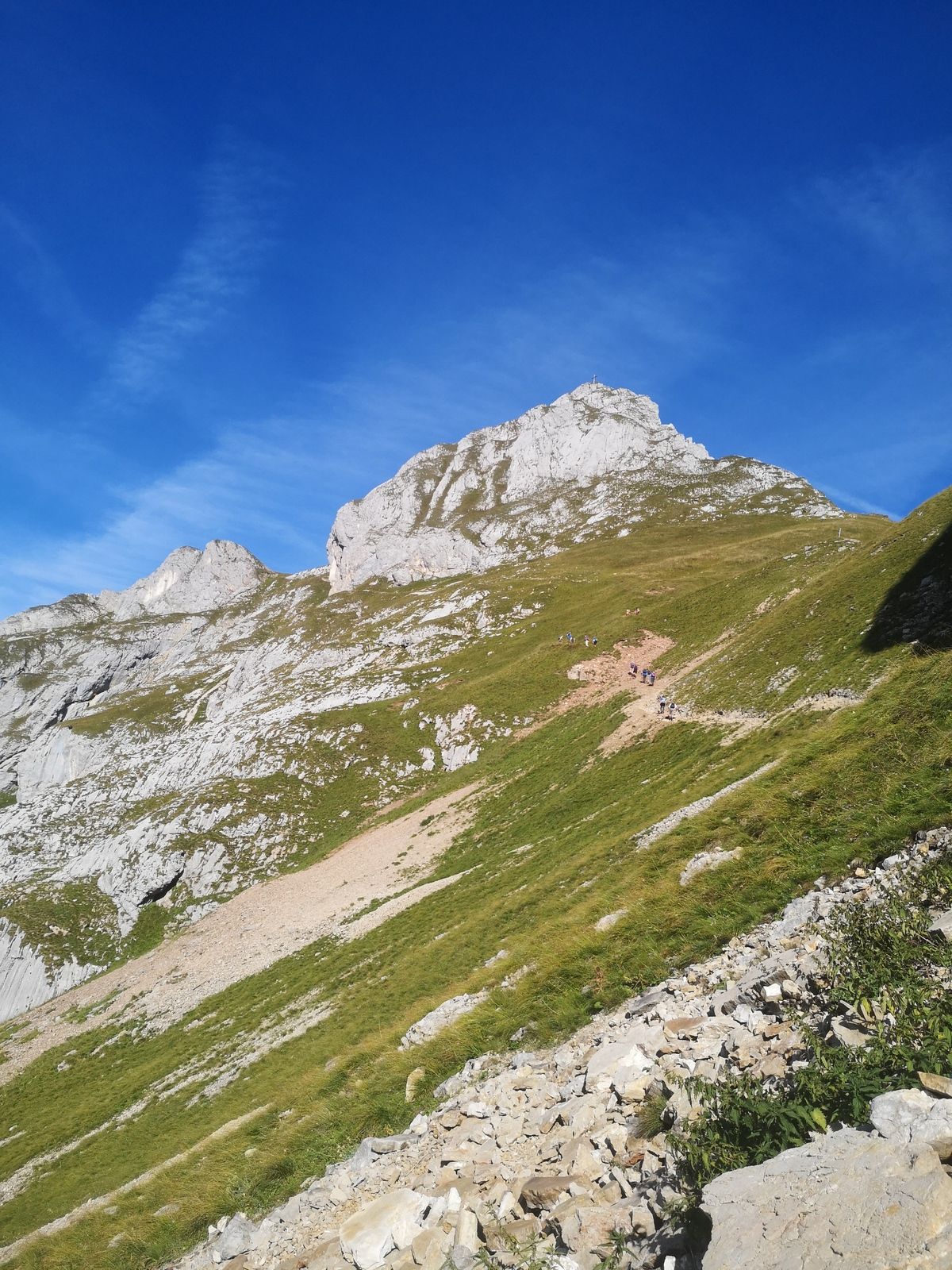
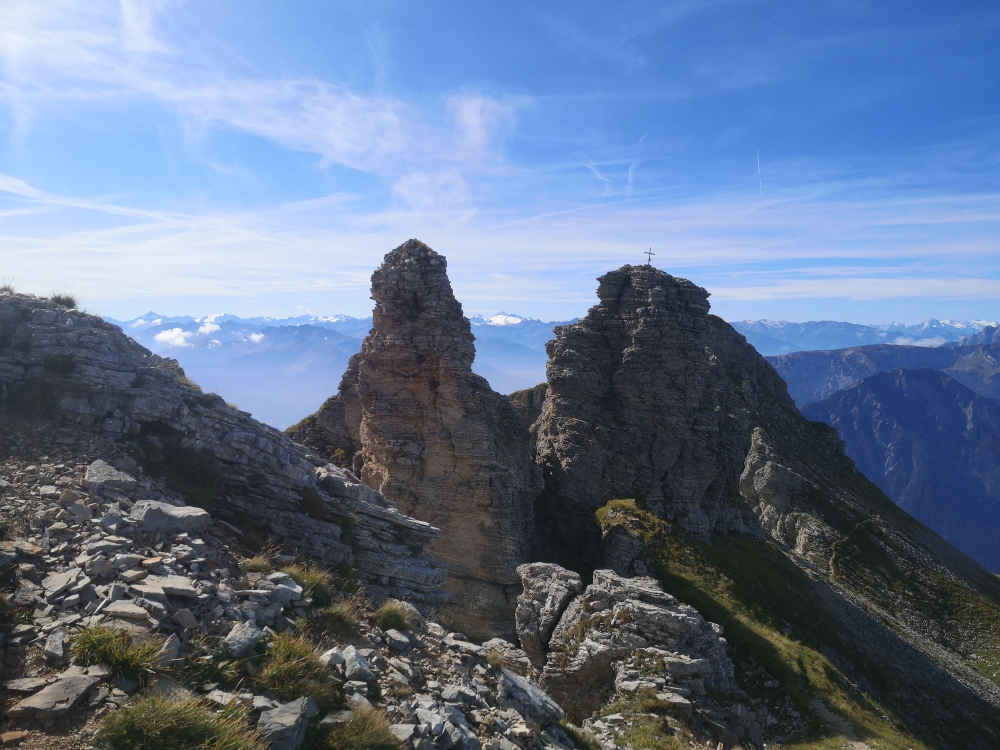
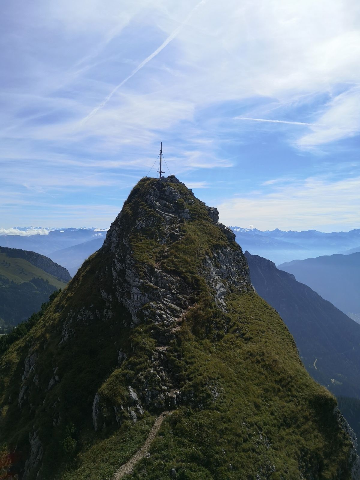
www.bergfex.at/sommer/tirol/touren/wa...The hike starts at the top station of "Rofanbahn" cable car. Descend a few meters, direction north, and follow the signposts in the direction "Hochiss". The relatively wide trail passes below Gschöllkopf mountain. After an easy and not exposed fixed-rope section you will reach a relatively flat and grassy plateau. There, continue northwards to the col between Spieljoch and Hochiss mountains (rockfall along this section!). Now the trail turns left and passes below the summit of Hochiss mountain, then steeply uphill to another signpost. Turn right there and you will soon reach the summit of Hochiss mountain with its stunning views.
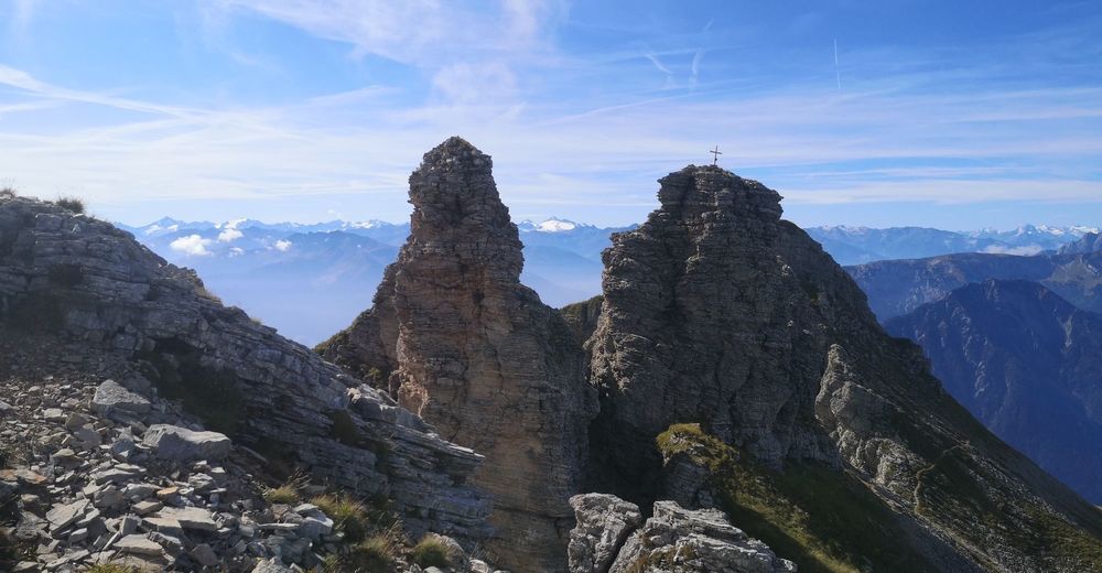
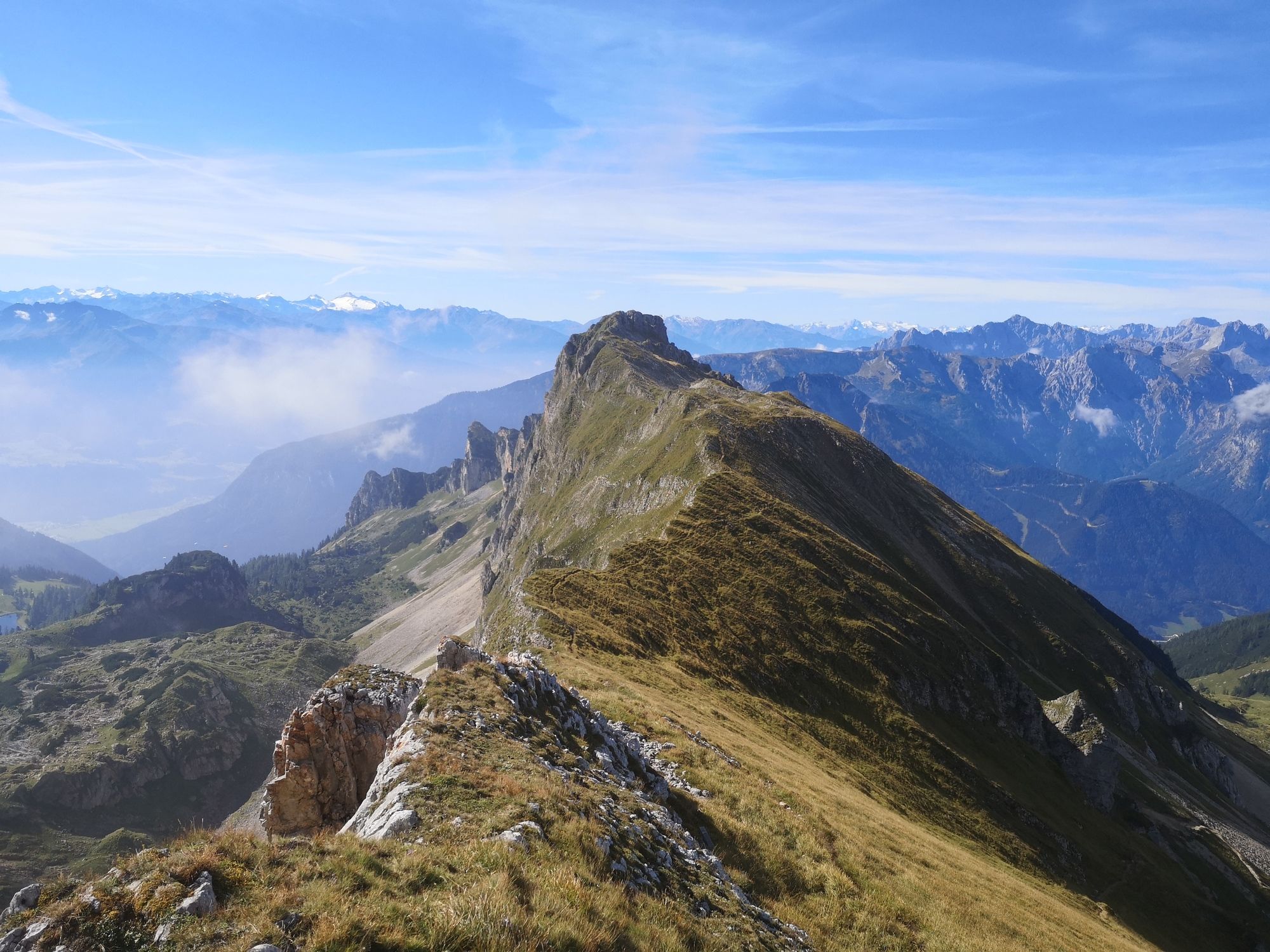
Back at the last signpost you can either turn left and walk down the ascent route (easy option) or you can turn right (direction west) and hike the trail along Dalfazer Kamm ridge. Soon you will reach a steep fixed-rope section and soon afterwards the top of Dalfazer Kamm ridge. Turn left onto the grassy ridge there (trail well visible and marked!). On the ridge you will pass over and pass by several small summits. At one point you will have to ascend a very exposed and nearly vertical fixed-rope section! After that section the trail will become easier again and you will reach patches of mountain pines, right below the summit of Rotspitze mountain which can be ascended in only a few minutes extra. Continue further south, now relatively steeply downhill until you reach the intersection with the very wide trail that leads from the gondola top station to Dalfazalm.Turn left there and you will reach the gondola in about 20 minutes. - Highest point
- Hochiss (2,211 m)
- Endpoint
-
Top station "Rofanbahn" gondola
- Alternatives
-
*Descent along the ascent route
*Route via Dalfazer Alm hut: When you are at the beginning of Dalfazer Kamm ridge do not turn left onto it, but continue straight downhill via Steinernes Törl signpost to Dalfazer Alm hut. From there follow the wide trail back to the top station of the gondola. Route well marked and signposted! - Rest/Retreat
-
None along the way, but "Erfurter Hütte" hut at the start or end of the hike (right next to the top station)
- Equipment
-
Strong hiking boots, food, drinks, suncream, cap/hat, mobile phone, and everything else one needs in the mountains.
A via ferrata kit is recommended, a helmet as well! - Safety instructions
-
For the most part walking terrain, but the route also includes multiple fixed-rope sections, some of which are steep and exposed. A via-ferrata kit is highly recommended for those who are not familiar with this terrain!
- Ticket material
-
BEV-map scale 1:25000, NL 32-02-18 West, Achensee
- Directions
-
A12 exit Wiesing. From there B181 uphill to Maurach and there turn right to the parking area near the valley station of "Rofanbahn" gondola.
- Parking
-
Valley station "Rofanbahn" gondola


Trail conditions
-
Achensee
1362
-
Maurach - Eben am Achensee
442