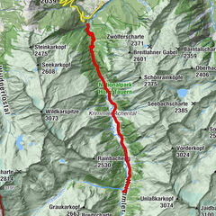
Tour data
10.36km
1,180
- 1,702m
529hm
522hm
02:00h
- Brief description
-
Gehzeit: ca. 2 h (Hinweg)
Seehöhe: 1.686 m
Höhendifferenz: ca. 400 Hm - Difficulty
-
medium
- Rating
-
- Route
-
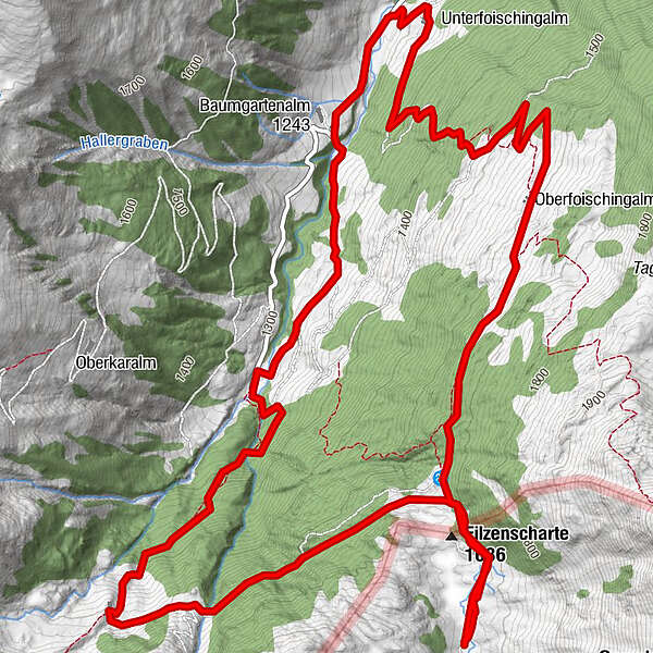
Rotwand Grundalm (1,600 m)3.3 kmRotwand-Grundalm3.3 kmSchreier Bründl6.4 kmOberfoisching Alm7.7 kmUnterfoisching Alm9.9 km
- Best season
-
JanFebMarAprMayJunJulAugSepOctNovDec
- Highest point
- 1,702 m
GPS Downloads


Trail conditions
Asphalt
Gravel
Meadow
Forest
Rock
Exposed
Other tours in the regions