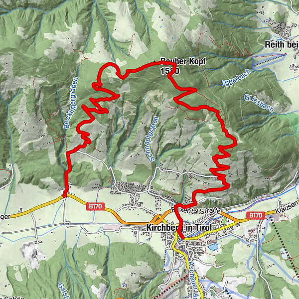
Tour data
13.45km
816 - 1,556m
Distance
714hm
678hm
Ascent
05:30h
 
Duration
Brief description

Gehzeit: ca. 5:30 h
Seehöhe: 1.580 m
Höhendifferenz: ca. 743 Hm

Difficulty
medium
Rating
Technique
Fitness
Landscape
Experience
Starting point

Kirchberg in Tirol

Route
Kirchberg in Tirol
0.1 km
Ruetzenhof
11.5 km


Best season
Jan
Feb
Mar
Apr
May
Jun
Jul
Aug
Sep
Oct
Nov
Dec
Highest point
Rauher Kopf (1,556 m)
Endpoint

Bockern

Videos

Overall rating

5

0

%

4

0

%

3

0

%

2

0

%

1

0

%

Error
An error has occurred. Please try again.
Thank you for your review

Rating has been deleted

GPS Downloads
  • GPX GPS Exchange Format (XML)
  • KML Google Earth, Google Maps
QR Download Codes for Mobile Phones
Other tours in the regions

Popular tours in the area

Unterberghorn

medium Hiking
7.53km | 1048hm | 06:00h

From Hintersteiner See to the Walleralm

medium Hiking
9.32km | 328hm | 03:15h

Erpfendorf: Griesbachklamm

medium Hiking
10km | 488hm | 04:30h

Rosskopf

easy Hiking
7.02km | 320hm | 03:00h