


- Brief description
-
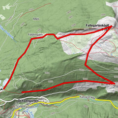
LEHN -> Stabele Alm –> Leckalm –> Plattach See –> Felder Scharte -> Weißer See –> Unterer Spitzig See –> Hauersee –> Innerbergalm -> LEHN
- Difficulty
-
difficult
- Rating
-
- Starting point
-
Lehn - Längenfeld
- Route
-
LehnStabelealm2.8 kmInnerbergalm14.1 kmLehn17.4 km
- Best season
-
JanFebMarAprMayJunJulAugSepOctNovDec
- Description
-
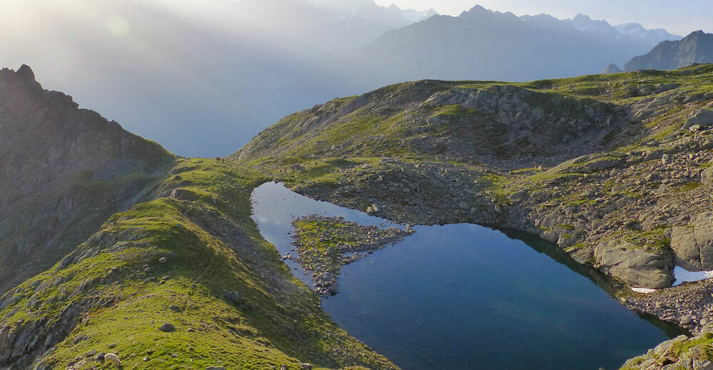
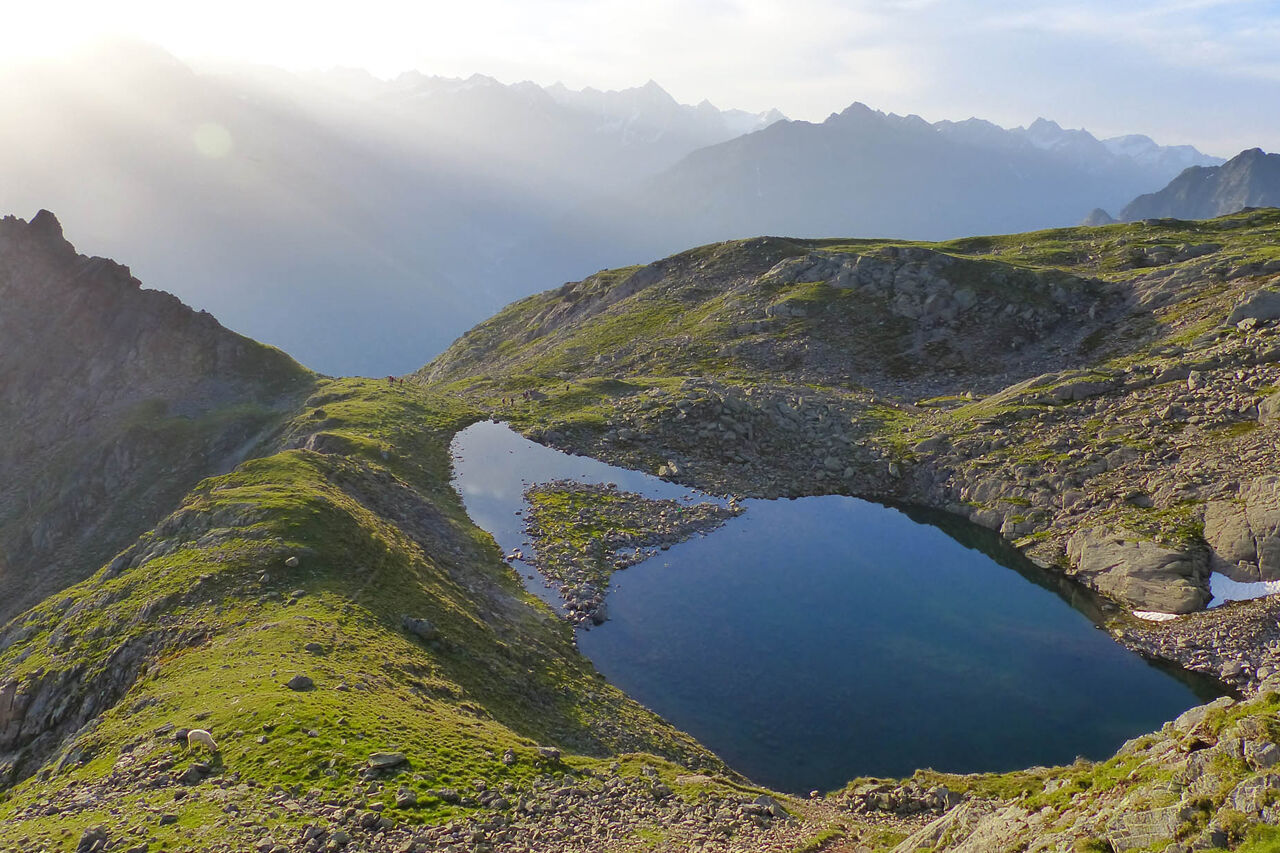
This round-trip trail with its four lakes, which vary in color according to the season, reflects the color palette of the water, from Caribbean blue to crystal-clear green. However, the small treasures in and around the lakes themselves should also be paid attention.
The trail leads from the hamlet of Lehn in Längenfeld over a trail to Stabele Alm past the Leckalm over lush green pastures on a ridge along to the first of the four mountain lakes, the Plattachsee. From there, you can already see the newly created path, the over the fields Scharte, past the salt places for the sheep down over steeper grassy slopes to a new natural spectacle, the White Lake. It is the largest and deepest of the four lakes and invites with its milky green color and its numerous rest areas for a short break for a break. Slowly it goes over a beautiful mountain trail from the White Lake to the lower Spitzig lake below. Nestled in a rugged mountain landscape, he rests there completely still and has a soothing charisma. From there you continue to the last of the four lakes, the Hauersee. Depending on the season, it shimmers milky green to turquoise. Surrounded by the so-called Fünffingerspitzen you can once again briefly enjoy the pleasant tranquility of the 2300 vertical meters before you begin the descent. On the way down, the Hauerkamm towards Innerbergalm offers a fantastic view of the Innerbergtal and the Hauertal. At the top of this ridge is the Wöckelwarte, from which you can let your gaze wander over Längenfeld. From there it goes through a charming pine forest back to the lush alpine pastures and fields just before the Innerbergalm. The descent is like the ascent via the trail back to Lehn.
- Directions
-
This circular route leads from Längenfeld Lehn to the Leckalm (not managed) over pastures along a ridge to the first of the four mountain lakes, the Plattachsee. Continue on the newly created trail over the fields Scharte, the White Lake. He is the largest and deepest of the four lakes. About the trail leads to the lower Spitzig lake below. From there you continue to the last of the four lakes, the Hauersee. On the way back to Innerbergalm is the Wöckelwarte from which you have a wonderful view of Längenfeld.
- Highest point
- 2,731 m
- Endpoint
-
Lehn - Längenfeld
- Height profile
-

- Equipment
-
Appropriate equipment such as breathable suitable outdoor clothes for the weather, is for all hikes and tours necessary. Please bring a first-aid box, a mobile phone, a walking map and if there is no hut on the way a snack and enough to drink
.
- Safety instructions
-
Moderate mountain trail; for sure-footed and experienced hikers. Good physical condition, mountain experience & mountain equipment (see notice equipment) necessary. Please pay attention to the current weather report
- Tips
-
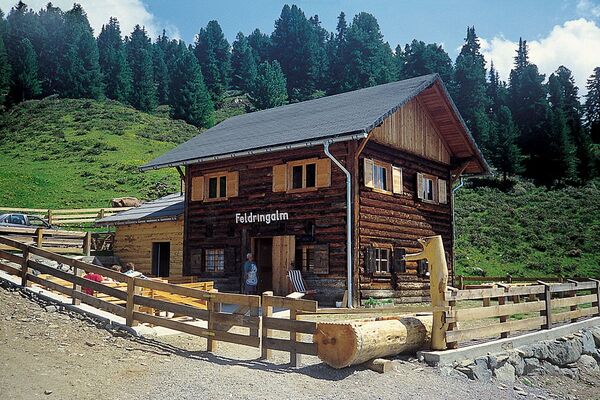
The hut taxi runs in the summer season every Tuesday to the Stabelealm. Thus you spare yourself a climb of about 2 hours. Reservations are required until 17.00 on Monday.
https://www.oetztal.com/de/erlebnisse/shop - Additional information
- Directions
-
The car drive to the Ötztal valley. Situated in Tirol, the Ötztal valley set off in southerly direction and is the
longest side valley in the Eastern Alps. The journey with the car leads you through the Inntal valley to the
entrance of the valley and further on through the valley. Among the toll motorways you can also use the country
roads. A route planner will show you the easiest and most convenient way: https://www.google.at/maps
- Public transportation
-
Travel safe and comfortable with the train to the Ötztal Bahnhof train station. Last stop and exit point is the
train station Ötztal Bahnhof. Afterwards you can travel smoothly and quick with the public transport or our local
taxi companies through the valley to your desired destination. Please find the current bus timetable here:
http://fahrplan.vvt.at
- Parking
-
The following parking facilities are available in Längenfeld:
-
Lehn - via ferrata (chargeable)
-


- Author
-
The tour 4-Lakes Trail - Längenfeld is used by outdooractive.com provided.


General info
-
Ötztal
1107
-
Längenfeld - Huben - Gries
354