


- Brief description
-
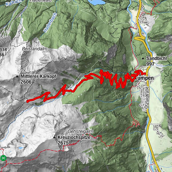
TUMPEN -> car park elementary school -> "Grube" -> crossroads -> Vordere Tumpenalm -> HINTERE TUMPENALM
- Difficulty
-
medium
- Rating
-
- Starting point
-
car park elementary school in Tumpen
- Route
-
TumpenMuttergotteskapelle0.6 kmTumpener Wasserfall1.4 kmTumpener Wasserfall1.7 kmVordere Tumpen Alm7.1 km
- Best season
-
JanFebMarAprMayJunJulAugSepOctNovDec
- Description
-
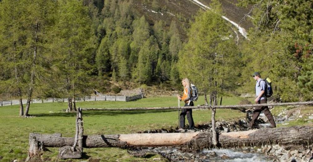
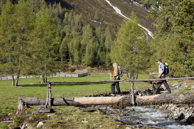
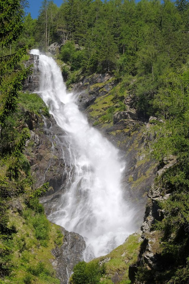
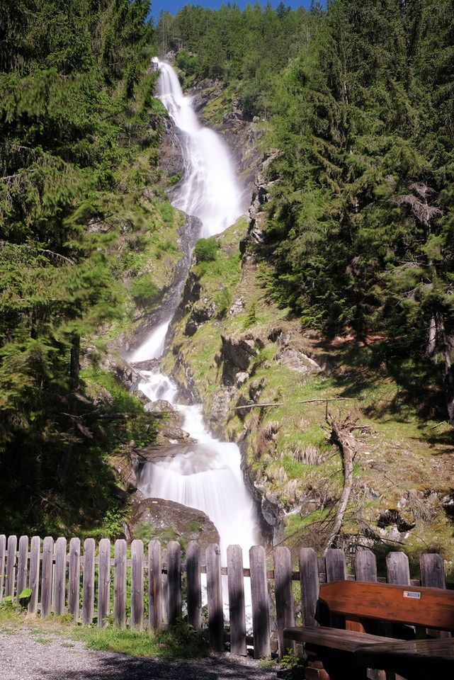
The start is in Tumpen at the car park from the elementary school. Follow the road towards "Grube" - then turn to the left and follow the forest path further upwards passing the Tumpener waterfall. At the last crossroads, turn left towards the "Vordere Tumpenalm" and "Gehsteigalm". Follow the forest trail, passing Vordere Tumpenalm to Hintere Tumpenalm. The Alm is not managed! Highlight on the quiet and varied way is the Tumpener waterfall. The Vordere Tumpenalm offers at half-time as a refreshment stop.
- Directions
-
The start is in Tumpen at the car park from the elementary school. Follow the road towards "Grube" - then turn to the left and follow the forest path further upwards passing the Tumpener waterfall. At the last crossroads, turn left towards the "Vordere Tumpenalm" and "Gehsteigalm". Follow the forest trail, passing Vordere Tumpenalm to Hintere Tumpenalm. The Alm is not managed! Highlight on the quiet and varied way is the Tumpener waterfall. The Vordere Tumpenalm offers at half-time as a refreshment stop.
- Highest point
- 2,189 m
- Endpoint
-
Hintere Tumpenalm
- Height profile
-

- Equipment
-
Appropriate equipment such as breathable suitable outdoor clothes for the weather, ankle-high walking boots, wind-, rain- & sun protection, hat, possibly gloves, is for all hikes and tours necessary. Please bring a first-aid box, a mobile phone, a walking map and if there is not hut on the way a snack and enough to drink.
- Safety instructions
- Additional information
- Arrival
-
The car drive to the Ötztal valley. Situated in Tirol, the Ötztal valley set off in southerly direction and is the longest side valley in the Eastern Alps. The journey with the car leads you through the Inntal valley to the entrance of the valley and further on through the valley. Among the toll motorways you can also use the country roads. A route planner will show you the easiest and most convenient way: https://www.google.at/maps
- Public transportation
-
Travel safe and comfortable with the train to the Ötztal Bahnhof train station. Last stop and exit point is the train station Ötztal Bahnhof. Afterwards you can travel smoothly and quick with the public transport or our local taxi companies through the valley to your desired destination. Please find the current bus timetable here: http://fahrplan.vvt.at
- Parking
-
In Tumpen the following parking facilities are available:
- car park at the elementary school | free of charge

- Author
-
The tour Hintere Tumpenalm - Umhausen is used by outdooractive.com provided.