


- Brief description
-
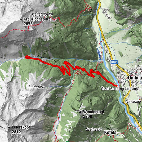
UMHAUSEN -> car park "Mure" -> district Neudorf -> Fundus bridge -> crossroads Fundustal / Leierstal -> VORDERE LEIERSTALALM
- Difficulty
-
medium
- Rating
-
- Starting point
-
car park "Mure"
- Route
-
Vordere Leierstalalm6.7 km
- Best season
-
JanFebMarAprMayJunJulAugSepOctNovDec
- Description
-
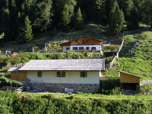
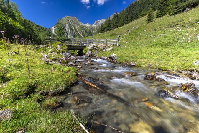
From the car park "Mure" in the center of Umhausen you walk comfortably through the district Neudorf. After crossing the Fundus bridge, follow the wide forest path to the crossroads Fundustal (left) and Leierstal (right). There you follow the path to the right until you reach the Vordere Leierstalalm, which is not managed. If you continue your walk along the creek up the valley you will reach the Hintere Leierstalalm (also not managed) at the end of the valley.
- Directions
-
From the car park "Mure" in the center of Umhausen you walk comfortably through the district Neudorf. After crossing the Fundus bridge, follow the wide forest path to the crossroads Fundustal (left) and Leierstal (right). There you follow the path to the right until you reach the Vordere Leierstalalm, which is not managed.
- Highest point
- 1,806 m
- Endpoint
-
Vordere Leierstalalm
- Height profile
-

- Equipment
-
Appropriate equipment such as breathable suitable outdoor clothes for the weather, ankle-high walking boots, wind-, rain- & sun protection, hat, possibly gloves, is for all hikes and tours necessary. Please bring a first-aid box, a mobile phone, a walking map and if there is not hut on the way a snack and enough to drink.
- Safety instructions
- Additional information
- Directions
-
The car drive to the Ötztal valley. Situated in Tirol, the Ötztal valley set off in southerly direction and is the longest side valley in the Eastern Alps. The journey with the car leads you through the Inntal valley to the entrance of the valley and further on through the valley. Among the toll motorways you can also use the country roads. A route planner will show you the easiest and most convenient way: https://www.google.at/maps
- Public transportation
-
Travel safe and comfortable with the train to the Ötztal Bahnhof train station. Last stop and exit point is the train station Ötztal Bahnhof. Afterwards you can travel smoothly and quick with the public transport or our local taxi companies through the valley to your desired destination. Please find the current bus timetable here:
- Parking
-
In Umhausen the following parking facilities are available:
- car park "Mure" | free of charge


- Author
-
The tour Vordere Leierstalalm - Umhausen is used by outdooractive.com provided.
GPS Downloads


General info
Refreshment stop
A lot of view
Other tours in the regions
-
Pitztal
1067
-
Umhausen im Ötztal
401


