


- Brief description
-
HUBEN MÜHLE -> forestpath direction Polltallam -> follow Fußweg Polltalalm -> POLLTALALM
- Difficulty
-
medium
- Rating
-
- Starting point
-
Huben/Fun Park
- Route
-
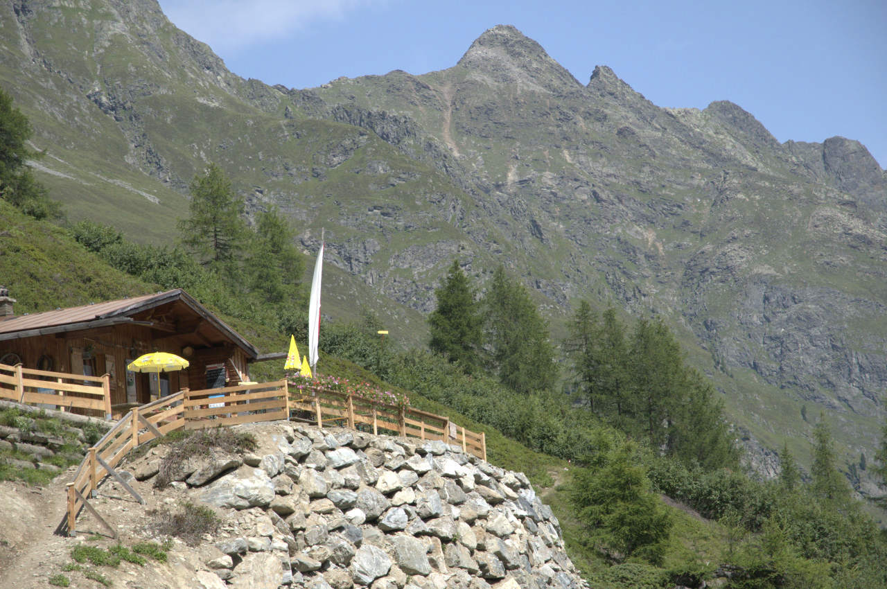
Polltalalm (1,840 m)4.8 km
- Best season
-
JanFebMarAprMayJunJulAugSepOctNovDec
- Description
-
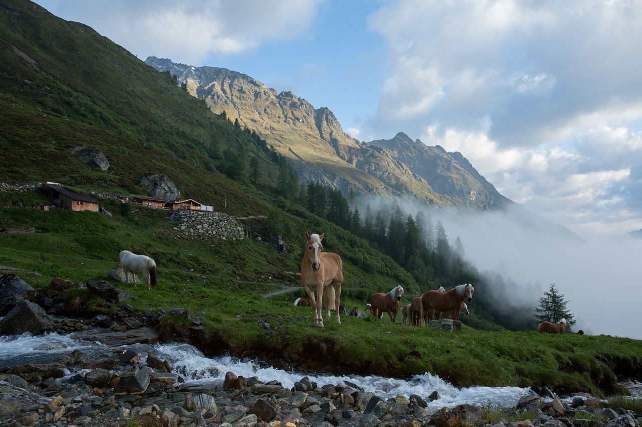
Starting from Mühle in Huben, the track leads to the Polltal and Breitlehnalm. Hikers can soon change to the footpath, although a larger slope but the many turns abbreviates. Striking is the fern-rich larch and stone pine forest which you can almost reach the top. Arrived at the hut, you can enjoy a magnificent view of the valley and the Ötztal mountains. Relaxed and strengthened, we return to the valley. For this you either choose the track or walk first to the Breitlehnalm and from there take the mountain trail (a bit steeper) back to Huben.
- Directions
-
Take the small bridge on the left in Mühle, then immediately right follow the wide forest road. After a short time to change the footpath which although steeper but also a lot shorter.
- Highest point
- 1,927 m
- Endpoint
-
Polltalalm
- Height profile
-

- Equipment
-
Appropriate equipment such as breathable suitable outdoor clothes for the weather, ankle-high walking boots,
wind-, rain- & sun protection, hat, is for all hikes and tours necessary. Please bring a first-aid
box, a mobile phone, a walking map and if there is no hut on the way a snack and enough to drink.
- Safety instructions
-
Moderate mountain trail; for sure-footed and experienced hikers. Good physical condition, mountain experience
& mountain equipment (see notice equipment) necessary. Please pay attention to the current weather report:
- Tips
-
From the Polltalalm a path leads through the alm rose soil, blueberry and cranberry heath and Erikapolster to Hahlkogelhaus. (not managed - but imposing view of the Hahlkogel.
- Additional information
- Directions
-
The car drive to the Ötztal valley. Situated in Tirol, the Ötztal valley set off in southerly direction and is the
longest side valley in the Eastern Alps. The journey with the car leads you through the Inntal valley to the
entrance of the valley and further on through the valley. Among the toll motorways you can also use the country
roads. A route planner will show you the easiest and most convenient way: https://www.google.at/maps
- Public transportation
-
Travel safe and comfortable with the train to the Ötztal Bahnhof train station. Last stop and exit point is the
train station Ötztal Bahnhof. Afterwards you can travel smoothly and quick with the public transport or our local
taxi companies through the valley to your desired destination. Please find the current bus timetable here:
http://fahrplan.vvt.at
- Parking
-
The following parking facilities are available in Huben:
- Huben first local entrance before carpentry Praxmarer - free of charge
- Funpark Huben - free of charge
- Author
-
The tour Polltalalm - Längenfeld is used by outdooractive.com provided.


General info
-
Ötztal
1107
-
Längenfeld - Huben - Gries
354


