

© Tourismusverband Region Hall-Wattens - Moritz Klee

© Tourismusverband Region Hall-Wattens - Hall Wattens

© Tourismusverband Region Hall-Wattens - Hall Wattens
- Brief description
-
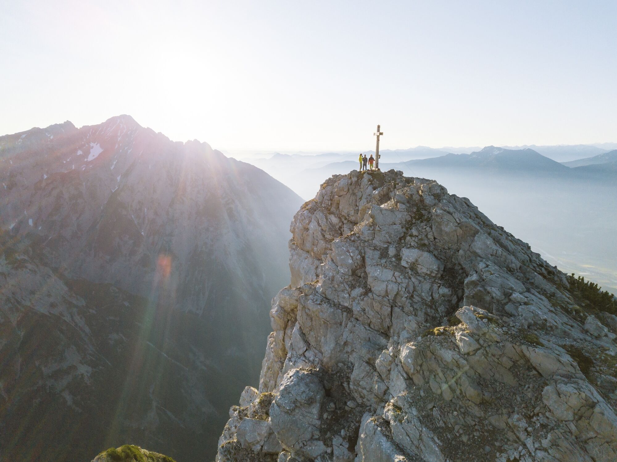
An unobstructed view from the Hundskopf - with a little imagination and the right viewing point, it will become obvious how the Hundskopf (Dog's Head) gets its name
- Difficulty
-
difficult
- Rating
-
- Route
-
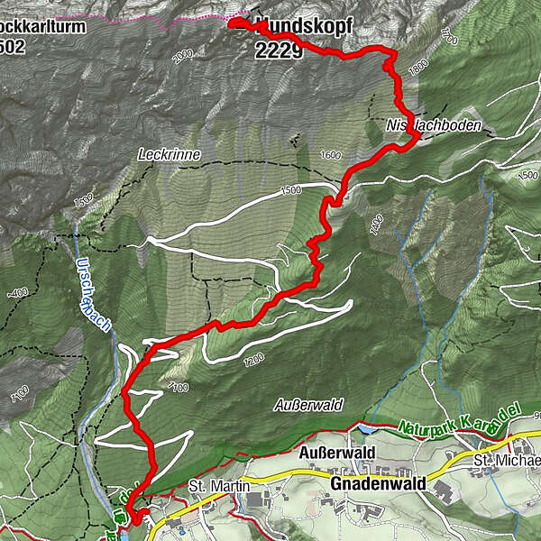
Martlboden1.9 kmHinterhorn Alm2.7 kmHundskopf (2,229 m)4.8 km
- Best season
-
JanFebMarAprMayJunJulAugSepOctNovDec
- Description
-
Although it is often climbed, the rope-secured final summit section should not be underestimated. Another option is the more demanding "via ferrata" on the north face.
- Directions
-
Leave the St Martin car-park (890m) and follow initially the asphalted toll road. After a short distance leave this and follow the signposted path towards the Hinterhornalm (1,522m). At the Hinterhornalm - just to the north of the favoured launching pad for hang-gliders - the path continues up the mountain. It then crosses an extensive field of mountain pines and a small scree slope, which gradually becomes bouldered terrain. After just a few metres of elevation gain, you will reach a small saddle with a magnificent view over the Karwendel range and the rest of the tour.
The marked path divides a little further on. Keep left for the normal route. After crossing another field of mountain pines, the path continues uphill over rope-secured boulders. The hardest section is a narrow ridge, demanding surefootedness, before you reach the summit of the Hundskopf at 2,243m.
Return to the valley by the same route.
- Highest point
- 2,222 m
- Endpoint
-
Hundskopf
- Height profile
-

- Tips
-
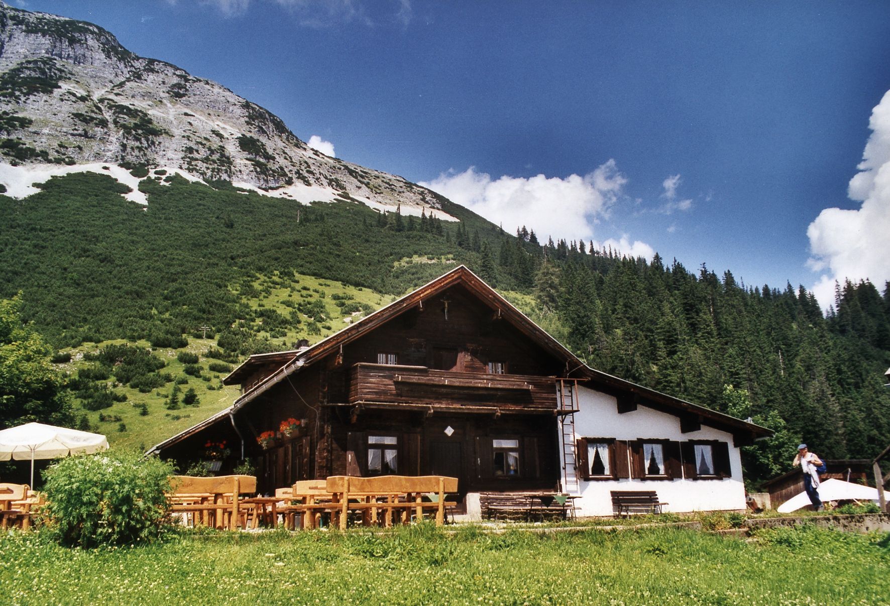
Refreshment stops:
Hinterhornalm
Tel.: +43 (0)664/996 283 55
- Public transportation
-
Regiobus 3
- Author
-
The tour Gnadenwald - Hinterhornalm - Hundskopf is used by outdooractive.com provided.
GPS Downloads


General info
Refreshment stop
A lot of view
Other tours in the regions
-
Ferienregion Hall - Wattens
1475
-
Gnadenwald
350


