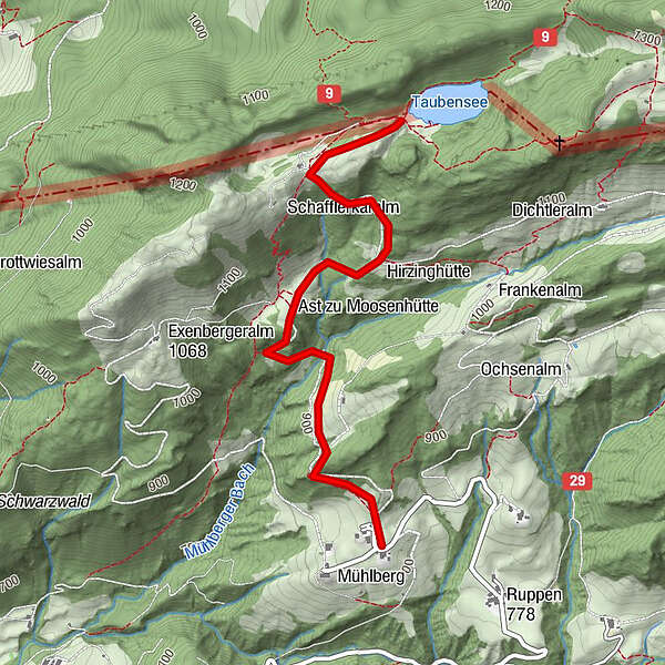
Mühlberg - Taubensee

Logo Mühlberg - Taubensee
Tour data
2.87km
818 - 1,182m
Distance
357hm
Ascent
02:30h
 
Duration
Brief description

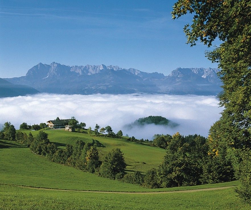
Traumhafter Panoramablick über den Kaiserwinkl

Rating
Technique
Fitness
Landscape
Experience
Starting point

Kössen Ortsmitte

Route
Mühlberg
0.0 km
Taubenseehütte
2.4 km


Best season
Jan
Feb
Mar
Apr
May
Jun
Jul
Aug
Sep
Oct
Nov
Dec
Highest point
1,182 m

Rest/Retreat

Taubenseehütte


3,0
Overall rating

5

0

%

4

0

%

3

100

%

2

0

%

1

0

%

GPS Downloads
  • GPX GPS Exchange Format (XML)
  • KML Google Earth, Google Maps
QR Download Codes for Mobile Phones

Trail conditions

Asphalt (20%)
Gravel (60%)
Meadow (10%)
Forest (10%)
Rock
Exposed
Other tours in the regions

Popular tours in the area

Hintersteiner See circular walk

easy Hiking
5.24km | 93hm | 01:30h

Ellmau: Gruttenhütte

Hiking
3.24km | 621hm | 03:00h

Kaisertal Rund-Wanderung

medium Hiking
13.94km | 887hm | 03:29h