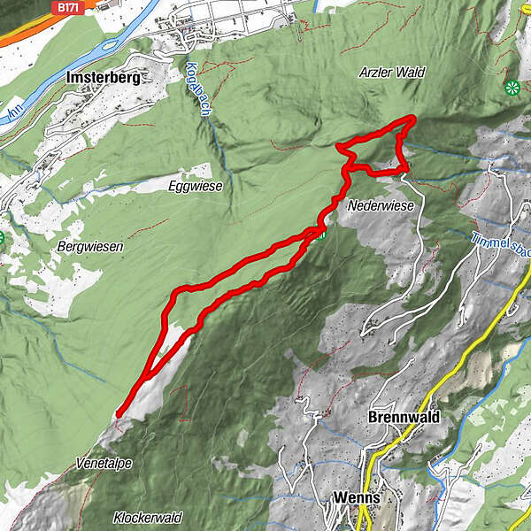
Tour data
10.06km
1,477
- 1,988m
489hm
470hm
02:30h
- Rating
-
- Route
-
Venetalm (1,980 m)4.3 kmHochasteralm (1,756 m)7.3 km
- Best season
-
JanFebMarAprMayJunJulAugSepOctNovDec
- Description
-
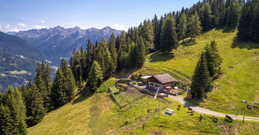
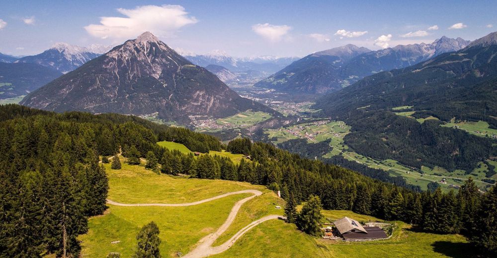
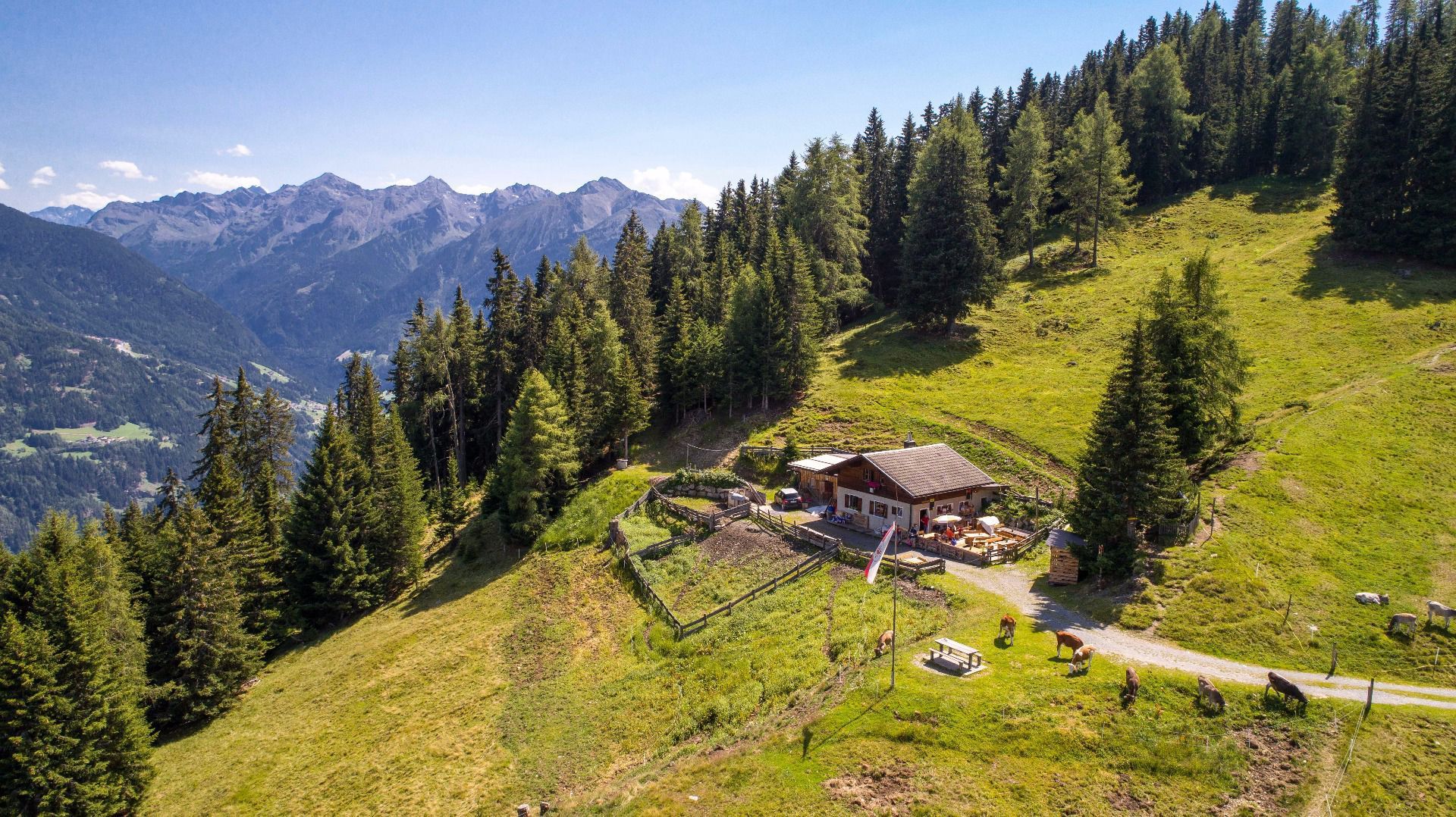
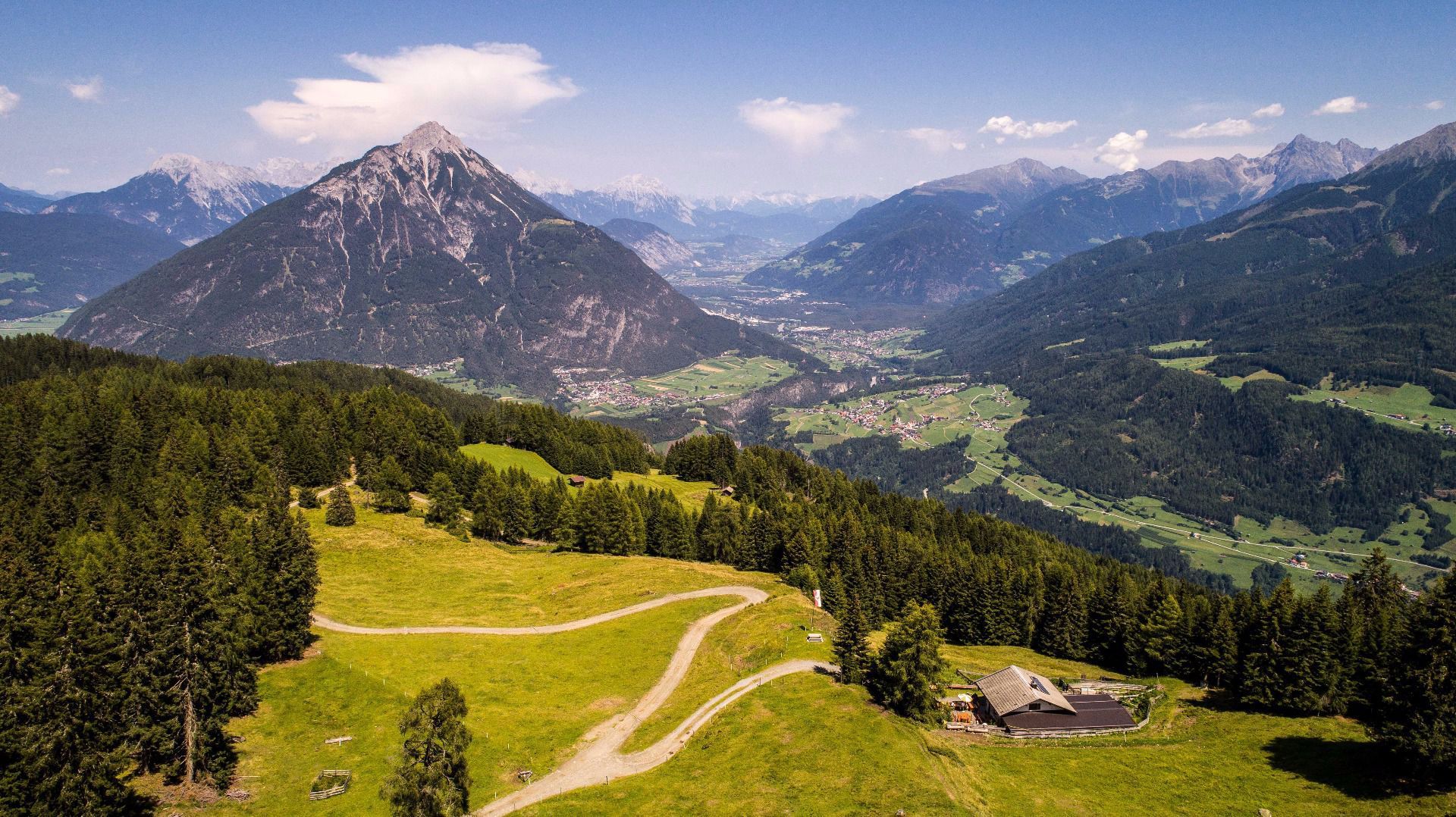
Walk along a steeper path from Plattenrain to the catered mountain hut
Hochastner Alm. Then walk along the mountain ridge along a beautiful
forest path directly to the catered mountain hut Venetalm. (Signposted as
“Venet-Rundwanderweg” Venet circular route). To return, turn left at the first fork and continue to walk along this path back to Hochaster Alm and then continue to walk on the same path as on your way up initially. After the fork keep left and the forest road will take you back to the un-catered mountain hut Timler Alm and to the starting point. - Highest point
- 1,988 m
GPS Downloads


Other tours in the regions
-
Outdoorregion Imst
1231
-
Wenns
304