From the Thaurer Almparkplatz over the Thaurer castle to the Romediwirt

Hiking

© Tourismusverband Region Hall-Wattens - Hall Wattens

© Tourismusverband Region Hall-Wattens - Hall Wattens

© Tourismusverband Region Hall-Wattens - Hall Wattens

© Tourismusverband Region Hall-Wattens - Hall Wattens

© Tourismusverband Region Hall-Wattens - Hall Wattens

© Tourismusverband Region Hall-Wattens - Hall Wattens
- Brief description
-
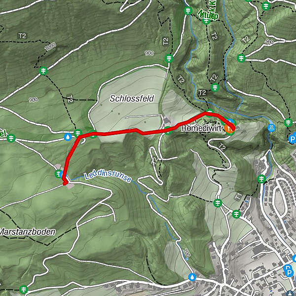
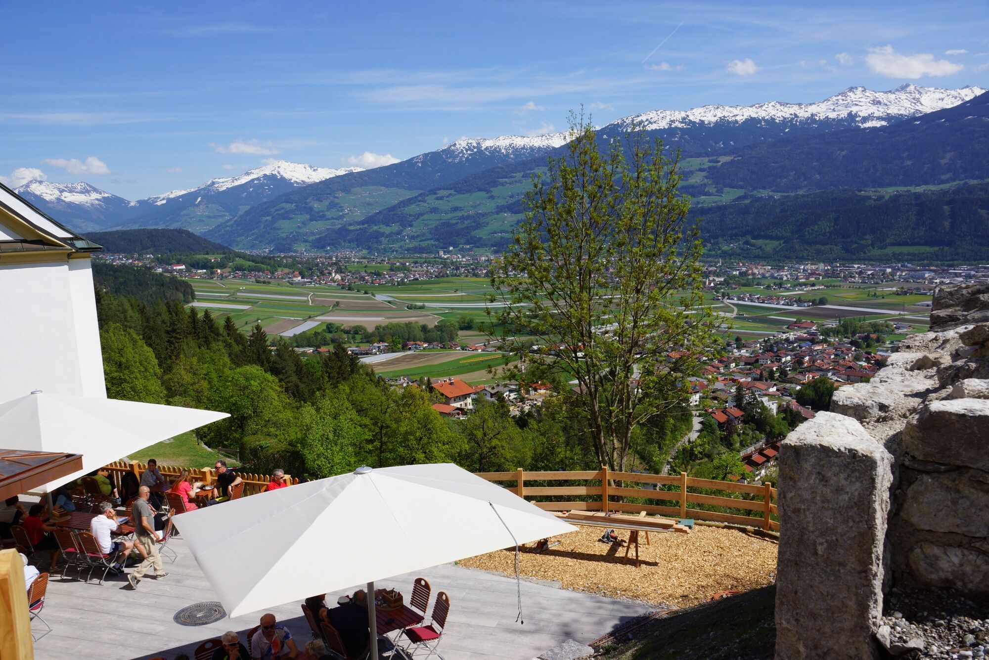
This short walk leads us over the Thaur castle ruin to the newly built Romediwirt.
- Difficulty
-
easy
- Rating
-
- Starting point
-
Thaur
- Route
-
Romediwirt0.9 km100.9 kmSchlosskirche St. Romedius0.9 km
- Best season
-
JanFebMarAprMayJunJulAugSepOctNovDec
- Directions
-
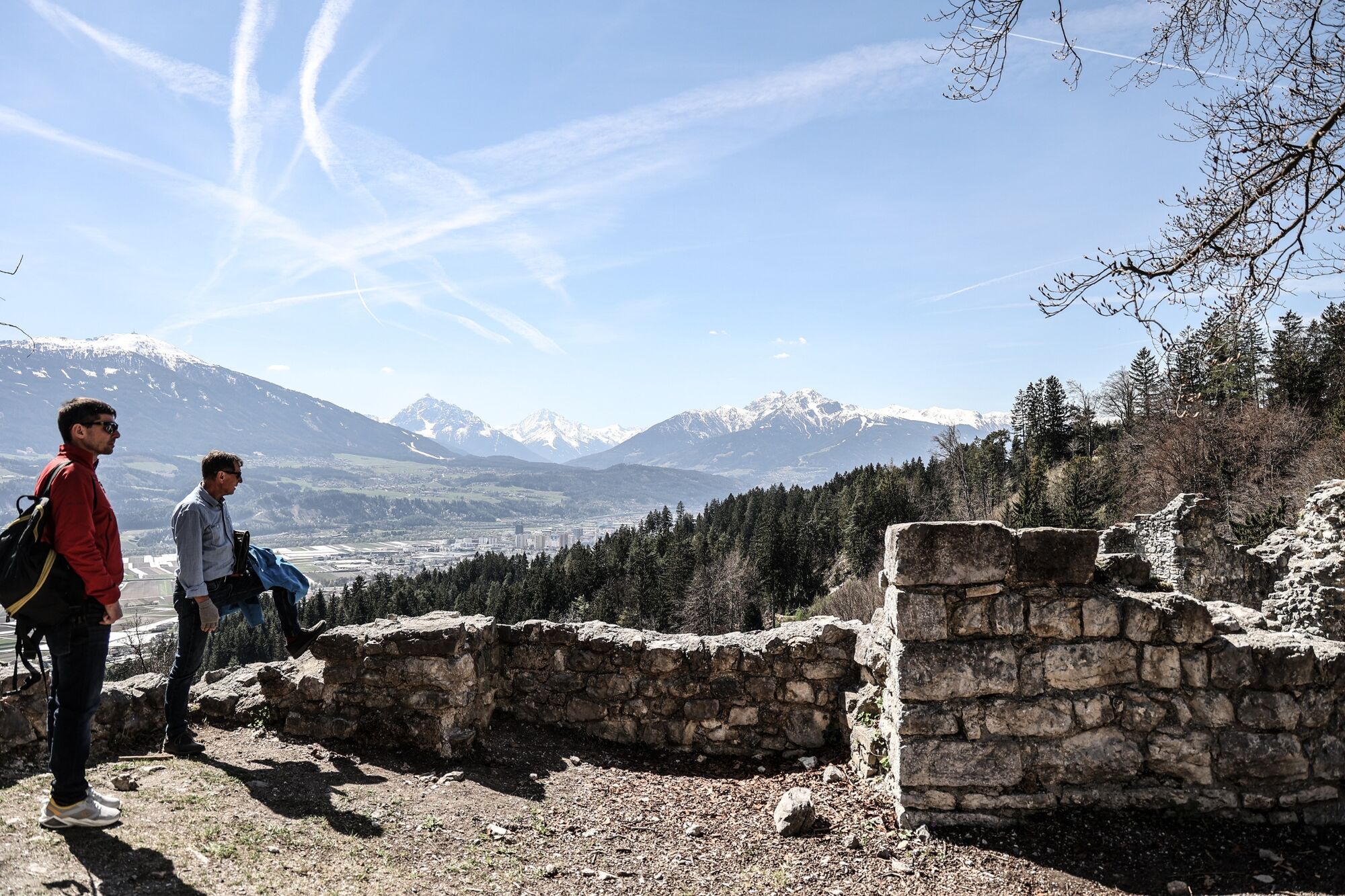
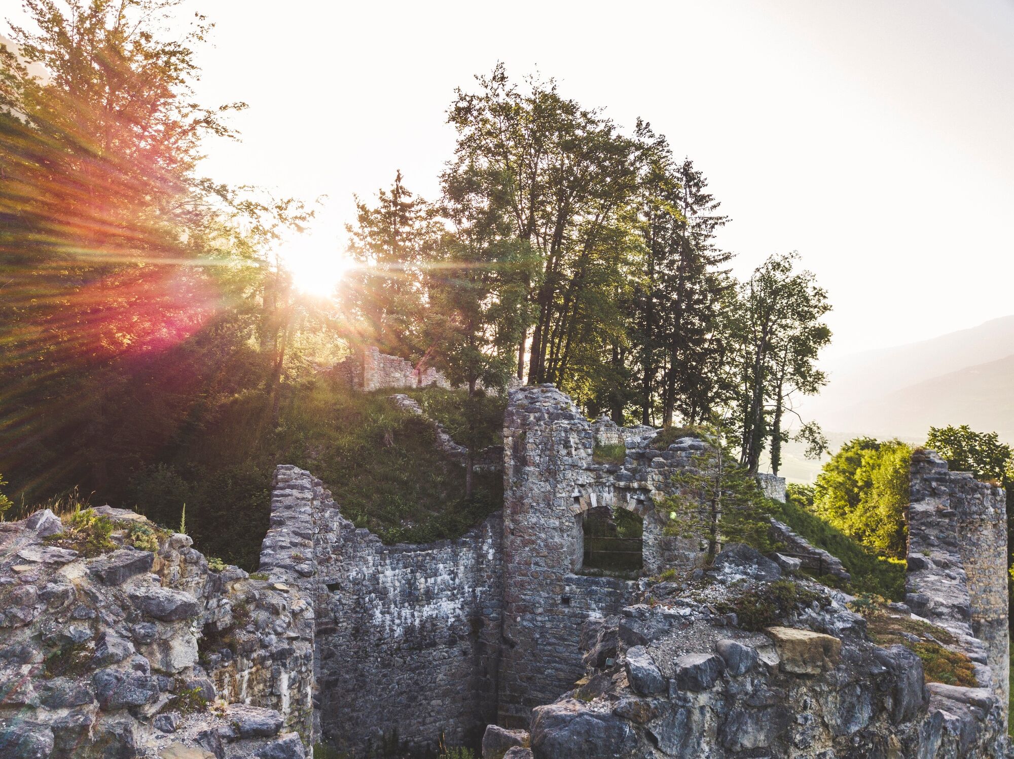
From Thaur we follow the signs uphill to the Thaurer Alm car park. We walk uphill for a short distance and at a forest road junction we turn left in the direction of the Thaurer Schlossruine. Walk between woods and meadows for about 20 minutes to the Thaurer Schlossruine.
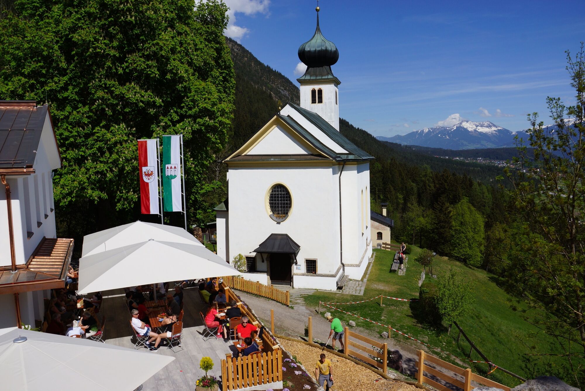
After another 5 minutes we reach the newly built Romediwirt next to the Romedi chapel. The view of Thaur and the Inntal from up here is really beautiful.
- Highest point
- 855 m
- Endpoint
-
Thaur
- Height profile
-

- Tips
-
A lunch stop in the Romediwirt
- Public transportation
-
Take line 501, 502 or 503 to Thauer Mitte. From here approx. 20min more.
- Parking
-
Thaur


-

-
AuthorThe tour From the Thaurer Almparkplatz over the Thaurer castle to the Romediwirt is used by outdooractive.com provided.
GPS Downloads


General info
Refreshment stop
Cultural/Historical
Other tours in the regions
-
Innsbruck und seine Feriendörfer
1520
-
Thaur
356


