

© Mittersill Plus GmbH_Alphotel Mittersill - Christine Reichholf

© Mittersill Plus GmbH_Alphotel Mittersill - Christine Reichholf

© Mittersill Plus GmbH_Alphotel Mittersill - Christine Reichholf
- Brief description
-
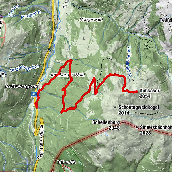
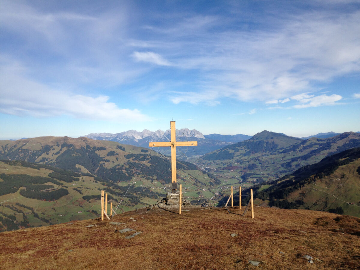
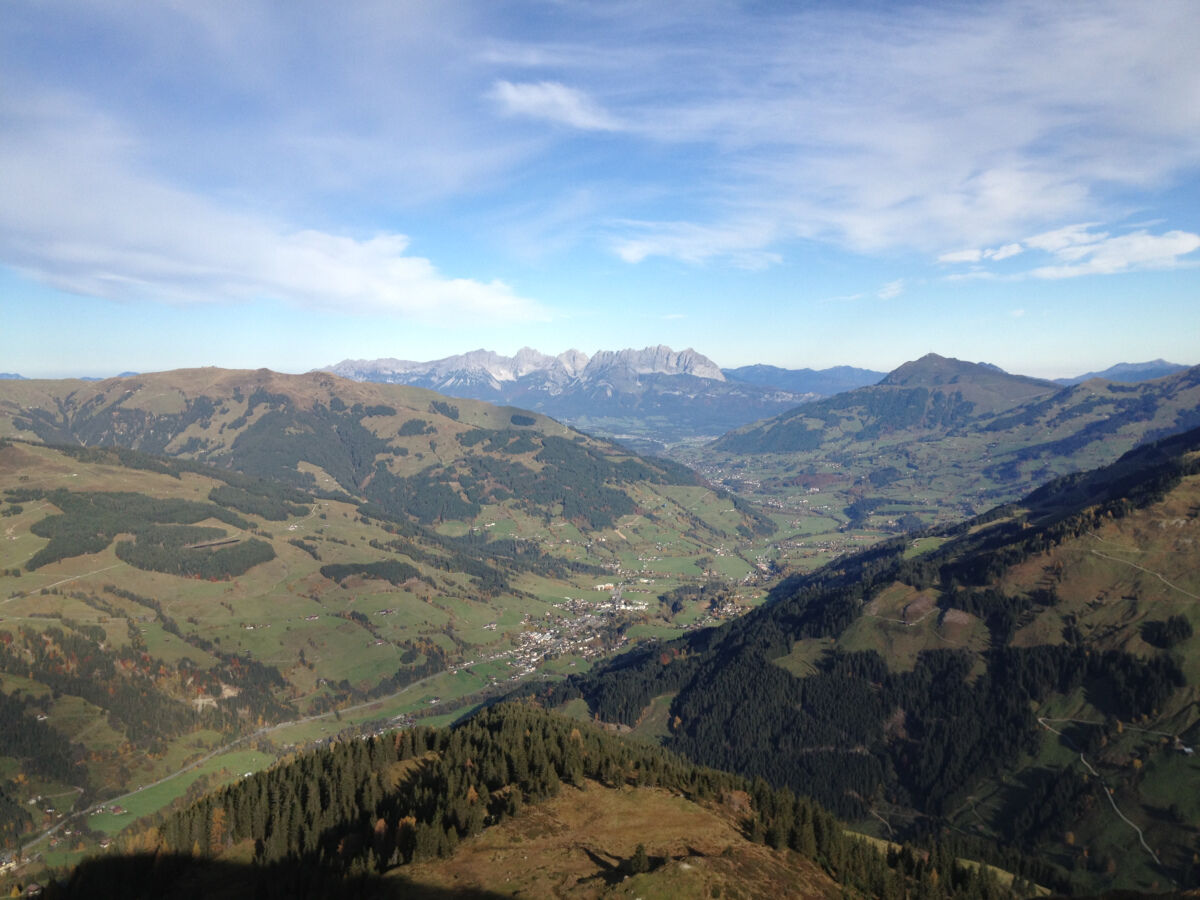
Wandern Sie auf einen der angrenzenden Tiroler Berge, den Kuhkaser auf 2.054 m und genießen Sie den fabelhaften Rundblick auf den Wilden Kaiser und die Kitzbüheler Alpen.
- Difficulty
-
medium
- Rating
-
- Route
-
Wallfahrtskirche Mariae Heimsuchung0.1 kmWaldwirt0.1 kmSchöntagweidalm6.2 kmKuhkaser (2,054 m)8.4 kmSchöntagweidalm10.6 kmWaldwirt16.7 kmWallfahrtskirche Mariae Heimsuchung16.7 km
- Best season
-
JanFebMarAprMayJunJulAugSepOctNovDec
- Highest point
- 2,039 m
- Endpoint
-
Pass Thurn /Jochberg / Waldwirt
- Height profile
-


- Author
-
The tour Mittersill: Kuhkaser is used by outdooractive.com provided.
GPS Downloads


General info
A lot of view
Other tours in the regions


