© TVB Kufsteinerland - Sportalpen Marketing

- Brief description
-
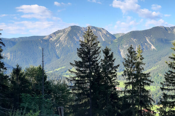
Across the power place "Himmelschauen" to the rustic chalet!
- Difficulty
-
easy
- Rating
-
- Starting point
-
Summit station Kaiserlift Kufstein
- Route
-
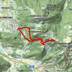
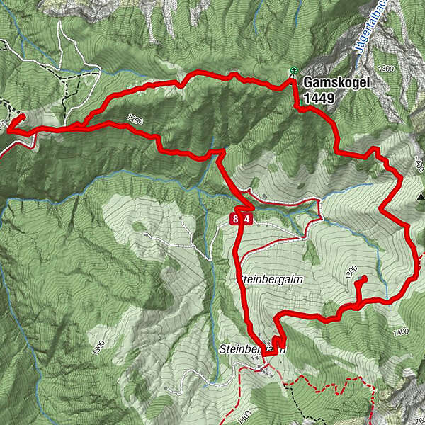
Jahnhügel (1,273 m)0.0 kmBrentenjoch-Alm0.3 kmGamskogel (1,449 m)2.1 kmSteinbergkapelle6.0 kmKaindlhütte6.0 kmBrentenjoch-Alm9.0 kmJahnhügel (1,273 m)9.5 km
- Best season
-
JanFebMarAprMayJunJulAugSepOctNovDec
- Description
-
Experience the nature reserve. The Kaiserlift transports hikers and nature lovers into the Kaiser Mountains in just 30 minutes. This tour starts at the Brentenjoch top station, from where it leads along a narrow trail to Gamskogel before continuing toward Steinbergalmen, where you can look forward to a tasty snack. From there it returns via forestry roads.
We are starting our hiking tour at the summit station of the Kaiserlift. From there we hike along the forest path to the fork of the path (direction Steinbergalm). From here the steep path in the direction of gamskogel begins. After about 45 minutes we reach the peak and take a rest at the power place "Himmelschauen". The wooden spiral can be used as a seat to have a snack or you can even lie on it to slow down and relax your whole body. At the summit cross close by we enjoy the view to the Kaiser valley, before we continue our hike to Steinbergalm (about 45 minutes). Innkeeper Maria serves a fresh glass of milk and a proper snack. Strengthened we follow the forest path across the alp back to the summit station where we started the tour.
- Highest point
- 1,437 m
- Endpoint
-
Summit station Kaiserlift Kufstein
- Height profile
-

- Equipment
-
Outdoor clothing appropriate to the weather (good footwear, rain protection, breathable clothing...)
Snacks (e.g. fruit, muesli bars, wholemeal breads) and drinks (allow for sufficient liquid)
First aid equipment
Mobile phone with full battery
Hiking map and guide literature
Sun protection (sun cream and glasses, cap)
Bivouac bag - Directions
-
Arrival is possible by car to the paid parking lot of the Kaiserlift.
- Public transportation
-
Take the city bus line 1 to the Meraner Straße stop and walk to the valley station. With the KufsteinerlandCard within the region bus free of charge.
- Parking
-
Bottom station Kaiserlift, subject to a charge.

- Author
-
The tour Kaiserlift Tourentipp 2: Steinbergalm is used by outdooractive.com provided.
GPS Downloads


Other tours in the regions
-
Kufsteinerland
2116
-
Scheffau am Wilden Kaiser
614